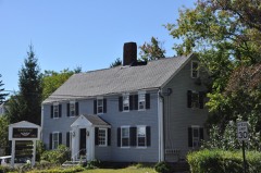
Listed on the National Register of Historic Places in
1976. A historic map-sheet match is not published yet. The record needs a coordinate-quality review before it can be joined to a sheet boundary.
From the record
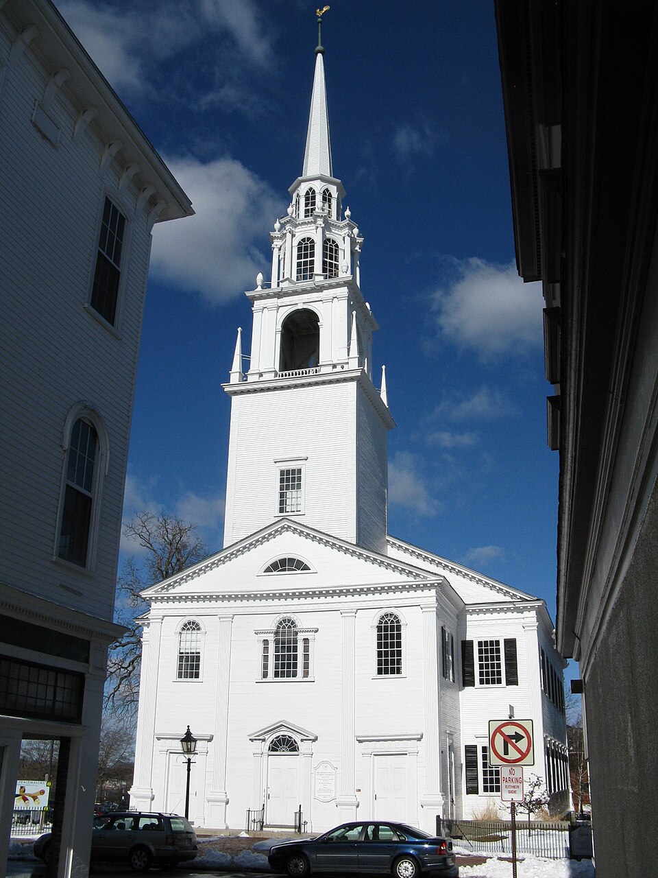
“The First Religious Society Church and Parish Hall is a historic church building at 26 Pleasant Street in Newburyport, Massachusetts. Originally a Reformed congregation, the congregation is currently affiliated with the Unitarian Universalist denomination.”
Wikipedia article First Religious Society Church and Parish Hall, CC BY-SA 4.0.
one of 350 National Register listings in Essex County · listed in 1976 · category: Building · one of 2 National Historic Landmarks in Essex County.
National Register reference number.76000278- the number the National Park Service assigned this property when it was listed, and the key its nomination file is catalogued under at the National Archives.
Fires near this property
79 since 2007
Regional context, not property-specific
evidence. The
federal wildfire occurrence database
lists 79 fires within 5 miles of First Religious Society Church and Parish Hall between
2007 and 2020, burning about 33 acres in total. None started naturally. 9 were recorded as arson.
Distance is straight-line from the map coordinates, so a fire counted
here may appear on a neighbouring settlement's page as well.
Reported cause
Fires
Debris and open burning
18
Missing data/not specified/undetermined
10
Equipment and vehicle use
10
Arson/incendiarism
9
Recreation and ceremony
8
Fireworks
7
Power generation/transmission/distribution
6
Smoking
5
Misuse of fire by a minor
4
Railroad operations and maintenance
1
Other causes
1
The most recent of
them, most recent first, with the day each was reported and the service
that recorded it.
Regional context, not property-specific
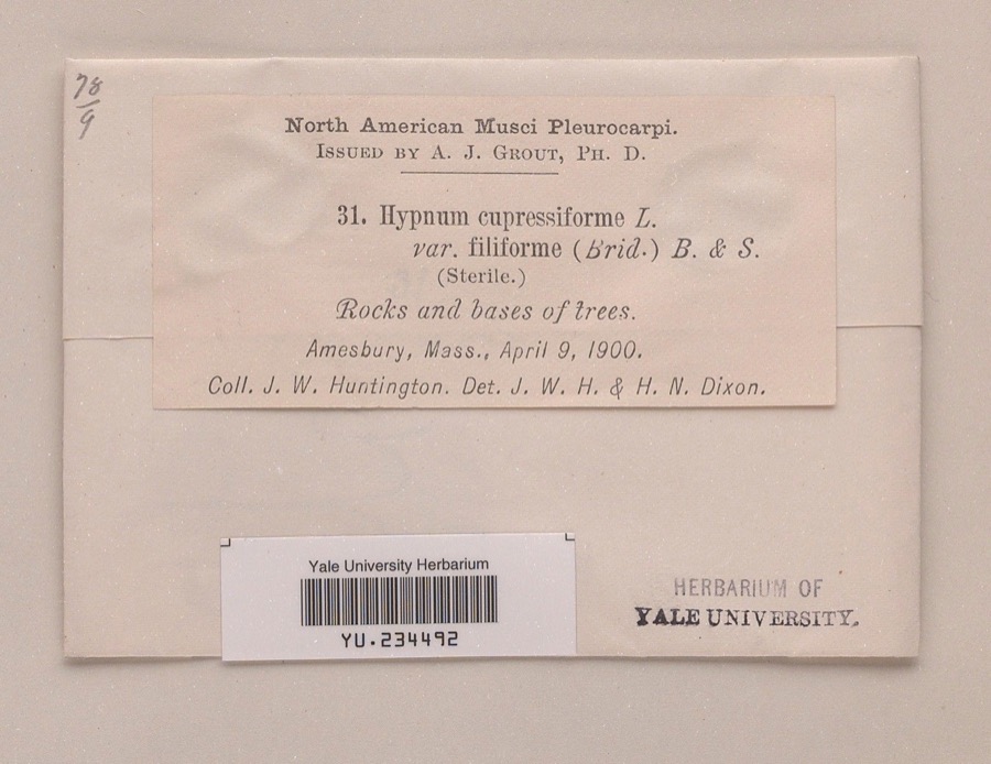
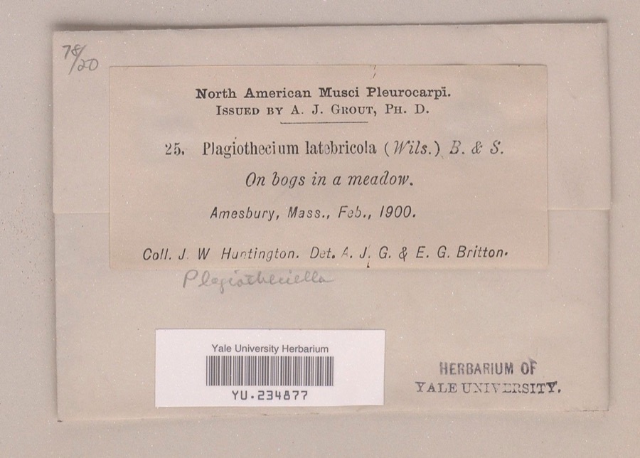
evidence. Museums hold 2,348 specimens
collected within 10 miles of First Religious Society Church and Parish Hall between 1800 and
1975: 1,401 Plantae, 656 Animalia, 190 Fungi, 88 Chromista, 7 Unrecorded, 4 Protozoa, 2 Bacteria. 12 distinct Species records are shown.
Collected by A A Eaton, A Brown, A. A. Eaton and others. Each is a
physical object with a catalogue
number, and each entry opens the museum's record. This is what was
collected and kept, not a survey of what lives here - nothing can be
concluded from a species being absent.
Regional context, not property-specific
evidence. The federal mineral resources record lists
4 workings within 5 miles of First Religious Society Church and Parish Hall: 4 past producers.
None of them still produces. What was taken out: Lead, Sand and Gravel, Construction, Silver, Zinc, Copper, Gold, Silver. Distance is straight-line from the
map coordinates, so a quarry counted here may appear on a neighbouring
settlement's page as well.
Regional context, not property-specific
evidence. The National Weather Service names
Newburyport, the town this property stands in, in 13 storm reports between 1997 and 2023: 8 thunderstorm wind, 3 hail, 1 heavy rain, 1 lightning.
No death or injury is recorded in these reports. Each account below is quoted exactly as the forecast office
filed it, from the NOAA Storm Events Database, and each date
opens the federal record of that event.
The Weatherflow reporting station at Plum Island recorded a wind gust of 69 mph. Wires were downed onto Sunset Drive in Newburyport from these thunderstorm winds.
1 paper published in this town,
digitised by the Library of Congress and free to read: 0 issues,
0 pages. Every page is searchable, so a name or a street can be
looked for directly in what the town printed about itself at the time.
No historic map-sheet match is published
for this property yet. That does not mean no map exists. This record needs
a coordinate-quality review before it can be joined to a sheet boundary.
Browse the county's mapped places while that work is
pending.
From the nomination file
2,863 words on record
When this property was proposed for the
National Register, someone wrote the case for it: what the building is,
and why it matters. That document is a federal record in the public domain.
It is quoted below word for word, never summarised. The text was read off the scanned case file by machine, so the
occasional stray character is the recogniser's and the 1970s
typewriter's.
Description of the property
The Church of the First Religious Society, Unitarian, is located in downtown New- buryport near Market Square (National Register 2/25/71) but not contiguous to it. The church faces Pleasant Street and is set back 25 feet from the street line. The Parish Hall next door is situated approximately 60 feet from the street and is fronted by a small lawn. The sidewalk in front of the buildings is red brick, and utility poles have been removed and wires installed underground. The surrounding buildings on Pleasant Street are commercial and derive principally from the late nineteenth century. The Church of the First Religious Society was built and dedicated in 1801.
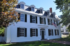
Although the architect is unknown, the design of the building bears a striking resemblance to a Samuel McIntire church in Salem which has a similar spire. Historian John J. Currier has speculated that the church may have been the work of Timothy Palmer who designed the Essex Merrimac bridge. The church is two stories high and is built on a granite block foundation. The exterior walls are sheathed in clapboard, ard the ridge roof is covered with dark asphalt shingles. A single brick chimney rises through the rear of the roof to the left of the ridge line. The church has as its prototype the famous St. Martin's-in-the-Fields in London, designed by James Gibbs in about 1700. The magnificent spire of the Newburyport Englandaf described by McIntire hinself as the "...
Xival (oflanything in New The central entrance is surmounted by a handsome fanlight and pediment and is balanced by two doors on either side. Over the main entrance is a Palladian window, above which there is a fanlighted pediment.
/ARCHITECT Attributed to Timothy Palmer STATEMENT OF SIGNIFICANCE ahe churoh ot tihe otrat aal dous, Boototy tn tariat in aooduyoor la ni eanant citizens of Newburyport and Massachusetts. The church was built in 1801 and re- placed an earlier and more modest church which had stood in nearby Market Square. The handsome design of the new church, no doubt inspired by the work of Samuel MoIntire in Salem, is Federal architecture at its finest. Elegant detail, pax- ticularly in the central entry and the Palladian window on the facade, attests to the refinement inherent in the more sophisticated examples of the Federal period. The first minister of the church was the Reverend John Lowel1 whose descendants are listed among the country's most distinguished authors, educators and professional men.
Reverend Iowell's son, Judge John Iowell was responsible for the clause "All men are born free and equal" being written into the Constitution of Massachusetts. Another important clergyman of the church was Reverend Thomas Wentworth Higginson, friend of Theodore Parker and William Lloyd Garrison. According to church records, visitors to the First Religious Society included John Quincy Adams and Theodore Parker. Among the church's many distinguished parishioners were the eminent lawyer Theophilus Parsons, wealthy merchant Nathaniel Tracy and many others im- portant in Newburyport history such as Theophilus Bradbury and Colonel Edward Wigglesworth. The church is also proud of its 1834 organ built by Joseph Alley of Newburyport.
An Act of Parliament clock of the 1790's hangs in the church, and the communion silver contains silver tankards dating from 1743 to 1805. The baptismal bowl was created from silver dollars donated by parishioners and was made in 1804 by the famous Moulton firm of silversmiths of Newburyport.
Quoted from the National Register nomination
for reference 76000278, 15 pages, held by the National Archives in Record
Group 79. See the
catalogue record.
Listed places nearby
6 within 8 miles
Other National Register properties close
enough to walk or drive between, ordered by distance from this one. Both
positions come from the same geocoding pass that matched these properties
to their map sheets.
Listing record. National Park Service National Register of Historic Places, listed-properties dataset, current to 2026-05-22.
Map join. Address geocoded through the United States Census geocoder, then tested against the published boundary of every sheet in the USGS Historical Topographic Map Collection.
How this page is made. Listing fields come from federal records; map-sheet coverage is a labelled coordinate-to-boundary calculation, not a source-field claim.
Wildfire. Short, Karen C. 2022. Spatial wildfire occurrence data for the United States, 1992-2020 [FPA_FOD_20221014]. 6th Edition. Fort Collins, CO: Forest Service Research Data Archive. https://doi.org/10.2737/RDS-2013-0009.6 Collected with United States Government funding and usable without additional permissions or fees.
Specimens. Global Biodiversity Information Facility (GBIF), https://www.gbif.org/. Only records licensed CC0 or CC BY are used. Records licensed CC BY-NC are excluded because this site carries advertising. Images are checked individually and any whose licence is non-commercial, no-derivatives or unreadable is refused.
Mines and quarries. USGS Mineral Resources Data System (MRDS) https://mrdata.usgs.gov/mrds/ A work of the United States government, no copyright under 17 U.S.C. 105.
Storms. NOAA National Centers for Environmental Information, Storm Events Database https://www.ncei.noaa.gov/stormevents/ A work of the United States government, no copyright under 17 U.S.C. 105. Narratives are quoted verbatim from the National Weather Service report and are not edited or summarised.
 Block
Block