Listed on the National Register of Historic Places in
1975. A historic map-sheet match is not published yet. The record needs a coordinate-quality review before it can be joined to a sheet boundary.
From the record
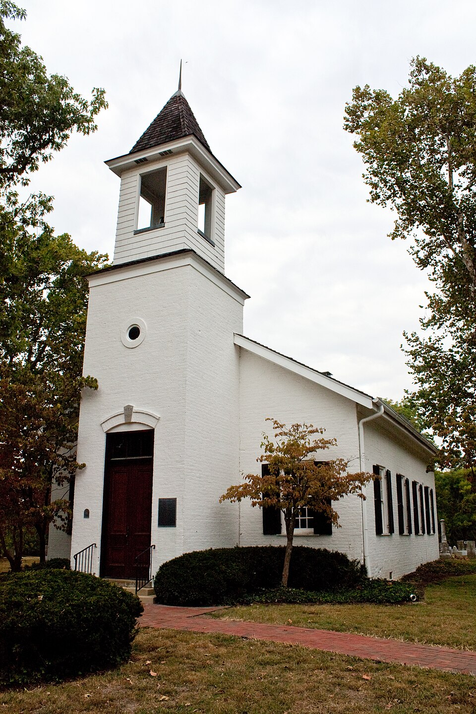
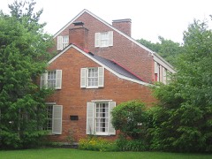
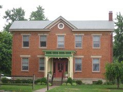
“Armstrong Chapel United Methodist Church is a historic church in the city of Indian Hill, Ohio, United States. Built in 1831, it is a small rectangular building with a prominent front tower.”
Wikipedia article Armstrong Chapel United Methodist Church, CC BY-SA 4.0.
one of 314 National Register listings in Hamilton County · listed in 1975 · category: Building · one of 9 National Historic Landmarks in Hamilton County.
National Register reference number.75001432- the number the National Park Service assigned this property when it was listed, and the key its nomination file is catalogued under at the National Archives.
Specimens collected near this property
12 of 6,502 shown
Regional context, not property-specific
evidence. Museums hold 6,502 specimens
collected within 10 miles of United Methodist Church between 1819 and
1975: 3,799 Fungi, 1,539 Animalia, 766 Plantae, 356 Protozoa, 29 Unrecorded, 13 Chromista. 12 distinct Species records are shown.
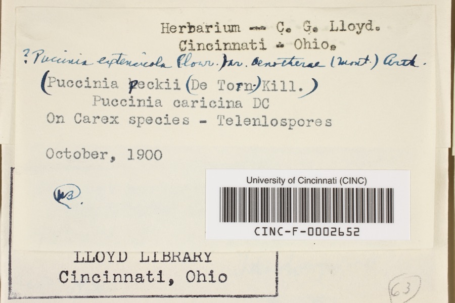
Collected by 14753, A. Braun, A. F. Braun and others. Each is a
physical object with a catalogue
number, and each entry opens the museum's record. This is what was
collected and kept, not a survey of what lives here - nothing can be
concluded from a species being absent.
Regional context, not property-specific
evidence. The federal mineral resources record lists
8 workings within 5 miles of United Methodist Church: 4 past producers, 2 unknowns, 1 producer, 1 plant.
2 still produce. What was taken out: Sand and Gravel, Construction, Zirconium, Titanium, Zirconium. Distance is straight-line from the
map coordinates, so a quarry counted here may appear on a neighbouring
settlement's page as well.
Regional context, not property-specific
evidence. The National Weather Service names
Mariemont, the town this property stands in, in 5 storm reports between 2000 and 2013: 2 hail, 2 thunderstorm wind, 1 flood.
No death or injury is recorded in these reports. Each account below is quoted exactly as the forecast office
filed it, from the NOAA Storm Events Database, and each date
opens the federal record of that event.
A supercell reintensified over the southeastern part of the county creating hail to golfball size at Mariemont and to quarter size near Ashbury. Trees were also blown down in Mariemont.
No historic map-sheet match is published
for this property yet. That does not mean no map exists. This record needs
a coordinate-quality review before it can be joined to a sheet boundary.
Browse the county's mapped places while that work is
pending.
From the nomination file
2,735 words on record
When this property was proposed for the
National Register, someone wrote the case for it: what the building is,
and why it matters. That document is a federal record in the public domain.
It is quoted below word for word, never summarised. The text was read off the scanned case file by machine, so the
occasional stray character is the recogniser's and the 1970s
typewriter's.
Description of the property
cutout openings on all four sides. This was smaller than the tower placed along either side of the building. Originally, a side door been where the windows second from the end are located today. These DATE The entrance consists of stone as the exterior. When entering through the front, you pass through pointed roof.The later bell tower was a simple box-like affair with and so produced an inset effect.T the east end of the church; one to either side of the altar.Origi- MOLDING LRUINS AREAS OF
Statement of significance
dist for over 140 years. Veterans of all U.S. wars from the Revolutionary to WWII are buried - in The Armstrong Chapel Cemetery- known if he fought in the Revolution, but it was on part of the "new land" such veterans could claim, in Virginia's Shenandoah Valley, that on their land in 1802, and it was said to be the second mill in the 1500-1599 1600-1699 1700-1799 X1800-1899 ARCHEOLOGY-HISTORIC PERIOD AGRICULTURE BUILDER/ARCHITECT SCIENCE ART THEATER MILITARY SIGNIFICANCE the Rockingham Militia and helped President Washington suppress the XARCHITECTURE the area, the Nathaniel Armstrong Family.
_EXPLORATION/SETTLEMENT _COMMUNICATIONS ARCHEOLOGY-PREHISTORIC Samuel Earhart 1900- POLITICS/GOVERNMENT _ENGINEERING _CONSERVATION dent Jefferson's government hired the Armstrongs to build flatboats at _TRANSPORTATION Louisiana territory from the French and erect a Western empire, Presi- SCULPTURE could be used, Burr was seized, and they were sold at public auction Hill.Nathaniel Armstrong had been a miller in Virginia,and his son dent Aaron Burr was mustering a flotilla of flatboats to sieze the hundred acres of government land" and worked a small farm there for 15 XRELIGION home was situated on the Little Miami River in what is today Indian _EDUCATION it represents a monument to one of the earliest pioneer families in -ECONOMICS -PHILOSOPHY _INDUSTRY John had been an ensign in the 58th Regiment of American church architecture since the building dates from 183l.
Nathaniel Shepherd Armstrong was born in 1749,and until the age of -LITERATURE _COMMERCE -1400-1499 by what he found in he prevailed upon his family to follow - MUSIC -LAW The denomination has been continuously Metho- His son, John Armstrong, left the family home in Virginia at the The Armstrong Chapel is a significant local historic landmark because -important locally because of its contributions to the growth of 36, lived near Baltimore, in Maryland's Hartford County.
Quoted from the National Register nomination
for reference 75001432, 22 pages, held by the National Archives in Record
Group 79. See the
catalogue record.
Listed places nearby
6 within 8 miles
Other National Register properties close
enough to walk or drive between, ordered by distance from this one. Both
positions come from the same geocoding pass that matched these properties
to their map sheets.
Listing record. National Park Service National Register of Historic Places, listed-properties dataset, current to 2026-05-22.
Map join. Address geocoded through the United States Census geocoder, then tested against the published boundary of every sheet in the USGS Historical Topographic Map Collection.
How this page is made. Listing fields come from federal records; map-sheet coverage is a labelled coordinate-to-boundary calculation, not a source-field claim.
Specimens. Global Biodiversity Information Facility (GBIF), https://www.gbif.org/. Only records licensed CC0 or CC BY are used. Records licensed CC BY-NC are excluded because this site carries advertising. Images are checked individually and any whose licence is non-commercial, no-derivatives or unreadable is refused.
Mines and quarries. USGS Mineral Resources Data System (MRDS) https://mrdata.usgs.gov/mrds/ A work of the United States government, no copyright under 17 U.S.C. 105.
Storms. NOAA National Centers for Environmental Information, Storm Events Database https://www.ncei.noaa.gov/stormevents/ A work of the United States government, no copyright under 17 U.S.C. 105. Narratives are quoted verbatim from the National Weather Service report and are not edited or summarised.
 Block
Block