Listed on the National Register of Historic Places in
1976. A historic map-sheet match is not published yet. The record needs a coordinate-quality review before it can be joined to a sheet boundary.
From the record
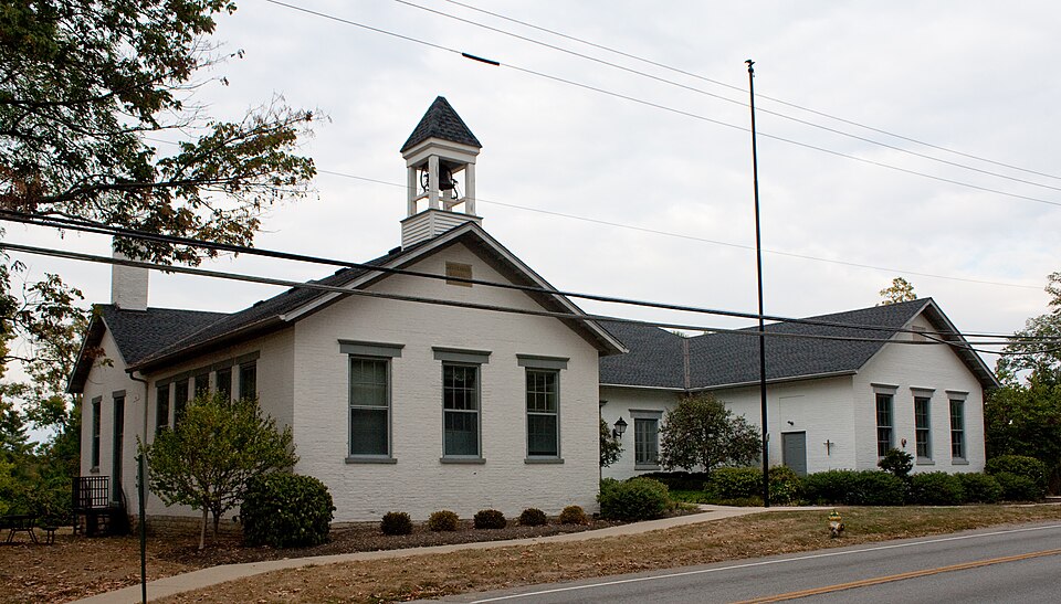
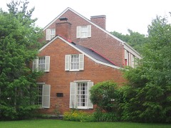
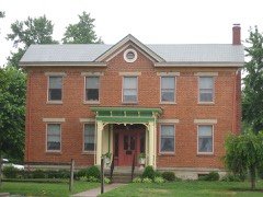
“The Jefferson Schoolhouse is a historic one-room school in the Village of Indian Hill, Ohio, United States. Built along Drake Road in 1851, it is Indian Hill's oldest extant school.”
Wikipedia article Jefferson Schoolhouse, CC BY-SA 4.0.
one of 314 National Register listings in Hamilton County · listed in 1976 · category: Building · one of 9 National Historic Landmarks in Hamilton County.
National Register reference number.76001450- the number the National Park Service assigned this property when it was listed, and the key its nomination file is catalogued under at the National Archives.
Specimens collected near this property
12 of 6,434 shown
Regional context, not property-specific
evidence. Museums hold 6,434 specimens
collected within 10 miles of Jefferson Schoolhouse between 1819 and
1975: 3,799 Fungi, 1,488 Animalia, 751 Plantae, 356 Protozoa, 27 Unrecorded, 13 Chromista. 12 distinct Species records are shown.
Collected by 14753, A. Braun, A. F. Braun and others. Each is a
physical object with a catalogue
number, and each entry opens the museum's record. This is what was
collected and kept, not a survey of what lives here - nothing can be
concluded from a species being absent.
Regional context, not property-specific
evidence. The federal mineral resources record lists
8 workings within 5 miles of Jefferson Schoolhouse: 4 past producers, 2 unknowns, 1 producer, 1 plant.
2 still produce. What was taken out: Sand and Gravel, Construction, Zirconium, Titanium, Zirconium. Distance is straight-line from the
map coordinates, so a quarry counted here may appear on a neighbouring
settlement's page as well.
No historic map-sheet match is published
for this property yet. That does not mean no map exists. This record needs
a coordinate-quality review before it can be joined to a sheet boundary.
Browse the county's mapped places while that work is
pending.
From the nomination file
1,739 words on record
When this property was proposed for the
National Register, someone wrote the case for it: what the building is,
and why it matters. That document is a federal record in the public domain.
It is quoted below word for word, never summarised. The text was read off the scanned case file by machine, so the
occasional stray character is the recogniser's and the 1970s
typewriter's.
Description of the property
When this small, one room structure became insufficient, a rectangular the building is devoid of decorative, architectural details. CONDITION MOVED UNEXPOSED roof. DETERIORATED DATE EXCELLENT UNALTERED XALTERED building resulting in its present U-shaped configuration.The wing The Jefferson Schoolhouse was originally a one story, rectangular bay south facade and five bays on the east side. is identical to the original section of the building with a three windows, six-over-six with simple stone sills and lintels.The west school and date built inscribed.
south end of the building is divided into three bays by double hung flanked by a window on either side.The north side is divided into shaped floor plan.The south facade has a centrally located entrance At a still later date a wing was added to the southeast side of the building, constructed of brick with a gabled roof of easy pitch. side is divided into five bays by identical windows. The roof is Except for the regular placement of the windows and the bell tower, seven bays by double hung windows.This section also has a gabled The foundation is stone and the brick is layed in common bond.The aflat roof.A stone plaque in the south gable has the name of the wing was added to the north end of the building resulting in an L- -RUINS -GOOD AREAS OF
Statement of significance
The Jefferson School House, dating from 1851, is the oldest school in !Indian Hill and representative of the early type of building Americans; Washington, Jefferson and Franklin. The Jefferson School is located directly across from the Armstrong Chapel, on designations had nothing to do with structural size, but instead 1700-1799 1500-1599 1600-1699 1851 COMMERCE RELIGION INVENTION ART PHILOSOPHY AGRICULTURE ARCHEOLOGY-HISTORIC PERIOD THEATER LAW TRANSPORTATION PREHISTORIC POLITICS/GOVERNMENT BUILDER/ARCHITECT SIGNIFICANCE SCULPTURE MILITARY LITERATURE XARCHITECTURE XEDUCATION unknown MUSIC SCIENCE 1900- X1800-1899 _ECONOMICS _EXPLORATION/SETTLEMENT the Armstrong Community Building ever since. _CONSERVATION used in school houses at that time.
_1400-1499 the north side of Indian Hill Road and is owned by The Armstrong creating the structure as we see it today.The structure outgrew The first schools of Indian Hill were named after three great was added in l926,doubling the size of the structure and the last four grades taught in the Big Room.Another addition designation of the rooms as Little Room and Big Room;these _ENGINEERING its usefulness as a school in the l940's and has been used as The architect is unknown.Sometime around 1900,an ell was _COMMUNITY PLANNING Chapel. This school is the oldest in the area, dating from 1851. added, creating a two room structure. This resulted in the ARCHEOLOGY-PREHISTORIC referred to the first four grades taught in the Little Room and
Quoted from the National Register nomination
for reference 76001450, 15 pages, held by the National Archives in Record
Group 79. See the
catalogue record.
Listed places nearby
6 within 8 miles
Other National Register properties close
enough to walk or drive between, ordered by distance from this one. Both
positions come from the same geocoding pass that matched these properties
to their map sheets.
Listing record. National Park Service National Register of Historic Places, listed-properties dataset, current to 2026-05-22.
Map join. Address geocoded through the United States Census geocoder, then tested against the published boundary of every sheet in the USGS Historical Topographic Map Collection.
How this page is made. Listing fields come from federal records; map-sheet coverage is a labelled coordinate-to-boundary calculation, not a source-field claim.
Specimens. Global Biodiversity Information Facility (GBIF), https://www.gbif.org/. Only records licensed CC0 or CC BY are used. Records licensed CC BY-NC are excluded because this site carries advertising. Images are checked individually and any whose licence is non-commercial, no-derivatives or unreadable is refused.
Mines and quarries. USGS Mineral Resources Data System (MRDS) https://mrdata.usgs.gov/mrds/ A work of the United States government, no copyright under 17 U.S.C. 105.
 Block
Block