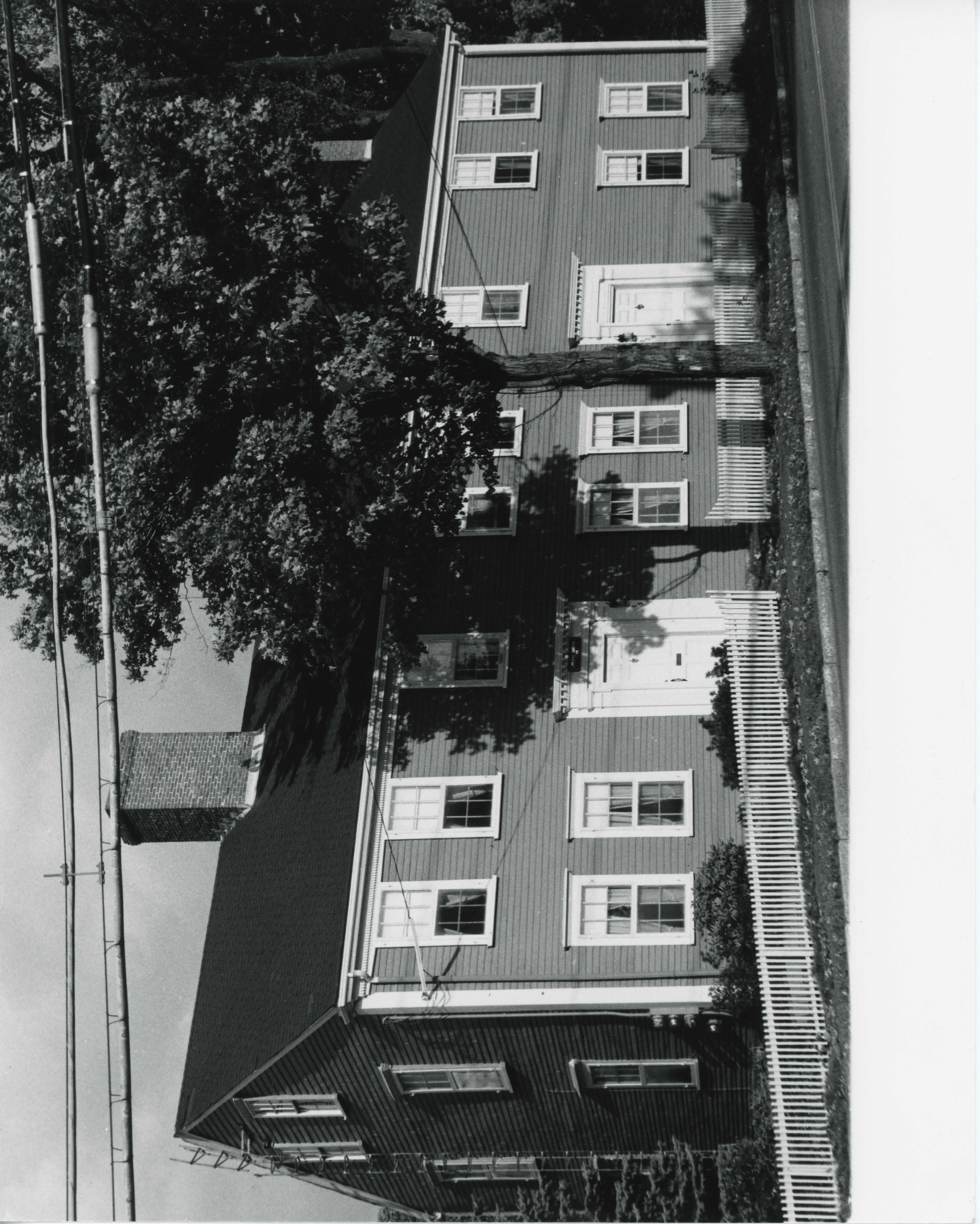
Photographs from the nomination case file, National Park Service records.
Simonds Tavern
Listed on the National Register of Historic Places in
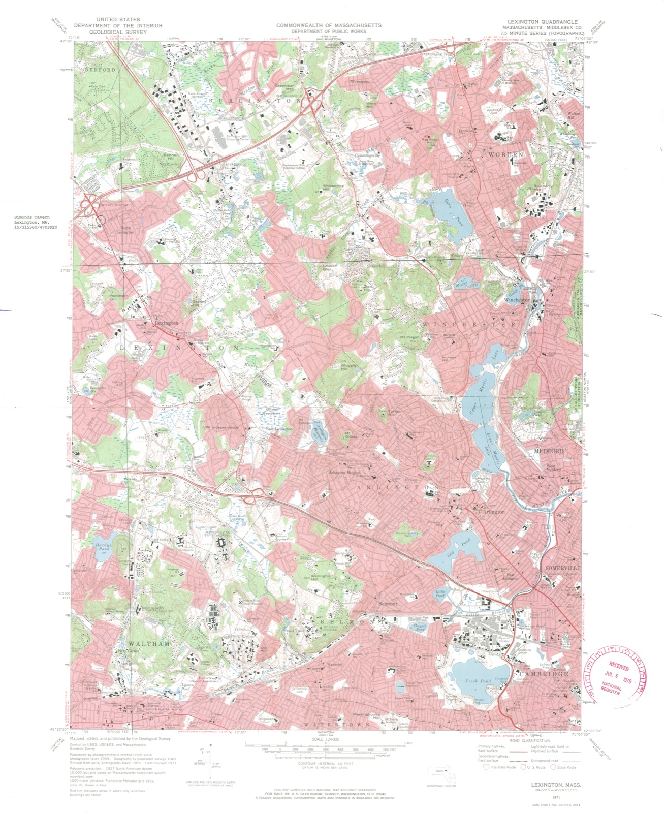
1976. A historic map-sheet match is not published yet. The record needs a coordinate-quality review before it can be joined to a sheet boundary.
From the record
“Such were tlie opinions expressed, the resokitions adopted, and the measures taken by the people of tliis Province, long before the 19th of April, 1775. It was not the battle of Lexington that gave rise to the llevolution.”
History of the Town of Lexington, Middlesex County, Massachusetts, from Its First Settlement to 1868, with a Genealogical Register of Lexington Families (1868). Machine-read text.
one of 1100 National Register listings in Middlesex County · listed in 1976 · category: Building · one of 3 National Historic Landmarks in Middlesex County.
National Register reference number.76000251- the number the National Park Service assigned this property when it was listed, and the key its nomination file is catalogued under at the National Archives.
What happened here
An account from the chapter on Lexington town, The inset identifies its exact
source book and publication year.
He was first taxed in 1748< He was a member of Capt. Parker's company on the morning of 19 April 1775, and was severely wounded by a bullet which struck his right arm, and so fractured the bone that he was not only disabled for a long time, but pieces of bone were extracted from it for several months afterward.
Of the illustrations bound witli this work, the portraits of Rev. Mr. Hancock, Col. INIunroe, and the author were furnished by their respective descendants ; and those of Theodore Parker, Rev. Dr. and Mrs. Follen, and Rev. Mr. Stetson, by their numerous friends resident in the vicinity. The views of dwelling-houses, including the Lexington House, Avere, except as stated below, sup])lied by their present or late owners ; and those of public buildings by citizens' subscriptions.
In the exercise of the powers given to them, the Committee have inserted the following illustrations at the town's expense, viz. : a lithographic portrait of Jonathan Harrington ; wood enjrravinffs of the Clarke House, the old Munroe Tavern, the INIonument, the proposed Monument, and the Battle Scene on the 19th of April ; diagrams of Lexington Common, and the Old North Bridge at Concord, with their surroundings as they were in 1775 ; andy^c similes of the autogi'aphs of twenty-nine men whose names are affixed to public documents which are a part of the History. It was thought that nothing ought to be omitted from the book, which could serve to explain, or invest with additional interest, the events narrated.
Regional context, not property-specific
evidence. The
federal wildfire occurrence database
lists 28 fires within 5 miles of Simonds Tavern between
1992 and 2020, burning about 18 acres in total. 1 started naturally. None was recorded as arson.
Distance is straight-line from the map coordinates, so a fire counted
here may appear on a neighbouring settlement's page as well.
Reported cause
Fires
Debris and open burning
14
Missing data/not specified/undetermined
9
Recreation and ceremony
2
Other causes
1
Misuse of fire by a minor
1
Natural
1
The most recent of
them, most recent first, with the day each was reported and the service
that recorded it.
Regional context, not property-specific
evidence. Museums hold 1,727 specimens
collected within 10 miles of Simonds Tavern between 1898 and
1975: 751 Animalia, 567 Plantae, 366 Fungi, 17 Bacteria, 9 Unrecorded, 9 Protozoa, 8 Chromista. 12 distinct Species records are shown.
Collected by ?, A B Seymour, A B. Proper and others. Each is a
physical object with a catalogue
number, and each entry opens the museum's record. This is what was
collected and kept, not a survey of what lives here - nothing can be
concluded from a species being absent.
Regional context, not property-specific
evidence. The federal mineral resources record lists
11 workings within 5 miles of Simonds Tavern: 7 past producers, 2 producers, 2 plants.
4 still produce. What was taken out: Sand and Gravel, Construction, Peat, Clay, Iron. Distance is straight-line from the
map coordinates, so a quarry counted here may appear on a neighbouring
settlement's page as well.
Regional context, not property-specific
evidence. The National Weather Service names
Lexington, the town this property stands in, in 14 storm reports between 1997 and 2022: 6 hail, 6 thunderstorm wind, 1 flood, 1 lightning.
No death or injury is recorded in these reports. Each account below is quoted exactly as the forecast office
filed it, from the NOAA Storm Events Database, and each date
opens the federal record of that event.
Three lanes of Route 128 in Burlington were closed due to flooding. There was also 6 inches of flooding across the all lanes of Route 128 near North Street in Reading.
No historic map-sheet match is published
for this property yet. That does not mean no map exists. This record needs
a coordinate-quality review before it can be joined to a sheet boundary.
Browse the county's mapped places while that work is
pending.
From the nomination file
2,038 words on record
When this property was proposed for the
National Register, someone wrote the case for it: what the building is,
and why it matters. That document is a federal record in the public domain.
It is quoted below word for word, never summarised. The text was read off the scanned case file by machine, so the
occasional stray character is the recogniser's and the 1970s
typewriter's.
Description of the property
Simond's Tavern is a free standing two-story, gabled block situated on the east side of Bedford Street inmediately before its intersection with the highway Route 128, and about Iz miles northwest of Lexington Center. The heavy traffic on Bedford Street detracts somewhat from the predominantly residential character of the neighborhood, as does Route 128. Despite these intrusions, Simond's Tavern remains unaltered. Simond's Tavern is built on a granite faced, brick foundation with the gables to the side. The facade which faces west, the north elevation, and the east elevation are sheathed in clapboard. The south elevation is brick with bridged chimneys. The ori- ginal Georgian house, c. 1795, is five bays wide, with a center entry and center chim- ney.
A wing was added to the house about 1810; it is three bays wide with an entrance anattenpioco bala placed in the first bay, in an attempt to balance the facade proportionally. The facade has been treated as a unit; the dentil course of the cornice continues un- interrupted for the full length of the building. The two entrances of the main facade are nearly identical with pilasters, a simple entablature and a projecting, flat cornice with modillions above a dentil course. The southern door, however, has a simpler and narrower architrave than the northern entrance. Fenestration throughout is six-over-six sash.
On the facade, the bays are equally pro- portioned except for the bay south of the south door, which is slightly wider; this tenas to emphasize the distinction between the two sections of the building. Second floor window tops are flush with the cornice. On the north elevation, at the attic level, are two small windows placed close together.
/ARCHITECT The Simonds Tavern is significant because of its association with the early settlers of Lexington and the commercial history of the Federal era of the Town. The Simonds family arrived in Lexington in 1686 and were large landowners. In 1760, Joshua Simonds acquired thirty-six acres of land where the Tavern was later built. He was a member of Captain Parker's company of Minute Men and participated in the Battle of April 19, 1775. Joshua Simonds Jr. (1770-1858) inherited the land and built the ori- ington.orth section of the tavern about 1794, when he married Abigail Cutler of lex- He kept a tavern (now lost) on Monument Street (now Massachusetts Avenue), at the base of Fiske Hill, west of Lexington Center.
Sensing the opportunity created by the growing traffic of drovers bringing cattle, sheep and turkeys to the Boston market from the north, in 1802 he opened a tavern in his house on Bedford Street. TARE 1806, Bedford Street was rebuilt west from the Lexington Green, replacing the older more circuitous route. Simonds' new tavern prospered because of the new road, and an addition was built in 1810. Joshua Simonds apparently found running two taverns too strenuous and closed the Bedford Street tavern in 1828. Since then, the building has served as a farmhouse and residence for a succession of Lexington families. The present owners have meticulously preserved the magnificent interior panelling of the older north section.
Architecturally, Simonds Tavern is significant as one of the few double Federal houses in Lexington.
Quoted from the National Register nomination
for reference 76000251, 11 pages, held by the National Archives in Record
Group 79. See the
catalogue record.
Listed places nearby
6 within 8 miles
Other National Register properties close
enough to walk or drive between, ordered by distance from this one. Both
positions come from the same geocoding pass that matched these properties
to their map sheets.
Listing record. National Park Service National Register of Historic Places, listed-properties dataset, current to 2026-05-22.
Map join. Address geocoded through the United States Census geocoder, then tested against the published boundary of every sheet in the USGS Historical Topographic Map Collection.
How this page is made. Listing fields come from federal records; map-sheet coverage is a labelled coordinate-to-boundary calculation, not a source-field claim.
Wildfire. Short, Karen C. 2022. Spatial wildfire occurrence data for the United States, 1992-2020 [FPA_FOD_20221014]. 6th Edition. Fort Collins, CO: Forest Service Research Data Archive. https://doi.org/10.2737/RDS-2013-0009.6 Collected with United States Government funding and usable without additional permissions or fees.
Specimens. Global Biodiversity Information Facility (GBIF), https://www.gbif.org/. Only records licensed CC0 or CC BY are used. Records licensed CC BY-NC are excluded because this site carries advertising. Images are checked individually and any whose licence is non-commercial, no-derivatives or unreadable is refused.
Mines and quarries. USGS Mineral Resources Data System (MRDS) https://mrdata.usgs.gov/mrds/ A work of the United States government, no copyright under 17 U.S.C. 105.
Storms. NOAA National Centers for Environmental Information, Storm Events Database https://www.ncei.noaa.gov/stormevents/ A work of the United States government, no copyright under 17 U.S.C. 105. Narratives are quoted verbatim from the National Weather Service report and are not edited or summarised.
 Block
Block