BlockBefore
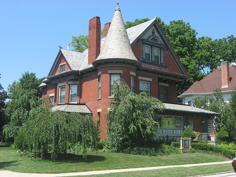
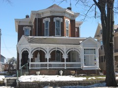
Photograph of Donovan Robeson House
Photograph by Nyttend, Public domain. Via Wikimedia Commons.

Robeson, Dr. Donovan, House

Listed on the National Register of Historic Places in 1976. A historic map-sheet match is not published yet. The record needs a coordinate-quality review before it can be joined to a sheet boundary.

From the record

“The Donovan Robeson House is a historic house in Greenville, Ohio, United States. Located along Fourth Street west of downtown, the Robeson House has been ranked as the city's most significant Queen Anne mansion.”

Wikipedia article Donovan Robeson House, CC BY-SA 4.0.

one of 25 National Register listings in Darke County · listed in 1976 · category: Building.

Sources: the Wikipedia article · the case file at the National Archives · the National Register database, National Park Service

The listing

  • What is counted as historic. The nomination lists 1 building as contributing to the listing.
  • Address. 330 W. 4th St., Greenville, 45331
  • When was it listed? 1976-12-12
  • Category. building
  • Township. Greenville township
  • Architectural style. Queen Anne style architecture in the United States
  • National Register reference number. 76001411 - the number the National Park Service assigned this property when it was listed, and the key its nomination file is catalogued under at the National Archives.

The ground it stands on

167,840 words

The chapter on Greenville Township in The History of Darke County, Ohio, Containing a History of the County; Its Cities, Towns, Etc.; General and Local Statistics; Portraits of Early Settlers and Prominent Men;, published 1880 names Greenville. This is what it says, exactly as the scans read.

Darke County was organized in March, 1817, from Miami County. It is abundantly timbered with poplar, walnut, blue ash, hickory, beech and sugar maple. It yields superior wheat, and is well adapted to grazing. In this county occurred the lamentable defeat of St. Clair, and the treaty of Greenville.

Passage source: The History of Darke County, Ohio, Containing a History of the County; Its Cities, Towns, Etc.; General and Local Statistics; Portraits of Early Settlers and Prominent Men;, published 1880.

Greenville is the county seat, and was laid out August 10, 1808, by Robert Gray and John Dover. In December, 1793, Wayne built Fort Greenville on this spot, which covered about the same extent as the present town.

Passage source: The History of Darke County, Ohio, Containing a History of the County; Its Cities, Towns, Etc.; General and Local Statistics; Portraits of Early Settlers and Prominent Men;, published 1880.

Machine-read from a century-old scan, so expect the errors a machine makes: misspelled names, dropped words, stray characters.

Read the whole chapter on Greenville Township - 167,840 words on its settlement, mills, schools and churches.

Specimens collected near this property

12 of 478 shown

Regional context, not property-specific evidence. Museums hold 478 specimens collected within 10 miles of Robeson, Dr. Donovan, House between 1895 and 1975: 446 Animalia, 18 Plantae, 14 Fungi. 12 distinct Species records are shown. Collected by A VERWYST, A. F. C.; Stover, W. G., Albrecht, C. and others. Each is a physical object with a catalogue number, and each entry opens the museum's record. This is what was collected and kept, not a survey of what lives here - nothing can be concluded from a species being absent.

Image SpeciesYear Collected by Where, as recorded
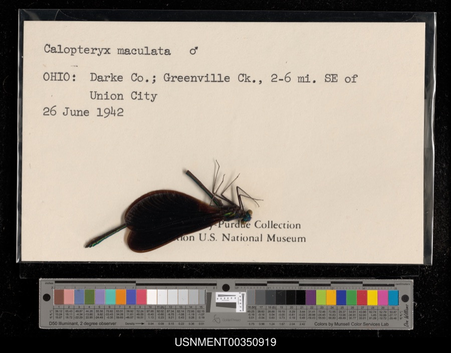
Specimen of Calopteryx maculata (Palisot de Beauvois, 1807)Calopteryx maculata (Palisot de Beauvois, 1807)1942[Not Stated]Greenville Creek, 2-6 miles southeast of Union City
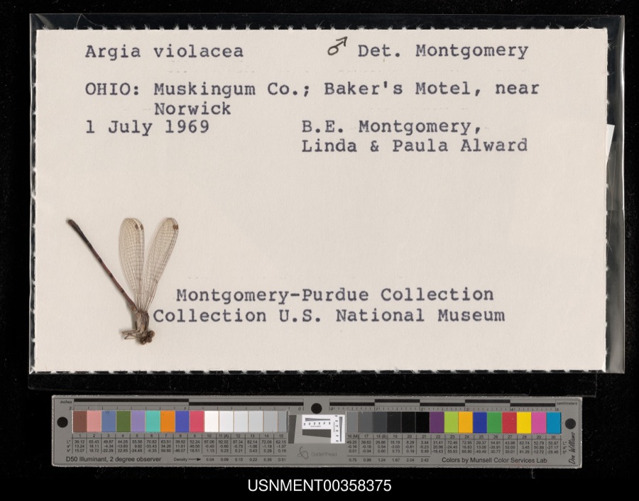
Specimen of Argia fumipennis violacea (Hagen, 1861)Argia fumipennis violacea (Hagen, 1861)1969B. Montgomery, L. Alward & P. AlwardBaker's Motel, near Norwick
A photograph of the species Dispira americana, not of this specimenDispira americana Thaxt.1895Rush W. H.Greenville
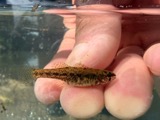
A photograph of the species Etheostoma caeruleum, not of this specimenEtheostoma caeruleum Storer, 18451905Clark, C. F. (Clarence F.)Prairie Outlet, Sec 28 of Neave township, ~0.3 mi NE of Wayne Lakes Park, Neave township
A photograph of the species Etheostoma microperca, not of this specimenEtheostoma microperca Jordan & Gilbert, 18881905Clark, C. F. (Clarence F.)Prairie Outlet, Sec 28 of Neave township, ~0.3 mi NE of Wayne Lakes Park, Neave township
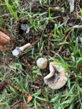
A photograph of the species Clitocybe multiceps, not of this specimenClitocybe multiceps Peck1906H.J. BrememanGreenville
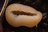
A photograph of the species Peziza vesiculosa, not of this specimenPeziza vesiculosa Bull.1907Lucas, CGreenville
A photograph of the species Amanita phalloides, not of this specimenAmanita phalloides (Vaill. ex Fr.) Secr.1909A. F. C.; Stover, W. G.Greenville
A photograph of the species Clitocybe odora, not of this specimenClitocybe odora (Bull.) P.Kumm.1909Stover, W. G.Greenville
A photograph of the species Panaeolus solidipes, not of this specimenPanaeolus solidipes (Peck) Sacc.1909Stover, W. G.Greenville
A photograph of the species Fomes lobatus, not of this specimenFomes lobatus Cooke1911Overholts L. O.Gettysburg
A photograph of the species Macrolepiota procera, not of this specimenMacrolepiota procera (Scop.) Singer1911OverholtsGettysburg

All 478 specimens within 10 miles, at the Global Biodiversity Information Facility.

Mines and quarries near this property

5 within 5 miles

Regional context, not property-specific evidence. The federal mineral resources record lists 5 workings within 5 miles of Robeson, Dr. Donovan, House: 3 producers, 2 past producers. 3 still produce. What was taken out: Sand and Gravel, Construction, Clay. Distance is straight-line from the map coordinates, so a quarry counted here may appear on a neighbouring settlement's page as well.

Where SiteCommodity StatusRecorded
Darke County PitClayPast ProducerSedimentary
Darke County PitClayProducer
Feitshans PitSand and Gravel, ConstructionPast ProducerSedimentary
Feitshans PitSand and Gravel, ConstructionProducer
Fourmans Gravel PitSand and Gravel, ConstructionProducer

Every working recorded in Darke County

Storms near this property

60 of 65 shown

Regional context, not property-specific evidence. The National Weather Service names Greenville, the town this property stands in, in 65 storm reports between 1994 and 2026: 31 thunderstorm wind, 18 hail, 9 flood, 4 flash flood. No death or injury is recorded in these reports. Each account below is quoted exactly as the forecast office filed it, from the NOAA Storm Events Database, and each date opens the federal record of that event.

WhenEvent Place namedHarm What the report says
May 2002Thunderstorm WindGreenville$100,000Several mobile homes in the Sherwood Forest Trailer Park suffered severe damage, and a nearby 10' by 12' shed was destroyed. The roof of a home on Hog Path Road was torn off.
July 2003Thunderstorm WindGreenville$25,000Numerous large trees were knocked down. Three homes on Oliver Road sustained structural damage, likely from a microburst.
July 2023Thunderstorm WindGreenville$20,000Numerous trees were downed throughout the county, especially in the Greenville area.
April 2010LightningGreenville$20,000There were several reports of damage and structural fires due to lightning across the county.
June 1995Thunderstorm WindGreenville$15,000Several trees downed, some onto an automobile.
September 2024Thunderstorm WindGreenville$12,000Several trees and power lines were downed in the Greenville area.
July 2013Thunderstorm WindGreenville$10,000A large tree fell on a house due to thunderstorm winds.
September 2011Thunderstorm WindGreenville$10,000Numerous trees were down and a roof was removed from a barn due to damaging thunderstorm winds.
October 2010Thunderstorm WindGreenville$10,000Several trees, power poles, and power lines were reported down across the southern half of the county.
September 2000Thunderstorm WindGreenville$10,000Large limbs and power lined knocked down.
June 1998Tornado (F0)Greenville$10,000A brief tornado touchdown produced downed power lines and damaged a camper. Also, 1 home received minor structural damage.
July 1998Thunderstorm WindGreenville$10,000Numerous trees downed.
January 2017Thunderstorm WindGreenville$8,000Numerous trees and power lines were downed across Darke County, especially in the vicinity of Greenville, New Madison and Pitsburg.
May 2022Thunderstorm WindGreenville$6,000Several trees were downed in the Greenville area.
March 2011FloodGreenville$5,000Roads were flooded due to heavy rainfall.
March 2011FloodGreenville$5,000High water was reported on roads and some roads were closed due to heavy rainfall and previous snow melt. Flooding began around 0749 EST on February 28th and continued until around 1100 EST on March 1st. Damage estimates during February were around five-thousand dollars.
February 2011FloodGreenville$5,000High water was reported on roads and some of the roads were closed due to heavy rainfall and previous snow melt. Flooding began around 0749 EST on February 28th and continued until around 1100 EST on March 1st. Damage estimates during March were around five-thousand dollars.
August 2007Thunderstorm WindGreenville$5,000Numerous large tree limbs were downed.
March 2007FloodGreenville$5,000Several roads were flooded across the county.
March 2007FloodGreenville$5,000Several roads were flooded and closed. Sandbagging was necessary around residences near Gettysburg in the vicinity of Greenville Creek.
May 1994Thunderstorm WindGreenville$5,000Winds measured at 62 mph with some tree limbs downed.
April 2026Thunderstorm WindGreenville$3,000A few trees were downed.
July 2014Thunderstorm WindGreenville$3,000Several trees were downed due to thunderstorm winds.
July 2012Thunderstorm WindGreenville$3,000Trees were reported down in the area due to damaging thunderstorm winds.
December 2006FloodGreenville$3,000Several roads were flooded near the Stillwater River in eastern Darke county.
August 2005Thunderstorm WindGreenville$3,000A circus tent at the county fair was blown over.
June 2004Thunderstorm WindGreenville$3,000Six power poles were knocked down.
April 2003Thunderstorm WindGreenville$3,000Power poles were downed in town.
August 2003Thunderstorm WindGreenville$3,000Trees were knocked down.
June 1998Thunderstorm WindGreenville$3,000Trees downed.
June 2010Flash FloodGreenville$2,000Three feet of water was reported to be over Sater Street due to heavy rainfall.
November 2002Thunderstorm WindGreenville$2,000Numerous trees were downed between Greenville and Ansonia.
March 2026Thunderstorm WindGreenville$1,000A large tree was downed.
August 2014Thunderstorm WindGreenville$1,000One tree was knocked down.
June 2012Thunderstorm WindGreenville$1,000Large limbs were downed due to thunderstorm winds. The wind gust was estimated by the spotter.
April 2011Heavy RainGreenville$1,000A couple of roads were covered with high water.
June 2010Thunderstorm WindGreenville$1,000Two trees were reported down due to damaging thunderstorm winds.
June 2010FloodGreenville$1,000High water was still occurring over area roadways due to earlier flash flooding.
June 2016Thunderstorm WindGreenville$500A couple of large limbs were knocked down.
March 2020Flash FloodGreenville-High water was reported on numerous roads throughout the county.
February 2019FloodGreenville-Numerous roads were flooded throughout the county, specifically near Greenville, Versailles and Gettysburg, as well as north of Palastine.
December 2013FloodGreenville-State Route 502 west of Greenville was closed in both directions due to high water caused by earlier heavy rainfall.
May 2004Flash FloodGreenville-Two roads were flooded and closed in the southern part of the county.
August 2001Flash FloodGreenville-Heavy rainfall flooded roads.
May 2000HailGreenville-Hail as large as baseballs fell across the county for the second time in 90 minutes. This time the hail fell over a populated area causing damage to many cars, including 2 car lots.
May 2024HailGreenville-no account filed
June 2021HailGreenville-no account filed
May 2014HailGreenville-no account filed
September 2012HailGreenville-no account filed
March 2012HailGreenville-no account filed
March 2011HailGreenville-no account filed
May 2011HailGreenville-no account filed
September 2011HailGreenville-no account filed
June 2005HailGreenville-no account filed

Every storm recorded in Darke County

Newspapers printed here

0 digitised pages

1 paper published in this town, digitised by the Library of Congress and free to read: 0 issues, 0 pages. Every page is searchable, so a name or a street can be looked for directly in what the town printed about itself at the time.

NewspaperPublished
The Greenville Journal1850 to 1918

Map coverage status

No historic map-sheet match is published for this property yet. That does not mean no map exists. This record needs a coordinate-quality review before it can be joined to a sheet boundary. Browse the county's mapped places while that work is pending.

From the nomination file

1,563 words on record

When this property was proposed for the National Register, someone wrote the case for it: what the building is, and why it matters. That document is a federal record in the public domain. It is quoted below word for word, never summarised. The text was read off the scanned case file by machine, so the occasional stray character is the recogniser's and the 1970s typewriter's.

Description of the property

The right side has one box oriel window, a large polygonal bay with and hips. There are four tapered brick chimneys, two interior and an turn of the century houses but does not constitute a district in CONDITION stairway. quality. DETERIORATED FAIR The left side has a pedimented polygonal bay with pendented ornament CHECK ONE face stone rails and piers and projecting truncated hip roof. X_EXCELLENT The environment is a mature residential neighborhood of large The interior trim is in an excellent state of preservation. The Robeson House is a two and one-half story brick Queen inside on each side wall. multifaceted roof and a frame two story sun porch back of the bay. _UNEXPOSED -RUINS -GOOD (c.

1934) appended to the rear again with rockfaced piers, hip roof DATE concave conical patterned slate roof with fenial.The windows Anne of irregular plan standing on a moderately high rockface stone moulded frieze.The roof is patterned slate with complex gables Excellent tracery art glass windows are on each landing of the veranda partially encloses the bay.There is a carport and garage The living room has a fireplace in mission style.The dining room has a built in walnut buffet. There are boxed beam ceilings.

double hung sash with stone lintels and sills.The main door is including three bays with curved lights in the turret are l/l on the projecting cornice.A one story side porch patterned after the and concrete foundation with basement windows.The two bay The eaves are box cornice with consoles on a narrow in the right bay.The lower level is dominated by a veranda with rock- and a deck.T AREAS OF

Statement of significance

doctor served as Darke County Probate Judge. -1600-1699 Greenville at the turn of the century and had his new home built -1700-1799 Dr.Donovan Robeson was a physician, surgeon, and probate offices in the basement. -1500-1599 _CONSERVATION -1800-1899 study at Bellvue Medical College in 1874.Dr.Robeson moved to -1400-1499 -MUSIC _RELIGION From 1902 until 1908 the XLAW The most outstanding example of late Queen Anne brick house with his offices in the basement.

The whole case file for this property - 1,563 words, 12 pages, reproduced complete.

Quoted from the National Register nomination for reference 76001411, 12 pages, held by the National Archives in Record Group 79. See the catalogue record.

Listed places nearby

6 within 8 miles

Other National Register properties close enough to walk or drive between, ordered by distance from this one. Both positions come from the same geocoding pass that matched these properties to their map sheets.

Photograph PropertyDistance Listed
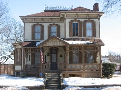
Waring Houseunder 500 feet1977
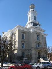
Darke County Courthouse, Sheriff's House, And Jail0.2 miles1976
Leftwich House0.3 miles1975
Coppess, Benjamin Franklin House0.3 miles1978
Beir, Anna, House0.4 miles1977
Broadway Bridge0.4 miles1996

Sources for this property

National Archives recordThe nomination case file for reference 76001411 in Record Group 79.
Wikipedia articleCommunity-written account of this property, licensed CC BY-SA.
Darke CountyAll 25 listed properties in this county.

Provenance

  • Listing record. National Park Service National Register of Historic Places, listed-properties dataset, current to 2026-05-22.
  • Map join. Address geocoded through the United States Census geocoder, then tested against the published boundary of every sheet in the USGS Historical Topographic Map Collection.
  • How this page is made. Listing fields come from federal records; map-sheet coverage is a labelled coordinate-to-boundary calculation, not a source-field claim.
  • Specimens. Global Biodiversity Information Facility (GBIF), https://www.gbif.org/. Only records licensed CC0 or CC BY are used. Records licensed CC BY-NC are excluded because this site carries advertising. Images are checked individually and any whose licence is non-commercial, no-derivatives or unreadable is refused.
  • Mines and quarries. USGS Mineral Resources Data System (MRDS) https://mrdata.usgs.gov/mrds/ A work of the United States government, no copyright under 17 U.S.C. 105.
  • Storms. NOAA National Centers for Environmental Information, Storm Events Database https://www.ncei.noaa.gov/stormevents/ A work of the United States government, no copyright under 17 U.S.C. 105. Narratives are quoted verbatim from the National Weather Service report and are not edited or summarised.