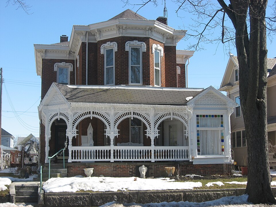
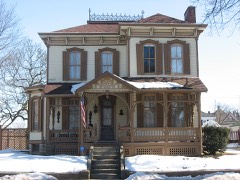
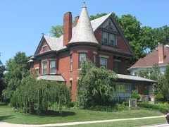
Built in 1882 in the Queen Anne style. Listed on the National Register of Historic Places in
1978. A historic map-sheet match is not published yet. The record needs a coordinate-quality review before it can be joined to a sheet boundary.
From the record
“The Benjamin Franklin Coppess House, built in 1882, is a historic Queen Anne and Stick-Eastlake style house located at 209 Washington Street in Greenville, Ohio, United States.”
Wikipedia article Benjamin Franklin Coppess House, CC BY-SA 4.0.
one of 25 National Register listings in Darke County · listed in 1978 · category: Building · built in 1882, Queen Anne style.
National Register reference number.78002052- the number the National Park Service assigned this property when it was listed, and the key its nomination file is catalogued under at the National Archives.
Darke County was organized in March, 1817, from Miami County. It is abundantly timbered with poplar, walnut, blue ash, hickory, beech and sugar maple. It yields superior wheat, and is well adapted to grazing. In this county occurred the lamentable defeat of St. Clair, and the treaty of Greenville.
Greenville is the county seat, and was laid out August 10, 1808, by Robert Gray and John Dover. In December, 1793, Wayne built Fort Greenville on this spot, which covered about the same extent as the present town.
Regional context, not property-specific
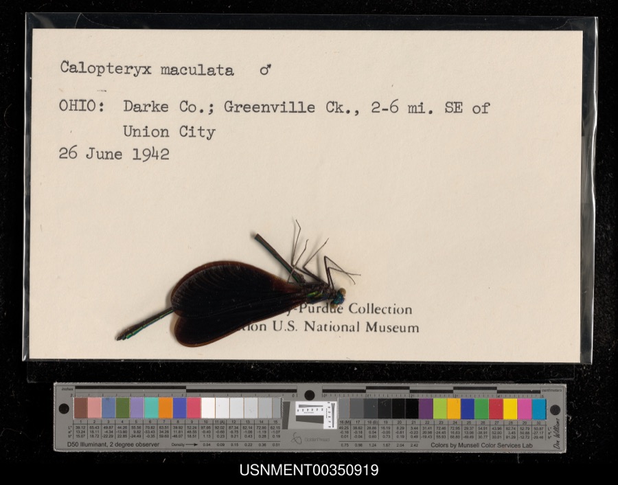
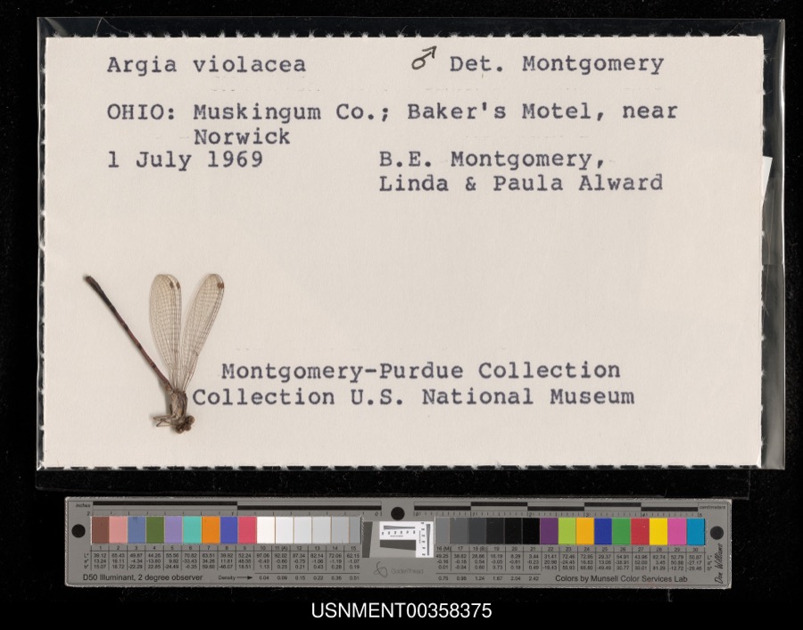
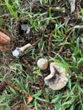
evidence. Museums hold 478 specimens
collected within 10 miles of Coppess, Benjamin Franklin House between 1895 and
1975: 446 Animalia, 18 Plantae, 14 Fungi. 12 distinct Species records are shown.
Collected by A VERWYST, A. F. C.; Stover, W. G., Albrecht, C. and others. Each is a
physical object with a catalogue
number, and each entry opens the museum's record. This is what was
collected and kept, not a survey of what lives here - nothing can be
concluded from a species being absent.
Regional context, not property-specific
evidence. The federal mineral resources record lists
5 workings within 5 miles of Coppess, Benjamin Franklin House: 3 producers, 2 past producers.
3 still produce. What was taken out: Sand and Gravel, Construction, Clay. Distance is straight-line from the
map coordinates, so a quarry counted here may appear on a neighbouring
settlement's page as well.
Regional context, not property-specific
evidence. The National Weather Service names
Greenville, the town this property stands in, in 65 storm reports between 1994 and 2026: 31 thunderstorm wind, 18 hail, 9 flood, 4 flash flood.
No death or injury is recorded in these reports. Each account below is quoted exactly as the forecast office
filed it, from the NOAA Storm Events Database, and each date
opens the federal record of that event.
Several mobile homes in the Sherwood Forest Trailer Park suffered severe damage, and a nearby 10' by 12' shed was destroyed. The roof of a home on Hog Path Road was torn off.
High water was reported on roads and some roads were closed due to heavy rainfall and previous snow melt. Flooding began around 0749 EST on February 28th and continued until around 1100 EST on March 1st. Damage estimates during February were around five-thousand dollars.
High water was reported on roads and some of the roads were closed due to heavy rainfall and previous snow melt. Flooding began around 0749 EST on February 28th and continued until around 1100 EST on March 1st. Damage estimates during March were around five-thousand dollars.
Hail as large as baseballs fell across the county for the second time in 90 minutes. This time the hail fell over a populated area causing damage to many cars, including 2 car lots.
1 paper published in this town,
digitised by the Library of Congress and free to read: 0 issues,
0 pages. Every page is searchable, so a name or a street can be
looked for directly in what the town printed about itself at the time.
No historic map-sheet match is published
for this property yet. That does not mean no map exists. This record needs
a coordinate-quality review before it can be joined to a sheet boundary.
Browse the county's mapped places while that work is
pending.
From the nomination file
1,359 words on record
When this property was proposed for the
National Register, someone wrote the case for it: what the building is,
and why it matters. That document is a federal record in the public domain.
It is quoted below word for word, never summarised. The text was read off the scanned case file by machine, so the
occasional stray character is the recogniser's and the 1970s
typewriter's.
Description of the property
is a notable example of the Eastlake style of decoration. The porch that is the most striking feature of the design.]The in character. CONDITION MOVED DATE UNALTERED FAIR XALTERED leg of the T thrusts forward surrounded by a veranda and enclosed The veranda is an outstanding Eastlake structure with veranda has retained its patterned slate roof. having keystone and incised decoration and stone lug sills. This T shaped brick house on a rock face stone foundation The eave is box cornice with brackets and panelled frieze. discloses cresting that has been removed.There is a one story onto the veranda and porch respectively.The facade has a polygonal of the house discloses that the veranda once extended across the bay with multifaceted roof.
_DETERIORATED The interior is very well preserved Victorian rather austere XORIGINAL SITE The windows are l/l double hung sash with wrapped hoodmoulds table leg columns, arches of intricate turning and gouge work, CHECK ONE extended forward sometime after l9oo.The window with small gable ends in moulded and carved relief work, and turned balusters. frame shed addition to the rear. X_EXCELLENT plain border shows in the old photo on line with the facade.The -UNEXPOSED -GOOD The old photo The asphalt shingle roof is truncated hip. corner.An old photograph with Mr.and Mrs. Coppess in front cross bar is a square block with Victorian moulded doors opening The main stone steps come on the porch at an angle on the northwest AREAS OF
Statement of significance
1400-1499 1500-1599 1882 1700-1799 1600-1699 EDUCATION ARCHEOLOGY-HISTORIC X1800-1899 ART PERIOD LAW RELIGION BUILDER/ARCHITECT CONSERVATION INVENTION PHILOSOPHY SIGNIFICANCE 1900- THEATER _COMMUNICATIONS AGRICULTURE SCIENCE SCULPTURE INDUSTRY LITERATURE in Greenville. MILITARY Benjamin Coppesss was grandson of pioneer Adam Coppess MUSIC An outstanding example of Eastlake decorative detail on XARCHITECTURE _EXPLORATION/SETTLEMENT _POLITICS/GOVERNMENT Coppess is also recorded in history as a soil analyst and abstract _TRANSPORTATION The house is reported to have had the first flush toilet clerk possibly work taken up after his retirement from the farm _PREHISTORIC Coppesses moved to Greenville and built the house in 1882. the town home of a retired farmer.
Richland Township on April 25,1838 and died in Greenville -ECONOMICS _OTHER(SPECIFY) on November 17,19ll at age 73.He was the youngest of eight _COMMERCE _COMMUNITY PLANNING to town. Mrs. Coppess died in 1913. brothers. years. ARCHEOLOGY-PREHISTORIC Benjamin was born in Benj. and Maria Coppess were married for forty-nine who came to Darke County in 18l9. oido
Quoted from the National Register nomination
for reference 78002052, 11 pages, held by the National Archives in Record
Group 79. See the
catalogue record.
Listed places nearby
6 within 8 miles
Other National Register properties close
enough to walk or drive between, ordered by distance from this one. Both
positions come from the same geocoding pass that matched these properties
to their map sheets.
Listing record. National Park Service National Register of Historic Places, listed-properties dataset, current to 2026-05-22.
Map join. Address geocoded through the United States Census geocoder, then tested against the published boundary of every sheet in the USGS Historical Topographic Map Collection.
How this page is made. Listing fields come from federal records; map-sheet coverage is a labelled coordinate-to-boundary calculation, not a source-field claim.
Specimens. Global Biodiversity Information Facility (GBIF), https://www.gbif.org/. Only records licensed CC0 or CC BY are used. Records licensed CC BY-NC are excluded because this site carries advertising. Images are checked individually and any whose licence is non-commercial, no-derivatives or unreadable is refused.
Mines and quarries. USGS Mineral Resources Data System (MRDS) https://mrdata.usgs.gov/mrds/ A work of the United States government, no copyright under 17 U.S.C. 105.
Storms. NOAA National Centers for Environmental Information, Storm Events Database https://www.ncei.noaa.gov/stormevents/ A work of the United States government, no copyright under 17 U.S.C. 105. Narratives are quoted verbatim from the National Weather Service report and are not edited or summarised.
 Block
Block