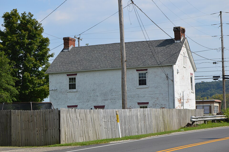
Listed on the National Register of Historic Places in
1976. A historic map-sheet match is not published yet. The record needs a coordinate-quality review before it can be joined to a sheet boundary.
From the record
one of 16 National Register listings in Lawrence County · listed in 1976 · category: Building.
National Register reference number.76001463- the number the National Park Service assigned this property when it was listed, and the key its nomination file is catalogued under at the National Archives.
Fires near this property
26 since 2001
Regional context, not property-specific
evidence. The
federal wildfire occurrence database
lists 26 fires within 5 miles of Johnston, William C., House And General Store between
2001 and 2020, burning about 54 acres in total. None started naturally. 1 was recorded as arson.
Distance is straight-line from the map coordinates, so a fire counted
here may appear on a neighbouring settlement's page as well.
Reported cause
Fires
Debris and open burning
16
Missing data/not specified/undetermined
5
Recreation and ceremony
3
Arson/incendiarism
1
Other causes
1
The most recent of
them, most recent first, with the day each was reported and the service
that recorded it.
Regional context, not property-specific
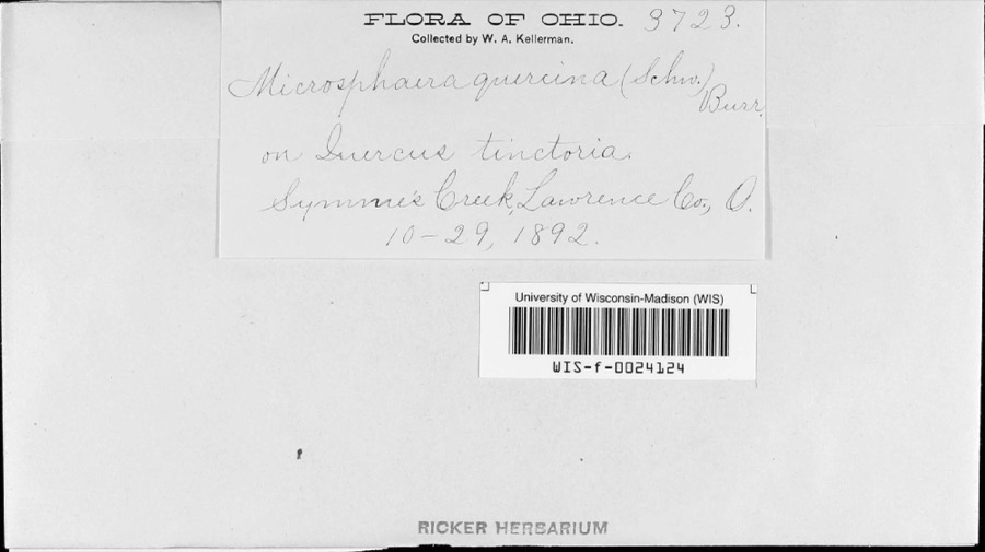
evidence. Museums hold 863 specimens
collected within 10 miles of Johnston, William C., House And General Store between 1840 and
1972: 611 Animalia, 115 Fungi, 114 Plantae, 20 Protozoa, 2 Unrecorded, 1 Chromista. 12 distinct Species records are shown.
Collected by Archer W. A., BARBOUR, DOUGLAS I, BARUCH and others. Each is a
physical object with a catalogue
number, and each entry opens the museum's record. This is what was
collected and kept, not a survey of what lives here - nothing can be
concluded from a species being absent.
Regional context, not property-specific
evidence. The federal mineral resources record lists
8 workings within 5 miles of Johnston, William C., House And General Store: 6 past producers, 1 unknown, 1 producer.
1 still produces. What was taken out: Sand and Gravel, Construction, Sulfur, Nickel. Distance is straight-line from the
map coordinates, so a quarry counted here may appear on a neighbouring
settlement's page as well.
Regional context, not property-specific
evidence. The National Weather Service names
Burlington, the town this property stands in, in 4 storm reports between 2005 and 2024: 4 thunderstorm wind.
No death or injury is recorded in these reports. Each account below is quoted exactly as the forecast office
filed it, from the NOAA Storm Events Database, and each date
opens the federal record of that event.
No historic map-sheet match is published
for this property yet. That does not mean no map exists. This record needs
a coordinate-quality review before it can be joined to a sheet boundary.
Browse the county's mapped places while that work is
pending.
From the nomination file
12,249 words on record
When this property was proposed for the
National Register, someone wrote the case for it: what the building is,
and why it matters. That document is a federal record in the public domain.
It is quoted below word for word, never summarised. The text was read off the scanned case file by machine, so the
occasional stray character is the recogniser's and the 1970s
typewriter's.
Description of the property
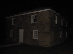
The William C. Johnston House and General Store faces onto the Ohio River. The right of the entrance and on the second floor the windows are 8/8 light with flat triple window, each of the three portions having 8/8 lights. Again there is a flat east end and the upper right window in the west end have been bricked in. The north (rear) elevation has two 6/6 light windows per floor.
These windows are set Hewn timbers, random width structural members, brick nogging and tree nail joining CONDITION UNEXPOSED EXCELLENT RUINS FAIR XALTERED UNALTERED XGOOD brick arch and wood sill.This configuration is a modern replacement for the gable roofed frame wing of unknown design has been removed from the north side.This built of Flemish bond brick.The center entrance in the three-bay facade is round for use as a single family house. CHECK ONE The end of the building originally had two windows per floor and a single window directly above each other and are centered in the outer bays.Just left of center of a frieze. had a wood hatchway and was used for the delivery of materials sold in the store.
The only other element of note on the facade is a band of brick corbeling in place foundation is rough cut, coursed limestone. An 1890 photo shows two stone courses a portion of a cellar entrance can be seen. porches (or an open lean-to) attached to both the east and west ends of the building.
In addition to a general store, William and Benjamin ran a tannery and blacksmith that "In election times we had no telephone so we depended on the mailboat captain for suited, a mighty yell would go up." The Johnston Store is believed, by persons throughout Lawrence County, to have been system, the Johnston House & Store is often referred to locally as the Old Distribue 1400-1499 1500-1599 1600-1699 1700-1799 INVENTION ENGINEERING ART AGRICULTURE ARCHITECTURE RELIGION 1900- SCULPTURE THEATER ARCHEOLOGY-HISTORIC TRANSPORTATION PERIOD SIGNIFICANCE PREHISTORIC MILITARY LITERATURE SOCIAL/HUMANITARIAN Place.
Burlington's most colorful history stems from its participation in the Underground _CONSERVATION _COMMUNICATIONS _POLITICS/GOVERNMENT a stop for those fleeing.Many believe that tunnels ran from the store to the _PHILOSOPHY Hardesty (l882) William and Benjamin Johnston had the first store in Lawrence Mr.Distribue was know to people in the town due to his long tenure in the school issued in the county seat.Seven months prior to this William Johnston purchased riverbank but no such evidence has been found.
_ECONOMICS X.COMMERCE _EDUCATION The postmaster would read this news to the crowds outside the door, and if the news early structures in Lawrence County.In addition it is a good local example of was a well known shipping point along the Ohio River.In 1840 Benjamin Johnston During the latter 180o's part of the Johnston Store housed the medical office of Dr. believed to have been a link in the Underground Railroad. 1ot #59 on which the house-general store was built. -MUSIC - INDUSTRY -LAW -COMMUNITY PLANNING SPECIFIC DATES Ca. 1820 County.
The structure also served as a post office from 1840-1887 and is locally for services rendered to the county: locks for the courthouse, iron for repair to Siebert (1951) describes Numerous entries in the Commissioners records show payment to the Johnstons Burilington ARCHEOLOGY-PREHISTORIC County.
Quoted from the National Register nomination
for reference 76001463, 64 pages, held by the National Archives in Record
Group 79. See the
catalogue record.
Listed places nearby
4 within 8 miles
Other National Register properties close
enough to walk or drive between, ordered by distance from this one. Both
positions come from the same geocoding pass that matched these properties
to their map sheets.
Listing record. National Park Service National Register of Historic Places, listed-properties dataset, current to 2026-05-22.
Map join. Address geocoded through the United States Census geocoder, then tested against the published boundary of every sheet in the USGS Historical Topographic Map Collection.
How this page is made. Listing fields come from federal records; map-sheet coverage is a labelled coordinate-to-boundary calculation, not a source-field claim.
Wildfire. Short, Karen C. 2022. Spatial wildfire occurrence data for the United States, 1992-2020 [FPA_FOD_20221014]. 6th Edition. Fort Collins, CO: Forest Service Research Data Archive. https://doi.org/10.2737/RDS-2013-0009.6 Collected with United States Government funding and usable without additional permissions or fees.
Specimens. Global Biodiversity Information Facility (GBIF), https://www.gbif.org/. Only records licensed CC0 or CC BY are used. Records licensed CC BY-NC are excluded because this site carries advertising. Images are checked individually and any whose licence is non-commercial, no-derivatives or unreadable is refused.
Mines and quarries. USGS Mineral Resources Data System (MRDS) https://mrdata.usgs.gov/mrds/ A work of the United States government, no copyright under 17 U.S.C. 105.
Storms. NOAA National Centers for Environmental Information, Storm Events Database https://www.ncei.noaa.gov/stormevents/ A work of the United States government, no copyright under 17 U.S.C. 105. Narratives are quoted verbatim from the National Weather Service report and are not edited or summarised.
 Block
Block