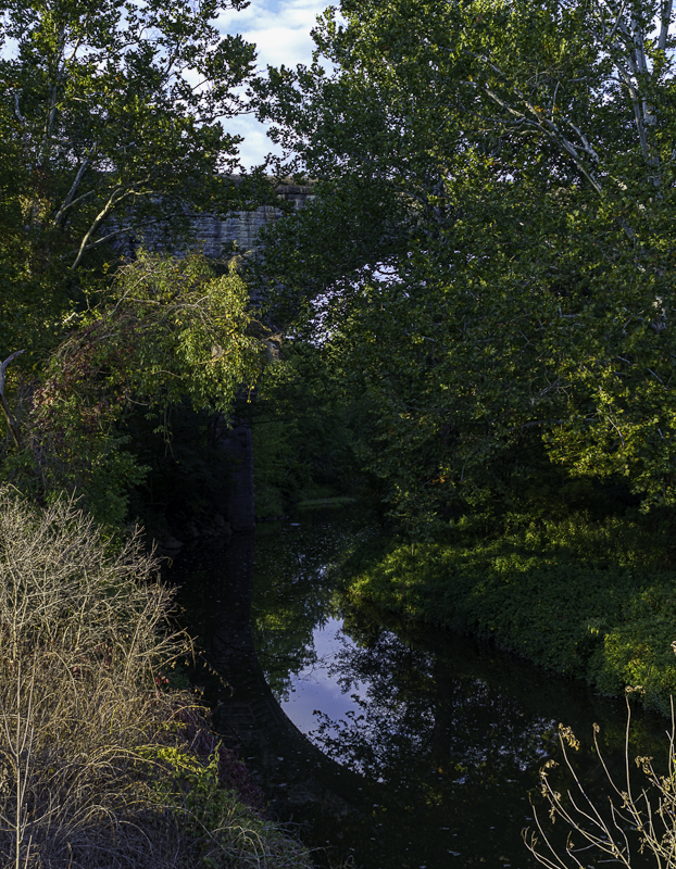
Listed on the National Register of Historic Places in
1976. A historic map-sheet match is not published yet. The record needs a coordinate-quality review before it can be joined to a sheet boundary.
From the record
one of 27 National Register listings in Medina County · listed in 1976 · category: Structure.
National Register reference number.76001488- the number the National Park Service assigned this property when it was listed, and the key its nomination file is catalogued under at the National Archives.
The ground it stands on
4,413 words
This property stands in Harrisville Township. Pioneer History of Medina County, published 1861 gives that township a chapter of its own.
The chapter covers the township.
Machine-read from a century-old scan, so
expect the errors a machine makes: misspelled names, dropped words,
stray characters.
Regional context, not property-specific
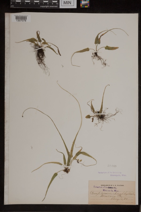
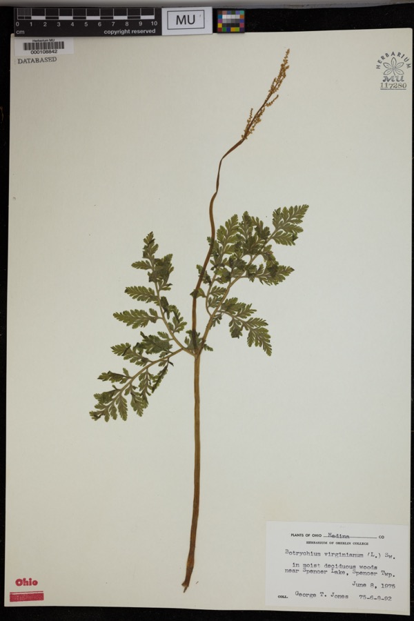
evidence. Museums hold 280 specimens
collected within 10 miles of Black River Viaduct, Baltimore And Ohio Railroad between 1888 and
1975: 269 Animalia, 8 Plantae, 2 Fungi, 1 Protozoa. 12 distinct Species records are shown.
Collected by A. Roberts, BJ Zahuranec & party, Bosler and others. Each is a
physical object with a catalogue
number, and each entry opens the museum's record. This is what was
collected and kept, not a survey of what lives here - nothing can be
concluded from a species being absent.
Regional context, not property-specific
evidence. The federal mineral resources record lists
9 workings within 5 miles of Black River Viaduct, Baltimore And Ohio Railroad: 7 past producers, 1 plant, 1 producer.
2 still produce. What was taken out: Sand and Gravel, Construction. Distance is straight-line from the
map coordinates, so a quarry counted here may appear on a neighbouring
settlement's page as well.
Regional context, not property-specific
evidence. The National Weather Service names
Lodi, the town this property stands in, in 32 storm reports between 1994 and 2025: 16 thunderstorm wind, 12 hail, 2 tornado, 1 lightning.
No death or injury is recorded in these reports. Each account below is quoted exactly as the forecast office
filed it, from the NOAA Storm Events Database, and each date
opens the federal record of that event.
Numerous roads were inundated and closed in and around downtown Lodi due to excessive runoff from heavy rainfall. Reports of numerous basements flooded, with some reports of vehicle damage as well.
A storm survey revealed that an EF1 tornado touched down on a farm about two miles north of Lodi, just north of U.S. Route 224. Three barns were destroyed by the tornado. As many as 100 dairy cows were trapped in a barn that collapsed and had to be rescued from the debris. Some of the animals were killed or had to be put down because the injuries were so severe. Dozens of trees were damaged along the damage path which was about a mile in length and no more than 50 yards in width.
A tornado touched down briefly in Lodi doing some structural damage. Roofs and siding were torn off of several homes with dozens of trees also downed. An amateur radio tower was knocked and the metal roofing of a local business was peeled off. Many trees were downed in the front yard of the local elementary school.
No historic map-sheet match is published
for this property yet. That does not mean no map exists. This record needs
a coordinate-quality review before it can be joined to a sheet boundary.
Browse the county's mapped places while that work is
pending.
From the nomination file
1,362 words on record
When this property was proposed for the
National Register, someone wrote the case for it: what the building is,
and why it matters. That document is a federal record in the public domain.
It is quoted below word for word, never summarised. The text was read off the scanned case file by machine, so the
occasional stray character is the recogniser's and the 1970s
typewriter's.
Description of the property
the Black River near Lodi, Ohio. It consists of three great semi- to the design, with the exception of a slightly projecting sill CONDITION sandstone. UNEXPOSED DETERIORATED DESCRIPTION RUINS FAIR viaduct consists of regular horizontal courses of slightly rusticated in diameter.Their voussoirs are of uniform size and shape.There XEXCELLENT path along the bank.There is almost no architectural refinement The center arch stands on short vertical piers, while the two circular arches of true arch construction, approximately fifty feet XUNALTERED spans the stream, and each of the two end ones spans an unpaved CHECK ONE course at the upper edge.
end ones spring from the banks of the stream.The center arch This isa large masonry arch bridge over the West Fork of DATE are no emphasized keystones.The masonry of the body of the AREAS OF
Statement of significance
The Baltimore and Ohio viaduct over the Black River west of Lodi of the Baltimore and Ohio, Charles F. Mayer. In 1890 the road was section a part of the Baltimore and Ohio's direct route to Chicago, it Junction (Willard, Ohio). This Akron division was completed by 1893, at Wilmington, Delaware, completed after 1910.
"It was constructed in a 1600-1699 1890-1892 ART EDUCATION PERIOD ARCHITECTURE PHILOSOPHY THEATER ECONOMICS RELIGION AGRICULTURE CONSERVATION EXPLORATION/SETTLEMENT SIGNIFICANCE INDUSTRY BUILDER/ARCHITECT MILITARY SCULPTURE INVENTION MUSIC X1800-1899 XENGINEERING _POLITICS/GOVERNMENT SOCIAL/HUMANITARIAN generation when the parent Pennsylvania was still inclined to favor the Roman form and proportions have a timeless quality and testify to the terminal of the newly acquired Pittsburgh and Western.To make this well, even though it consists of three spans instead of seven.
city.The Valley Railroad ran south to Akron, which was the western These general conclusions apply to the Black River viaduct as The significance of the masonry structure used instead of fabricated -1500-1599 connecting Chicago with the East. The viaduct was built under the administration of the tenth president _PREHISTORIC _COMMUNICATIONS is a monumental masonry civil engineering work. Its grandly simple of bridge construction;of all time or place...
Quoted from the National Register nomination
for reference 76001488, 9 pages, held by the National Archives in Record
Group 79. See the
catalogue record.
Listed places nearby
4 within 8 miles
Other National Register properties close
enough to walk or drive between, ordered by distance from this one. Both
positions come from the same geocoding pass that matched these properties
to their map sheets.
Listing record. National Park Service National Register of Historic Places, listed-properties dataset, current to 2026-05-22.
Map join. Address geocoded through the United States Census geocoder, then tested against the published boundary of every sheet in the USGS Historical Topographic Map Collection.
How this page is made. Listing fields come from federal records; map-sheet coverage is a labelled coordinate-to-boundary calculation, not a source-field claim.
Specimens. Global Biodiversity Information Facility (GBIF), https://www.gbif.org/. Only records licensed CC0 or CC BY are used. Records licensed CC BY-NC are excluded because this site carries advertising. Images are checked individually and any whose licence is non-commercial, no-derivatives or unreadable is refused.
Mines and quarries. USGS Mineral Resources Data System (MRDS) https://mrdata.usgs.gov/mrds/ A work of the United States government, no copyright under 17 U.S.C. 105.
Storms. NOAA National Centers for Environmental Information, Storm Events Database https://www.ncei.noaa.gov/stormevents/ A work of the United States government, no copyright under 17 U.S.C. 105. Narratives are quoted verbatim from the National Weather Service report and are not edited or summarised.
 Block
Block