Listed on the National Register of Historic Places in
1978. A historic map-sheet match is not published yet. The record needs a coordinate-quality review before it can be joined to a sheet boundary.
From the record
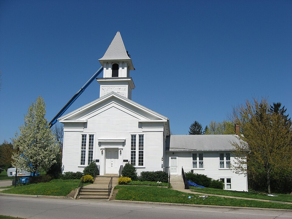
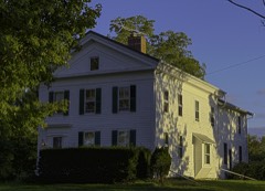
“The Universalist Church of Westfield Center is a historic church in Westfield Center, Ohio, United States. One of Ohio's oldest Universalist congregations, it has experienced a generally peaceful history since its establishment in the 1830s.”
Wikipedia article Universalist Church of Westfield Center, CC BY-SA 4.0.
one of 27 National Register listings in Medina County · listed in 1978 · category: Building.
National Register reference number.78002135- the number the National Park Service assigned this property when it was listed, and the key its nomination file is catalogued under at the National Archives.
The ground it stands on
603 words
This property stands in Westfield Township. Pioneer History of Medina County, published 1861 gives that township a chapter of its own.
The chapter covers the township.
Machine-read from a century-old scan, so
expect the errors a machine makes: misspelled names, dropped words,
stray characters.
Regional context, not property-specific
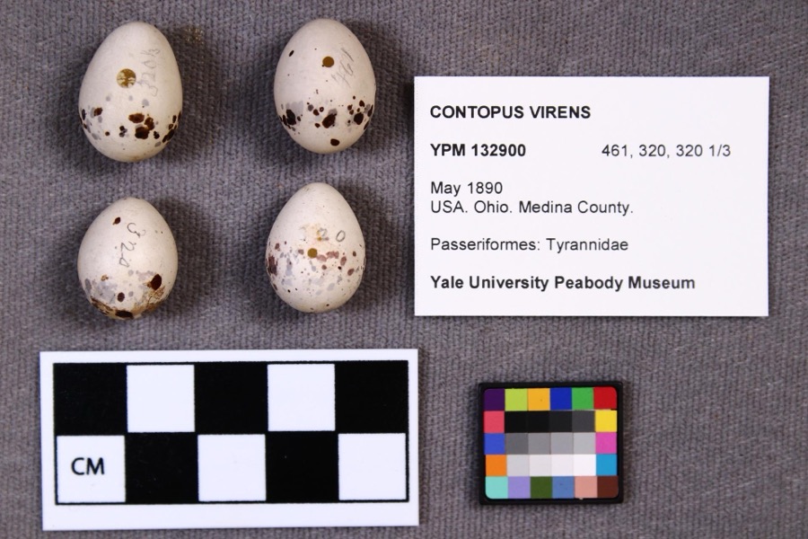
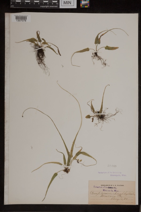
evidence. Museums hold 288 specimens
collected within 10 miles of Universalist Church Of Westfield Center between 1884 and
1975: 273 Animalia, 9 Plantae, 5 Fungi, 1 Protozoa. 12 distinct Species records are shown.
Collected by A. Roberts, B Zahuranec & party, Bosler and others. Each is a
physical object with a catalogue
number, and each entry opens the museum's record. This is what was
collected and kept, not a survey of what lives here - nothing can be
concluded from a species being absent.
Regional context, not property-specific
evidence. The federal mineral resources record lists
10 workings within 5 miles of Universalist Church Of Westfield Center: 8 past producers, 1 plant, 1 producer.
2 still produce. What was taken out: Sand and Gravel, Construction. Distance is straight-line from the
map coordinates, so a quarry counted here may appear on a neighbouring
settlement's page as well.
No historic map-sheet match is published
for this property yet. That does not mean no map exists. This record needs
a coordinate-quality review before it can be joined to a sheet boundary.
Browse the county's mapped places while that work is
pending.
From the nomination file
1,387 words on record
When this property was proposed for the
National Register, someone wrote the case for it: what the building is,
and why it matters. That document is a federal record in the public domain.
It is quoted below word for word, never summarised. The text was read off the scanned case file by machine, so the
occasional stray character is the recogniser's and the 1970s
typewriter's.
Description of the property
a wide frieze, and corner boards. A broken-bed pediment, with a projecting Doric pilasters supporting a full architrave, and paired 10x10 double-hung With its paneled doors, shallow gable roof, narrow siding, and Ixl double-hung wooden crenellations on the tower with a pyramidal roof, the replacement of the original 8x10 stained glass windows with clear glass, and the placement of CONDITION DATE DETERIORATED UNEXPOSED EXCELLENT UNALTERED XGOOD related. XALTERED LMOVED CHECK ONE The gabled, wood-frame Universalist Church of Westfield Center is rectangular cornice and a two fasciae frieze, acts as a transition from the tower to the windows set within plain surrounds, this wing covers one bay of the church.
However, the Universalist Church of Westfield Center remains a well-preserved central steeple features a pyramidal roof and flared eaves, supported by a A two story addition on the east side relates well to the original structure. The narrow clapboard siding, the tall double-hung windows, and the stuccoed shrubs, concrete stoops, and iron railings around the building. A small, shed-roof entrance vestibule, attached to the windowless rear elevation, gives access toa parking lot.Other changes include the replacementof _FAIR in plan, with a rectangular, gabled addition attached to one side. The facade's corner. The tower rests upon a square base, which has a projecting cornice, lower facade.
The central bay contains recessed paneled doors, flanked by belfry containing segmentally-arched louvers and paired Doric pilasters at each foundations continue on the side elevations. AREAS OF
Statement of significance
Center (formerly LeRoy) - Ohio. They purchased a 1/2 acre site for $60 in 1847 and built the present the church, eventually to be demolished and replaced with the present school the Stick Style, complements the original structure.
The Universalist Church of Westfield Center, having held continuous services for over 135 years, is thus a significant architectural remnant from the 1700-1799 ECONOMICS ART LAW POLITICS/GOVERNMENT ENGINEERING ARCHEOLOGY-HISTORIC INVENTION PERIOD BUILDER/ARCHITECT AGRICULTURE COMMUNICATIONS 1900- TRANSPORTATION INDUSTRY SIGNIFICANCE ARCHEOLOGY-PREHISTORIC THEATER MILITARY LITERATURE _EXPLORATION/SETTLEMENT XARCHITECTURE belfry and the trabeated entrance, provide a fine example of the studied _PHILOSOPHY Greek Revival period and an important institution in the history of the area. The congregation, organized in 1839, was the second Universalist church in The temple form of the building, along with such elements as the pilastered additions that show great respect for the original building.
As well, the The Universalist Church of Westfield Center is an excellent example of the _CONSERVATION -1600-1699 Victorian side addition, while true to the more linear, vertical emphasis of - EDUCATION wing in 1896.Other interior alterations were completed soon afterwards. _SOCIAL/HUMANITARIAN -1500-1599 -1400-1499 -COMMERCE structure in 1849 for $1,500.A log Sunday School was built in front of - MUSIC Greek Revival style, with later 19th and early 20th Century alterations and simplicity and harmonious proportions of the Greek Revival style.The late 9
Quoted from the National Register nomination
for reference 78002135, 9 pages, held by the National Archives in Record
Group 79. See the
catalogue record.
Listed places nearby
6 within 8 miles
Other National Register properties close
enough to walk or drive between, ordered by distance from this one. Both
positions come from the same geocoding pass that matched these properties
to their map sheets.
Listing record. National Park Service National Register of Historic Places, listed-properties dataset, current to 2026-05-22.
Map join. Address geocoded through the United States Census geocoder, then tested against the published boundary of every sheet in the USGS Historical Topographic Map Collection.
How this page is made. Listing fields come from federal records; map-sheet coverage is a labelled coordinate-to-boundary calculation, not a source-field claim.
Specimens. Global Biodiversity Information Facility (GBIF), https://www.gbif.org/. Only records licensed CC0 or CC BY are used. Records licensed CC BY-NC are excluded because this site carries advertising. Images are checked individually and any whose licence is non-commercial, no-derivatives or unreadable is refused.
Mines and quarries. USGS Mineral Resources Data System (MRDS) https://mrdata.usgs.gov/mrds/ A work of the United States government, no copyright under 17 U.S.C. 105.
 Block
Block