Listed on the National Register of Historic Places in
1980. A historic map-sheet match is not published yet. The record needs a coordinate-quality review before it can be joined to a sheet boundary.
From the record
“All of these efforts failed, and the route was fixed west from Springbok to Brandt, in Bethel Township, Miami County, crossing the Miami River inti this county at Tachnor, in Butler Township, thence continuing west throng] Vandalia, Harrisburg, Arlington and Bachman, in Butler, Randolph and Cl;*. Improvements so long needed were now begun on the country roads In February, 1833, three turnpike companies were chartered: Dayton& Covingtor Dayton, Centerville & Lebanon, Dayton & Springfield.”
The History of Montgomery County, Ohio, Containing a History of the County; (1882). Machine-read text.
one of 117 National Register listings in Montgomery County · listed in 1980 · category: Building · one of 4 National Historic Landmarks in Montgomery County.
National Register reference number.80003169- the number the National Park Service assigned this property when it was listed, and the key its nomination file is catalogued under at the National Archives.
All of these efforts failed, and the route was fixed west from Springbok to Brandt, in Bethel Township, Miami County, crossing the Miami River inti this county at Tachnor, in Butler Township, thence continuing west throng] Vandalia, Harrisburg, Arlington and Bachman, in Butler, Randolph and Cl;*. 'Townships. Improvements so long needed were now begun on the country roads In February, 1833, three turnpike companies were chartered: Dayton& Covingtor Dayton, Centerville & Lebanon, Dayton & Springfield. The last-named compan intended to locate a road built through to Eaton and Richmond, but tho Dayla ,& Western Company was afterward formed to build the pike west of Daytoi
The roads were only partly graveled until after the McAdam invention then the pikes were built by chartered companies; and of late years all imperial roads in the county have been macadamized by the County Commissioners. Th Dayton, Centerville & Lebanon Company let the contracts for building that pit at Centerville, April 16, 1838, and work began at once.
Regional context, not property-specific
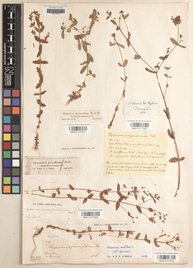
evidence. Museums hold 482 specimens
collected within 10 miles of Pease Homestead between 1835 and
1975: 324 Animalia, 89 Plantae, 60 Fungi, 4 Protozoa, 4 Chromista, 1 Unrecorded. 12 distinct Species records are shown.
Collected by A JOHN, A JOHN AND W E DUELLMAN, A. E. Foeerste and others. Each is a
physical object with a catalogue
number, and each entry opens the museum's record. This is what was
collected and kept, not a survey of what lives here - nothing can be
concluded from a species being absent.
Regional context, not property-specific
evidence. The federal mineral resources record lists
16 workings within 5 miles of Pease Homestead: 9 producers, 7 past producers.
9 still produce. What was taken out: Sand and Gravel, Construction. Distance is straight-line from the
map coordinates, so a quarry counted here may appear on a neighbouring
settlement's page as well.
Regional context, not property-specific
evidence. The National Weather Service names
Centerville, the town this property stands in, in 29 storm reports between 1995 and 2025: 15 thunderstorm wind, 11 hail, 2 flood, 1 tornado.
No death or injury is recorded in these reports. Each account below is quoted exactly as the forecast office
filed it, from the NOAA Storm Events Database, and each date
opens the federal record of that event.
A microburst producing winds of 70 to 75 mph did significant damage to a few trailers. Several homes sustained siding damage, and numerous trees were knocked down. A 30-foot tower was also downed.
The tornado initially developed just east of State Route 48 in Warren County, at 2358EST, April 2nd. The tornado moved northeast and entered Montgomery County at 2359 EST, just south of Elk Creek Drive. As the tornado moved northeast across far southeast Montgomery County, it cause sporadic tree damage. More large trees were uprooted and damaged along a portion of East Social Row Road, east of Mount Holly Avenue. Tree damage was also noted farther to the northeast near and along Nutt Road and Clyo Road, where the tornado dissipated at 0001EST, April 3rd.
Several large trees up to 15 inches in diameter were downed across the southern and eastern Dayton suburbs. A few homes sustained minor damage from falling trees near Farmersville.
Several reports of hail came in from spotters and a NWS employee. Hail of 2 inches fell south of Centerville. Seven minutes later, 1.5 inch hail was reported south of Miamisburg.
No historic map-sheet match is published
for this property yet. That does not mean no map exists. This record needs
a coordinate-quality review before it can be joined to a sheet boundary.
Browse the county's mapped places while that work is
pending.
From the nomination file
4,560 words on record
When this property was proposed for the
National Register, someone wrote the case for it: what the building is,
and why it matters. That document is a federal record in the public domain.
It is quoted below word for word, never summarised. The text was read off the scanned case file by machine, so the
occasional stray character is the recogniser's and the 1970s
typewriter's.
Description of the property
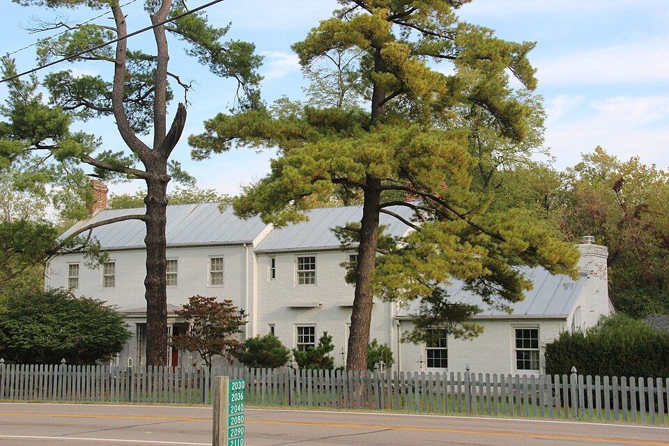
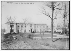
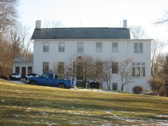
The HORACE PEASE HOMESTEAD faces south on the north side of Alexander-Bellbrook Road, a heavily traveled country highway connecting two communities. Located on the far western end of the road and set back 60 feet, the nominated property is situated on a large tree covered lot on which is also found a carriage house/ The two and one half story Federal farmhouse, irregular in plan, sits on a brick lights, both under a latticed panel supported entrance porch (c. 1925). The recessed 6/6 double hung sash windows have cyclinder glass panes and solid wooden blinds with a A small rectangular louvered vent appears in the left side gable end.
An early wooden two story, stone foundationed addition(the kitchen) appears centrally - sash with a mullion bay on the north end of the second story and a kitchen entrance in the second bay of the first story. The door and windows have wooden surrounds. The wide eaved gable roof has a right side rear corbelled brick chimney. A small rectangular breakfast room (c.1940) fills in the el between the west wall of the addition and the west end of the main block. On the eastern side of the main block is a later brick addition(c.1925).
Although in lesser scale, this three bay facade addition successfully continues the style and detail of the original main block in its treatment of the door, windows, glass panes, porch, slightly projecting wall which verges close with a moulded facia and an elliptical wall of the brick addition has a massive corbelled brick chimney with oven in seven course brick bonding. Three of the six original outbuilding remaining on the property are worth nomination. To the immediate rear of the house is a smoke house and summer kitchen/root cellar.
(in one paragraph) The HORACE PEASE HOMESTEAD is significant both architecturally as a Federal farm Horace Pease was born on February 14, 1791 in Suffield, Connecticut, the oldest of eleven children whose parents were Joseph Pease and Elizabeth Pierce. In 1816, Horace Pease came to Ohio and went to Cincinnati to pursue his trade of making saddle-trees which he continued to do until 1827.- His brother, Perry Pease, had, during this time, been living near Hole's Creek (a creek which runs across the north part of the nominated property's lot) as a farmer and distiller.
In 1827, (Ann Stilz, who Horace Pease had married in 1821, died in 1829, Leaving four - of two locks at Carrollton with the view of getting water power for his flouring mill which he had also established and which , in 1832, is said to have been the years and more the firm of H&P. Pease, of which he was the head, conducted the ional Bank, and of the latter he was a director until the time of his death. He on the Board of County Commissioners, being a member when the Old Courthouse (which is on the National Register of Historic Places) was erected, the designs: of which he made himself. The first locomotive that steamed into Dayton, on the Xenia and Belpre tracks, was named "Horace Pease," he having been, with Joseph Clegg, most active in the establishment of that road.
Quoted from the National Register nomination
for reference 80003169, 31 pages, held by the National Archives in Record
Group 79. See the
catalogue record.
Listed places nearby
6 within 8 miles
Other National Register properties close
enough to walk or drive between, ordered by distance from this one. Both
positions come from the same geocoding pass that matched these properties
to their map sheets.
Listing record. National Park Service National Register of Historic Places, listed-properties dataset, current to 2026-05-22.
Map join. Address geocoded through the United States Census geocoder, then tested against the published boundary of every sheet in the USGS Historical Topographic Map Collection.
How this page is made. Listing fields come from federal records; map-sheet coverage is a labelled coordinate-to-boundary calculation, not a source-field claim.
Specimens. Global Biodiversity Information Facility (GBIF), https://www.gbif.org/. Only records licensed CC0 or CC BY are used. Records licensed CC BY-NC are excluded because this site carries advertising. Images are checked individually and any whose licence is non-commercial, no-derivatives or unreadable is refused.
Mines and quarries. USGS Mineral Resources Data System (MRDS) https://mrdata.usgs.gov/mrds/ A work of the United States government, no copyright under 17 U.S.C. 105.
Storms. NOAA National Centers for Environmental Information, Storm Events Database https://www.ncei.noaa.gov/stormevents/ A work of the United States government, no copyright under 17 U.S.C. 105. Narratives are quoted verbatim from the National Weather Service report and are not edited or summarised.
 Block
Block