Listed on the National Register of Historic Places in
1976. A historic map-sheet match is not published yet. The record needs a coordinate-quality review before it can be joined to a sheet boundary.
From the record
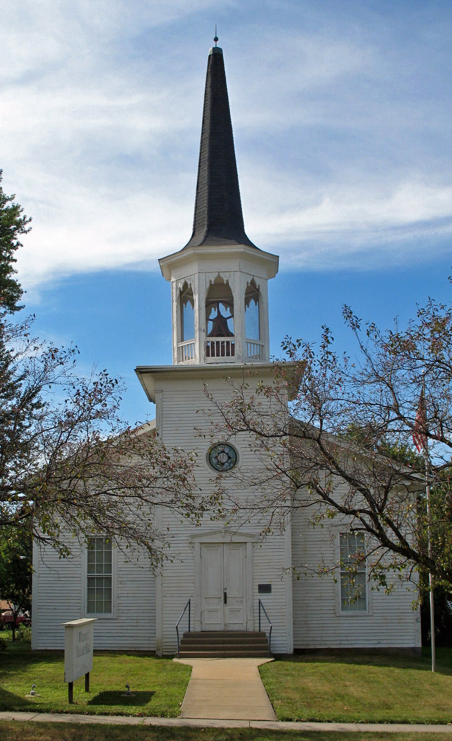
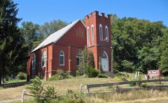
“Wilmot United Brethren Church is a historic church on Massillon Street in Wilmot, Ohio.”
Wikipedia article Wilmot United Brethren Church, CC BY-SA 4.0.
one of 81 National Register listings in Stark County · listed in 1976 · category: Building.
National Register reference number.76001529- the number the National Park Service assigned this property when it was listed, and the key its nomination file is catalogued under at the National Archives.
Fires near this property
1 since 2018
Regional context, not property-specific
evidence. The
federal wildfire occurrence database
lists 1 fire within 5 miles of Wilmot United Brethren Church between
2018 and 2018, burning about 1 acres in total. None started naturally. None was recorded as arson.
Distance is straight-line from the map coordinates, so a fire counted
here may appear on a neighbouring settlement's page as well.
Reported cause
Fires
Debris and open burning
1
The most recent of
them, most recent first, with the day each was reported and the service
that recorded it.
Regional context, not property-specific
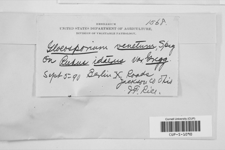
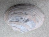
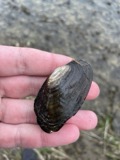
evidence. Museums hold 87 specimens
collected within 10 miles of Wilmot United Brethren Church between 1875 and
1975: 80 Animalia, 4 Plantae, 2 Fungi, 1 Chromista. 12 distinct Species records are shown.
Collected by Armbruster, D. C. (Daniel C.), Borror, D.J., Cooke W. B.; Cooke V. G. and others. Each is a
physical object with a catalogue
number, and each entry opens the museum's record. This is what was
collected and kept, not a survey of what lives here - nothing can be
concluded from a species being absent.
Regional context, not property-specific
evidence. The federal mineral resources record lists
1 working within 5 miles of Wilmot United Brethren Church: 1 producer.
All of them still produce. What was taken out: Sand and Gravel, Construction. Distance is straight-line from the
map coordinates, so a quarry counted here may appear on a neighbouring
settlement's page as well.
Regional context, not property-specific
evidence. The National Weather Service names
Wilmot, the town this property stands in, in 4 storm reports between 2007 and 2026: 3 hail, 1 thunderstorm wind.
No death or injury is recorded in these reports. Each account below is quoted exactly as the forecast office
filed it, from the NOAA Storm Events Database, and each date
opens the federal record of that event.
No historic map-sheet match is published
for this property yet. That does not mean no map exists. This record needs
a coordinate-quality review before it can be joined to a sheet boundary.
Browse the county's mapped places while that work is
pending.
Named in the fire insurance atlases
Sanborn surveyors printed an index of the
town's establishments at the front of each atlas. This property is named in
one, read straight off the scanned sheet.
When this property was proposed for the
National Register, someone wrote the case for it: what the building is,
and why it matters. That document is a federal record in the public domain.
It is quoted below word for word, never summarised. The text was read off the scanned case file by machine, so the
occasional stray character is the recogniser's and the 1970s
typewriter's.
Description of the property
tion, in a mixture of Greek Revival, Italianate and Gothic styles. A later to match the windows. There is a cornice return and' wide frame. For this reason, a kind of reinforcing or tying timber is Above, the octagonal belfry has openings of a multiple ogee shape On the interior, the small vestibule area contains the stairway UNEXPOSED CONDITION DESCRIPTION FAIR since that time. surfaces are of horizontal clapboard, but the internal structure consists replaced with large frosted panes, and a large central chandelier and is flanked by two windows.There are Italianate pediments over molding frames.The tower is constructed in the same plank method. of solid walls of stacked layers of planks.
There is no conventional straight-back benches by the present curved oak pews, and the which is Victorian Gothic, and still contains the bell cast in 1869. In addition, the roof is supported by king-post trusses. CHECK ONE sloping floor was laid.No significant alterations have been made frieze characteristic of the Greek Revival style.The exterior wall shows as a part of the external design above the Italianate drop to the tower belfry. Between the vestibule and the main hall there It is topped by a tall octagonal spire. All evidence indicates that This is a small church structure of unusual wooden wall construc- center tower projecting slightly from the facade hasa single entrance - DETERIORATED the basic structure, design, belfry and spire are all contemporary.
Township, the southwesternmost township in Stark County, The area at Weimer's Hill, a few miles to the east, and decided to erect its own building in 1869. The contractor was William Bell, a "well-known" local carpenter-builder. The church was dedicated 1600-1699 1500-1599 1869 1400-1499 EDUCATION THEATER ARCHEOLOGY-HISTORIC LAW PHILOSOPHY PERIOD ART INDUSTRY LITERATURE MILITARY AGRICULTURE SCIENCE SIGNIFICANCE SCULPTURE _TRANSPORTATION MUSIC _POLITICS/GOVERNMENT over a hundred years, and was recently acquired by a private unsual wood construction, the walls being made of stacked horizon- _EXPLORATION/SETTLEMENT -COMMUNICATIONS _CONSERVATION not yet fully documented.
The building is also distinctive because tal planks.while a few houses of this type of construction are _ECONOMICS The United Brethren congregation was a part of an earlier church owner for restoration as a community building. The primary significance of this church building lies in its _PREHISTORIC in August,1869.The building served the church continuously for known in northern Ohio, the origin and extent of the method are - INVENTION of the Victorian Gothick' belfry on a basically Greek Revival body. _ENGINEERING -COMMERCE Wilmot was the first village laid out (l836) in Sugar Creek - 1700-1799 -1900- _COMMUNITY PLANNING BUILDER/ARCHITECT ARCHEOLOGY-PREHISTORIC William Bell was settled mainly by Germans and Scotch-Irish from Pennsylvania. 1869-1929), (Wilmot, 1929), n. p. Edward T.
Heald, The Stark County Story (Canton, 1949), I, 289-296.
Quoted from the National Register nomination
for reference 76001529, 10 pages, held by the National Archives in Record
Group 79. See the
catalogue record.
Listed places nearby
6 within 8 miles
Other National Register properties close
enough to walk or drive between, ordered by distance from this one. Both
positions come from the same geocoding pass that matched these properties
to their map sheets.
Listing record. National Park Service National Register of Historic Places, listed-properties dataset, current to 2026-05-22.
Map join. Address geocoded through the United States Census geocoder, then tested against the published boundary of every sheet in the USGS Historical Topographic Map Collection.
How this page is made. Listing fields come from federal records; map-sheet coverage is a labelled coordinate-to-boundary calculation, not a source-field claim.
Wildfire. Short, Karen C. 2022. Spatial wildfire occurrence data for the United States, 1992-2020 [FPA_FOD_20221014]. 6th Edition. Fort Collins, CO: Forest Service Research Data Archive. https://doi.org/10.2737/RDS-2013-0009.6 Collected with United States Government funding and usable without additional permissions or fees.
Specimens. Global Biodiversity Information Facility (GBIF), https://www.gbif.org/. Only records licensed CC0 or CC BY are used. Records licensed CC BY-NC are excluded because this site carries advertising. Images are checked individually and any whose licence is non-commercial, no-derivatives or unreadable is refused.
Mines and quarries. USGS Mineral Resources Data System (MRDS) https://mrdata.usgs.gov/mrds/ A work of the United States government, no copyright under 17 U.S.C. 105.
Storms. NOAA National Centers for Environmental Information, Storm Events Database https://www.ncei.noaa.gov/stormevents/ A work of the United States government, no copyright under 17 U.S.C. 105. Narratives are quoted verbatim from the National Weather Service report and are not edited or summarised.
 Block
Block