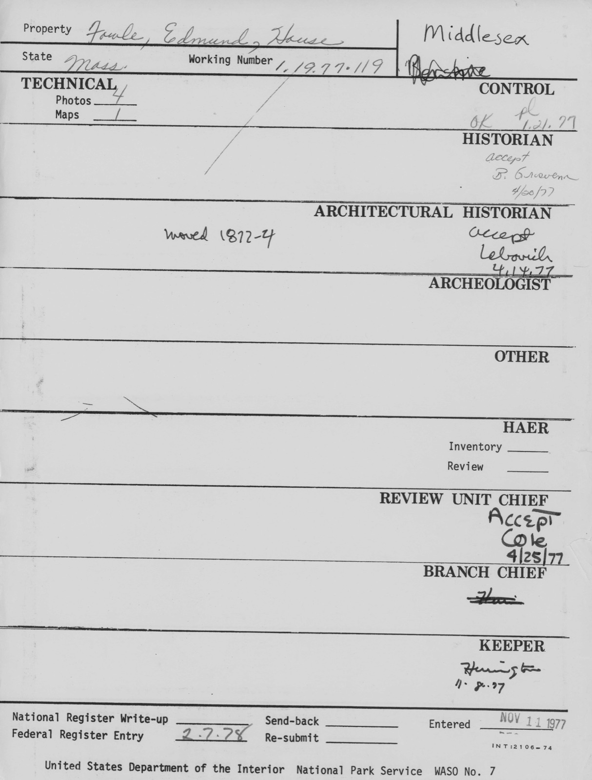
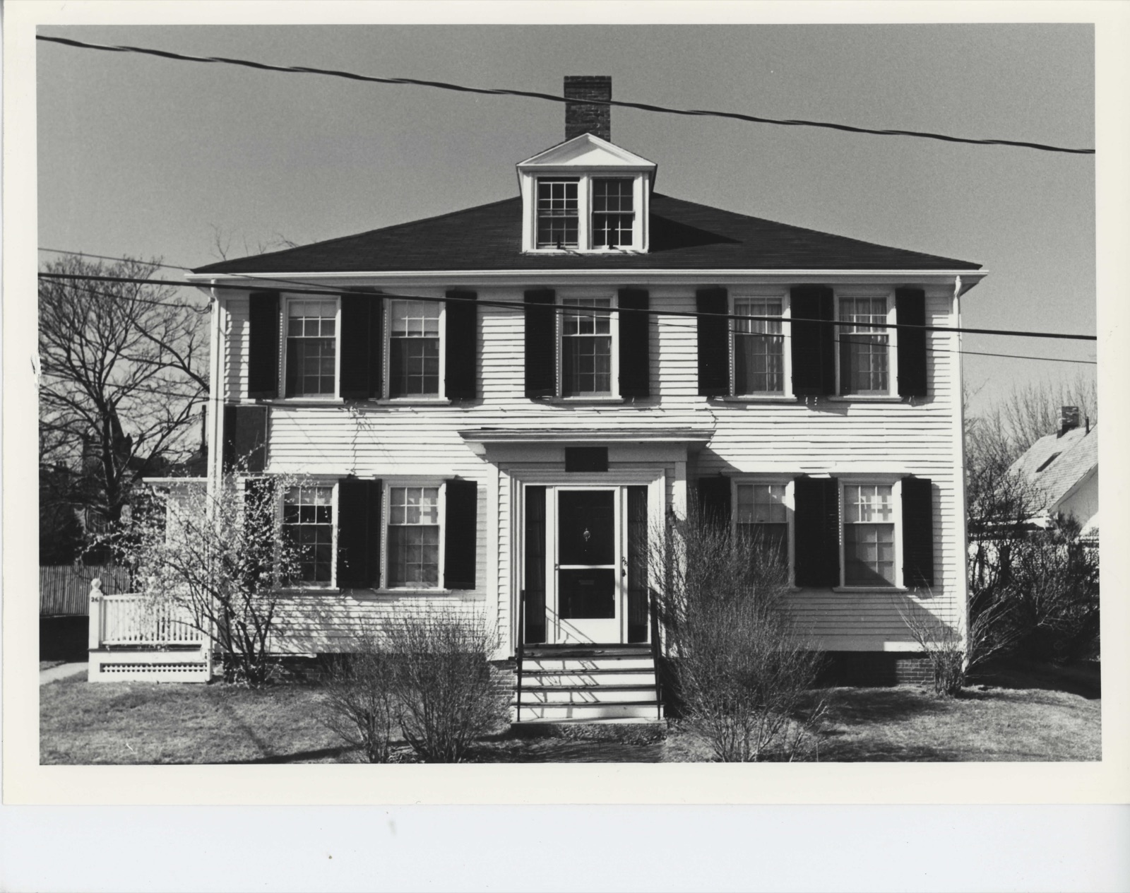
Photographs from the nomination case file, National Park Service records.
Fowle, Edmund, House
Listed on the National Register of Historic Places in
1977. A historic map-sheet match is not published yet. The record needs a coordinate-quality review before it can be joined to a sheet boundary.
From the record
“At ^is point a fall fumished water-power for the first mill built in the town. Other falls above fumish powerfor the Etna Mills and for the upper and lower Waltham factories.”
History of Middlesex County, Massachusetts (1880). Machine-read text.
one of 1100 National Register listings in Middlesex County · listed in 1977 · category: Building · one of 3 National Historic Landmarks in Middlesex County.
National Register reference number.77000189- the number the National Park Service assigned this property when it was listed, and the key its nomination file is catalogued under at the National Archives.
The uneventful annals of the town record the peaceful progress of an agriculturnl community occupied in drawing its needful supplies of food from the soil and from the river, and occasionally sending its little colonies to the Connecticut valley, the "far west" of that day. Undisturbed by tlie terrible Indian war that in 1675 devastated so many thriving New England villages, and untroubled by the , whirlwind of superstition that culminated in tiie Salem tragedy of 1692, singularly free from these and other calamities that befell less favored localities, Watertown yet bore lier full share in the efforts and in the burdens of tiie colony in its struggles, first for existence, and subsequently for independence. For more than lialf a century she was preserved from mentfll stagnation by an acrimonious dispute over the question of the proper location of a new meeting-house.
A striking contrast to the simple lives of these Puritan emigrants is afforded by those of their descendants of to-day. Religion furnished not only tiieir spiritual food, but intellectual recreation as well. The two Sunday services, tiie weekly lecture, and the family devotions, filled the place now occupied by the newspaper, the public library, the lyceum, public amusements, and the other manifold methods of employing spare time. Books were scarce and highly prized, and - the Bible excepted - consisted principally of treatises by the Puritan divines. Without being superstitious, they saw a providential significance in the most trivial occurrences. Thus at Watertown, one day (so Governor Winthrop tells us), "many persons saw a great contest between a mouse and a snake. After a long fight the mouse prevailed, and killed the snake. The Eev. Mr. Wilson of Boston, a very sincere and holy man, gave this interpretation of it : the snake was the devil : the mouse was a
Regional context, not property-specific
evidence. The
federal wildfire occurrence database
lists 71 fires within 5 miles of Fowle, Edmund, House between
2015 and 2020, burning about 110 acres in total. None started naturally. 23 were recorded as arson.
Distance is straight-line from the map coordinates, so a fire counted
here may appear on a neighbouring settlement's page as well.
Reported cause
Fires
Arson/incendiarism
23
Recreation and ceremony
20
Missing data/not specified/undetermined
16
Debris and open burning
6
Smoking
3
Equipment and vehicle use
1
Power generation/transmission/distribution
1
Misuse of fire by a minor
1
The most recent of
them, most recent first, with the day each was reported and the service
that recorded it.
Regional context, not property-specific
evidence. Museums hold 2,340 specimens
collected within 10 miles of Fowle, Edmund, House between 1898 and
1975: 1,158 Animalia, 645 Plantae, 468 Fungi, 29 Protozoa, 17 Bacteria, 14 Chromista, 9 Unrecorded. 12 distinct Species records are shown.
Collected by ?, A B Seymour, A B. Proper and others. Each is a
physical object with a catalogue
number, and each entry opens the museum's record. This is what was
collected and kept, not a survey of what lives here - nothing can be
concluded from a species being absent.
Regional context, not property-specific
evidence. The federal mineral resources record lists
11 workings within 5 miles of Fowle, Edmund, House: 5 past producers, 5 plants, 1 producer.
6 still produce. What was taken out: Sand and Gravel, Construction, Stone, Crushed/Broken, Iron, Lead. Distance is straight-line from the
map coordinates, so a quarry counted here may appear on a neighbouring
settlement's page as well.
Regional context, not property-specific
evidence. The National Weather Service names
Watertown, the town this property stands in, in 16 storm reports between 1999 and 2023: 8 thunderstorm wind, 3 flash flood, 3 flood, 2 hail.
No death or injury is recorded in these reports. Each account below is quoted exactly as the forecast office
filed it, from the NOAA Storm Events Database, and each date
opens the federal record of that event.
The most significant flash flooding affected Somerville, where damage was estimated to be around ten million dollars. Several businesses experienced severe flooding, and the Somerville Public Safety Building was inundated with nearly four feet of water. Three police cruisers were destroyed. Two schools and the library were also affected. Over three feet of water flooded Washington Street at McGrath Highway where several cars were stranded. A water rescue was required at an underpass in Union Square as flood waters rapidly inundated a vehicle. Widespread significant street flooding also occurred in Watertown, Belmont, Cambridge, and Medford.
Trees were downed on several streets in Cambridge, including one that fell onto a car on Magazine Street. An amateur radio operator recorded a wind gust of 60 mph on their home weather station. In Watertown, a large tennis court complex balloon structure was lifted off the ground by the winds, damaging both the structure and the complex on the ground. In addition a portion of the roof of a condo complex was blown off resulting in roof damage and some damage on the ground from blowing debris.
In Newton at 1250 PM EST (150 PM EDT), police responded to a report of a tree down at the intersection of Charlesbank Road and Nonantum Road. At the same time, a tree was reported down on Border Street in West Newton. On Pleasant Street, a tree was down against a house, with wires also down. At 1253 PM EST (153 PM EDT), a tree and power lines were down on Carver Road near Newton Highlands.
No historic map-sheet match is published
for this property yet. That does not mean no map exists. This record needs
a coordinate-quality review before it can be joined to a sheet boundary.
Browse the county's mapped places while that work is
pending.
From the nomination file
5,505 words on record
When this property was proposed for the
National Register, someone wrote the case for it: what the building is,
and why it matters. That document is a federal record in the public domain.
It is quoted below word for word, never summarised. The text was read off the scanned case file by machine, so the
occasional stray character is the recogniser's and the 1970s
typewriter's.
Description of the property
The Edmund Fowle House is located at 26-28 Marshall Street in Watertown. The house originally stood facing south on Old Mill Street, now Mt. Auburn Street. Between 1872-74, the Fowle House was moved from its original site to its present location on Marshall Street. It was altered at that time into a two family dwelling as it remains today. The house is believed to have been constructed between 1740 and 1770. In 1775 a large chamber room on the second floor was described by a committee of the Third (Massa- chusetts) Provincial Congress as "being unfinished...even without a rough floor..." The committee was authorized to prepare the chamber for its meetings, which were held in the house during 1775-1776.
A large chamber such as this was probably located in the western rear of the house, but late 19th century remodeling on both floors has obscured the original floor plans of the rear of the house. The Fowle House is a square, symmetrical, two story Georgian style building with a hipped roof and central brick chimney. It is set on a brick cellar foundation, the exterior dimensions of which measure 36'8" wide by 35' deep. The house is sheathed in clapboards, painted white. Much of the clapboarding is original. It is hard- riven and smoothed, under 54" long with lapped ends, and is secured by hand wrought nails with rose heads. Spacing of each course varies from 2-3/4" to 3-3/4" - Fenes- tration is six over nine except in the later bays and extensions, where fenestration is six over six.
The original window architraves have survived with only minor repairs, retaining molded sills and full protruding molded cornices. The windows are framed by louvered shutters.
/ARCHITECT unknown The Edmund Fowle House is significant as being probably the second oldest house 13o yoare and oused ea e 1 remaining in Watertown. The house was occupied by the Fowle family for approximately 150 years and housed the Executive Authority of the emerging Commonwealth of Massa- chusetts during the early Revolutionary period. Edmund Fowle, a Watertown cordwainer, was born in 1719 and was married to Abigail Whitney in 1745. He acquired the property in 1747 and had his house built some- time between then and 1770. In 1771, Mr. Fowle died, leaving 1/3 of the house to his widow, and the remainder to his several children. The second Edmund Fowle was born in 1747. After his father's death, he bought his brothers' and sisters' shares in the house and married in 1772.
In 1774 his wife gave birth to their first child, Edmund. Edmund Fowle II became a widower soon after the child's birth. He later remarried. Children born of his second wife are recorded after 1785. The house was used by committees of the Third Provincial Congress, which was meeting in Watertown. Early in the summer of 1775, treaties with the Penobscott and Stock- bridge Indian tribes were signed here. General George Washington came to the house on August 5, 1775 to meet in private with the Executive Council to discuss a critical shortage of powder in the Continental Army, and local tradition has it that Martha Washington was received in the house in December 1775 on her way to join her hus- band in Cambridge.
During the winter of 1775-76, Benjamin Franklin sat for a few weeks with the Executive Council in the house. Marshall Fowle, son of Edmund III, occupied the house after it was moved to the newly laid out Marshall Street.
Quoted from the National Register nomination
for reference 77000189, 21 pages, held by the National Archives in Record
Group 79. See the
catalogue record.
Listed places nearby
6 within 8 miles
Other National Register properties close
enough to walk or drive between, ordered by distance from this one. Both
positions come from the same geocoding pass that matched these properties
to their map sheets.
Listing record. National Park Service National Register of Historic Places, listed-properties dataset, current to 2026-05-22.
Map join. Address geocoded through the United States Census geocoder, then tested against the published boundary of every sheet in the USGS Historical Topographic Map Collection.
How this page is made. Listing fields come from federal records; map-sheet coverage is a labelled coordinate-to-boundary calculation, not a source-field claim.
Wildfire. Short, Karen C. 2022. Spatial wildfire occurrence data for the United States, 1992-2020 [FPA_FOD_20221014]. 6th Edition. Fort Collins, CO: Forest Service Research Data Archive. https://doi.org/10.2737/RDS-2013-0009.6 Collected with United States Government funding and usable without additional permissions or fees.
Specimens. Global Biodiversity Information Facility (GBIF), https://www.gbif.org/. Only records licensed CC0 or CC BY are used. Records licensed CC BY-NC are excluded because this site carries advertising. Images are checked individually and any whose licence is non-commercial, no-derivatives or unreadable is refused.
Mines and quarries. USGS Mineral Resources Data System (MRDS) https://mrdata.usgs.gov/mrds/ A work of the United States government, no copyright under 17 U.S.C. 105.
Storms. NOAA National Centers for Environmental Information, Storm Events Database https://www.ncei.noaa.gov/stormevents/ A work of the United States government, no copyright under 17 U.S.C. 105. Narratives are quoted verbatim from the National Weather Service report and are not edited or summarised.
 Block
Block