Listed on the National Register of Historic Places in
1977. A historic map-sheet match is not published yet. The record needs a coordinate-quality review before it can be joined to a sheet boundary.
From the record
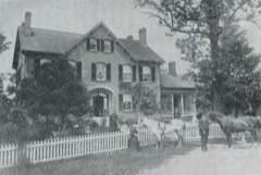
“Nathaniel and Levi Tyler, both of whom were noted men of the profession. After the war he continued his study with Dr.”
A Centennial Biographical History of the City of Columbus and Franklin County, Ohio .. (1901). Machine-read text.
one of 295 National Register listings in Franklin County · listed in 1977 · category: Building · one of 3 National Historic Landmarks in Franklin County.
National Register reference number.77001061- the number the National Park Service assigned this property when it was listed, and the key its nomination file is catalogued under at the National Archives.
What happened here
An account from the chapter on Columbus city, The inset identifies its exact
source book and publication year.
The Mound Builders and Indians - First White Settlements and Struggle for Possession - Indian Village at the Forks of the Scioto Attacked by Crawford and Dispersed - The Ohio Company, the Scioto Company and Symmes Purchase - Indian Power Broken and British Hopes Blasted - First Surveys - Topography, Geology and Soil of Franklin County.
On the 17th of Feljruary, 1859, Mr. Miller was united in marriage to Miss Julia A. Adams, a native of Delaware county, Ohio, and a daughter of William and Sarah Adams, the father now deceased, while the mother is in Westerville. Mr. and Mrs. Miller became the parents of three children, but only one is now living, John R. The mother died in 1867, and on the 19th of March, 1868, Mr. Miller was joined in marriage to Miss Sarah J. Gorsuch, a native of Harlem township, Delaware county. Her death occurred in January, 1 88 1, and on the 19th of March, 1884, was celebrated the marriage of Mr. Miller and Miss Celia H. Dent, a native of Trenton township, Delaware county. Her father, Edward H. Dent, was born in Licking county, Ohio, and after his marriage took up his abode in Delaware county. Elder L. B. Hanover, who is still living, performed all three ceremonies for our subject. The children of the present marriage are Ethel D. and Leroy D., both of whom are attending school.
After his marriage Mr. Miller resided upon a farm belonging to his father-in-law until the fall of 1866, when he operated the William Hunt farm for a year. He subsequently worked on the Jonathan Batesson farm for a year, receiving three hundred and fifty dollars for his services, and then removed to the Bigelow Bennett farm, near Centerville, renting that land. In 1868 he took up his abode on the farm now owned by Melvin B. Rich, in Harlem township, and a year later he removed to the Williams farm, for which he paid cash rent for two years. He made money in this way, it being his first notable success. In the spring of 1870 he removed to a tract of land in Plain township, Franklin county, owned by his father-in-law, Thomas Gorsuch. > Li 1868 he began operating a thresher and soon afterward began the manufacture of lumber, conducting a sawmill during the winter season for two years. He continued his threshing: operations to a greater or less extent until 1895, when his interests at home demanded his attention and he gave up that industry. After two years' spent upon his father-in-law's place he purchased fifty-six acres of his present farm, for which he paid seventy-five dollars per acre. He made a cash payment of five hundred dollars, giving his note for the balance, and as he prospered he cleared off all indebtedness and added to the place until the homestead now comprises two hundred and sixty-two acres of vahial>le land. He also owns one hundred and fifty-six acres in Delaware county, which he purchased in 1885. He has been engaged in buying and selling stock and has been an extensive feeder of hogs, finding this a very profitable source of income. He is als'o one of the directors of the Westerville Bank and owns residence property in Westerville.
Regional context, not property-specific
evidence. The
federal wildfire occurrence database
lists 1 fire within 5 miles of Osborn, Charles S., House between
2007 and 2007, burning about 0 acres in total. None started naturally. None was recorded as arson.
Distance is straight-line from the map coordinates, so a fire counted
here may appear on a neighbouring settlement's page as well.
Reported cause
Fires
Debris and open burning
1
The most recent of
them, most recent first, with the day each was reported and the service
that recorded it.
Regional context, not property-specific
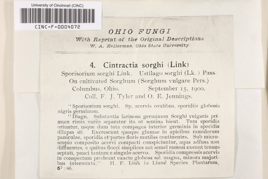
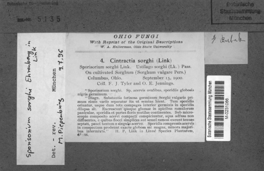
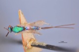
evidence. Museums hold 10,310 specimens
collected within 10 miles of Osborn, Charles S., House between 1804 and
1975: 8,321 Animalia, 1,273 Fungi, 568 Plantae, 117 Chromista, 30 Unrecorded, 1 Protozoa. 12 distinct Species records are shown.
Collected by 19 V 1938 in original publication, Knull, =, ? and others. Each is a
physical object with a catalogue
number, and each entry opens the museum's record. This is what was
collected and kept, not a survey of what lives here - nothing can be
concluded from a species being absent.
Regional context, not property-specific
evidence. The National Weather Service names
Westerville, the town this property stands in, in 36 storm reports between 1994 and 2026: 19 thunderstorm wind, 12 hail, 2 flash flood, 2 flood.
No death or injury is recorded in these reports. Each account below is quoted exactly as the forecast office
filed it, from the NOAA Storm Events Database, and each date
opens the federal record of that event.
Hail up to the size of golf balls affected the north side of the Columbus metro area and southern Delaware county. Hail was extensive from Dublin, through Worthington and Powell, to Westerville. Trees and shrubs were stripped of their foliage and cars and homes sustained significant hail damage. The hail covered the ground in some locations up to six inches deep in Worthington in northern Franklin county and near the Polaris Mall in southern Delaware county.
No historic map-sheet match is published
for this property yet. That does not mean no map exists. This record needs
a coordinate-quality review before it can be joined to a sheet boundary.
Browse the county's mapped places while that work is
pending.
From the nomination file
2,052 words on record
When this property was proposed for the
National Register, someone wrote the case for it: what the building is,
and why it matters. That document is a federal record in the public domain.
It is quoted below word for word, never summarised. The text was read off the scanned case file by machine, so the
occasional stray character is the recogniser's and the 1970s
typewriter's.
Description of the property
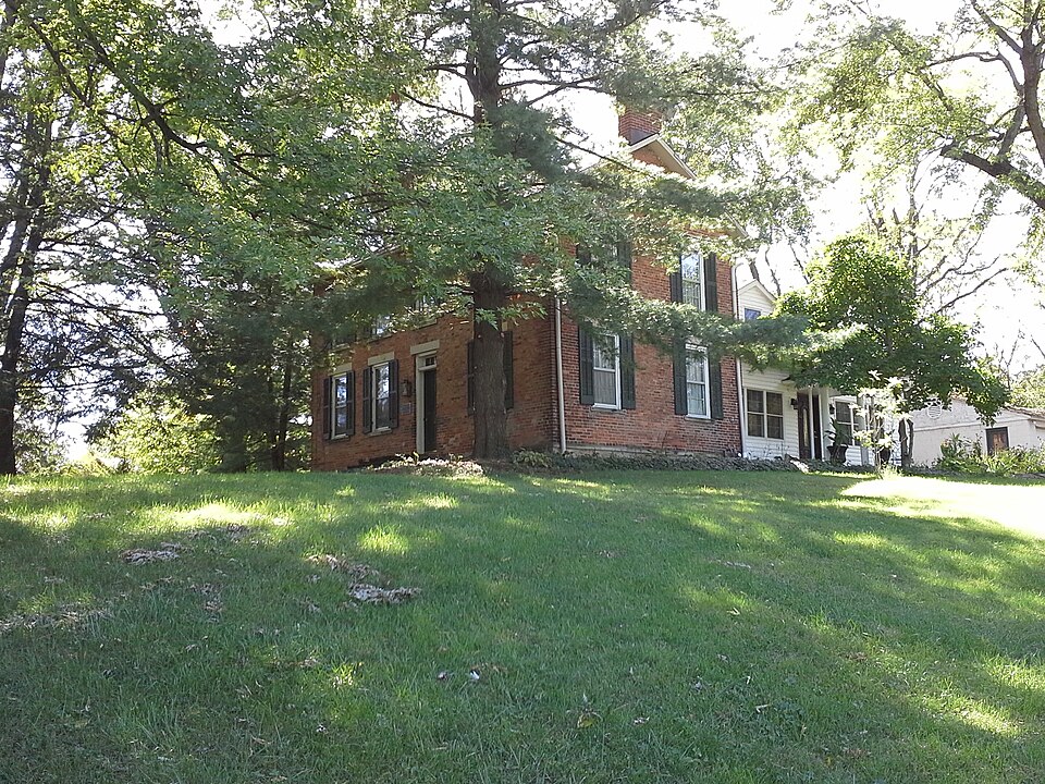
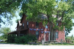
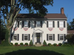
two windows to the left but only one to the right, centered in the right per floor, placed toward the front of the building. Again there are two To the rear of the building is a 1-1/2 story, gable-roofed, frame wing windows. The siding is also not original. CONDITION MOVED DESCRIPTION DETERIORATED light. _UNEXPOSED XALTERED The Charles Osborn house is a simple, two-story brick building on a stone frieze or cornice boards.Interior end chimneys are at the ridgeline on CHECK ONE gables and alteration of the placement and character of the doors and pane and have plain stone lintels and sills.Facade windows have wood _RUINS The north gable end has two 6/6 pane windows on each floor.There are two vents in the gable.The roof overhangs the building but there are no DATE.
- UNALTERED half of the facade. There are four windows on the second floor directly shutters.The doorway is slightly recessed and has a single pane transom the kitchen.It has been quite altered over the years by the addition of diamond-shaped vents in the gable.The south end has only one window above the door and windows below.Windows are double-hung sash,6/6 which forms a T' with the brick portion.The wing is early and was once both the N G S ends. AREAS OF
Statement of significance
The Charles Osborn House is a mid-1800's Ohio farmhouse of simple lines and the late 1950's. INVENTION ECONOMICS COMMUNICATIONS ARCHEOLOGY-HISTORIC SIGNIFICANCE PERIOD RELIGION BUILDER/ARCHITECT MILITARY THEATER ART LITERATURE AGRICULTURE known in Blendon township as farmers and early settlers. This is the only _POLITICS/GOVERNMENT spent here and together with his brothers,Hiram and Ralph,accounted for _EXPLORATION/SETTLEMENT settlers in the township and conducted a tavern on the local stagecoach road. Osborn home which remains.
_CONSERVATION _PREHISTORIC surrounded by modern housing development.The Osborn families were once Charles was married in 1849 and built this farm home.His entire life was X1800-1899 -1400-1499 -1500-1599 Charles Osborn was the son of George Osborn who came to northern Franklin and all of the outbuildings have been destroyed for new development since -1600-1699 _SCULPTURE -1700-1799 and respected.Of the three farm homesteads and the father's tavern and farm - TRANSPORTATION 1ocal history 1900- - MUSIC _LAW SCIENCE _COMMUNITY PLANNING ca. 1850 ARCHEOLOGY-PREHISTORIC only the home of Charles Osborn remains.Much of the original farm acreage SPECIFIC DATES
Quoted from the National Register nomination
for reference 77001061, 18 pages, held by the National Archives in Record
Group 79. See the
catalogue record.
Listed places nearby
6 within 8 miles
Other National Register properties close
enough to walk or drive between, ordered by distance from this one. Both
positions come from the same geocoding pass that matched these properties
to their map sheets.
Listing record. National Park Service National Register of Historic Places, listed-properties dataset, current to 2026-05-22.
Map join. Address geocoded through the United States Census geocoder, then tested against the published boundary of every sheet in the USGS Historical Topographic Map Collection.
How this page is made. Listing fields come from federal records; map-sheet coverage is a labelled coordinate-to-boundary calculation, not a source-field claim.
Wildfire. Short, Karen C. 2022. Spatial wildfire occurrence data for the United States, 1992-2020 [FPA_FOD_20221014]. 6th Edition. Fort Collins, CO: Forest Service Research Data Archive. https://doi.org/10.2737/RDS-2013-0009.6 Collected with United States Government funding and usable without additional permissions or fees.
Specimens. Global Biodiversity Information Facility (GBIF), https://www.gbif.org/. Only records licensed CC0 or CC BY are used. Records licensed CC BY-NC are excluded because this site carries advertising. Images are checked individually and any whose licence is non-commercial, no-derivatives or unreadable is refused.
Storms. NOAA National Centers for Environmental Information, Storm Events Database https://www.ncei.noaa.gov/stormevents/ A work of the United States government, no copyright under 17 U.S.C. 105. Narratives are quoted verbatim from the National Weather Service report and are not edited or summarised.
 Block
Block