BlockBefore
Decorative drawing: a canal lock with timber gates and a towpath. Not a photograph of this place.

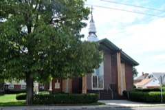
Taylorsville Canal Inn

Listed on the National Register of Historic Places in 1977. A historic map-sheet match is not published yet. The record needs a coordinate-quality review before it can be joined to a sheet boundary.

From the record

one of 117 National Register listings in Montgomery County · listed in 1977 · category: Building · one of 4 National Historic Landmarks in Montgomery County.

Sources: the case file at the National Archives · the National Register database, National Park Service

The listing

  • What is counted as historic. The nomination lists 1 building as contributing to the listing.
  • Address. 4240 Taylorsville Rd., Dayton, 45424
  • When was it listed? 1977-11-16
  • Category. building
  • Township. Huber Heights city
  • National Register reference number. 77001078 - the number the National Park Service assigned this property when it was listed, and the key its nomination file is catalogued under at the National Archives.

Specimens collected near this property

12 of 902 shown

Regional context, not property-specific evidence. Museums hold 902 specimens collected within 10 miles of Taylorsville Canal Inn between 1835 and 1975: 761 Animalia, 82 Plantae, 54 Fungi, 3 Unrecorded, 1 Protozoa, 1 Chromista. 12 distinct Species records are shown. Collected by A. E. Foeerste, A. E. Foerste, A. F. Foerste and others. Each is a physical object with a catalogue number, and each entry opens the museum's record. This is what was collected and kept, not a survey of what lives here - nothing can be concluded from a species being absent.

Image SpeciesYear Collected by Where, as recorded
Specimen of Ambrosia artemisiifolia L.Ambrosia artemisiifolia L.1881Foerste AF
Specimen of Geaster limbatus Fr.Geaster limbatus Fr.1883A. E. FoeersteDayton
Specimen of UredoUredo1897Prof. W.A. Kellerman
A photograph of the species Botrypus virginianus, not of this specimenBotrypus virginianus (L.) Michx.1835Joseph C. FrankOhio, Miami [County]
A photograph of the species Platanthera leucophaea, not of this specimenPlatanthera leucophaea (Nutt.) Lindl.1836C. W. ShortDayton
A photograph of the species Erythronium americanum, not of this specimenErythronium americanum Ker Gawl.1837van Cleve, John W.3 mi. north of Dayton
A photograph of the species Hydrophyllum macrophyllum, not of this specimenHydrophyllum macrophyllum Nutt.1838J. W. Van CleveDayton
A photograph of the species Allium canadense, not of this specimenAllium canadense L.1839not recordedDayton. 1 mi. northeast.
A photograph of the species Cardamine L., not of this specimenCardamine L.1839Sanders, Alfred; J.J. Nagel, J.G. Haupt.Dayton. 1 mile east.
A photograph of the species Cassia marilandica, not of this specimenCassia marilandica L.1839Sanders, AlfredDayton
A photograph of the species Cynoglossum officinale, not of this specimenCynoglossum officinale L.1839not recordedDayton. Suburbs E.
A photograph of the species Nuphar advena, not of this specimenNuphar advena (Aiton) Aiton1839Sanders, Mrs.; J.G. HauptDayton

All 902 specimens within 10 miles, at the Global Biodiversity Information Facility.

Mines and quarries near this property

10 of 11 shown

Regional context, not property-specific evidence. The federal mineral resources record lists 11 workings within 5 miles of Taylorsville Canal Inn: 7 past producers, 3 producers, 1 plant. 4 still produce. What was taken out: Sand and Gravel, Construction, Stone, Crushed/Broken. Distance is straight-line from the map coordinates, so a quarry counted here may appear on a neighbouring settlement's page as well.

Where SiteCommodity StatusRecorded
Southwestern PitStone, Crushed/BrokenProducer
Wayne QuarryStone, Crushed/BrokenProducer
Campbell PitSand and Gravel, ConstructionPast ProducerSedimentary
Campbell PitSand and Gravel, ConstructionPast Producer
Cassel PitSand and Gravel, ConstructionProducer
Cassel Sand & Gravel, Inc.Sand and Gravel, ConstructionPast Producer
Haas Sand and Gravel PitSand and Gravel, ConstructionPast ProducerSedimentary
Haas Sand and Gravel PitSand and Gravel, ConstructionPast Producer
Rip Rap Road Plant 416 & PitSand and Gravel, ConstructionPlant
Taylorville Gravel PitSand and Gravel, ConstructionPast ProducerSedimentary

Every working recorded in Montgomery County

Storms near this property

60 of 74 shown

Regional context, not property-specific evidence. The National Weather Service names Dayton, the town this property stands in, in 74 storm reports between 1994 and 2026: 41 thunderstorm wind, 15 hail, 8 flash flood, 7 flood. The reports record 1 injury. Each account below is quoted exactly as the forecast office filed it, from the NOAA Storm Events Database, and each date opens the federal record of that event.

WhenEvent Place namedHarm What the report says
April 2015LightningDayton1 hurtA University of Dayton student, Sean Ferguson, 23 of Pittsburgh, was struck by lightning as he ran across university parking lot C. The student was hospitalized with serious burns and a broken jaw.
April 2000Thunderstorm WindDayton$200,000Thunderstorms winds measured by spotters as high as 72 mph downed numerous trees, many of which fell on cars and blew on to and into homes. A construction trailer was severely damaged and some businesses received damage.
June 2001LightningDayton$100,000Lightning struck a building causing it to catch on fire.
July 1994Thunderstorm WindDayton$50,000Trees were downed. A large propane tank was blown over near Dayton. Large hail fell over the western part of Dayton.
June 1999Thunderstorm WindDayton$30,000A roof was blown off of a residence in East Dayton as well as several utility poles that were snapped in half. Numerous trees were down in the vicinity of Glenrock Road and East Fifth Street. Several trees landed on parked automobiles and garages.
August 2021Flash FloodDayton$10,000A few motorists were stranded in high water near downtown Dayton.
June 2014Thunderstorm WindDayton$10,000Large limbs were downed at Patterson and River Park due to thunderstorm winds. Two large trees were also downed in the area. One tree fell on a house.
June 2014FloodDayton$10,000High standing water under an overpass trapped a man on top of a car near Linden Avenue and Livingston Avenue.
August 2011Thunderstorm WindDayton$10,000Large tree limbs were reported down due to damaging thunderstorm winds. One of these tree limbs crushed a car.
July 2002Thunderstorm WindDayton$10,000Several trees were blown down.
August 2007Thunderstorm WindDayton$8,000Large tree limbs were downed. A tree fell on a house in Oakwood, causing minor structural damage.
June 2005Thunderstorm WindDayton$8,000Several large trees were downed across the southern Dayton metro area. An eight-foot diameter tree fell on a house.
June 2000Thunderstorm WindDayton$7,000Several trees were blown down in Butler Township.
May 1995Thunderstorm WindDayton$6,000Several trees were downed, some across power lines. Eight-three people were without power for a short period of time.
May 2019Thunderstorm WindDayton$5,000A tree was downed onto a house on 5 Oaks Avenue.
March 2011FloodDayton$5,000Several roads were flooded due to heavy rainfall.
April 2003Thunderstorm WindDayton$5,000Several trees were downed in the city.
June 2001Flash FloodDayton$5,000Two feet of water on roadways across eastern part of county
August 2000Thunderstorm WindDayton$5,000Trees knocked down in the southwestern part of the city. A wind gust of 62 mph was reported at the Dayton Dailey News building in downtown.
July 2000Thunderstorm WindDayton$5,000Trees knocked down.
August 1998Thunderstorm WindDayton$5,000Trees knocked down.
April 2026Thunderstorm WindDayton$4,000A tree fell onto some power lines.
June 2001Thunderstorm WindDayton$4,000Several trees and power lines reported down
February 2024Thunderstorm WindDayton$3,000Some wires were downed on Green Street.
February 2024Thunderstorm WindDayton$3,000Wires were downed on Drummer Avenue.
August 2021Thunderstorm WindDayton$3,000A few trees were downed in the city of Dayton.
July 2011Thunderstorm WindDayton$3,000Large limbs were reported broken. A large tree was uprooted. Numerous large tree limbs were down in the road. These occurrences were due to damaging thunderstorm winds.
June 2008Thunderstorm WindDayton$3,000Large tree limbs were downed.
May 2008HailDayton$3,000A few large tree limbs were also knocked down.
June 2008Thunderstorm WindDayton$3,000Large tree limbs were downed.
March 2007FloodDayton$3,000A few roads were flooded and closed throughout the Dayton metro area.
August 2003Thunderstorm WindDayton$3,000Trees and powerlines were downed.
July 1995Thunderstorm WindDayton$3,000Large trees were downed, some across city streets.
May 1996Thunderstorm WindDayton$3,000no account filed
January 2008Thunderstorm WindDayton$2,000Large tree limbs were knocked down.
March 2022Thunderstorm WindDayton$1,000A tree was downed onto Fountain Avenue.
July 2015Thunderstorm WindDayton$1,000A large tree was blown down.
June 2014Thunderstorm WindDayton$1,000A large limb was downed on Wyoming Street due to thunderstorm winds.
December 2013Flash FloodDayton$1,000Multiple roads were closed countywide due to high water caused by heavy rainfall.
January 2012FloodDayton$1,000Several roads in the area were reported closed due to high water caused by heavy rain.
June 2012Thunderstorm WindDayton$1,000Multiple large tree limbs were downed due to damaging thunderstorm winds.
May 2011Thunderstorm WindDayton$1,000A tree was down across a road due to damaging thunderstorm winds.
May 2011Thunderstorm WindDayton$1,000A large tree was uprooted due to damaging thunderstorm winds.
June 2010Thunderstorm WindDayton$1,000Large tree limbs were reported down due to damaging thunderstorm winds.
August 2010Thunderstorm WindDayton$1,000Several large branches were reported down due to damaging thunderstorm winds.
June 2008FloodDayton$1,000A foot to a foot and a half of water was standing on South Patterson between Apple and Stewart Roads.
April 2008HailDayton$1,000no account filed
June 2020Thunderstorm WindDayton$500A large limb was knocked down into the parking lot of the downtown Dayton YMCA parking lot.
July 2016Flash FloodDayton$500A car was stranded on Keowee Street under State Route 4 due to high water. Three feet of water was also reported on Webster Street at the underpass of State Route 4.
June 2025Flash FloodDayton-Several inches of water were flowing across the roadway near the intersection of Wilfred and St Charles Avenues.
June 2025Flash FloodDayton-Several inches of water were flowing across Carlisle Avenue and Tacoma Street.
August 2020FloodDayton-Street flooding was reported on U.S. 35 and I-75.
April 2017Thunderstorm WindDayton-Dime size hail was reported as well.
June 2017HailDayton-Hail size was estimated from social media photo.
August 2016Thunderstorm WindDayton-Winds were estimated by a trained spotter.
June 2015Heavy RainDayton-Water was covering a road at the University of Dayton.
April 2015HailDayton-In addition to the hail, small limbs were knocked down by estimated 60 MPH winds.
May 2014FloodDayton-A car was stalled in standing water beneath a railroad overpass due to heavy rainfall.
June 2012Thunderstorm WindDayton-The spotter estimated the speed of the wind gust.
September 2002Flash FloodDayton-Numerous roads were flooded throughout the Dayton metropolitan area. A man had to be rescued when he drove his car into a flooded retention pond near the Dayton Mall.

Every storm recorded in Montgomery County

Newspapers printed here

0 digitised pages

8 papers published in this town, digitised by the Library of Congress and free to read: 0 issues, 0 pages. Every page is searchable, so a name or a street can be looked for directly in what the town printed about itself at the time.

NewspaperPublished
The Daily Bulletin1942 to 1946
The Dayton Forum1913 to 1949
Dayton Union News1940 to 1944
Dayton Daily Empire1850 to 1865
The Daily Express1950 to 1955
The Ohio Daily-Express1946 to 1950
The Daily Empire1865 to 1867
The Dayton Citizen1950 to 19??

Map coverage status

No historic map-sheet match is published for this property yet. That does not mean no map exists. This record needs a coordinate-quality review before it can be joined to a sheet boundary. Browse the county's mapped places while that work is pending.

From the nomination file

2,013 words on record

When this property was proposed for the National Register, someone wrote the case for it: what the building is, and why it matters. That document is a federal record in the public domain. It is quoted below word for word, never summarised. The text was read off the scanned case file by machine, so the occasional stray character is the recogniser's and the 1970s typewriter's.

Description of the property

CONDITION DESCRIPTION sawn stone. RUINS UNALTERED FAIR This large two story brick H shaped Greek Revival influence The Greek Revival interior trim is excellently preserved. room for a large two story porch on the south side between the originally was. Taylorsville, never much, has faded away. One or two buildings frieze.The four gable ends are pedimented and have inside end _EXCELLENT chimneys.A totally out of character Tara style veranda has been CHECK ONE added to the north side.without modifying the basic structure. building faces west about 80'from the canal trace with the legs rooms - sash with stone lintels and sills. The eaves are box cornice with The entrance hall is quite lavish with dog leg stairs. Unfortunately DATE undistinguished entrance porch. east and west blocks.

make this building a perfect representation of the Canal Inn it There is a small cellar under the east end.The foundation is of the H oriented north and South.The cross bar is offset to make The windows are 6/6 double hung possibly of the canal era are nearby. XXGOOD Form No. 10-300a (Rev. 10-74) UNITED STATES DEPARTMENT OF THE INTERIOR FOR NPS USE ONLY NATIONAL PARK SERVICE NATIONAL REGISTER OF HISTORIC PLACES INVENTORY -- NOMINATION FORM DATE ENTERED CONTINUATION SHEET ITEM NUMBER Item 7 Added: GPO 892 455 PAGE RECEIVED that the circumstantial evidence is sufficiently strong The use of the Inn designation was questioned by the The Tara style porch and porch enclosure are both c.l954. The mantel in the front parlor is c.1973. to identify this as a canal inn.

JUL 2 7 1977 Item 8: NOV 16 1977 reviewer. It is my professional judgment asa historian AREAS OF

Statement of significance

From an analysis of the public record one can deduce its this section in 1836 and the canal officially opened by merchant, was township clerk, the first township postmaster at Taylorsville in 1846, and Justice of the Peace. 1700-1799 1500-1599 1400-1499 INVENTION ECONOMICS ARCHEOLOGY-HISTORIC LAW BUILDER/ARCHITECT SIGNIFICANCE PERIOD SCIENCE ART AGRICULTURE SCULPTURE EDUCATION MUSIC LITERATURE MILITARY XARCHITECTURE almost a certainty. XRANSPORTATION INDUSTRY _PHILOSOPHY _COMMUNICATIONS SOCIAL/HUMANITARIAN _CONSERVATION _POLITICS/GOVERNMENT _EXPLORATION/SETTLEMENT "positions of trust" in Wayne Township.Joseph H.Johnson from bewildering series of transactions including litigation.

Very _PREHISTORIC _THEATER The property passed back and forth between Koogler, who _ENGINEERING is highly possible the inn housed constructors in anticipation of the building to the canal and its physical layout makes this use owned the Inn twice for several years, and the Sullivans in a proved in history.Tradition says it was and the orientation of was started north from Dayton early in l833.Water was turned into -1600-1699 A very minor to remove minor renovations, presidential candidate William Henry Harrison on July 4,l837. _RELIGION This is an excellent representation of a Greek Revival Canal would return this Canal Inn to its appearance of 1836.

-COMMERCE Virginia built a cabin at what would be Taylorsville in l806 and clearly shows on an l85l map as his property. __1900- -COMMUNITY PLANNING SPECIFIC DATES established a large and prosperous farm. Samuel Johnson, a ARCHEOLOGY-PREHISTORIC c.1834 or 1845-1850 That it was an inn cannot be Inn on the old Miami and Erie Canal.

The whole case file for this property - 2,013 words, 21 pages, reproduced complete.

Quoted from the National Register nomination for reference 77001078, 21 pages, held by the National Archives in Record Group 79. See the catalogue record.

Listed places nearby

6 within 8 miles

Other National Register properties close enough to walk or drive between, ordered by distance from this one. Both positions come from the same geocoding pass that matched these properties to their map sheets.

Photograph PropertyDistance Listed
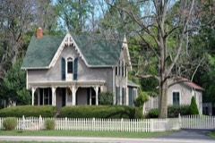
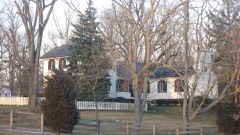
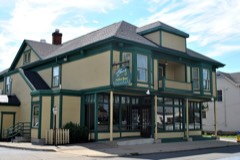
Miami-Erie Canal Lock No. 701.6 miles1982
Ausenbaugh-McElhenny House3.3 miles1975
Deerwood Farm3.4 miles1975
St. Adalbert Polish Catholic Church5.5 miles1991
Sig's General Store5.6 miles1991
Holy Cross Lithuanian Roman Catholic Church5.7 miles1991

Sources for this property

National Archives recordThe nomination case file for reference 77001078 in Record Group 79.
Montgomery CountyAll 117 listed properties in this county.

Provenance

  • Listing record. National Park Service National Register of Historic Places, listed-properties dataset, current to 2026-05-22.
  • Map join. Address geocoded through the United States Census geocoder, then tested against the published boundary of every sheet in the USGS Historical Topographic Map Collection.
  • How this page is made. Listing fields come from federal records; map-sheet coverage is a labelled coordinate-to-boundary calculation, not a source-field claim.
  • Specimens. Global Biodiversity Information Facility (GBIF), https://www.gbif.org/. Only records licensed CC0 or CC BY are used. Records licensed CC BY-NC are excluded because this site carries advertising. Images are checked individually and any whose licence is non-commercial, no-derivatives or unreadable is refused.
  • Mines and quarries. USGS Mineral Resources Data System (MRDS) https://mrdata.usgs.gov/mrds/ A work of the United States government, no copyright under 17 U.S.C. 105.
  • Storms. NOAA National Centers for Environmental Information, Storm Events Database https://www.ncei.noaa.gov/stormevents/ A work of the United States government, no copyright under 17 U.S.C. 105. Narratives are quoted verbatim from the National Weather Service report and are not edited or summarised.