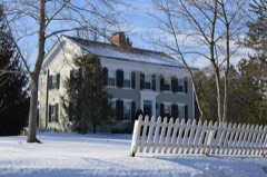
Listed on the National Register of Historic Places in
1977. A historic map-sheet match is not published yet. The record needs a coordinate-quality review before it can be joined to a sheet boundary.
From the record
“The little settlement thus dropped in the woods, like a pebble in the ocean, seemed lost in the vast expanse of wilderness that stretched, with interminable proportions, from the frontiers of Western New York along the lakes to the great West. By the treaty 1785 with the savages, the Cuyahoga River was made a pai-t of the dividing line between the territories of the contracting parties.”
History of Summit County, with an Outline Sketch of Ohio (1881). Machine-read text.
one of 137 National Register listings in Summit County · listed in 1977 · category: Building · one of 1 National Historic Landmarks in Summit County.
National Register reference number.77001088- the number the National Park Service assigned this property when it was listed, and the key its nomination file is catalogued under at the National Archives.
The early settlement of the Reserve was an effort to reproduce in this Western wild the honored institutions of the motherland. This was the beginning of the golden period of the Connecticut churches, a period marked by revivals of religion throughout the State, distinguished for their power, purity and permanent influence, gi'eatly enlarging the chm-ches, improving the moi-als of society, and bringing the people of the State, to a great extent, under the control of religion." It was just at this time also that the Connecticut method of " missions to the new settlements " was completed, which was destined to play so important a part in the New Connecticut; and these civilizing influences combined to leave an impress upon the plastic civilization of the new land that has been ciystallized in the cultm'e of to-day. These influences were early marked, and perhaps nowhere more distinctly than in the region which is now embraced in Summit County. A letter from the Western Reserve to Eastern friends dated 1812, reads as follows: "I like Tallmadge better on several accounts than any other place I have seen. The settlers in this toA\Ta are much the most respectable of any on the Reserve. There is provision made for the pennanent support of preaching, which is not the case in any other town." Another letter dated from Tallmadge in the same year, speaks in the same strain: "I am persuaded that if any of om' fi'iends tliiulv of going to a new country, they will find none that they will be so well pleased with, either on account of the quality of the land or of the society. I do not think there is in the State of Connecticut a society where there is that attention paid to the Sabbath, and to religion generally, that there is here. There are very few who do not attend meeting regularly, and very few prayerless families." There is no question but that the early histoiy of Tallmadge was exceptional in some respects, but of Hudson it was scai'cely less true. Its founder, the son of a tailor who taught his children as he plied his trade, grew up to advanced manhood embracing skeptical notions. Caught by the sweeping power of the chiur.h movement of this period he was converted, and with the characteristic practicability of the Pm-itan mind, he sought an opportunity to prove his faith in work. The missionary spirit that had begun to pervade the religious communities of his native State, and the recent organization of the gi'eat Land Company, prepared the way which he adopted without hesitation. Zealous in his new found faith, " he wished to do something to repair the injury he had done, and to advance, to the extent of his ability, the interests of that cause which he had early labored to destroy. These were the views that led him to emigrate. * * * * The early efforts and sacrifices of the men who came to Hudson, show that they were actuated by the motives I have ascribed to them. They never suffered the Sabbath to pass by after the settlement was commenced, without religious worship; and by great effort and great pecuniary expenditure, they provided for the enjoyment of religious ordinances among themselves, and sought to promote the progi-ess of religion in this part of our country. It was the first desire of ^Ir. Hudson's heart to see the day when a chm'ch shou^ld be organized within the township, and he rejoiced in that day. The next object of desire was that this chiu-ch might enjoy the labors of a settled Pastor, and he lived to see that day and was glad. Then it was in his heart to see a house erected for the worship of Grod, and that he saw completed to his great satisfaction. 'But,' said he, 'the college - the college; that was a child of my old age. I never expected to live to see that.' Yet the college was in coincidence with his plans and with his missionary spirit. He spent most of his time in visiting Clmstian families in all parts of the Reserve, and securing the organization of churches and it was with him a matter of painful solicitude, how the infant chm*ches rising up on the Reserve were to be supplied with able, faithful ministers, in sufficient numbers to meet their wants. The college came in as the appropriate instrument to supply the deficiency."*
The original purchasers of this township with its annexes, were Nathaniel Norton, of Bloomfield, N. Y.,Birdseye Norton and David Hudson, of Goshen. Conn. There are no means now of ascertaining the arrangement between these partners in relation to this purchase. Nathaniel Norton was a well-to-do farmer in Bloomfield, N. Y., where he had come as an early settler ; Birdseye Norton was a wealthy merchant of Goshen, and David Hudson a farmer in comfortable circumstances, but of little cash capital. From such evidence as the old account books of Mr. Hudson afford, it is probable that Birdseye Norton furnished one-half of the capital and each of the others contributing a fourth, Mr. Hudson probably turning in his Connecticut farm to Mr. Birdseye Norton. The land was purchased at 52 cents per acre, but with the equalizing annexes the average cost per acre was reduced to 34 cents. Nathaniel Norton, some time in 1S()1, disposed of his share, probably to Stephen Baldwin, Benjamin Oviatt and Theodore Parmele. The first di-aft of the Reserve was made in 1798. and earlv in the following: yeai'. Mr. Hudson started out to explore and survey the land for the company in which he was a partner. His preparations for his new adventui'e were carefully made, as the following exhibit taken from an old account-book shows : far West was forced to depend upon the uncertain guidance of Indian trails and the surveyor's marks. The thoroughfare of Western travel was by the lakes, and IVIr. Hudson has left a carefully prepared " traveler's guide " over that route as follows: From Black Rock to Buffalo Creek, tlu-ee miles; Buffalo Creek to Five Mile Creek, live miles; Five Mile Creek to Eighteen Mile Creek, thirteen miles; Eighteen Mile Creek to Cattaraugus, twelve miles; Cattaraugus to Four Mile Creek, four miles; Four Mile Creek to Fifteen Mile Creek, eleven miles; Fifteen Mile Creek to Chataqua, twenty-live miles; Chataqua to Lowiy's, sixteen miles; Lowry's to Presque Isle, sixteen miles; Presq^^e Isle to Walnut Creek, twelve miles ; Walnut Creek to Elk Creek, eight miles ; Elk Creek to Conneaut, ten miles; Conneaut to Ashtabula, fourteen miles; Ashtabula to Grand River, twenty-six miles; Grand River to Chagrin, ten miles; Chagrin to Cuyahoga, twenty miles; a total of 205 miles. The only public source of information in regard to this country was " Morse's Geography," which represented the latter river as navigable for sloops for forty miles from its moiith.
Regional context, not property-specific
evidence. The
federal wildfire occurrence database
lists 4 fires within 5 miles of Brown, John, Farmhouse between
1993 and 2005, burning about 1 acres in total. None started naturally. None was recorded as arson.
Distance is straight-line from the map coordinates, so a fire counted
here may appear on a neighbouring settlement's page as well.
Reported cause
Fires
Debris and open burning
2
Recreation and ceremony
1
Missing data/not specified/undetermined
1
The most recent of
them, most recent first, with the day each was reported and the service
that recorded it.
Regional context, not property-specific
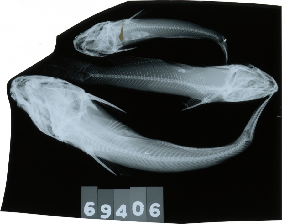
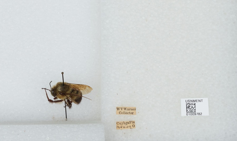
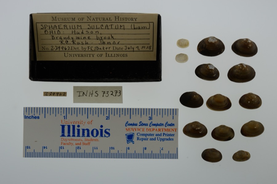
evidence. Museums hold 662 specimens
collected within 10 miles of Brown, John, Farmhouse between 1877 and
1973: 629 Animalia, 24 Plantae, 9 Fungi. 12 distinct Species records are shown.
Collected by A. Hall, Adams J. M. R., Armbruster, D. C. (Daniel C.) and others. Each is a
physical object with a catalogue
number, and each entry opens the museum's record. This is what was
collected and kept, not a survey of what lives here - nothing can be
concluded from a species being absent.
Regional context, not property-specific
evidence. The federal mineral resources record lists
7 workings within 5 miles of Brown, John, Farmhouse: 5 past producers, 2 producers.
2 still produce. What was taken out: Stone, Crushed/Broken, Sand and Gravel, Construction. Distance is straight-line from the
map coordinates, so a quarry counted here may appear on a neighbouring
settlement's page as well.
Regional context, not property-specific
evidence. The National Weather Service names
Hudson, the town this property stands in, in 25 storm reports between 1996 and 2024: 11 thunderstorm wind, 8 hail, 4 flash flood, 2 lightning.
No death or injury is recorded in these reports. Each account below is quoted exactly as the forecast office
filed it, from the NOAA Storm Events Database, and each date
opens the federal record of that event.
Reports of flooded and impassable roadways in northeast Hudson, including Pine Trails, Alexandra Drive, Huntington Road, Mayapple Drive, Herrick Park Drive, and Deerpath Trails. Ponds overflowing on Stow Road. Vehicles stuck in water in front of Hudson High School and on Woodspring Lane and Stow Road. 34 homes reported flooding, mainly basement flooding. One partial basement collapse was reported, with 11 rescues from cars stuck in water.
No historic map-sheet match is published
for this property yet. That does not mean no map exists. This record needs
a coordinate-quality review before it can be joined to a sheet boundary.
Browse the county's mapped places while that work is
pending.
From the nomination file
1,766 words on record
When this property was proposed for the
National Register, someone wrote the case for it: what the building is,
and why it matters. That document is a federal record in the public domain.
It is quoted below word for word, never summarised. The text was read off the scanned case file by machine, so the
occasional stray character is the recogniser's and the 1970s
typewriter's.
Description of the property
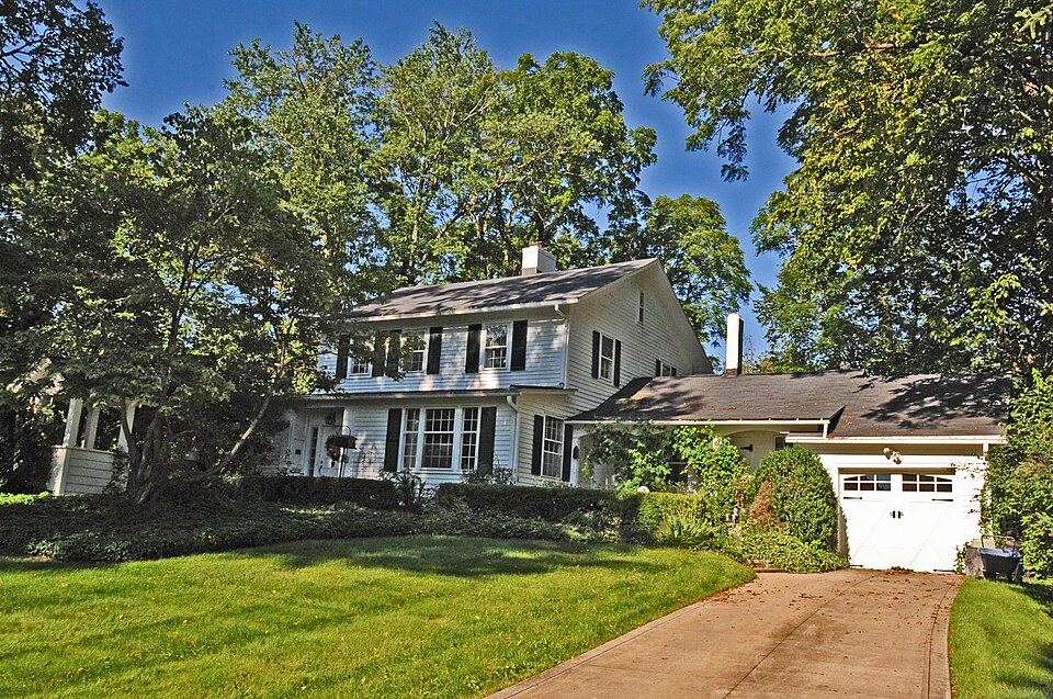
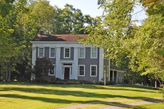
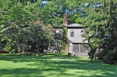
The house was completed in 1824 for John Brown by his carpenter, Herman Peck. a recessed door with sidelights on the left half and a three-part, multi-paned 6/6 pane windows on the second floor of the original portion of the house. Un the north side of the house 1s a one-story, gable rooted wing; the gable end on the east side of this wing overhangs the wall, creating a small porch. The west side of the house is covered by a 1-1/2 story, gable-roofed wing, the and prior to 1950.
The property has had many alteration, both exterior and interior, over the years; its association with John Brown, however, is retained and is the CONDITION DATE EXCELLENT DETERIORATED MOVED UNEXPOSED XGOOD RUINS FAIR UNALTERED was centered in the south end.Today this facade retains its center entrance reason for its nomination to the National Register. ridgeline of the roof coming just under the cornice of the original portion of CHECK ONE Attached to the wing is a garage. The building is a two-story, frame, gable-roofed farmhouse.The major entrance second floor and a single small window in the gable.There is a one-story and on the west side a doorway with small entrance porch with trellised sides the addition on the north is a screened porch.
The original portion of the which is now flanked by tall bay windows 6/6 pane windows on the house was rectangular - there were no wings.All wings were added after 1869 the house.This wing has a single window centered in the south and north sides shed-roofed addition on the south side.This addition has a 6/6 pane window and AREAS OF
Statement of significance
John Brown, most famous of all abolitionists, spent a total of 38 years of his more Underground Railroad Stations than any other area in the country. It was abolitionists Charles Backus Storrs, Joshua Reed Giddings, and Ben Wade. It was John Brown came to Ohio with his father, Owen, in 1805 at the age of five. Owen brother, Levi Blakeslee, opened their own tannery and built a log house. John establishement of the Liberty Party, the first national anti-slavery party by Early in the 1850's the Kansas Nebraska Act drew many Ohioans to "squat" in to disarm the enemy, convinced that the American nation would be killed if 1824 1500-1599 ENGINEERING COMMERCE THEATER AGRICULTURE PREHISTORIC slaves.
PERIOD ARCHITECTURE ARCHEOLOGY-HISTORIC LAW SIGNIFICANCE BUILDER/ARCHITECT TRANSPORTATION INDUSTRY _POLITICS/GOVERNMENT LITERATURE 1900- XSOCIAL/HUMANITARIAN INVENTION EDUCATION his life.
Quoted from the National Register nomination
for reference 77001088, 13 pages, held by the National Archives in Record
Group 79. See the
catalogue record.
Listed places nearby
6 within 8 miles
Other National Register properties close
enough to walk or drive between, ordered by distance from this one. Both
positions come from the same geocoding pass that matched these properties
to their map sheets.
Listing record. National Park Service National Register of Historic Places, listed-properties dataset, current to 2026-05-22.
Map join. Address geocoded through the United States Census geocoder, then tested against the published boundary of every sheet in the USGS Historical Topographic Map Collection.
How this page is made. Listing fields come from federal records; map-sheet coverage is a labelled coordinate-to-boundary calculation, not a source-field claim.
Wildfire. Short, Karen C. 2022. Spatial wildfire occurrence data for the United States, 1992-2020 [FPA_FOD_20221014]. 6th Edition. Fort Collins, CO: Forest Service Research Data Archive. https://doi.org/10.2737/RDS-2013-0009.6 Collected with United States Government funding and usable without additional permissions or fees.
Specimens. Global Biodiversity Information Facility (GBIF), https://www.gbif.org/. Only records licensed CC0 or CC BY are used. Records licensed CC BY-NC are excluded because this site carries advertising. Images are checked individually and any whose licence is non-commercial, no-derivatives or unreadable is refused.
Mines and quarries. USGS Mineral Resources Data System (MRDS) https://mrdata.usgs.gov/mrds/ A work of the United States government, no copyright under 17 U.S.C. 105.
Storms. NOAA National Centers for Environmental Information, Storm Events Database https://www.ncei.noaa.gov/stormevents/ A work of the United States government, no copyright under 17 U.S.C. 105. Narratives are quoted verbatim from the National Weather Service report and are not edited or summarised.
 Block
Block