Listed on the National Register of Historic Places in
1978. A historic map-sheet match is not published yet. The record needs a coordinate-quality review before it can be joined to a sheet boundary.
From the record
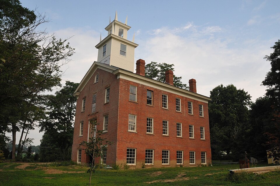
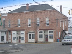
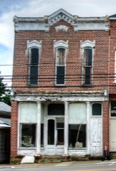
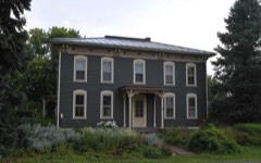
“The Vermillion Institute in Hayesville, Ohio was a co-educational school that during the mid- to late 19th century was a preeminent center of higher education that trained people who became prominent in various professions. At one time it was a rival to "Oberlin, Kenyon or Denison".”
Wikipedia article Vermillion Institute, CC BY-SA 4.0.
one of 11 National Register listings in Ashland County · listed in 1978 · category: Building.
National Register reference number.78002000- the number the National Park Service assigned this property when it was listed, and the key its nomination file is catalogued under at the National Archives.
What happened here
An account from the chapter on Vermillion township, The inset identifies its exact
source book and publication year.
"The Coulter family are known as among the earliest settlers at Perrysville, on the Black Fork. Thomas Coulter (the father of John) was born in the State of New York, and moved from thence with his father to the Wyoming Valley, Pennsylvania, and was living there at the time of the Wyoming massacre.
The original proprietors of the town of Hayesville were Rev. John Cox and Linus Hayes. As the Loudonville and Ashland, and Wooster and Mansfield roads crossed at this point, Mr. Cox concluded that it might be the site of a future town. He accordingly gave notice of a sale of lots, and on the day named a considerable number assembled to attend the sale. The business opened in the forenoon, and the auctioneer, John Shriver, expended his "yelloquence" in vain on the advantages offered, for no bids whatever could be obtained. At noon Mr. Cox despaired of being the founder of a town in this locality, and offered his whole farm for three hundred dollars. Even this offer, however, he could persuade no one to accept.
In tills extremity some one suggested that whisky possessed a virtue in these matters which might insure better success. A jug of that beverage was tlierefore obtained, a quantity of poke berries placed in it, and, under the name of "cherry bounce," offered the crowd, who partook of it h^eely. After a little " things worked," tlie services of John Shriver were dispensed with, and T. J. Bull, of Loudonville, mounted a cliestnut stump which stood about the place now occupied by the town fountain, where the principal streets cross, and again offered the first lots in the embryo town of Hayesville. After a little effort the first lot (tlie one now occupied by Armentrout & Son) was sold to David Richmond (a shoemaker) for seventy-five dollars. At the close of the da}- a mere fraction of the land, which at noon he liad offered for three hundred dollars, had been sold for more than twice that amount. Great is whisky, and great are sometimes its conquests.
Regional context, not property-specific
evidence. The
federal wildfire occurrence database
lists 5 fires within 5 miles of Vermilion Institute between
2018 and 2020, burning about 2 acres in total. None started naturally. None was recorded as arson.
Distance is straight-line from the map coordinates, so a fire counted
here may appear on a neighbouring settlement's page as well.
Reported cause
Fires
Debris and open burning
3
Equipment and vehicle use
2
The most recent of
them, most recent first, with the day each was reported and the service
that recorded it.
Regional context, not property-specific
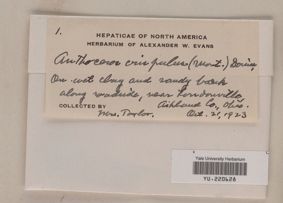
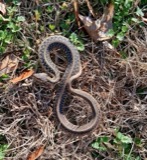
evidence. Museums hold 380 specimens
collected within 10 miles of Vermilion Institute between 1846 and
1975: 351 Animalia, 27 Plantae, 2 Fungi. 12 distinct Species records are shown.
Collected by Auten, B Zahuranec & party, B.H., H.P., M.A. & R. Rhoades and others. Each is a
physical object with a catalogue
number, and each entry opens the museum's record. This is what was
collected and kept, not a survey of what lives here - nothing can be
concluded from a species being absent.
Regional context, not property-specific
evidence. The federal mineral resources record lists
2 workings within 5 miles of Vermilion Institute: 2 past producers.
None of them still produces. What was taken out: Sand and Gravel, Construction. Distance is straight-line from the
map coordinates, so a quarry counted here may appear on a neighbouring
settlement's page as well.
Regional context, not property-specific
evidence. The National Weather Service names
Hayesville, the town this property stands in, in 19 storm reports between 1998 and 2020: 11 thunderstorm wind, 5 hail, 3 flash flood.
No death or injury is recorded in these reports. Each account below is quoted exactly as the forecast office
filed it, from the NOAA Storm Events Database, and each date
opens the federal record of that event.
Flooding occurred from heavy thunderstorm rains on top of already saturated soil. Roads were closed from flood waters. Telephone poles being readied to replace storm damage poles from previous days floated away down County Road 1802.
A local newspaper reported trees downed southeast of Hayesville. There was also a social media report of roof damage to a barn between Hayesville and Loudonville.
No historic map-sheet match is published
for this property yet. That does not mean no map exists. This record needs
a coordinate-quality review before it can be joined to a sheet boundary.
Browse the county's mapped places while that work is
pending.
From the nomination file
1,511 words on record
When this property was proposed for the
National Register, someone wrote the case for it: what the building is,
and why it matters. That document is a federal record in the public domain.
It is quoted below word for word, never summarised. The text was read off the scanned case file by machine, so the
occasional stray character is the recogniser's and the 1970s
typewriter's.
Description of the property
The large, rectangular, brick structure is two-stories in height with an Windows on the remaining floors are 2/2 pane, double hung, with original sash, sandstone sills, and brick headers. There is a plain brick watertable about eight feet above grade level. door opened, is missing. There is a fixed sash, round-arched window centered The rear elevation has a short casement window placed left of center and a centered on the first and second floors, each flanked by 2/2 pane windows centered in the gable. An iron firescape leads from the second floor. cornice on the front and sides of the building. Originally there was a square bell tower placed toward the front of the UNEXPOSED EXCELLENT DETERIORATED DATE DESCRIPTION UNALTERED MOVED foundations remain. XFAIR in the gable.
CHECK ONE flush with the ground and have brick headers.Each half of the casement the side elevations have casement windows in the basement level which are institute stood frame dormitory buildings. No evidence of these or their The building is beginning to show signs of deterioration and neglect. which have stone sills and brick headers.A small rectangular window is CONDITION, entrance has a 16 light, rectangular transom. There is a flat, bracketed the entrance, but it is presently rotted away. To either side of the entrance These were once visually blocked by the centered in the middle bay. To either side of the door are 2/2 pane windows. The deck above the bracketed hood, onto which the second floor The tower was blown off around 1913.
To either side of the The facade features a wide double door in a paneled recess. This center is a 2/2 pane window with stone sill and lintel. The basement level of The roof is standing seam metal. There are four brick chimneys, inset from building.
Vermilion area devoted to education beyond the elementery school level. The school prospered for five years, then in 1851, it was purchased by the acted as the preparatory school for the college. In 1875 the school operated as a non-sectarian school until 1886 when the Academy was From 1889 until 1929 the Hayesville High School occupied the building. 1700-1799 1845-1846 COMMERCE discontinued. THEATER RELIGION SIGNIFICANCE SCULPTURE PERIOD ART MILITARY LAW INDUSTRY BUILDER/ARCHITECT MUSIC TRANSPORTATION INVENTION _EXPLORATION/SETTLEMENT _CONSERVATION Dave Liston X.EDUCATION _POLITICS/GOVERNMENT 1900- _PHILOSOPHY associated with the College of Wooster.During these years the Institute LITERATURE public auction.
excellent example of early educational structures.in Ohio.During the This school building represents the first school in the Hayesville- known as the Vermilion Institute.
presbetery of Richland and Wayne counties and became a sectarian school -COMMUNICATIONS was sold by the ministry and it returned to it's original owners.It Architecturally it is a handsome and well-proportioned structure and an -1600-1699 years it had a very good academic curriculum and became known as one of When a new high school was built the academy building was placed on _ECONOMICS -1400-1499 was granteda charter by the Ohio State Legislature in 1846 and became _ENGINEERING Due to the lack of facilities for higher education and through the collective efforts of the citizens of the Hayesville-Vermilion area, the finest schools in the state.
Quoted from the National Register nomination
for reference 78002000, 11 pages, held by the National Archives in Record
Group 79. See the
catalogue record.
Listed places nearby
6 within 8 miles
Other National Register properties close
enough to walk or drive between, ordered by distance from this one. Both
positions come from the same geocoding pass that matched these properties
to their map sheets.
Listing record. National Park Service National Register of Historic Places, listed-properties dataset, current to 2026-05-22.
Map join. Address geocoded through the United States Census geocoder, then tested against the published boundary of every sheet in the USGS Historical Topographic Map Collection.
How this page is made. Listing fields come from federal records; map-sheet coverage is a labelled coordinate-to-boundary calculation, not a source-field claim.
Wildfire. Short, Karen C. 2022. Spatial wildfire occurrence data for the United States, 1992-2020 [FPA_FOD_20221014]. 6th Edition. Fort Collins, CO: Forest Service Research Data Archive. https://doi.org/10.2737/RDS-2013-0009.6 Collected with United States Government funding and usable without additional permissions or fees.
Specimens. Global Biodiversity Information Facility (GBIF), https://www.gbif.org/. Only records licensed CC0 or CC BY are used. Records licensed CC BY-NC are excluded because this site carries advertising. Images are checked individually and any whose licence is non-commercial, no-derivatives or unreadable is refused.
Mines and quarries. USGS Mineral Resources Data System (MRDS) https://mrdata.usgs.gov/mrds/ A work of the United States government, no copyright under 17 U.S.C. 105.
Storms. NOAA National Centers for Environmental Information, Storm Events Database https://www.ncei.noaa.gov/stormevents/ A work of the United States government, no copyright under 17 U.S.C. 105. Narratives are quoted verbatim from the National Weather Service report and are not edited or summarised.
 Block
Block