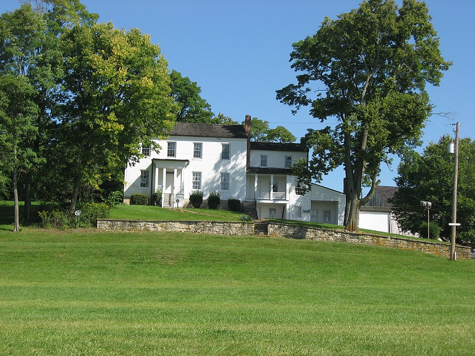
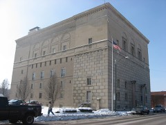
Built in 1854. Listed on the National Register of Historic Places in
1978. A historic map-sheet match is not published yet. The record needs a coordinate-quality review before it can be joined to a sheet boundary.
From the record
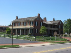
“The Daniel Hertzler House, near Springfield, Ohio, was built in c. 1854. It is a brick house of Pennsylvania "Bank Style" architecture, larger and more complex than other historic structures in Clark County, Ohio.”
Wikipedia article Daniel Hertzler House, CC BY-SA 4.0.
one of 32 National Register listings in Clark County · listed in 1978 · category: Building · built in 1854.
National Register reference number.78002018- the number the National Park Service assigned this property when it was listed, and the key its nomination file is catalogued under at the National Archives.
After w severe two hours! fight during the night, the men reached Harper's Ferry. 'The regiment camped fora time near New York and Brooklyn. September 6, they guard a train in Virginia, Oclober 10, they stund to urms all wight, and next day take pluce on the first line nem the Rappabunnock. November 7, they cornered and captured ao number of prisovers. Shelled at Brandy Station, acting vs train-guard, and fighting at Locust Grove, the men finally go into winter quarters at the Station. May 4, the regiment buving passed the Rupidan at Germania Ford, take position on the extreme right iu the Wilderness. They skirmish, charge, and, driving the enemy, hold bis works till dark, and then go back for ammunition. Ilere they lose ninelcen killed, eighty-cight wounded, and eleven missing. Next day they withstand artillery, and wt night fall buck, After several skirmishes, the 110th engage the one upon the banks of Mad River, the other on a tributary, and supplied a convenionce to the farmiug interest. James Leffel is imperfectly known as the inventor of the double turbine water-wheels, g0 extensively manufactured at Springfield, and generally demanded the world over. Personally the inyention was not lugrative, but his widow realizes fro this source u bandsome income. Sumuel Smith was w settler on the creek above Donnelsville in 1510, Ile was no eceentri¢ character. In 1808, Jacob Funderbaugh, of Virginia, bronght on a family of eight children, John, Daniel, and David Miller took up lands in tho north of the township. Dounelaville, a village of two or three hundred inhabitants, was laid out August 6, 1886, by James Donnels and Alwabam Smith, Reuben Miller being surveyor. Its growth waa rapid for Lwo or three years, and then ceased, The first house was moved from Lowry's paper-mill. Donunelg kept the first tavern, John Movorehonse the first store, and Wood tho first The Methodists erected here a church in 1842, was platted August 24, 1816, by Archibald Stoel, and the auknowledgment taken before Samuel Smith, a jnstive of the ponce. The first house was built ly Jacob Hersey, the proprietor of whut was culled the MeQueen Mill." also the first postmaster of the village. New Carlisle, a town of some hundred people, was formerly known as Monroe. It was laid out by Wim. M. Rayburn on July 25, 1818, John Cram beiag justice of the peace at the timu.
Jonathan Tay- Lt bod three Th Mr. The first person to keep tavern in Bethel Township was Jonathan Littlejohn, in an extinet town, then known ns New Boston, and a competitor with Springfield for the County seat, on County seat or nothing, and won the latter,
Regional context, not property-specific
evidence. The
federal wildfire occurrence database
lists 4 fires within 5 miles of Hertzler, Daniel, House between
2002 and 2002, burning about 2 acres in total. 1 started naturally. None was recorded as arson.
Distance is straight-line from the map coordinates, so a fire counted
here may appear on a neighbouring settlement's page as well.
Reported cause
Fires
Natural
1
Debris and open burning
1
Missing data/not specified/undetermined
1
Recreation and ceremony
1
The most recent of
them, most recent first, with the day each was reported and the service
that recorded it.
Regional context, not property-specific
evidence. Museums hold 1,408 specimens
collected within 10 miles of Hertzler, Daniel, House between 1840 and
1975: 934 Animalia, 338 Plantae, 125 Fungi, 7 Protozoa, 3 Unrecorded, 1 Chromista. 12 distinct Species records are shown.
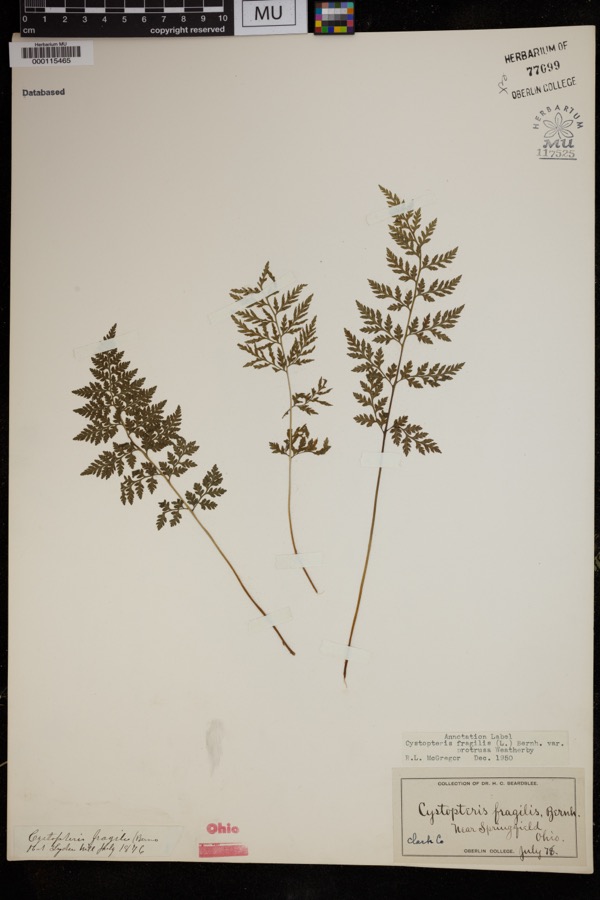
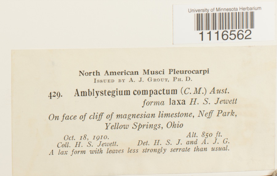
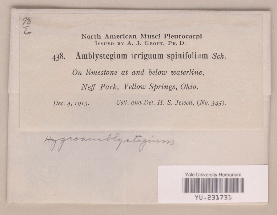
Collected by 73.7; J.H., ?, A JOHN and others. Each is a
physical object with a catalogue
number, and each entry opens the museum's record. This is what was
collected and kept, not a survey of what lives here - nothing can be
concluded from a species being absent.
Regional context, not property-specific
evidence. The federal mineral resources record lists
7 workings within 5 miles of Hertzler, Daniel, House: 4 producers, 3 past producers.
4 still produce. What was taken out: Sand and Gravel, Construction, Stone, Crushed/Broken. Distance is straight-line from the
map coordinates, so a quarry counted here may appear on a neighbouring
settlement's page as well.
Regional context, not property-specific
evidence. The National Weather Service names
Springfield, the town this property stands in, in 107 storm reports between 1994 and 2023: 56 thunderstorm wind, 31 hail, 10 flash flood, 4 flood.
The reports record 2 injuries. Each account below is quoted exactly as the forecast office
filed it, from the NOAA Storm Events Database, and each date
opens the federal record of that event.
Several utility poles were down, a barn was blown off of its foundation, and minor damage occurred to a house and an apartment due to damaging thunderstorm winds.
A tornado touched down along Moorefield Road, just to the east of State Route 4. Trees were either uprooted or snapped off towards their tops with additional large limbs down from other trees. Some minor structural damage occured as well along the 250 yard damage path. The tornado was rated EF-0 with top wind speeds of 70 mph.
A barn was blown over on Victory Road. Several trees and power lines were down on Sintz Road. In another location, a roof was peeled back due to damaging thunderstorm winds.
There was scattered damage at a mobile home park affecting four mobile homes. A metal carport was heavily damaged. Three evergreen trees were also downed.
Numerous 12 to 15 inch diameter trees were downed in Snyder Park. A tree fell on a house on Upper Valley Pike. Part of the roof was removed as a result.
Three to four inches of rain fell across southern Clark County as thunderstorms pushed slowly east during the late evening. A car was washed into a flooded ditch near the Springfield Airport along US 68. High water caused several road closures across the southern part of the county, with basements flooded on the south side of Springfield.
2 papers published in this town,
digitised by the Library of Congress and free to read: 0 issues,
0 pages. Every page is searchable, so a name or a street can be
looked for directly in what the town printed about itself at the time.
No historic map-sheet match is published
for this property yet. That does not mean no map exists. This record needs
a coordinate-quality review before it can be joined to a sheet boundary.
Browse the county's mapped places while that work is
pending.
From the nomination file
2,632 words on record
When this property was proposed for the
National Register, someone wrote the case for it: what the building is,
and why it matters. That document is a federal record in the public domain.
It is quoted below word for word, never summarised. The text was read off the scanned case file by machine, so the
occasional stray character is the recogniser's and the 1970s
typewriter's.
Description of the property
house wall -- the south side, up a wooden staircase to a portico supported on stone piers. CONDITION MOVED UNEXPOSED enclosed stairway on the west and two storage rooms forming the extremities been remodelled numerous times and have thus lost all period characteristics forested, and includes several large meadows and an artificial lake created The present situation of the Hertzler House is that of being located on higher ground to the west, and the two lesser appendages to the east. provide accommodations for a caretaker couple.
the house has recently been remodelled and modernized by the Park Board to simple rectangle, originally one room only with a staircase (enclosed) Section is entered at approximately ground level through a small Victorian of the house is of two stories, rectangular, and contains four rooms on upper floors are on the same level approximately as those of the first sec- portico is more massive and, although the square columns supporting it are The western or main section of the house was originally entered from CHECK ONE The ground under the westernmost or main section of the house slopes off closed porch into a large rectangular room with a fireplace on the east wall tion, though the ridge of its roof comes only to the level of the attic Entering this second section at ground level, you pass through the en- in woodwork, except for a fake mantel in the n.w.room, first floor, masking an obelisk, erected in l924,stands six hundred meters n.w.of the Hertzler _EXCELLENT _UNALTERED near the western perimeter of a 2oo+ acre park, owned by the City of Spring- DATE.
this has occurred sometime in the last 40 years. On the north side, this obvious replacements, the canopy has the appearance oi late, vernacularizeo level.
a home in 1854. on October 10, 1867, Hertzler was murdered between 2 and 3 A.M. In his home- 1500-1599 1400-1499 1700-1799 LAW ARCHEOLOGY-HISTORIC ART INVENTION THEATER unknown SIGNIFICANCE LITERATURE PERIOD and house. INDUSTRY XARCHITECTURE RELIGION _POLITICS/GOVERNMENT XEXPLORATION/SETTLEMENT _COMMUNICATIONS MILITARY is apparently confirmed by a collection of Hertzler's receipts in the Clark been converted into a battlefield memorial park. the Shawnee Indians.The Hertzler House is located in the middle of a large, SPECIFIC DATES workmen for labor and materials obviously connected with the construction of Location is a point of consideration with the house.
On August 8, amorphous area over which the battle raged and in a section of which has _CONSERVATION farm buildings on the old Jonathon Donnel property in section 27 of Bethel SOCIAL/HUMANITARIAN his son-in-law, Henry Snyder, and this was just ready for operation when, death of Daniel Hertzler marked the last chapter in the history of the site X.COMMERCE 1900- a small park and monumental statue were dedicated in 1924 and conveyed to nated to the City of Springfield.
the largest land battle of the Revolution west of the Alleghenies - with -1600-1699 _ENGINEERING The Hertzler House itself is a brick structure of the Pennsylvania - TRANSPORTATION Twp., while also owning extensively in sections 33 and 32.By the 1860 County Historical Society, which show numerous sums being paid out to various 1780,George Rogers Clark fought the Battle of Piqua - often described as _SCULPTURE -ECONOMICS Hertzler had come to Clark County in 1840 from Lancaster, Pa., evid- - EDUCATION _SCIENCE census, he was already worth over $100,000.00 in real estate alone. -MUSIC In 1853 he sold out Historical Society, plans were made for a park to commemorate the site of 1854-6 BUILDER/ARCHITECT business in Mad River township and reaped a fortune.
Quoted from the National Register nomination
for reference 78002018, 14 pages, held by the National Archives in Record
Group 79. See the
catalogue record.
Listed places nearby
6 within 8 miles
Other National Register properties close
enough to walk or drive between, ordered by distance from this one. Both
positions come from the same geocoding pass that matched these properties
to their map sheets.
Listing record. National Park Service National Register of Historic Places, listed-properties dataset, current to 2026-05-22.
Map join. Address geocoded through the United States Census geocoder, then tested against the published boundary of every sheet in the USGS Historical Topographic Map Collection.
How this page is made. Listing fields come from federal records; map-sheet coverage is a labelled coordinate-to-boundary calculation, not a source-field claim.
Wildfire. Short, Karen C. 2022. Spatial wildfire occurrence data for the United States, 1992-2020 [FPA_FOD_20221014]. 6th Edition. Fort Collins, CO: Forest Service Research Data Archive. https://doi.org/10.2737/RDS-2013-0009.6 Collected with United States Government funding and usable without additional permissions or fees.
Specimens. Global Biodiversity Information Facility (GBIF), https://www.gbif.org/. Only records licensed CC0 or CC BY are used. Records licensed CC BY-NC are excluded because this site carries advertising. Images are checked individually and any whose licence is non-commercial, no-derivatives or unreadable is refused.
Mines and quarries. USGS Mineral Resources Data System (MRDS) https://mrdata.usgs.gov/mrds/ A work of the United States government, no copyright under 17 U.S.C. 105.
Storms. NOAA National Centers for Environmental Information, Storm Events Database https://www.ncei.noaa.gov/stormevents/ A work of the United States government, no copyright under 17 U.S.C. 105. Narratives are quoted verbatim from the National Weather Service report and are not edited or summarised.
 Block
Block