Listed on the National Register of Historic Places in
1978. A historic map-sheet match is not published yet. The record needs a coordinate-quality review before it can be joined to a sheet boundary.
From the record
“John Buckley, in a conversation with the writer regarding the early history of the township, said: "I was born in Dutchess County, in the State of New York, April 16, 1807. In 1816, my parents, accompanied by my grandfather and grandmother on my mother's side, and two of their children, then grown, together with myself, then nine years old, and my four brothers and sisters, started for Ohio in wagons, landing in Clinton County in the latter part of December of that year.”
The History of Clinton County, Ohio (1882). Machine-read text.
one of 11 National Register listings in Clinton County · listed in 1978 · category: Building.
National Register reference number.78002024- the number the National Park Service assigned this property when it was listed, and the key its nomination file is catalogued under at the National Archives.
The ground it stands on
47,244 words
The chapter on Adams Township in The History of Clinton County, Ohio, published 1882 names Clarksville. This is what it says, exactly as the scans read.
The road from Columbus to Cincinnati, known as the State road, was surveyed in October, 1822, under a resolution adopted by the General Assembly of Ohio, February, 1822. The resolution named John Matson, of Hamilton County, and Joseph Brown, of Knox County, as Commissioners for that purpose, who selected R. G. W. Howe as surveyor. The direction from Wilmington toward Cincinnati for the first eight miles was south 53° west. The whole length of the road was 101 miles. This road was never opened all the way. The high bluff south of Cowan's Creek prevented travel on it from that point south for several miles. Its location was not satisfactory to the people of Clinton and Fayette Counties. Accordingly, on the 27th of January, 1823, an act of the Legislature was passed naming Joseph Doan, of Wilmington, Jesse Millikan, of Washington Court House, as Commissioners to resurvey the State road from Columbus to Cincinnati, and authorizing them to view the route by Washington, Wilmington, Clarksville, mouth of Todd's Fork and Hopkinsville to Cincinnati, and to compare as much of said route as lay between Wilmington and Cincinnati, with the route located by John Matson and Joseph Brown, and determine which of said routes would be of the most general and public utility. The survey was made in October, 1823. They reported in favor of the route surveyed by themselves by the way of Washington Court House, Wilmington, Clarksville, mouth of Todd's Fork, Hopkinsville and Montgomery to Cincinnati. Jesse Millikan was the surveyor from Washington to Cincinnati. The bearings on this road changed frequently, the line being mainly on the divide between Todd's Fork and Lytle's Creek. It was on better ground, and through a much more populated locality, and was of easy access from the settlements along both streams. The whole length of this route was 105 miles.
In the year 1835, a charter was granted by the Legislature for building the Goshen, Columbus & Wilmington pike. Work was begun on the southwest end of it the following year. The portion in Clinton County was built mainly in 1839, but not completed until 1840. It was never completed the whole distance, that part in Clinton County stopping two miles east of Wilmington. The line from Clarksville to Wilmington was in the main built on the route of a road laid out by Doan and Millikan in 1823, but on a more direct line, cutting off many of the angles. The building of this pike was looked upon at the time by the people of Clinton County, and especially those residing along the line, as an event of great importance in the history of the county. It facilitated travel and gave the farmers a broad, macadamized highway over which to trasport their grain and produce to market at Cincinnati. It shortened the time of the trip fully one-half. It gave the people of Adams Township, and indeed of the whole county, the benefit of a stage line, with daily coaches each way; also greatly increased mail facilities. A line of telegraph was established along the pike, which remained until the 0., W. & Z. Railroad was built. This was the first pike in the county. Toll-gates were erected at various points, and tolls taken. A toll-gate house was built at the hal E-way point between Wilmington and Clarksville, which might be termed the nucleus of the village of Sligo.
Regional context, not property-specific
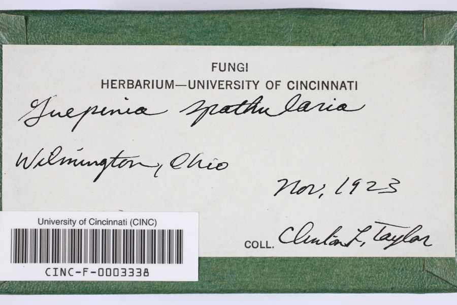
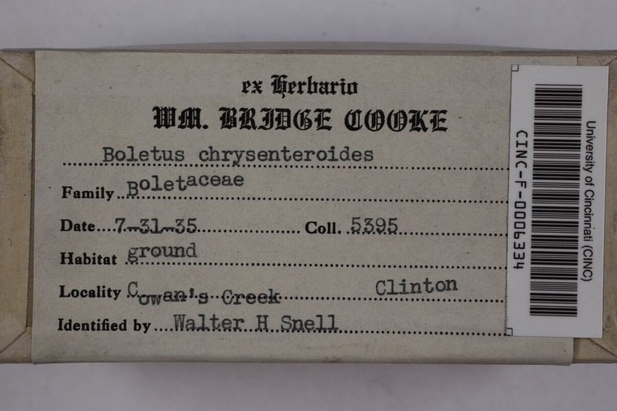
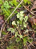
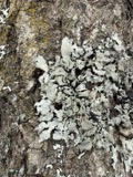
evidence. Museums hold 465 specimens
collected within 10 miles of Harvey, Eli, House between 1919 and
1974: 400 Animalia, 55 Fungi, 7 Plantae, 3 Unrecorded. 12 distinct Species records are shown.
Collected by A. R. Gaufin, A.R. Gaufin, H.H. Ross, Allen, A. (Avery) and others. Each is a
physical object with a catalogue
number, and each entry opens the museum's record. This is what was
collected and kept, not a survey of what lives here - nothing can be
concluded from a species being absent.
Regional context, not property-specific
evidence. The National Weather Service names
Clarksville, the town this property stands in, in 28 storm reports between 1994 and 2025: 17 thunderstorm wind, 5 hail, 3 tornado, 2 flood.
The reports record 1 injury. Each account below is quoted exactly as the forecast office
filed it, from the NOAA Storm Events Database, and each date
opens the federal record of that event.
Numerous trees downed, some on homes and vehicles. A metal storage shed was blown from its foundation and found suspended in a tree. A local resident was injured in a traffic accident during the storm from falling debris striking the car.
The same storm that produced tornadoes to the southwest of the county moved to the Pansy road area southwest of Clarksville. Three homes and a business were destroyed by the storm and 20 other properties were damaged.
The weak tornado touched down and produced a concentrated path of minor damage along 2nd street in the village of Clarksville. Numerous structures along 2nd street received very minor damage, including windows broken and roofing materials lifted and strewn downstream. In addition, fences and play sets were blown over, and trees were snapped or uprooted. Most of the damage occurred to roofs and tree tops, suggesting that this tornado was only weakly in contact with the ground. Based on the damage surveyed, the maximum wind speed of this tornado was estimated at 70 miles per hour.
A roof was removed from a brick building and was blown thirty feet away due to damaging thunderstorm winds. A metal roof was partially pulled off of a barn and a garage door was forced inward due to the winds. In addition, siding was peeled off of a barn.
Several trees were downed near Cowan Lake, and large limbs were knocked down along State Route 730. Additional damage occurred to a few headstones at the Clarksville Cemetery.
A tornado intermittently touched down over a five mile long path in western Clinton County. Brief touchdowns took place near the intersection of US Route 22 and George Road, along US Route 22 a few miles west of Wilmington, the intersection of Hale and Nelson Roads, and the intersection of US Route 68 and Center Road. Two billboards and several large trees were knocked over along US Route 22, with some minor structural damage to a home.
The tornado initially touched down along Todd's Fork Creek south of Highway 350 in Warren County at 1442 EST. The tornado crossed into Clinton County at Springhill Road and quickly lifted in a wooded area on the east side of Springhill Road where some minor tree damage occurred.
No historic map-sheet match is published
for this property yet. That does not mean no map exists. This record needs
a coordinate-quality review before it can be joined to a sheet boundary.
Browse the county's mapped places while that work is
pending.
From the nomination file
1,931 words on record
When this property was proposed for the
National Register, someone wrote the case for it: what the building is,
and why it matters. That document is a federal record in the public domain.
It is quoted below word for word, never summarised. The text was read off the scanned case file by machine, so the
occasional stray character is the recogniser's and the 1970s
typewriter's.
Description of the property
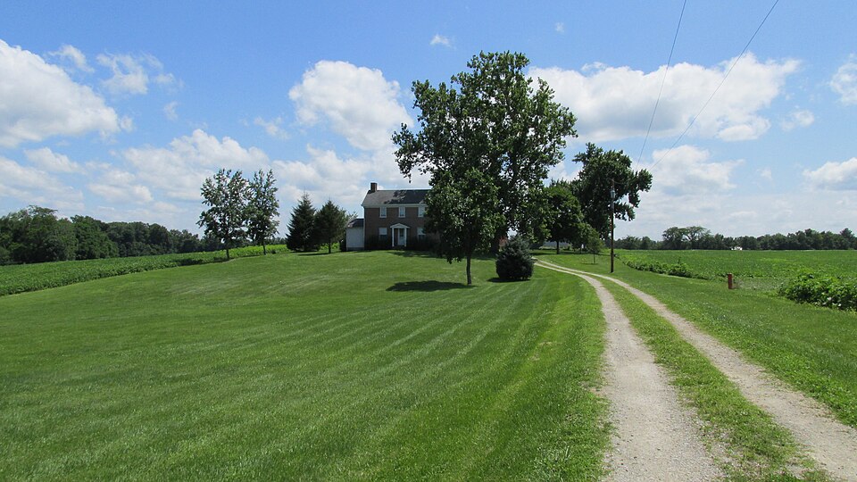
& two story rear wing extending from the left rear of the central block as dows and the main central door, which is protected by & one bay, open 1870, a second story was built around the original chimney, the ex- room - The one bay wide open frame porch, which protects the main entrance corner, & basement entrance was walled in and window emplaced c. 1936. CONDITION EXCELLENT DETERIORATED fieldstone. XGOOD XALTERED DESCRIPTION The house retains many of its original interior appointments in- A one story addition covered with asbestos siding was added to either side. original had small seats or benches on either side.
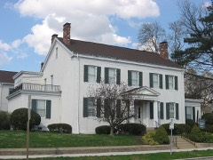
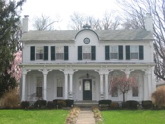
terior wall of which still visibly contrasts with the newer brick on The facade is divided into three bays by symmetrical rows of win- The Eli Harvey House consists of a two story central block, with fourteen inches thick and rests upon a foundation of random coursed The building is constructed of common bond brick with walls nine to the smaller upper level windows are six over six. returns on the gable ends. The west side of the main block is one bay and the east side with present sash installed about 1870. proximately forty yards from the house to the rear is a story and a dows are larger and have two lights over two lights, while those of XORIGINAL SITE in appear on the wall of the west gable.
Virginia, Central North Carolina and, after the American Revolution, to Ohtio Douglas, President of the Wilmington (Ohio) College Board of Directors. in, fed and sheltered families of Virginia refugees, driven from their homes Later in life, William Penn Harvey, & Quaker minister reared in the house, attended the Salvation Army International Congress in England in to the ministry, which recounted much of his early fife when he resided in Zoological Park. The El1:Harvey house is an important landmark in the pro- gress of Quakerism and the early settlement of Clinton County, Ohio.
1500-1599 ARCHEOLOGY-HISTORIC COMMUNICATIONS SIGNIFICANCE PERIOD _EDUCATION BUILDER/ARCHITECT SCIENCE TRANSPORTATION ARCHITECTURE LAW THEATER INDUSTRY _ECONOMICS LITERATURE XEXPLORATION/SETTLEMENT MUSIC PREHISTORIC XRELIGION _POLITICS/GOVERNMENT MILITARY migrations from the old meeting in Chester Co.,Pennsylvania to Northern _PHILOSOPHY and divested of their property by the Confederacy for refusing to serve tant early Quaker migration and settlement in the Todd's Fork area of _1600-1699 in the Southern Army. in l823,William traveled to North Carolina, Eastern Ohio and Pennsylvania. _1700-1799 one hundred persons wanting to leave the slave states of the South.
seen when the ground is plowed.William Harvey resided with his son in _1400-1499 The house is probably the oldest house in the T.Baytop Survey 2372, Eli Harvey is probable thattthe house was built either when Eli Harvey moved upon the 1830,Eli received a deed to the land from his father,William Harvey.It -COMMERCE his old age. M800-1899 -1900- SPECIFIC DATES -c. 1826-1830 The Todd' In 1811 a four hundred and fifty acre tract, upon which the house now stands, was sold to a fifth Harvey brother, Will1am (d. 1858), whose X AGRICULTURE XSOCIAL/HUMANITARIAN Township, Clinton County, Ohio. It is a tangible reminder of an impor- He rendered the sculptured decoration for the lion house at the New York INVENTION Carolina.
Quoted from the National Register nomination
for reference 78002024, 11 pages, held by the National Archives in Record
Group 79. See the
catalogue record.
Listed places nearby
6 within 8 miles
Other National Register properties close
enough to walk or drive between, ordered by distance from this one. Both
positions come from the same geocoding pass that matched these properties
to their map sheets.
Listing record. National Park Service National Register of Historic Places, listed-properties dataset, current to 2026-05-22.
Map join. Address geocoded through the United States Census geocoder, then tested against the published boundary of every sheet in the USGS Historical Topographic Map Collection.
How this page is made. Listing fields come from federal records; map-sheet coverage is a labelled coordinate-to-boundary calculation, not a source-field claim.
Specimens. Global Biodiversity Information Facility (GBIF), https://www.gbif.org/. Only records licensed CC0 or CC BY are used. Records licensed CC BY-NC are excluded because this site carries advertising. Images are checked individually and any whose licence is non-commercial, no-derivatives or unreadable is refused.
Storms. NOAA National Centers for Environmental Information, Storm Events Database https://www.ncei.noaa.gov/stormevents/ A work of the United States government, no copyright under 17 U.S.C. 105. Narratives are quoted verbatim from the National Weather Service report and are not edited or summarised.
 Block
Block