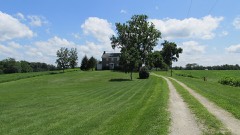
Pansy Methodist Church and School Historic District
Listed on the National Register of Historic Places in
1973. A historic map-sheet match is not published yet. The record needs a coordinate-quality review before it can be joined to a sheet boundary.
From the record
“Pansy Methodist Church is a historic church at Pansy in Clinton County, Ohio, United States. Built in 1885, it was formerly home to a congregation of the Methodist Episcopal Church.”
Wikipedia article Pansy Methodist Church, CC BY-SA 4.0.
one of 11 National Register listings in Clinton County · listed in 1973 · category: District.
National Register reference number.73001398- the number the National Park Service assigned this property when it was listed, and the key its nomination file is catalogued under at the National Archives.
The ground it stands on
2,926 words
The chapter on Vernon Township in History of Clinton County Ohio, published 1915 names Clarksville. This is what it says, exactly as the scans read.
Vernon township is located in the central western portion of Clinton county. It is bounded on the north by Adams township, on the east by Washington. on the south by Marion township and on the west by Warren county. It is one of the three original townships of which Clinton county was cemposed at the time of its organization in 1810. At that time it included also Marion and parts of Adams, Washington, Clark, Union and Jefferson townships. Todd's fork, a tributary of the Little Miami river, Cowan's creek, East fork of Todd's fork and Sewell's run, tributaries of Todd's fork, flow through the township, coming together, or nearly so, in the western part, near the town of Clarksville.
Clarksville. William Hadley came in 1810, from North Carolina, and settled on what was later known as the M. P. Marshall farm. William Austin came in'1811 and settled near the Mt. Pleasant church. James Villars settled in Vernon township in 1813. Josiah Biggs, Lemuel, John and Parson Garrison, David Ferris, Samuel Stabler, Dr. Asahel Tribbey, Ephraim Smith, James Marshall, Ezekiel Cast and Thomas Harden were all among the early settlers and pioneers of Vernon township.
Regional context, not property-specific
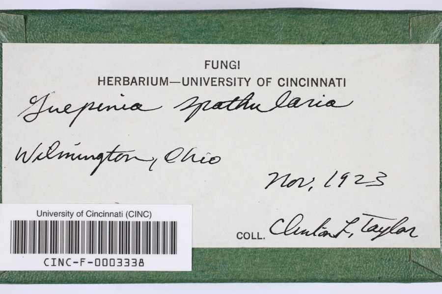
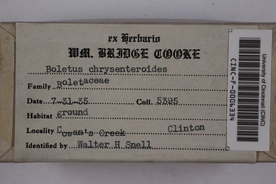
evidence. Museums hold 514 specimens
collected within 10 miles of Pansy Methodist Church and School Historic District between 1906 and
1974: 439 Animalia, 56 Fungi, 16 Plantae, 3 Unrecorded. 12 distinct Species records are shown.
Collected by A. R. Gaufin, A.R. Gaufin, H.H. Ross, Allen, A. (Avery) and others. Each is a
physical object with a catalogue
number, and each entry opens the museum's record. This is what was
collected and kept, not a survey of what lives here - nothing can be
concluded from a species being absent.
Regional context, not property-specific
evidence. The National Weather Service names
Clarksville, the town this property stands in, in 28 storm reports between 1994 and 2025: 17 thunderstorm wind, 5 hail, 3 tornado, 2 flood.
The reports record 1 injury. Each account below is quoted exactly as the forecast office
filed it, from the NOAA Storm Events Database, and each date
opens the federal record of that event.
Numerous trees downed, some on homes and vehicles. A metal storage shed was blown from its foundation and found suspended in a tree. A local resident was injured in a traffic accident during the storm from falling debris striking the car.
The same storm that produced tornadoes to the southwest of the county moved to the Pansy road area southwest of Clarksville. Three homes and a business were destroyed by the storm and 20 other properties were damaged.
The weak tornado touched down and produced a concentrated path of minor damage along 2nd street in the village of Clarksville. Numerous structures along 2nd street received very minor damage, including windows broken and roofing materials lifted and strewn downstream. In addition, fences and play sets were blown over, and trees were snapped or uprooted. Most of the damage occurred to roofs and tree tops, suggesting that this tornado was only weakly in contact with the ground. Based on the damage surveyed, the maximum wind speed of this tornado was estimated at 70 miles per hour.
A roof was removed from a brick building and was blown thirty feet away due to damaging thunderstorm winds. A metal roof was partially pulled off of a barn and a garage door was forced inward due to the winds. In addition, siding was peeled off of a barn.
Several trees were downed near Cowan Lake, and large limbs were knocked down along State Route 730. Additional damage occurred to a few headstones at the Clarksville Cemetery.
A tornado intermittently touched down over a five mile long path in western Clinton County. Brief touchdowns took place near the intersection of US Route 22 and George Road, along US Route 22 a few miles west of Wilmington, the intersection of Hale and Nelson Roads, and the intersection of US Route 68 and Center Road. Two billboards and several large trees were knocked over along US Route 22, with some minor structural damage to a home.
The tornado initially touched down along Todd's Fork Creek south of Highway 350 in Warren County at 1442 EST. The tornado crossed into Clinton County at Springhill Road and quickly lifted in a wooded area on the east side of Springhill Road where some minor tree damage occurred.
No historic map-sheet match is published
for this property yet. That does not mean no map exists. This record needs
a coordinate-quality review before it can be joined to a sheet boundary.
Browse the county's mapped places while that work is
pending.
From the nomination file
1,477 words on record
When this property was proposed for the
National Register, someone wrote the case for it: what the building is,
and why it matters. That document is a federal record in the public domain.
It is quoted below word for word, never summarised. The text was read off the scanned case file by machine, so the
occasional stray character is the recogniser's and the 1970s
typewriter's.
Description of the property
from a country road on a level, grassy lawn shaded by several large trees. the Gothic arched doorway and above the doorway, higher up in the arcade, is sided roof is slightly onion shaped, with a short, slender four-sided steeple taining a bell, with a wood shingled base and a wood shingled roof with con- MAR 6 CONDITION Excellent Ruins REGISTER cave lines rising to a point.There are four rectangular windows with stone NATIONAL the children attending the school and gathering place for churchgoers.The ior is finished in pine and plastered and has a single pine floor. little or no alteration except the installation of electricity--the buildings school is pine finished, plastered and has a single pine floor.
tion with decorative brickwork in a label design following the roof line on lasters supporting a brickwork round arch, three bricks wide, with a stone two buildings present what we might consider a typical picture of the little are still without plumbing or furnaces, and there are no interior partitions.
16th Century 4) Their setting is unusually attractive and is not immediately threaten- goa little beyond the simplest basics,giving them a charm not al- Other SPECIFIC DATE(S) (If Applicable and Known) Church: 1885 School: 1900 SIGNIFICANCE itarian 3) They remain largely unaltered and in an acceptable state of preserva- 1) The buildings stand in a near and pleasing relationship to each other.
Quoted from the National Register nomination
for reference 73001398, 12 pages, held by the National Archives in Record
Group 79. See the
catalogue record.
Listed places nearby
3 within 8 miles
Other National Register properties close
enough to walk or drive between, ordered by distance from this one. Both
positions come from the same geocoding pass that matched these properties
to their map sheets.
Listing record. National Park Service National Register of Historic Places, listed-properties dataset, current to 2026-05-22.
Map join. Address geocoded through the United States Census geocoder, then tested against the published boundary of every sheet in the USGS Historical Topographic Map Collection.
How this page is made. Listing fields come from federal records; map-sheet coverage is a labelled coordinate-to-boundary calculation, not a source-field claim.
Specimens. Global Biodiversity Information Facility (GBIF), https://www.gbif.org/. Only records licensed CC0 or CC BY are used. Records licensed CC BY-NC are excluded because this site carries advertising. Images are checked individually and any whose licence is non-commercial, no-derivatives or unreadable is refused.
Storms. NOAA National Centers for Environmental Information, Storm Events Database https://www.ncei.noaa.gov/stormevents/ A work of the United States government, no copyright under 17 U.S.C. 105. Narratives are quoted verbatim from the National Weather Service report and are not edited or summarised.
 Block
Block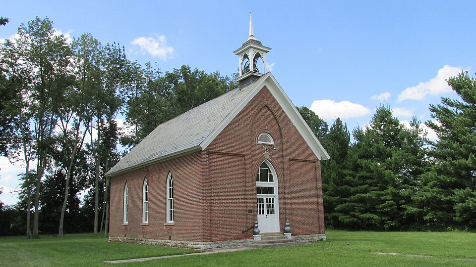

_BHL4428192.jpg)