BlockBefore
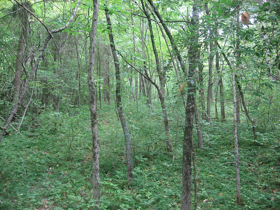
Photograph of Cowan Creek Circular Enclosure
Photograph by Nyttend, Public domain. Via Wikimedia Commons.

Cowan Creek Circular Enclosure

Listed on the National Register of Historic Places in 1974. A historic map-sheet match is not published yet. The record needs a coordinate-quality review before it can be joined to a sheet boundary.

From the record

“The Cowan Creek Circular Enclosure (33CN11) is an earthworks complex in the southwestern part of the U.S. state of Ohio. Named for its location near the stream known as Cowan Creek, the enclosure is an important archaeological site, and it is protected as part of a state park.”

Wikipedia article Cowan Creek Circular Enclosure, CC BY-SA 4.0.

one of 11 National Register listings in Clinton County · listed in 1974 · category: Site.

Sources: the Wikipedia article · the case file at the National Archives · the National Register database, National Park Service

The listing

  • What is counted as historic. The nomination lists 1 site as contributing to the listing.
  • Address. SW of Wilmington, Wilmington, 45177
  • When was it listed? 1974-07-15
  • Category. site
  • Township. Vernon township
  • National Register reference number. 74001422 - the number the National Park Service assigned this property when it was listed, and the key its nomination file is catalogued under at the National Archives.

The ground it stands on

2,926 words

The chapter on Vernon Township in The History of Clinton County, Ohio : Containing a History of the County; Its Townships, Cities, Towns ... General and Local Statistics; Portraits of Early Settlers and Prominent Men; History of the Northwest Territory; History of Ohio .., published 1915 names Wilmington. This is what it says, exactly as the scans read.

The first pike through the township was the Goshen & Wilmington turnpike. It was bnllt of broken stone in about 1840. by a company, and was kept up as a toll pike until about 1880. when the commissioners of Clinton county bought it and Improved it About 1.S70 the College township road, from Cuba to Clarksvllle. was piked. The road-l>ed was made twenty feet at the top. thirty-four feet at the base, and two feet high from the bottom of side drains. The road-bed was covered with gravel twelve feet wide and sixteen and one-fourth inches deep. About the year 1876. the road from Vlllar's chapel, through Rlanchester to the Brown county line, was piked In the same manner. In 1880 the Goshen & Wilmington pike was purchased by the county commissioners and Improved, making It a free pike About the same year the road from the Goshen & Wilmington pike near Clarksvllle to the Warren county line, in the direction of Harveysburg. was piked.

Passage source: The History of Clinton County, Ohio : Containing a History of the County; Its Townships, Cities, Towns ... General and Local Statistics; Portraits of Early Settlers and Prominent Men; History of the Northwest Territory; History of Ohio .., published 1915.

The history of the towns of Cnlon township will not require many words, as the - history of Wilmington will be taken up In a separate chapter. There are three small hamlets marked on the county map. These are Deserted Camp, which has been t:iken tip in detail In another chapter: Rurtonville. which is situated on the Wilmington and Martinsville pike, and Clinton, which is a flag stop on the Midland division of the Baltimore & Ohio railroad. None of these vlllaccs was ever platted and nt present they have no business or professional interests. Little Center Is the location of a Friends church.

Passage source: The History of Clinton County, Ohio : Containing a History of the County; Its Townships, Cities, Towns ... General and Local Statistics; Portraits of Early Settlers and Prominent Men; History of the Northwest Territory; History of Ohio .., published 1915.

Machine-read from a century-old scan, so expect the errors a machine makes: misspelled names, dropped words, stray characters.

Read the whole chapter on Vernon Township - 2,926 words on its settlement, mills, schools and churches.

Specimens collected near this property

12 of 531 shown

Regional context, not property-specific evidence. Museums hold 531 specimens collected within 10 miles of Cowan Creek Circular Enclosure between 1892 and 1974: 452 Animalia, 56 Fungi, 20 Plantae, 3 Unrecorded. 12 distinct Species records are shown. Collected by A. R. Gaufin, A.R. Gaufin, H.H. Ross, Allen, A. (Avery) and others. Each is a physical object with a catalogue number, and each entry opens the museum's record. This is what was collected and kept, not a survey of what lives here - nothing can be concluded from a species being absent.

Image SpeciesYear Collected by Where, as recorded
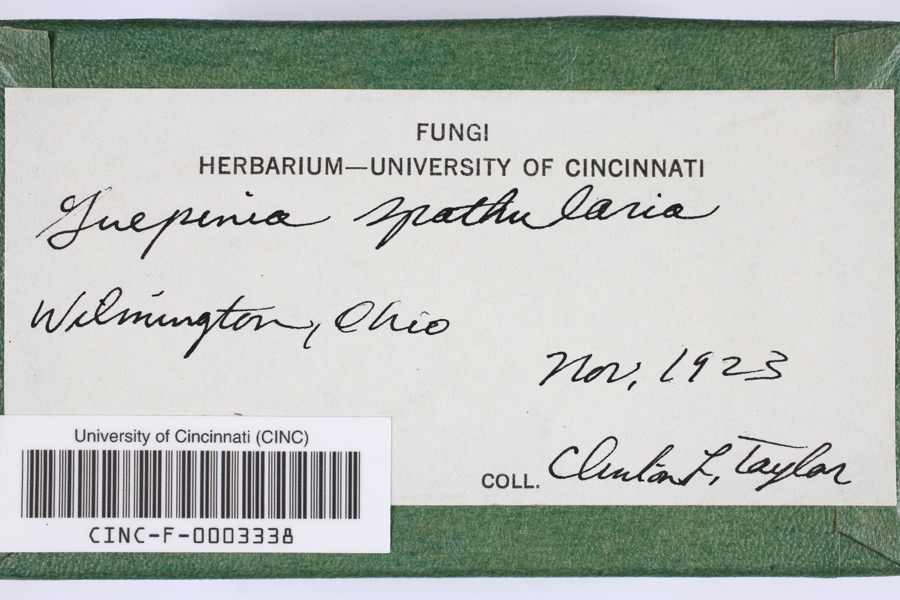
Specimen of Guepinia spathularia (Schwein.) Fr.Guepinia spathularia (Schwein.) Fr.1923Taylor, C.L.Wilmington
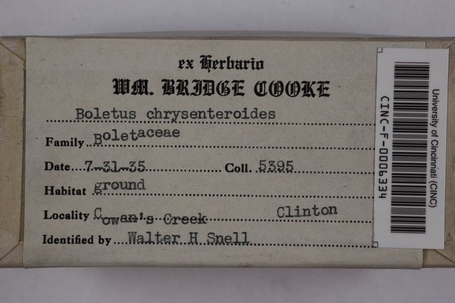
Specimen of Boletellus chrysenteroides (Snell) SnellBoletellus chrysenteroides (Snell) Snell1935Cooke, William BridgeCowan's Creek
Specimen of Boletus bicolor RaddiBoletus bicolor Raddi1935Cooke, William BridgeCowan's Creek
A photograph of the species Desmodium pauciflorum, not of this specimenDesmodium pauciflorum (Nutt.) DC.1892J. S. VanderwortNew Antioch
A photograph of the species Cicada sayi, not of this specimenCicada sayi Smith & Grossbeck, 19071906W. TemplinBlanchester
A photograph of the species Pseudosuccinea columella, not of this specimenPseudosuccinea columella (Say, 1817)1911not recordedClinton, North America
A photograph of the species Ditrichum pallidum, not of this specimenDitrichum pallidum (Hedw.) Hampe1913Braun, E. Lucy
A photograph of the species Claviceps purpurea, not of this specimenClaviceps purpurea (Fr.) Tul.1919Lewis H. L.Wilmington
A photograph of the species Corydalus cornutus, not of this specimenCorydalus cornutus (Linnaeus, 1758)1920E. C. StinsonHarveysburg
A photograph of the species Cladonia coniocraea, not of this specimenCladonia coniocraea (Flörke) Spreng.1923Braun, E. LucyKlock's Crossing
A photograph of the species Cladonia fimbriata, not of this specimenCladonia fimbriata (L.) Fr.1923Taylor, C.J.Wilmington
A photograph of the species Parmelia Acharius, not of this specimenParmelia Acharius, 18031924Taylor, L.Wilmington

All 531 specimens within 10 miles, at the Global Biodiversity Information Facility.

Storms near this property

60 of 112 shown

Regional context, not property-specific evidence. The National Weather Service names Wilmington, the town this property stands in, in 112 storm reports between 1994 and 2025: 69 thunderstorm wind, 30 hail, 4 tornado, 4 flood. No death or injury is recorded in these reports. Each account below is quoted exactly as the forecast office filed it, from the NOAA Storm Events Database, and each date opens the federal record of that event.

WhenEvent Place namedHarm What the report says
March 2019Thunderstorm WindWilmington$100,000Multiple power poles and power lines were downed across the county. Several barns were also damaged throughout the county.
May 1998HailWilmington$100,000Hail as large as baseballs occurred around Wilmington. Extensive damage occurred ranging from broken car windows to 4 airplanes at Airborne Express, which is located at the Wilmington Airport.
June 1996LightningWilmington$100,000no account filed
May 2002Tornado (F0)Wilmington$50,000A weak tornado touched down just west of the Interstate 71/US Route 68 interchange, skipping across the interstate for a few minutes before lifting back into the clouds. Minor structural damage occurred at the exit to the Bush RV Center and at the Ramada Plaza Hotel. Several cars parked in the Ramada lot had windows blown out.
May 1996LightningWilmington$50,000no account filed
October 2001Thunderstorm WindWilmington$40,000A measured 69 mph gust occurred at the Wilmington National Weather Service office. Strong winds tore a roof off of a house in Sabina. The roofs of two houses were torn off in the vicinity of route 730 southwest of Wilmington. Trees were blown down in the Blanchester area. The Wilmington ASOS recorded a 58 mph gust.
October 2010Thunderstorm WindWilmington$35,000One barn was destroyed and another barn was damaged due to thunderstorm winds. Trees were also reported down due to damaging thunderstorm winds.
October 2010Thunderstorm WindWilmington$30,000Severe barn damage occurred along Ireland Road. Trees were also reported down along Ireland and Cuba Roads due to damaging thunderstorm winds.
May 2007Thunderstorm WindWilmington$30,000A metal shed was severely damaged near the intersection of State Route 134 and Dover Road. The Wilmington High School auditorium sustained roof damage. The tops of three trees were snapped off in town.
June 2002Thunderstorm WindWilmington$25,000A barn was demolished on State Route 350 between Farmers Road and State Route 73.
May 2009HailWilmington$20,000Hail up to quarter size fell for an extended period and collected in piles.
July 2002Thunderstorm WindWilmington$20,000A number of trees were downed along State Route 134. Several boats were overturned on Cowan Lake.
May 1998Tornado (F1)Wilmington$20,000A tornado briefly touched down just west of State route 380. Many trees were downed, some of which fell on top of a house causing significant damage.
May 2002Thunderstorm WindWilmington$15,000A few trees were downed. Several homes had siding peeled from the structure.
May 2001Thunderstorm WindWilmington$15,000Numerous trees downed in the ? country club. Three-quarter inch diameter hail also fell in Sabina.
April 2025Thunderstorm WindWilmington$10,000A barn collapsed.
November 2013Thunderstorm WindWilmington$10,000Roofing materials were blown off of two buildings due to thunderstorm winds.
July 2011Thunderstorm WindWilmington$10,000Siding was reported torn off of a garage. A trailer and a flag pole were damaged. These occurrences were due to damaging thunderstorm winds.
November 1998Thunderstorm WindWilmington$10,000The roof was blown off a barn and winds gusted to 58 mph at the National Weather Service office.
April 2002HailWilmington$10,000no account filed
May 2007Thunderstorm WindWilmington$8,000A building sustained minor structural damage along New Oglesbee Road. A fence was bent and tree limbs were downed in the vicinity of the building as well.
June 2021Thunderstorm WindWilmington$7,000Several trees and large branches were downed along Orchard Drive.
July 2024Thunderstorm WindWilmington$6,000Several large trees were downed in the Wilmington area.
April 2006Thunderstorm WindWilmington$6,000Windows were blown out of stores along Rombach Avenue. The Walmart Center on the east side of town sustained some structural damage. Six power poles were also downed along US Route 68.
April 2006Thunderstorm WindWilmington$6,000A large tree fell on a car, causing extensive damage to the vehicle.
June 2001Thunderstorm WindWilmington$6,000Trees and limbs down with a roof reported blown off of a greenhouse
May 2025Thunderstorm WindWilmington$5,000Several trees were downed and several other trees had large branches downed. A nearby home had roofing ductwork blown off.
June 2022Thunderstorm WindWilmington$5,000Several large trees were downed.
October 2010Thunderstorm WindWilmington$5,000A chicken coop was blown 35 yards away due to damaging thunderstorm winds. A few trees were also reported down due to the winds.
May 2004Thunderstorm WindWilmington$5,000Ten power poles were snapped along State Route 73 just east of Interstate 71. 0.88 inch hail also occurred with the storm.
May 2001Tornado (F0)Wilmington$5,000A brief tornado touchdown was observed by air traffic controller at Wilmington Airport
April 2000Thunderstorm WindWilmington$5,000Trees were knocked down at the intersection of Highway 68 and West Walker Road.
July 2000Flash FloodWilmington$5,000Three inches of rain in just a few hours caused flooding across State Route 134 at Brown Road. A few creeks exceeded their banks.
July 1999Thunderstorm WindWilmington$5,000Trees were knocked down across Highway 68 north of Wilmington.
July 1994Thunderstorm WindWilmington$5,000Trees were downed, some on power lines.
May 2009HailWilmington$5,000no account filed
July 1996Thunderstorm WindWilmington$5,000no account filed
August 2020Thunderstorm WindWilmington$4,000A tree was knocked down onto a house and power lines.
May 2005HailWilmington$4,000A car sustained minor damage from the hail.
May 1999Thunderstorm WindWilmington$4,000Four light poles on a baseball field were blown down.
November 2020Thunderstorm WindWilmington$3,000A large tree was downed onto a church pavilion.
August 2020Thunderstorm WindWilmington$3,000A tree was knocked down onto a car.
November 2013Thunderstorm WindWilmington$3,000Five trees were downed due to thunderstorm winds.
June 2012Thunderstorm WindWilmington$3,000Trees were reported down due to damaging thunderstorm winds.
February 2008Thunderstorm WindWilmington$3,000Two trees were knocked down along Antioch and Murphy Roads.
June 2005Thunderstorm WindWilmington$3,000Several trees were downed.
April 2003Thunderstorm WindWilmington$3,000A few trees and a power pole were downed along Jenkins Road.
June 2001Thunderstorm WindWilmington$3,000Thunderstorms produced a wind gust to 59 mph at the National Weather Service office. Trees and a power pole were also knocked down.
June 2001Flash FloodWilmington$3,000High water on Gurneyville Road
May 1995Thunderstorm WindWilmington$3,000Several trees downed.
May 2009HailWilmington$3,000no account filed
February 2002HailWilmington$3,000no account filed
July 2015Thunderstorm WindWilmington$2,000A few trees were downed near Quaker Way and Fife Avenue.
July 2015Thunderstorm WindWilmington$2,000Several large trees were downed near Blackthorne Court.
August 2003Thunderstorm WindWilmington$2,000Two large limbs were downed.
June 2000Thunderstorm WindWilmington$2,000Power lines were downed on route 68 south of Wilmington. A large tree blocked the intersection of Fife and Ludovic.
May 2025Thunderstorm WindWilmington$1,250A large healthy tree was downed. Other nearby trees had multiple limbs downed.
June 2021Thunderstorm WindWilmington$1,000A tree was downed at a property on U.S. Route 22 near Nelson Avenue.
May 2020Thunderstorm WindWilmington$1,000A large tree was snapped in half along Main Street by Clinton Memorial Hospital.
August 2020Thunderstorm WindWilmington$1,000A tree was blown down into the road.

Every storm recorded in Clinton County

Map coverage status

No historic map-sheet match is published for this property yet. That does not mean no map exists. This record needs a coordinate-quality review before it can be joined to a sheet boundary. Browse the county's mapped places while that work is pending.

From the nomination file

1,502 words on record

When this property was proposed for the National Register, someone wrote the case for it: what the building is, and why it matters. That document is a federal record in the public domain. It is quoted below word for word, never summarised. The text was read off the scanned case file by machine, so the occasional stray character is the recogniser's and the 1970s typewriter's.

Description of the property

Vernon Township, Clinton County, Ohio. On the north side of Cowan JUL 18 1972 CONDITION NATIONAL Excellent REGISTER Ruins Moved deposition have made the site impossible to locate without specific Road.The site was first noticed in 1949 when aerial photographs long been under cultivation so the original height of the enclosure left to return to its natural state.Secondary growth and natural Cowan Creek Circular Enclosure is within Cowan Creek State Park, was flooded.The circular enclosure was found north of the.mound knowledge of its existance. Archaeological excavations would show on the southwest edge of this promontory and is almost directly Original Site were taken of the Cowan Creek Mound, excavated before the reservoir RECEIVED the exact location of the enclosure, its

Statement of significance

burned down before mound construction. Communications Commerce Conservation Architecture Aboriginal Engineering Theater Literature Prehistoric Agriculture Music itarian Science Social/Human- SIGNIFICANCE losophy Political Cowan Creek Mound excavated in 1949.Approximately 300 feet separated The circular enclosure has been noted in other areas where Adena Religion/Phi- Industry be preserved, and possible reconstruction with an interpretive sign include such a possibility.

Since no testing has been done at the site it is unknown whether adjacent to each other.The Cowan Creek Circular Enclosure should Sculpture gives it added importance because that mound was very significant grave artifacts such as shell beads and stemmed points.The house mounds or house sites are found.One such site is the Green Fort Cowan Creek Circular Enclosure is evidently closely related to the might be considered.Its association with the Cowan Creek Mound Works in Vinton County where the mound and circle are located Within the mound 17 log tombs burials were found, most with associated Invention Landscape in the study of Ohio's prehistoric Adena people not inundated by the lake.The mound proved tobe of Adena Indian origin.The prehistoric Adena people inhabited Ohio from 1000 B.C.

A wood sample provided a radiocarbon date of 1509+ 250 years ago, and the paired post hole pattern is typical of the Late Adena. Education a habitation area is present.Three acres have been nominated to to A.D. 400;this site was found to be of the Late Adena period. A.D.100-600 AREAS OF SIGNIFICANCE (Check One or More as Appropriate) Military Art the two sites but the circle was located on higher ground and was 197

The whole case file for this property - 1,502 words, 10 pages, reproduced complete.

Quoted from the National Register nomination for reference 74001422, 10 pages, held by the National Archives in Record Group 79. See the catalogue record.

Listed places nearby

6 within 8 miles

Other National Register properties close enough to walk or drive between, ordered by distance from this one. Both positions come from the same geocoding pass that matched these properties to their map sheets.

Photograph PropertyDistance Listed
Pansy Methodist Church and School Historic District3.4 miles1973
Harvey, Eli, House4.6 miles1978
Main Building School5.5 miles1980
Martinsville Road Covered Bridge5.8 miles1974
Rombach Place6.0 miles1979
College Hall, Wilmington College6.2 miles1973

Sources for this property

National Archives recordThe nomination case file for reference 74001422 in Record Group 79.
Wikipedia articleCommunity-written account of this property, licensed CC BY-SA.
Clinton CountyAll 11 listed properties in this county.

Provenance

  • Listing record. National Park Service National Register of Historic Places, listed-properties dataset, current to 2026-05-22.
  • Map join. Address geocoded through the United States Census geocoder, then tested against the published boundary of every sheet in the USGS Historical Topographic Map Collection.
  • How this page is made. Listing fields come from federal records; map-sheet coverage is a labelled coordinate-to-boundary calculation, not a source-field claim.
  • Specimens. Global Biodiversity Information Facility (GBIF), https://www.gbif.org/. Only records licensed CC0 or CC BY are used. Records licensed CC BY-NC are excluded because this site carries advertising. Images are checked individually and any whose licence is non-commercial, no-derivatives or unreadable is refused.
  • Storms. NOAA National Centers for Environmental Information, Storm Events Database https://www.ncei.noaa.gov/stormevents/ A work of the United States government, no copyright under 17 U.S.C. 105. Narratives are quoted verbatim from the National Weather Service report and are not edited or summarised.