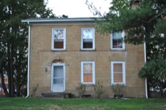
Listed on the National Register of Historic Places in
1978. A historic map-sheet match is not published yet. The record needs a coordinate-quality review before it can be joined to a sheet boundary.
From the record
“During General Harrison's visit to Newark, in 1836, he had a conversation with AmosH. Caffee, esq., in relation to the events of the War of 1812.”
History of Licking County, Ohio: Its Past and Present (1881). Machine-read text.
one of 52 National Register listings in Licking County · listed in 1978 · category: Building.
National Register reference number.78002102- the number the National Park Service assigned this property when it was listed, and the key its nomination file is catalogued under at the National Archives.
Rev. Peter Schmucker, a Lutheran minister, and father of the Hon. Isaac Smucker, yet living in Newark, was among the later pioneer preachers of Newton township. He often held religious services, preaching generally in English, but sometimes in the German language, at the school-house near the residence of General John Spencer, who with Mr. John Keim and their families, with others in the neighborhood, gave those labors their countenance and encouragement. He also, in co operation with the aforenamed gentlemen, organized a Sabbath-school in 1826, probably the first established in the township, or in that section of the county. Funds were raised with which a Sabbath-school library was purchased, and a good degree of success attended the school a number of years. These were the incipient steps in the work of the permanent establishment of Lutheranism in*Newton township.
Newton township was organized in 1809. Judge Elliott, father of the late Benjamin Elliott, laid out its first village in 1805, calling it Fairfield. It was situated on the south bank of Brushy fork, about three miles north of Newark, on the Mt. Vernon road. It ultimately came to be called Cannonsburgh, in honor of Thomas Cannon, the tavern keeper of the village. It never grew, and its lots were, after a time, vacated. J udge Elliott is more fully noticed in the chapter on the "First White Men."
Regional context, not property-specific
evidence. The
federal wildfire occurrence database
lists 2 fires within 5 miles of Upland Farm between
2019 and 2019, burning about 14 acres in total. None started naturally. None was recorded as arson.
Distance is straight-line from the map coordinates, so a fire counted
here may appear on a neighbouring settlement's page as well.
Reported cause
Fires
Debris and open burning
1
Missing data/not specified/undetermined
1
The most recent of
them, most recent first, with the day each was reported and the service
that recorded it.
Regional context, not property-specific
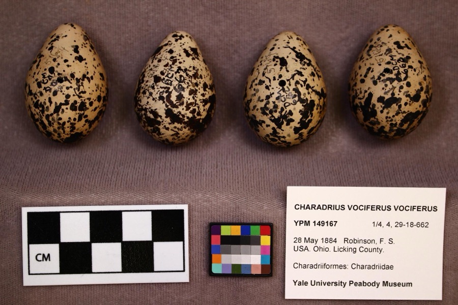
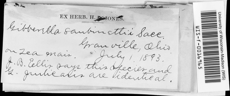
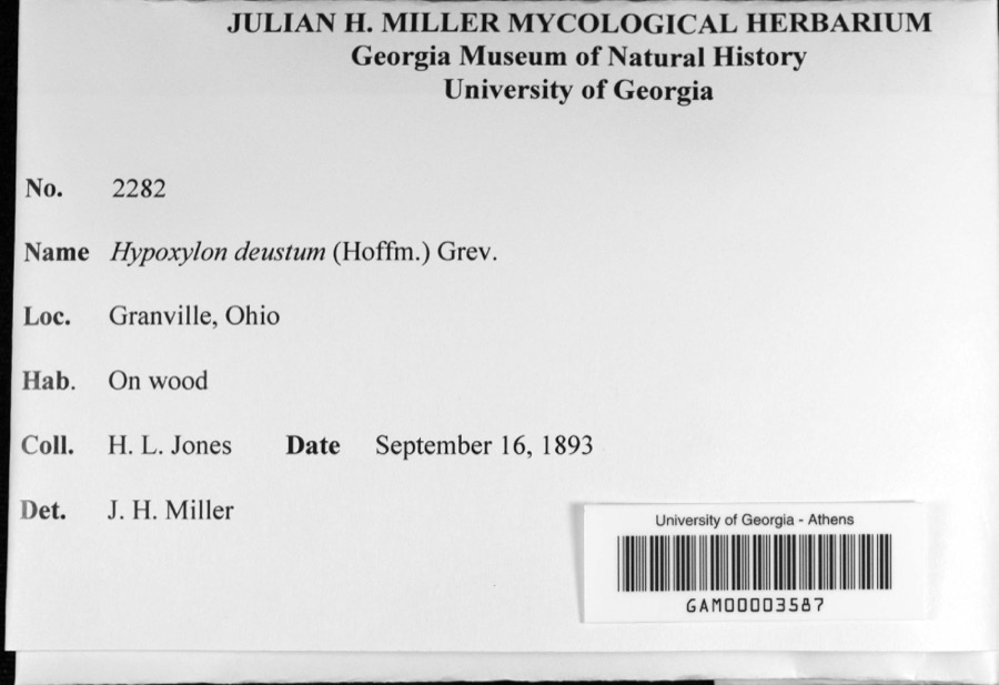
evidence. Museums hold 2,222 specimens
collected within 10 miles of Upland Farm between 1853 and
1975: 2,003 Animalia, 174 Fungi, 26 Protozoa, 16 Plantae, 3 Chromista. 12 distinct Species records are shown.
Collected by A. P. M., A. P. Morgan, A. W. Lindsey and others. Each is a
physical object with a catalogue
number, and each entry opens the museum's record. This is what was
collected and kept, not a survey of what lives here - nothing can be
concluded from a species being absent.
Regional context, not property-specific
evidence. The federal mineral resources record lists
8 workings within 5 miles of Upland Farm: 5 past producers, 2 producers, 1 plant.
3 still produce. What was taken out: Sand and Gravel, Construction. Distance is straight-line from the
map coordinates, so a quarry counted here may appear on a neighbouring
settlement's page as well.
Regional context, not property-specific
evidence. The National Weather Service names
Newark, the town this property stands in, in 69 storm reports between 1994 and 2026: 39 thunderstorm wind, 21 hail, 5 flood, 2 lightning.
The reports record 1 death and 1 injury. Each account below is quoted exactly as the forecast office
filed it, from the NOAA Storm Events Database, and each date
opens the federal record of that event.
,,,,,,,,Lightning Winds of 60 mph were reported in Newark. Large hail fell in Hebron where lightning killed a 46-year-old man as he attempted to untie a dog from under a tree to get it to shelter from the hail storm. A 33-year-old woman at the scene was also struck and injured. The dog was unharmed.
A 30-foot by 30-foot section of a roof was ripped off of a building on the southeast side of town. A construction trailer was turned on its side, and a steel overhang was pulled off of a home, causing minor damage to a wall.
1 paper published in this town,
digitised by the Library of Congress and free to read: 0 issues,
0 pages. Every page is searchable, so a name or a street can be
looked for directly in what the town printed about itself at the time.
No historic map-sheet match is published
for this property yet. That does not mean no map exists. This record needs
a coordinate-quality review before it can be joined to a sheet boundary.
Browse the county's mapped places while that work is
pending.
From the nomination file
1,707 words on record
When this property was proposed for the
National Register, someone wrote the case for it: what the building is,
and why it matters. That document is a federal record in the public domain.
It is quoted below word for word, never summarised. The text was read off the scanned case file by machine, so the
occasional stray character is the recogniser's and the 1970s
typewriter's.
Description of the property
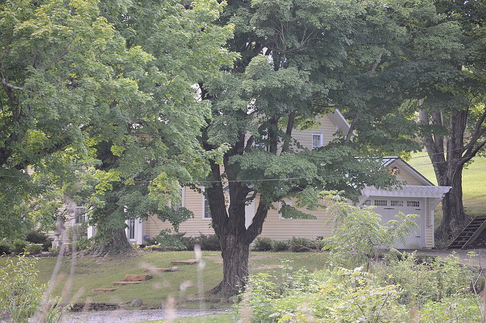
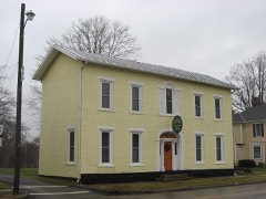
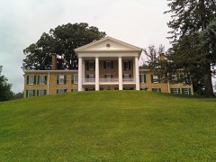
Upland Farm is located in Newton Township approximately11/4 miles north of Chatham. .south of the house. The facade and west elevations are simple and identical.,The entrances, with transoms are located windows were reversed to 6 over 9 lights in 1943. The kitchen and porch are located in the one story wing on the south, while the garage wing on the north was added in 1950. The interior woodwork and flooring are original and in excellent condition. 1943. CONDITION UNEXPOSED DESCRIPTION The Marple Cemetery, deeded to the township by David Marple's daughter before 1846, is UNALTERED A drawing in the 1875 Licking County Atlas depicted "Upland Farm". The house appeared much as it does today.
Also pictured were a barn which burned in 1900, a three story springhouse which was demolished before 1940 and a summer kitchen which was removed in The Federal farmhouse is constructed of wood frame on a stone foundation. Horizontal siding farmhouse remains today. measures 5 by 2 bays and is rectangular in plan. One story wings are located to the north and FAIR located across the road from Upland Farm. covers the framing while the gable roof is covered with tin. The house is 2 stories in height, XORIGINAL SITE At one time the farm included a barn, summer kitchen and springhouse, however, only the XEXCELLENT GOOD in the central bays. Double hung 9 over 6 windows are used throughout the house.
Some of the CHECK ONE Interior brick chimneys are located at either end of the 2 story central section of the house. -RUINS DATE XALTERED AREAS OF
Statement of significance
David Marple, a native of Chester County, Pennsylvania, purchased property in Newton "Upland Farm" remained in the Marple family until the turn of the century. It deteriorated considerably by the 1940's when the parents of the present owner purchased it. The house ART EDUCATION ECONOMICS ARCHEOLOGY-HISTORIC CONSERVATION LAW ARCHEOLOGY-PREHISTORIC PERIOD PHILOSOPHY X1800-1899 AGRICULTURE SCIENCE BUILDER/ARCHITECT PREHISTORIC THEATER SIGNIFICANCE preservation. MILITARY INDUSTRY _EXPLORATION/SETTLEMENT LITERATURE MUSIC XARCHITECTURE _COMMUNICATIONS Township in 1814. The family lived in a log house until this house was completed C. 1820. By mid-century, they controlled quite a bit of land in the northern portion of Newton Township.
_INVENTION of its simplicity of design, quality of construction and nearly original condition.In addition, _TRANSPORTATION _COMMERCE David and his son Miles Marple were prominent citizens and farmers in Licking County. _1700-1799 -1600-1699 _ENGINEERING "Upland Farm"is an excellent example of rural Federal architecture in Licking Counfy because -1500-1599 _SCULPTURE - 1400-1499 - RELIGION _1900- has been carefully rehabilitated and the present owners are interested in its continued
Quoted from the National Register nomination
for reference 78002102, 11 pages, held by the National Archives in Record
Group 79. See the
catalogue record.
Listed places nearby
6 within 8 miles
Other National Register properties close
enough to walk or drive between, ordered by distance from this one. Both
positions come from the same geocoding pass that matched these properties
to their map sheets.
Listing record. National Park Service National Register of Historic Places, listed-properties dataset, current to 2026-05-22.
Map join. Address geocoded through the United States Census geocoder, then tested against the published boundary of every sheet in the USGS Historical Topographic Map Collection.
How this page is made. Listing fields come from federal records; map-sheet coverage is a labelled coordinate-to-boundary calculation, not a source-field claim.
Wildfire. Short, Karen C. 2022. Spatial wildfire occurrence data for the United States, 1992-2020 [FPA_FOD_20221014]. 6th Edition. Fort Collins, CO: Forest Service Research Data Archive. https://doi.org/10.2737/RDS-2013-0009.6 Collected with United States Government funding and usable without additional permissions or fees.
Specimens. Global Biodiversity Information Facility (GBIF), https://www.gbif.org/. Only records licensed CC0 or CC BY are used. Records licensed CC BY-NC are excluded because this site carries advertising. Images are checked individually and any whose licence is non-commercial, no-derivatives or unreadable is refused.
Mines and quarries. USGS Mineral Resources Data System (MRDS) https://mrdata.usgs.gov/mrds/ A work of the United States government, no copyright under 17 U.S.C. 105.
Storms. NOAA National Centers for Environmental Information, Storm Events Database https://www.ncei.noaa.gov/stormevents/ A work of the United States government, no copyright under 17 U.S.C. 105. Narratives are quoted verbatim from the National Weather Service report and are not edited or summarised.
 Block
Block