BlockBefore
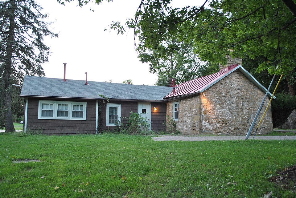
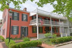
Photograph of Dustin Cabin
Photograph by Wdzinc, CC BY-SA 3.0. Via Wikimedia Commons.

Dustin Cabin

Listed on the National Register of Historic Places in 1980. A historic map-sheet match is not published yet. The record needs a coordinate-quality review before it can be joined to a sheet boundary.

From the record

“On the southern end of lot eight, of the Granville purchase, belonging to Messrs. Rose, very near and just south of Centerville street is a curious heap of sand, for which it is hard to account, unless it be that the Mound Builders placed it there.”

History of Licking County, Ohio: Its Past and Present (1881). Machine-read text.

one of 52 National Register listings in Licking County · listed in 1980 · category: Building.

Sources: the county history on the Internet Archive · the case file at the National Archives · the National Register database, National Park Service

The listing

  • What is counted as historic. The nomination lists 1 building as contributing to the listing.
  • Address. 597 N. Pearl St., Granville, 43023
  • When was it listed? 1980-11-28
  • Category. building
  • Also known as. Granville MRA
  • Township. Granville township
  • National Register reference number. 80003137 - the number the National Park Service assigned this property when it was listed, and the key its nomination file is catalogued under at the National Archives.

The ground it stands on

24,624 words

The chapter on Granville Township in History of Licking County, Ohio: Its Past and Present, published 1881 names Granville. This is what it says, exactly as the scans read.

The township was organized in 1807, out of the west half of Licking township, Fairfield county. The latter township then embraced all of what is now Licking county, except the Refugee lands. This being cut in two in the center, the west half was named Granville, and was, therefore, the second township organized in this territory.

Passage source: History of Licking County, Ohio: Its Past and Present, published 1881.

The works of the Mound Builders in this township are very numerous and interesting; indeed, in number and varied character are scarcely excelled by those of Newark township. The Raccoon valley and contiguous territory constitute, probably, the most interesting territory in the State, or even in the United States for the antiquarian. Mounds of different sizes and heights, earthworks of every kind known to the historian exist here in great numbers. Numbers yet to be seen and traced may almost be counted by the hundred, while many, very many, have disappeared entirely, by the ravages of time and the plow, and live only in the memory of the oldest inhabitants. No particular care seems to be taken to preserve these mounds and works. Wherever they are in the way of the tiller of the soil, they are ruthlessly plowed down or dug away. They are disappearing with comparative rapidity, and very soon, with few exceptions, will live only in history. Occcasionally they are erected upon high peaks, or places inaccessible to the plow and cultivator, and in such places are, of course, in the best state of preservation. The traveler between Newark and Granville will observe many of these mounds, a few yet pretty well preserved, even on the extensive and rich bottoms of the Raccoon; but the better preserved works, and those probably the most interesting, are located upon the hills that shut in the valley. Captain M. M. Munson, who occupies a beautiful farm in the midst of these mounds, and who has made them something of a study, is confident that around the great Aligator mound, located not far from his house, is a complete system of mounds and earthworks that point to it as a common center. However this may be, there is certainly a large circle of works in this vicinity, extending several miles in every direction, and seemingly connected with each other and with the "Old Fort" near Newark and its contiguous works.

Passage source: History of Licking County, Ohio: Its Past and Present, published 1881.

Machine-read from a century-old scan, so expect the errors a machine makes: misspelled names, dropped words, stray characters.

Read the whole chapter on Granville Township - 24,624 words on its settlement, mills, schools and churches.

Specimens collected near this property

12 of 2,352 shown

Regional context, not property-specific evidence. Museums hold 2,352 specimens collected within 10 miles of Dustin Cabin between 1853 and 1975: 2,116 Animalia, 190 Fungi, 26 Protozoa, 17 Plantae, 3 Chromista. 12 distinct Species records are shown. Collected by A. P. M., A. P. Morgan, A. R. Elliott and others. Each is a physical object with a catalogue number, and each entry opens the museum's record. This is what was collected and kept, not a survey of what lives here - nothing can be concluded from a species being absent.

Image SpeciesYear Collected by Where, as recorded
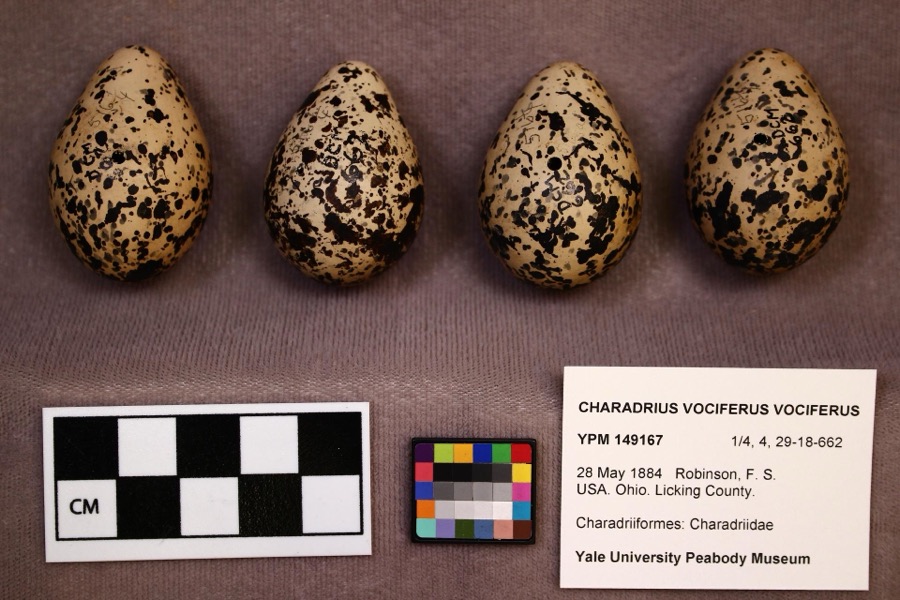
Specimen of Charadrius vociferus vociferus Linnaeus, 1758Charadrius vociferus vociferus Linnaeus, 17581884F. S. Robinson
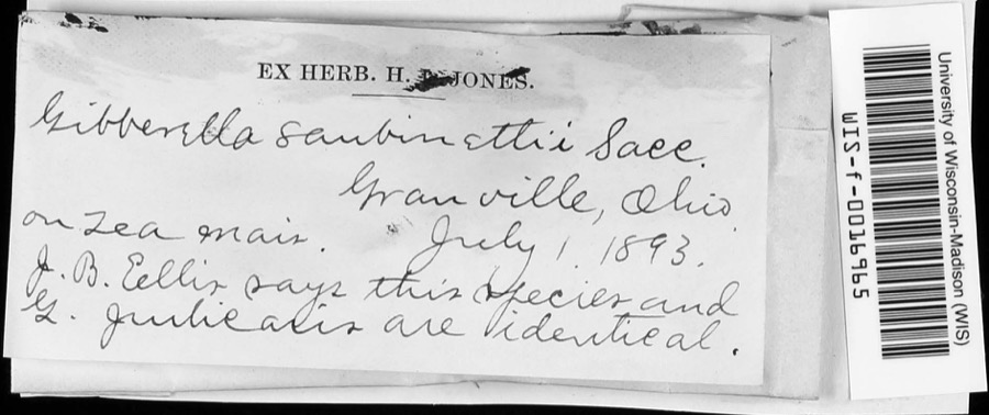
Specimen of Gibberella saubinetii (Durieu & Mont.) Sacc.Gibberella saubinetii (Durieu & Mont.) Sacc.1893J.B. EllisGranville
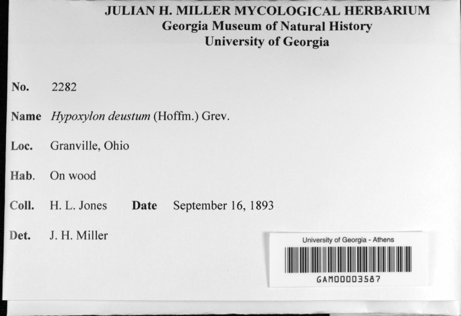
Specimen of Hypoxylon deustum (Hoffm.) Grev.Hypoxylon deustum (Hoffm.) Grev.1893H. L. Jones
A photograph of the species Bonasa umbellus, not of this specimenBonasa umbellus (Linnaeus, 1766)1853Mack, D. (Don)Eden Twp, Licking, Ohio, USA
A photograph of the species Pelecanus erythrorhynchos, not of this specimenPelecanus erythrorhynchos Gmelin, 17891874not recordedLicking Reservoir, Licking, Ohio, USA
A photograph of the species Calidris canutus, not of this specimenCalidris canutus rufa (A.Wilson, 1813)1878Savage, E. (Ed)Buckeye Lake Reservoir, Licking, Ohio, USA
A photograph of the species Lophodytes cucullatus, not of this specimenLophodytes cucullatus (Linnaeus, 1758)1878not recordedLicking Reservoir, Licking, Ohio, USA
A photograph of the species Aix sponsa, not of this specimenAix sponsa (Linnaeus, 1758)1880not recordedLicking Reservoir, Licking, Ohio, USA
A photograph of the species Anas americana, not of this specimenAnas americana J.F.Gmelin, 17891880not recordedBuckeye Lake Reservoir, Licking, Ohio, USA
A photograph of the species Podiceps auritus, not of this specimenPodiceps auritus (Linnaeus, 1758)1880not recordedLicking, Ohio, USA
Anas acuta Linnaeus, 17581881not recordedBuckeye Lake Reservoir, Licking, Ohio, USA
Anas clypeata Linnaeus, 17581881not recordedBuckeye Lake Reservoir, Licking, Ohio, USA

All 2,352 specimens within 10 miles, at the Global Biodiversity Information Facility.

Mines and quarries near this property

1 within 5 miles

Regional context, not property-specific evidence. The federal mineral resources record lists 1 working within 5 miles of Dustin Cabin: 1 producer. All of them still produce. What was taken out: Sand and Gravel, Construction. Distance is straight-line from the map coordinates, so a quarry counted here may appear on a neighbouring settlement's page as well.

Where SiteCommodity StatusRecorded
Rockport Sand & Gravel Co., Inc.Sand and Gravel, ConstructionProducer

Every working recorded in Licking County

Storms near this property

32 since 1995

Regional context, not property-specific evidence. The National Weather Service names Granville, the town this property stands in, in 32 storm reports between 1995 and 2026: 26 thunderstorm wind, 3 hail, 2 flash flood, 1 heavy rain. No death or injury is recorded in these reports. Each account below is quoted exactly as the forecast office filed it, from the NOAA Storm Events Database, and each date opens the federal record of that event.

WhenEvent Place namedHarm What the report says
February 2024Thunderstorm WindGranville$50,000Numerous trees were uprooted and several buildings were damaged at Lake Hudson near Granville.
July 2000Thunderstorm WindGranville$50,000Thunderstorm winds knocked down from 200 to 300 trees on a 5 mile path north and northeast of Granville. Nickel size hail also occurred in Newark.
July 2017Thunderstorm WindGranville$40,000Numerous trees were downed in the Granville area. A few barns were also damaged and/or destroyed and a home just south of town was damaged.
July 2003Thunderstorm WindGranville$30,000Numerous trees and power poles were downed.
February 2011Thunderstorm WindGranville$24,000Twelve power poles were snapped due to damaging thunderstorm winds.
June 2010Thunderstorm WindGranville$12,000Numerous power poles and trees were reported down. A few roofs were damaged and the main antenna at the 911 center was bent.
May 2004Thunderstorm WindGranville$10,000Numerous trees were downed from Granville to Newark. A tree fell on a car in Granville. Quarter size hail also occurred.
August 2004Thunderstorm WindGranville$10,000Numerous trees were downed from Denison University into Newark. A few trees fell on parked automobiles, causing minor damage.
March 2012Flash FloodGranville$5,000Heavy rainfall caused flash flooding in the area. There were numerous reports of water flowing over roads in Union Township, Hebron, and the Buckeye Lake area. One woman was trapped in a car due to high water.
July 1997Thunderstorm WindGranville$5,000Numerous trees downed.
April 2026Thunderstorm WindGranville$4,000A tree fell onto power lines.
April 2026Thunderstorm WindGranville$4,000Several trees were downed near the intersection of Burg Street and New Burg Street.
May 2022Thunderstorm WindGranville$4,000Several trees were downed in the Granville area.
May 2018Thunderstorm WindGranville$3,000Several trees were downed in the Granville area.
July 2017Thunderstorm WindGranville$3,000A few trees were downed in the Newark and Granville areas.
May 2013Thunderstorm WindGranville$3,000Trees and power lines were reported down in the area due to thunderstorm winds.
June 2012Thunderstorm WindGranville$3,000Trees were downed due to damaging thunderstorm winds.
June 2005Thunderstorm WindGranville$3,000Several large limbs were knocked down.
June 2008HailGranville$3,000no account filed
September 2022Thunderstorm WindGranville$2,000A couple of trees were downed in the Granville area.
July 2017Thunderstorm WindGranville$2,000Trees were downed on Welsh Hills Road.
May 2019Thunderstorm WindGranville$1,000A tree was downed onto Cambria Mill Road.
July 2013Thunderstorm WindGranville$1,000One tree was reported down at Highway 16 and Cherry Valley Road due to thunderstorm winds.
November 2013Thunderstorm WindGranville$1,000A tree was blown down and blocking a road due to thunderstorm winds.
October 2018Thunderstorm WindGranville$500Multiple wires were knocked down at Burg Street and Thornewood Drive.
July 2013Heavy RainGranville-Minor street and low lying flooding was occurring due to heavy rainfall.
June 2010Thunderstorm WindGranville-A trained spotter estimated the wind gust.
July 2002Flash FloodGranville-High water washed out a berm on State Route 661.
April 2011Thunderstorm WindGranville-no account filed
June 2011HailGranville-no account filed
September 2010Thunderstorm WindGranville-no account filed
July 1995HailGranville-no account filed

Every storm recorded in Licking County

Map coverage status

No historic map-sheet match is published for this property yet. That does not mean no map exists. This record needs a coordinate-quality review before it can be joined to a sheet boundary. Browse the county's mapped places while that work is pending.

From the nomination file

496 words on record

When this property was proposed for the National Register, someone wrote the case for it: what the building is, and why it matters. That document is a federal record in the public domain. It is reproduced in full on its own page, word for word and never summarised. The text was read off the scanned case file by machine, so the occasional stray character is the recogniser's and the 1970s typewriter's.

The whole case file for this property - 496 words, 5 pages, reproduced complete.

Quoted from the National Register nomination for reference 80003137, 5 pages, held by the National Archives in Record Group 79. See the catalogue record.

Listed places nearby

6 within 8 miles

Other National Register properties close enough to walk or drive between, ordered by distance from this one. Both positions come from the same geocoding pass that matched these properties to their map sheets.

Photograph PropertyDistance Listed
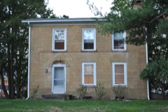
Bancroft, A. A., Houseunder 500 feet1980
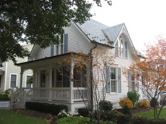
Rogers House0.4 miles1980
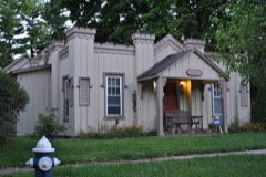
Carpenter, Wallace W., House0.4 miles1980
St. Luke's Episcopal Church0.5 miles1976
Avery-Hunter House0.5 miles1979
Buxton Inn0.5 miles1972

Sources for this property

National Archives recordThe nomination case file for reference 80003137 in Record Group 79.
Licking CountyAll 52 listed properties in this county.

Provenance

  • Listing record. National Park Service National Register of Historic Places, listed-properties dataset, current to 2026-05-22.
  • Map join. Address geocoded through the United States Census geocoder, then tested against the published boundary of every sheet in the USGS Historical Topographic Map Collection.
  • How this page is made. Listing fields come from federal records; map-sheet coverage is a labelled coordinate-to-boundary calculation, not a source-field claim.
  • Specimens. Global Biodiversity Information Facility (GBIF), https://www.gbif.org/. Only records licensed CC0 or CC BY are used. Records licensed CC BY-NC are excluded because this site carries advertising. Images are checked individually and any whose licence is non-commercial, no-derivatives or unreadable is refused.
  • Mines and quarries. USGS Mineral Resources Data System (MRDS) https://mrdata.usgs.gov/mrds/ A work of the United States government, no copyright under 17 U.S.C. 105.
  • Storms. NOAA National Centers for Environmental Information, Storm Events Database https://www.ncei.noaa.gov/stormevents/ A work of the United States government, no copyright under 17 U.S.C. 105. Narratives are quoted verbatim from the National Weather Service report and are not edited or summarised.