Listed on the National Register of Historic Places in
1978. A historic map-sheet match is not published yet. The record needs a coordinate-quality review before it can be joined to a sheet boundary.
From the record
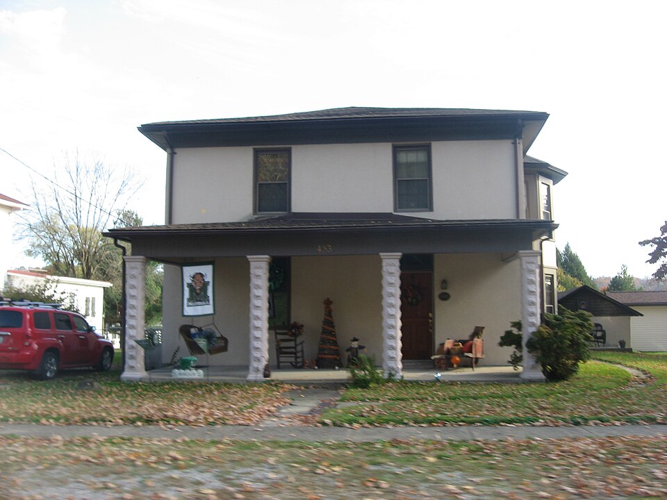
“Grant House is a historic house in Middleport, Ohio, United States. One of the area's earliest concrete houses, it has been designated a historic site.”
Wikipedia article William H. Grant House (Middleport, Ohio), CC BY-SA 4.0.
one of 8 National Register listings in Meigs County · listed in 1978 · category: Building.
National Register reference number.78002136- the number the National Park Service assigned this property when it was listed, and the key its nomination file is catalogued under at the National Archives.
Fires near this property
80 since 1992
Regional context, not property-specific
evidence. The
federal wildfire occurrence database
lists 80 fires within 5 miles of Grant, William H., House between
1992 and 2020, burning about 64 acres in total. None started naturally. 26 were recorded as arson.
Distance is straight-line from the map coordinates, so a fire counted
here may appear on a neighbouring settlement's page as well.
Reported cause
Fires
Debris and open burning
35
Arson/incendiarism
26
Equipment and vehicle use
7
Misuse of fire by a minor
3
Fireworks
2
Missing data/not specified/undetermined
2
Power generation/transmission/distribution
2
Smoking
2
Railroad operations and maintenance
1
The most recent of
them, most recent first, with the day each was reported and the service
that recorded it.
Regional context, not property-specific
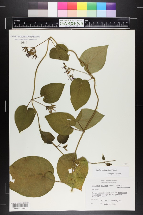
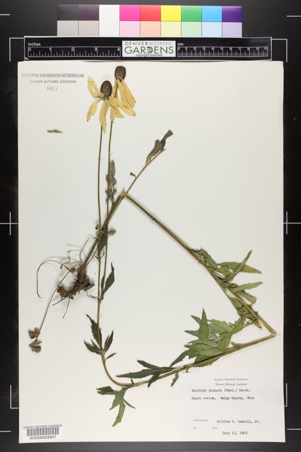
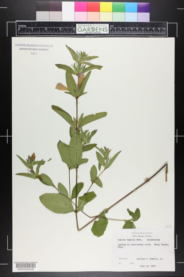
evidence. Museums hold 206 specimens
collected within 10 miles of Grant, William H., House between 1840 and
1973: 166 Animalia, 37 Plantae, 2 Fungi, 1 Chromista. 12 distinct Species records are shown.
Collected by Bartholomew, E.A.; Wilson, D., C. H. Jones, Charles M. Roberts and others. Each is a
physical object with a catalogue
number, and each entry opens the museum's record. This is what was
collected and kept, not a survey of what lives here - nothing can be
concluded from a species being absent.
Regional context, not property-specific
evidence. The federal mineral resources record lists
2 workings within 5 miles of Grant, William H., House: 1 past producer, 1 producer.
1 still produces. What was taken out: Aluminum, Sand and Gravel, Construction. Distance is straight-line from the
map coordinates, so a quarry counted here may appear on a neighbouring
settlement's page as well.
Regional context, not property-specific
evidence. The National Weather Service names
Middleport, the town this property stands in, in 23 storm reports between 1996 and 2026: 13 hail, 7 thunderstorm wind, 2 flood, 1 flash flood.
No death or injury is recorded in these reports. Each account below is quoted exactly as the forecast office
filed it, from the NOAA Storm Events Database, and each date
opens the federal record of that event.
Multiple trees and power lines were blown down onto the intersection of Main Street and Rutland Street in Middleport, which blocked the roadway for a brief period of time.
Several rivers and creeks rose out of their banks in Meigs County, leading to multiple road closures. Across the central part of the county, flooding impacted portions of Kingsbury Road, Route 143, Route 124 from Dead Mans Curve Road to State Route 325, and Noble Summit Road near McElhinney Hill Road and Bradbury Road.
Minor backwater flooding was seen along the Ohio River. The river gauge at Point Pleasant in West Virginia crested at 41.3 feet early on the 7th. Flood stage is 40 feet.
No historic map-sheet match is published
for this property yet. That does not mean no map exists. This record needs
a coordinate-quality review before it can be joined to a sheet boundary.
Browse the county's mapped places while that work is
pending.
From the nomination file
2,567 words on record
When this property was proposed for the
National Register, someone wrote the case for it: what the building is,
and why it matters. That document is a federal record in the public domain.
It is quoted below word for word, never summarised. The text was read off the scanned case file by machine, so the
occasional stray character is the recogniser's and the 1970s
typewriter's.
Description of the property
of cement construction (c. 1855) with a later (c. 1865) two story of the frame addition, the windows have louvered shutters. are still sound, the ground floor joists have rotted causing the floors stands to the west of the house. CONDITION EXCELLENT XALTERED UNALTERED XDETERIORATED CHECK ONE UNEXPOSED construction of the walls of the main block cement was poured,around The Grant House consists of a two story rectangular main block XORIGINAL SITE to the right as one faces the building.A one story open frame porch, original to the frame addition.The roof of the building is hipped. molding shaped in the form ofa cyma recta. light over one light.With the exception of the east and south sides have been found.
On the east side of the main block are two side entrances with protected by a one story open frame porch with ametal roof.The -RUINS _FAIR -GOOD is & five sided two story bay, added in the latter 19th Century. the width of the facade, protects the main entrance. have been added about the turn of the 20th Century. The sides of the deep. The roof line is decorated with a plain boxed cornice and plain to sag. The foundation of the large frame addition has settled on smaller sandstone rock, two stories high. The house, when originally roofmust have been covered with wooden shingles, in view ofa section found the house are rectangular and are of double hung sash.
Most of the The interior retains its original woodwork which includes crown DATE The The windows of two full length glass paneled doors with transoms. The facade is divided into two bays with the main entrnce being wooden frieze.The roof is now covered with asphalt shingles.
houses in Meigs County, Ohio, and was an important religious meeting his death in 1845, he converted William H. Grant and his wife, Esther. Grant house and John Chapman's association with the Grants, gives the Middleport, Ohio. 1700-1799 COMMUNICATIONS AGRICULTURE PERIOD place.
SIGNIFICANCE SCIENCE TRANSPORTATION THEATER ART _POLITICS/GOVERNMENT ARCHEOLOGY-HISTORIC MILITARY XARCHITECTURE 1400-1499 ARCHEOLOGY-PREHISTORIC INDUSTRY X1800-1899 LITERATURE _CONSERVATION MUSIC -1500-1599 -EXPLORATION/SETTLEMENT very possible that the house was constructed upon his return.Itis The Grants organized a local congregation and it was meeting in their 1900- John Chapman Appleseed)was a follower of Emanuel Sweden- -1600-1699 -SCULPTURE -ECONOMICS land that is now Middleport in 1845 and sold it off into lots as the years -COMMERCE _EDUCATION - LAW It is County, Ohio, except for a much smaller house no longer standing, which house in 1859.
Eventually, a permanent church was built nearby on Grant SPECIFIC DATES 1845 - 1885 Civil War are incomplete but they do show that Grant bought much of the INVENTION Grant had built on an experimental basis,nearby. house a distinguished position in the history of Meigs County and The house is significant because it was one of the earliest cement a cement -stone mixture.It was the first time cement was used in Meigs He married Esther Hobert on August records before the William H.Grant was born February 6,1820,in Meigs County,Ohio. went by.Grant took part in the 1849 gold rush in it is 1883, H. H. Hardesty and Co. Publishers.
Quoted from the National Register nomination
for reference 78002136, 20 pages, held by the National Archives in Record
Group 79. See the
catalogue record.
Listed places nearby
3 within 8 miles
Other National Register properties close
enough to walk or drive between, ordered by distance from this one. Both
positions come from the same geocoding pass that matched these properties
to their map sheets.
Listing record. National Park Service National Register of Historic Places, listed-properties dataset, current to 2026-05-22.
Map join. Address geocoded through the United States Census geocoder, then tested against the published boundary of every sheet in the USGS Historical Topographic Map Collection.
How this page is made. Listing fields come from federal records; map-sheet coverage is a labelled coordinate-to-boundary calculation, not a source-field claim.
Wildfire. Short, Karen C. 2022. Spatial wildfire occurrence data for the United States, 1992-2020 [FPA_FOD_20221014]. 6th Edition. Fort Collins, CO: Forest Service Research Data Archive. https://doi.org/10.2737/RDS-2013-0009.6 Collected with United States Government funding and usable without additional permissions or fees.
Specimens. Global Biodiversity Information Facility (GBIF), https://www.gbif.org/. Only records licensed CC0 or CC BY are used. Records licensed CC BY-NC are excluded because this site carries advertising. Images are checked individually and any whose licence is non-commercial, no-derivatives or unreadable is refused.
Mines and quarries. USGS Mineral Resources Data System (MRDS) https://mrdata.usgs.gov/mrds/ A work of the United States government, no copyright under 17 U.S.C. 105.
Storms. NOAA National Centers for Environmental Information, Storm Events Database https://www.ncei.noaa.gov/stormevents/ A work of the United States government, no copyright under 17 U.S.C. 105. Narratives are quoted verbatim from the National Weather Service report and are not edited or summarised.
 Block
Block