Listed on the National Register of Historic Places in
1978. A historic map-sheet match is not published yet. The record needs a coordinate-quality review before it can be joined to a sheet boundary.
From the record
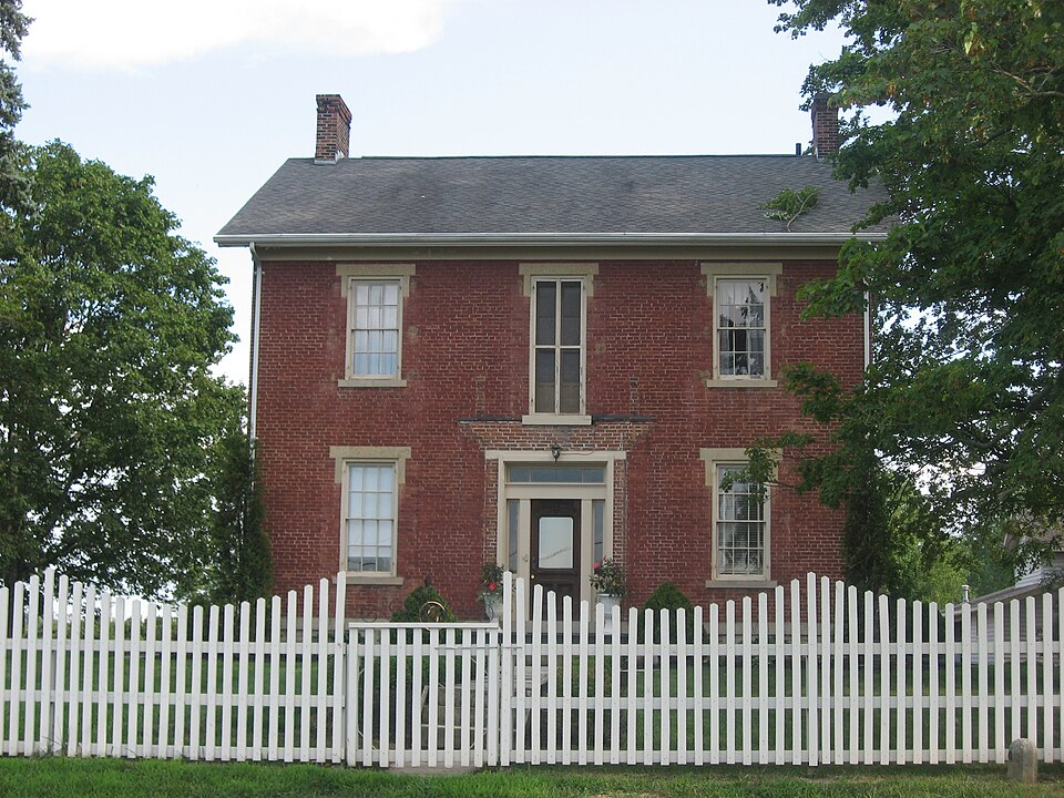
“The William Baumgardner Farm is a historic farmstead located near New Carlisle in Miami County, Ohio, United States. Constructed in 1857, the site remains typical of period farmsteads, and it has been named a historic site.”
Wikipedia article William Baumgardner Farm, CC BY-SA 4.0.
one of 36 National Register listings in Miami County · listed in 1978 · category: Building.
National Register reference number.78002141- the number the National Park Service assigned this property when it was listed, and the key its nomination file is catalogued under at the National Archives.
What happened here
An account from the chapter on Bethel township, The inset identifies its exact
source book and publication year.
All kinds of game abounded in the forests. The hunters killed large numbers of squirrels, turkeys, pheasants, etc. Wolves, bears and panthers were frequently encountered. It is related that David H. Morris, Sr., killed three panthers in one morning. This sturdy old pioneer was very fond of hunting. He required his boys to practice shooting daily ; when their record was poor, a general boxing of the ears was the result.
German Baptist Church. - In the first years of this century, Elder Jacob Miller crossed the waters of the Atlantic, and, coming to Ohio, settled on the west bank of the Great Miami River, about four miles southwest of Dayton. Later on came settlers from Penns}dvania and Virginia, and took possession of various Sections in Miami, Montgomery, Clarke and Greene Counties. From these pioneers have sprung the many German Baptist Associations which predominate in the counties just mentioned. The first members of this denomination settled in this and the surrounding townships in 1808. The present gchurch was erected in 1854, on the 0. Y. Yount farm, now occupied b}' Abram Neer. The organization branched off from the the Donnell's Creek Church (six miles east of New Carlisle), the present district comprising Bethel Township, of this county ; Wa}rne Township, Montgomery County, and portions of Clarke and Greene Counties. The church consisted of about a hundred members and the following ministers : Henry Rubsame, Adam Steinbarger and David Shellabarger. There are now about 120 members, Joseph Arnold and Henr}r Gumpis, ministers - the former since 1856.
Regional context, not property-specific
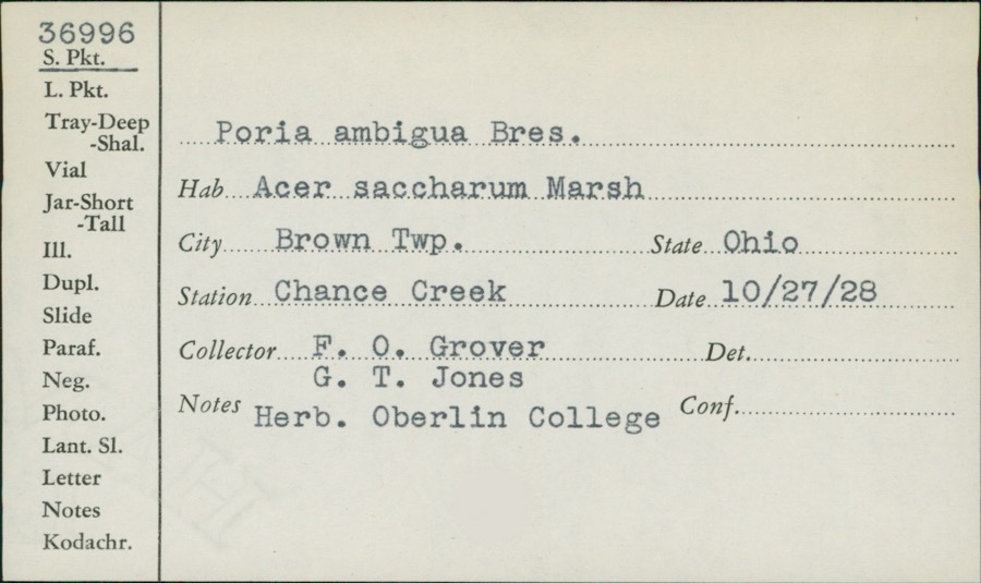
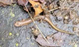
evidence. Museums hold 141 specimens
collected within 10 miles of Baumgardner, William, House and Farm Buildings between 1835 and
1975: 133 Animalia, 4 Fungi, 3 Protozoa, 1 Plantae. 12 distinct Species records are shown.
Collected by A. R. Gaufin, A.R. Gaufin, H.H. Ross, Arden R. Gaufin and others. Each is a
physical object with a catalogue
number, and each entry opens the museum's record. This is what was
collected and kept, not a survey of what lives here - nothing can be
concluded from a species being absent.
Regional context, not property-specific
evidence. The federal mineral resources record lists
4 workings within 5 miles of Baumgardner, William, House and Farm Buildings: 4 past producers.
None of them still produces. What was taken out: Sand and Gravel, Construction. Distance is straight-line from the
map coordinates, so a quarry counted here may appear on a neighbouring
settlement's page as well.
No historic map-sheet match is published
for this property yet. That does not mean no map exists. This record needs
a coordinate-quality review before it can be joined to a sheet boundary.
Browse the county's mapped places while that work is
pending.
From the nomination file
2,213 words on record
When this property was proposed for the
National Register, someone wrote the case for it: what the building is,
and why it matters. That document is a federal record in the public domain.
It is quoted below word for word, never summarised. The text was read off the scanned case file by machine, so the
occasional stray character is the recogniser's and the 1970s
typewriter's.
Description of the property
of the main house with summer kitchen, a large animal and hay storage barn, original locations and have few major alterations. The two story farmhouses is T-shaped in plan, built of brick on a coursed stone story porch across the front onto which this door opened. Windows are 6/6 light has two 6/6 light windows per side which match those of the front section. is a 2-story frame summer kitchen with an exterior bake oven at the rear. The rectangular kitchen structure has unfortunately been sided over and windows have been altered. The structure was in a very deteriorated condition and the was sided in 1975. is a shed-roofed, one-story addition on the south end. The 1-1/2 story carriage house is also frame, measuring 33' x 14'.
The north side has four sets of double doors across the lower level. Each door has a small round CONDITION UNEXPOSED DETERIORATED EXCELLENT gable roofs top the cupola.The east end has a shed-roofed addition. CHECK ONE undergone an unsympathetic alteration.A full size window was replaced with with plain stone sills and lintels.All windows have louvered wood shutters. on the south end.The one-story addition on the west is early but had recently The Hopper House and barns were built ca.1857.The remaining complex consists the 3-bay facade (north).The doorway has sidelights and a rectangular transom.
two per floor across the east end.To the rear isa centrally placed two-story rehabilitation was not sensitively done.A 1973 photo shows the building in its The large two-story barn is 41' x 71'.The ridgeline of the gable roof runs N-S. _UNALTERED X_FAIR - GOOD There is a smooth stone water table. The entrance is centered in section flanked by one-story shed roofed brick additions. original configuration. The kitchen has a gable roof with open belfry; the ridge- line runs north-south.
Though the outbuildings are not in the best state of preservation, the complex is an excellent collection of mid-19th century agricultural structures. The house is in good repair and has an excellent early interior. Though simple the proportions are excellent. The repeated use of small gables and cupolas provide one of the most complete farm complexes in southwest Ohio. The complex was built by William Baumgardner about 1857. His father, Jacob, brought his family, including William, to Miami County, Bethel Township, He became a very prosperous farmer with considerable landholdings. In 1860 his real estate was valued at $24, 425. Around 1870 David Mann purchased the Hopper House and farm. He, too, had Mann family until the 1940's when the Hoppers acquired it.
1700-1799 ECONOMICS ART 1900- ARCHEOLOGY-HISTORIC ENGINEERING SIGNIFICANCE BUILDER/ARCHITECT THEATER PERIOD SCIENCE RELIGION XARCHITECTURE MILITARY XAGRICULTURE INDUSTRY LITERATURE POLITICS/GOVERNMENT ARCHEOLOGY-PREHISTORIC X1800-1899 _COMMUNICATIONS _PHILOSOPHY LANDSCAPE ARCHITECTURE _COMMERCE _PREHISTORIC _TRANSPORTATION _EXPLORATION/SETTLEMENT _SOCIAL/HUMANITARIAN INVENTION _COMMUNITY PLANNING as decorative features provides considerable unity to the property.They -1400-1499 -1500-1599 _1600-1699 -SCULPTURE - MUSIC come from Pennsylvania where he was born in 1806. The farm remained in the
Quoted from the National Register nomination
for reference 78002141, 20 pages, held by the National Archives in Record
Group 79. See the
catalogue record.
Listed places nearby
2 within 8 miles
Other National Register properties close
enough to walk or drive between, ordered by distance from this one. Both
positions come from the same geocoding pass that matched these properties
to their map sheets.
Listing record. National Park Service National Register of Historic Places, listed-properties dataset, current to 2026-05-22.
Map join. Address geocoded through the United States Census geocoder, then tested against the published boundary of every sheet in the USGS Historical Topographic Map Collection.
How this page is made. Listing fields come from federal records; map-sheet coverage is a labelled coordinate-to-boundary calculation, not a source-field claim.
Specimens. Global Biodiversity Information Facility (GBIF), https://www.gbif.org/. Only records licensed CC0 or CC BY are used. Records licensed CC BY-NC are excluded because this site carries advertising. Images are checked individually and any whose licence is non-commercial, no-derivatives or unreadable is refused.
Mines and quarries. USGS Mineral Resources Data System (MRDS) https://mrdata.usgs.gov/mrds/ A work of the United States government, no copyright under 17 U.S.C. 105.
 Block
Block