Listed on the National Register of Historic Places in
1978. A historic map-sheet match is not published yet. The record needs a coordinate-quality review before it can be joined to a sheet boundary.
From the record
“It was laid out by Philip Gunckel, who, on the 4th day of October. G certified that the plat as recorded was correct.”
The History of Montgomery County, Ohio, Containing a History of the County; (1882). Machine-read text.
one of 117 National Register listings in Montgomery County · listed in 1978 · category: Building · one of 4 National Historic Landmarks in Montgomery County.
National Register reference number.78002149- the number the National Park Service assigned this property when it was listed, and the key its nomination file is catalogued under at the National Archives.
Germantown is situated in the Twin Yalley, with Little Twin Creek on its ide, and Big Twin on its west and south sides, being in the forks of these r| ns. It was laid out by Philip Gunckel, who, on the 4th day of October. G certified that the plat as recorded was correct. The first sale of lots oc- October 21, 1814, and the second sale November 15, 1815. It was -1 Germantown because the people who built up the town and lived around f e Germans. Howe, in his " Historical Collections of Ohio," says " Gern iwn was named from Germantown, Penn.," but in this he is mistaken; the n was given for the reason just stated. Its site, as well as its surfings, are in a high degree beautiful. The valley immediately around H Yn is on almost all sides inclosed by hills, which are in large part cov- "iet|)y trees, forming a forest- crowned wall, presenting a very pleasing pict- are.* The town is regularly laid out; its streets are wide, well graded and m adamized. The climate is most salubrious, the drainage admirable, malark diseases unknown, and the health of the people excellent. The post office v established in October. 1818, Peter Shaeffer being the first Postmaster. G mantown has no railroad, but has, nevertheless, good railroad facilities means of omnibus lines to the C., H. & D. and C., C. , C. & I., at Carlisle g Miamisburg, which points are each but four miles distant. The town posses good public buildings ; the schoolhouse is a very substantial, three-stor structure, overlooking the valley, containing twelve rooms, four on each He the Town Hall is an edifice that would do credit to a much larger town; g the armory, originally built for an academy, engine house and prison, are quite new, capacious and attractive. There are four churches of good arc tectural style, some of them finished and furnished with taste and elegan The town also has what many large places lack - a public park, contain; about five acres of ground, which has been but recently laid out. Germanfco has at present three dry goods stores, four grocery stores, two hardware, t furniture, two tin and stove stores, a number of other mercantile establishme possessed by such towns, three hotels and one banking house. The Exck;u!i Bank was established by Col. John Stump, and did business a few years, wl it was merged into the First National Bank of Germantown, which was org ized July .18, 1868, by Christian Rohrer, William Gunckel, John Stump, J< F. Kern and others, beginning business September 1 of that year, with a ca tal of $50,000, which has since been increased to $75,000. John F. Kern i; elected President, and John Stump, Cashier; the former serving as Presid! of the bank until January 10, 1882, when he resigned, and was succeeded ,j Joseph W. Shank. Col., Stump was succeeded as Cashier by J. H. Cross, vl was elected January 16, 1869; began his duties February 1 of that year, wlf position of trust and confidence he has filled up to the present. During m;| years, the German was the only language spoken among the people of it town, but the English language has almost entirely supplanted it as a inedi of social and business intercourse. - (
Sunsbury is but a small village of about forty dwellings; is separaj from Germantown by a space of .about a quarter of a mile, and is located rectly south of the latter town, on the Carlisle & Germantown piko. It very old place, being the first point settled in German Township, and f<| number of years was the only village or place of business in the Twin Val It was not, however, platted until March 18, 1825, according to the cod records. Its people form, to some extent, a community by themselves, yet t. interests are largely identified with those of the people of Germantown. £ though small in size and population, some of the most prominent men in township have lived here, such as the Emericks, Catrows and Liggets. It never given much prospect of growth, and to-day has no more houses tka had forty years ago. and is beginning to show its age by its external appj a nee.
Regional context, not property-specific
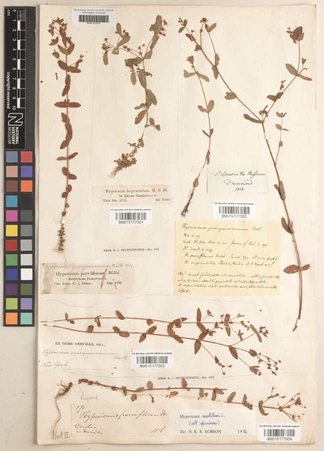
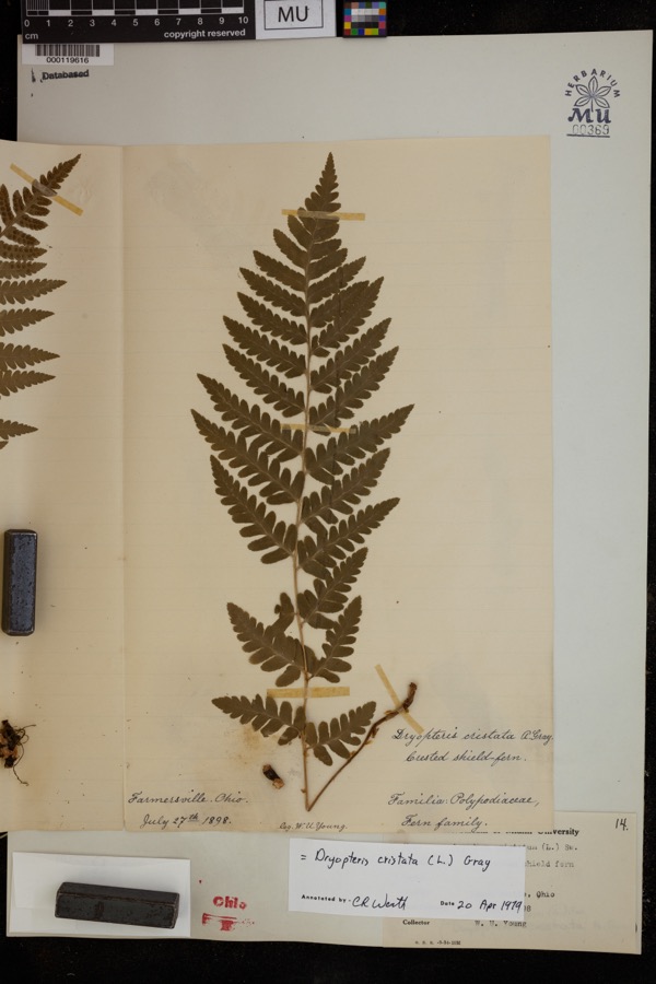
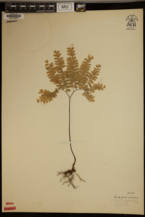
evidence. Museums hold 230 specimens
collected within 10 miles of Rohr, David, Mansion And Carriage House between 1835 and
1969: 203 Animalia, 10 Fungi, 10 Plantae, 3 Protozoa, 3 Chromista, 1 Unrecorded. 12 distinct Species records are shown.
Collected by ?, ATW, Arden R. Gaufin and others. Each is a
physical object with a catalogue
number, and each entry opens the museum's record. This is what was
collected and kept, not a survey of what lives here - nothing can be
concluded from a species being absent.
Regional context, not property-specific
evidence. The federal mineral resources record lists
3 workings within 5 miles of Rohr, David, Mansion And Carriage House: 2 producers, 1 past producer.
2 still produce. What was taken out: Sand and Gravel, Construction. Distance is straight-line from the
map coordinates, so a quarry counted here may appear on a neighbouring
settlement's page as well.
Regional context, not property-specific
evidence. The National Weather Service names
Germantown, the town this property stands in, in 29 storm reports between 1994 and 2025: 20 thunderstorm wind, 7 hail, 1 flash flood, 1 flood.
No death or injury is recorded in these reports. Each account below is quoted exactly as the forecast office
filed it, from the NOAA Storm Events Database, and each date
opens the federal record of that event.
The roof of a mini mall on West Market Street was partially removed. When this occurred, rain was allowed to enter the building causing water damage, which closed three businesses. When the roof came off it damaged a vehicle.
No historic map-sheet match is published
for this property yet. That does not mean no map exists. This record needs
a coordinate-quality review before it can be joined to a sheet boundary.
Browse the county's mapped places while that work is
pending.
From the nomination file
1,603 words on record
When this property was proposed for the
National Register, someone wrote the case for it: what the building is,
and why it matters. That document is a federal record in the public domain.
It is quoted below word for word, never summarised. The text was read off the scanned case file by machine, so the
occasional stray character is the recogniser's and the 1970s
typewriter's.
Description of the property
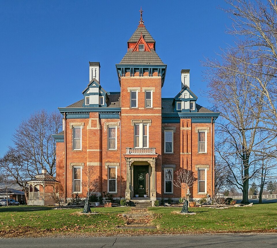
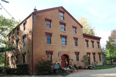
balustrade and a round cornered bay on the right. The dominant window under a pitched roof with ornamental gable. There is a hip roof is asphalt shingle with rail.The chimneys rise through wing with segmental windows having 4/4 and 6/6 double hung sash with stylizedpillars on panelled cornice and balustrade. and panelled and bracketed lintel. addition to this 1875 Atlas of Montgomery County shows a - RUINS Form No. 10-300a (Rev. 10-74) UNITED STATES DEPARTMENT OF THE INTERIOR FOR NPS USE ONLY NATIONAL PARK SERVICE DEC 12 1977 NATIONAL REGISTER OF HISTORIC PLACES DATE ENTERED MAY.
22 1978 INVENTORY -- NOMINATION FORM CONTINUATION SHEET ITEM NUMBER Each face has a small gable with round (north) or rectangular PAGE RECEIVED There is a large square carriage house of seven course American show in the 1875 Atlas. The rectangular windows are 6/6 double cupola. hung sash with stone lintels and sills.Eaves are box cornice. AREAS OF
Statement of significance
it a dominant and imposing structure, lending a unique character 1400-1499 1700-1799 1500-1599 structure.
EDUCATION BUILDER/ARCHITECT RELIGION SIGNIFICANCE ART ARCHEOLOGY-HISTORIC LAW THEATER AGRICULTURE X1800-1899 PERIOD PHILOSOPHY Eastlake interior trim greatly enhances the significance of the INVENTION XCOMMERCE INDUSTRY MILITARY _POLITICS/GOVERNMENT XARCHITECTURE LITERATURE The Second Empire house, which appears in the 1875 Atlas, _EXPLORATION/SETTLEMENT _TRANSPORTATION from the rear west and southern walls.The Eastlake house we see was built around a preceding Victorian house which still projects _PREHISTORIC today was a major renovation of the Second Empire house and was Germantown in the middle and latter part of the nineteenth cen- The unusual architectural combination of the Victorian, was badly neglected and abused.The trim, however, somehow managed SOCIAL/HUMANITARIAN _SCULPTURE Eastlake, and Queen Anne styles of the David Rohr Home has made _CONSERVATION _ECONOMICS _COMMUNICATIONS enjoys the manual arts and plans to do most of the restoration 1973 the house was purchased by Dr.and Mrs.
to survive with little damage. become the elegant showplace it has been in the past. -1600-1699 Noel Watson, a Native of Germantown, who plans to renovate the MUSIC -COMMUNITY PLANNING In addition, the excellent The house, in the past few years, has Dr. Watson is a craftman who himself. Under the Watsons' ownership, the house will again seen hard times as it was divided into low income dwellings and ARCHEOLOGY-PREHISTORIC to Germantown's historic atmosphere. carried out in the 1890's. house to its l890's appearance. Chicago: S.J. Clarke Publishing Co., 1909. The History of Montgomery County, Ohio. Chicago: W.H. Beers & Co., 1882.
Quoted from the National Register nomination
for reference 78002149, 13 pages, held by the National Archives in Record
Group 79. See the
catalogue record.
Listed places nearby
6 within 8 miles
Other National Register properties close
enough to walk or drive between, ordered by distance from this one. Both
positions come from the same geocoding pass that matched these properties
to their map sheets.
Listing record. National Park Service National Register of Historic Places, listed-properties dataset, current to 2026-05-22.
Map join. Address geocoded through the United States Census geocoder, then tested against the published boundary of every sheet in the USGS Historical Topographic Map Collection.
How this page is made. Listing fields come from federal records; map-sheet coverage is a labelled coordinate-to-boundary calculation, not a source-field claim.
Specimens. Global Biodiversity Information Facility (GBIF), https://www.gbif.org/. Only records licensed CC0 or CC BY are used. Records licensed CC BY-NC are excluded because this site carries advertising. Images are checked individually and any whose licence is non-commercial, no-derivatives or unreadable is refused.
Mines and quarries. USGS Mineral Resources Data System (MRDS) https://mrdata.usgs.gov/mrds/ A work of the United States government, no copyright under 17 U.S.C. 105.
Storms. NOAA National Centers for Environmental Information, Storm Events Database https://www.ncei.noaa.gov/stormevents/ A work of the United States government, no copyright under 17 U.S.C. 105. Narratives are quoted verbatim from the National Weather Service report and are not edited or summarised.
 Block
Block