Listed on the National Register of Historic Places in
1978. A historic map-sheet match is not published yet. The record needs a coordinate-quality review before it can be joined to a sheet boundary.
From the record
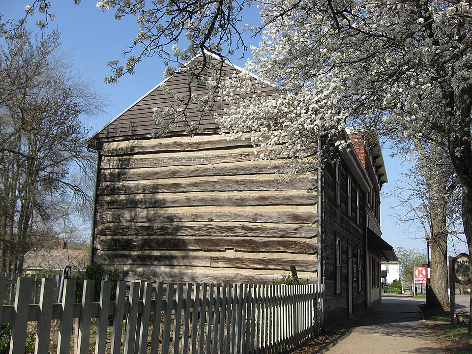
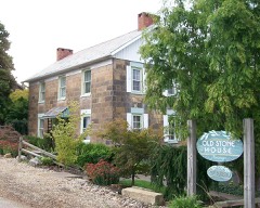
“The William Rainey Harper Log House, also known as the Harper Cabin, is located at 20 West Main Street in New Concord, Ohio, United States. The home was placed on the National Register of Historic Places on 1980-01-03.”
Wikipedia article William Rainey Harper Log House, CC BY-SA 4.0.
one of 70 National Register listings in Muskingum County · listed in 1978 · category: Building.
National Register reference number.78002154- the number the National Park Service assigned this property when it was listed, and the key its nomination file is catalogued under at the National Archives.
From 1803 to 1806, the Reasoners, Speers, Findleys, and Wilsons, from Pennsylvania, settled in the northeastern portion of the township, near the present site of New Concord. Henry Reasoner, having in the year 1804, entered the land on which the town now stands.
In the year 1804, Henry Reasoner, trom Pennsylvania, entered the southwest quarter of section one, which he sold to David Findley, in 1806, and, in 1828, Findley laid out the town of New Concord, along the line of the National Road.. .
Regional context, not property-specific
evidence. The
federal wildfire occurrence database
lists 28 fires within 5 miles of Harper, William Rainey, Log House between
2011 and 2020, burning about 31 acres in total. 1 started naturally. None was recorded as arson.
Distance is straight-line from the map coordinates, so a fire counted
here may appear on a neighbouring settlement's page as well.
Reported cause
Fires
Debris and open burning
15
Missing data/not specified/undetermined
8
Equipment and vehicle use
2
Natural
1
Smoking
1
Power generation/transmission/distribution
1
The most recent of
them, most recent first, with the day each was reported and the service
that recorded it.
Regional context, not property-specific
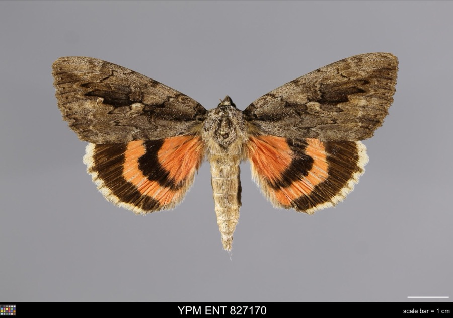
evidence. Museums hold 1,059 specimens
collected within 10 miles of Harper, William Rainey, Log House between 1908 and
1975: 767 Animalia, 289 Plantae, 3 Unrecorded. 12 distinct Species records are shown.
Collected by A. H. Wright, Adams, W., Adams, W. (William), Trautman, M. B. (Milton Bernard) et al. and others. Each is a
physical object with a catalogue
number, and each entry opens the museum's record. This is what was
collected and kept, not a survey of what lives here - nothing can be
concluded from a species being absent.
Regional context, not property-specific
evidence. The federal mineral resources record lists
2 workings within 5 miles of Harper, William Rainey, Log House: 2 past producers.
None of them still produces. What was taken out: Limestone, General, Stone, Crushed/Broken. Distance is straight-line from the
map coordinates, so a quarry counted here may appear on a neighbouring
settlement's page as well.
Regional context, not property-specific
evidence. The National Weather Service names
New Concord, the town this property stands in, in 16 storm reports between 1995 and 2025: 11 thunderstorm wind, 4 hail, 1 flash flood.
No death or injury is recorded in these reports. Each account below is quoted exactly as the forecast office
filed it, from the NOAA Storm Events Database, and each date
opens the federal record of that event.
Rte 83 was flooded between Bloomfield and Otsego in the northeast part of Muskingum County, beginning at 632 AM EDT. By 835 AM EDT, there was flooding in Adamsville; and along State Rte 16 in Adams Mills. One house was surrounded by water in Otsego area.
No historic map-sheet match is published
for this property yet. That does not mean no map exists. This record needs
a coordinate-quality review before it can be joined to a sheet boundary.
Browse the county's mapped places while that work is
pending.
From the nomination file
1,643 words on record
When this property was proposed for the
National Register, someone wrote the case for it: what the building is,
and why it matters. That document is a federal record in the public domain.
It is quoted below word for word, never summarised. The text was read off the scanned case file by machine, so the
occasional stray character is the recogniser's and the 1970s
typewriter's.
Description of the property
not within recent memory, and now faces north along the Main Street of the village of Muskingum College, A nineteenth-century store, now used by the College for oftices, southwest wall. CONDITION RUINS FAIR with the main entrance through the center bay.
The main door itself stands out as an This building is a two-story, double pen house, traditional in style, of square-hewn CHECK ONE _UNALTERED of poplar logs, twelve logs high to the plate log, with logs measuring up to sixteen inches XALTERED _UNEXPOSED to 1918) _DETERIORATED sits flush against the Harper house's west wall; land to the east and south is owned by well-intentioned attempt at restoration.A small wooden back porch is built onto the -GOOD The house is set on a stone and brick foundation, and is a three-bay structure, 1ogs, covered with a gable roof, of slate. It was moved to its present site, although building. with no fenestration on the gable ends.
There is a large inset chimney in the west XMOVED anachronism, due to its design and transom.The windows are double hung, six-over-six, New Concord the National Road),across the street from the main entrance to the Village and is used as a public park. The house measures 28'x50',and is constructed AREAS OF
Statement of significance
1og architecture, a style once prevalent on the cultural landscape of southern Ohio, began regular classes at ten, and graduated in 1870 at the age of fourteen, giving a graduation from Yale, he married Ella Paul, daughter of Muskingum President David Paul, and afterward taught at the Masonic Academy at Macon Tennessee, at Denison Uinversity, and own innovations, many of which are standard academic procedure today: university extention, a university press, and emphasis on graduate study and research. He held the Presidency served as the New Concord branch of the John McIntire Library. Muskingum College the building serves as a house museum, containing a collection of memorabilia of one of Muskingum College's greatest graduates, and one of the nation's greatest educators.
1500-1599 1400-1499 X1800-1899 ART LAW ARCHEOLOGY-HISTORIC PERIOD THEATER RELIGION AGRICULTURE XARCHITECTURE XEDUCATION TRANSPORTATION MILITARY XEXPLORATION/SETTLEMENT LITERATURE PHILOSOPHY _CONSERVATION INDUSTRY _COMMUNICATIONS INVENTION _POLITICS/GOVERNMENT _1700-1799 erected.This significance notwithstanding, this particular log house's greatest -1600-1699 commencement address to his graduating class in Hebrew.He taught Hebrew at his alma mater The University of Chicago's Harper Memorial Library was built in his honor and was ded- icated in 1912.
and the one style most used by early settlers before more impressive dwellings could be - ENGINEERING -COMMERCE 8 SIGNIFICANCE acquired the property in 1918,and shortly thereafter began a restoration under the Harper's birthplace was for some time occupied by the Pittsburgh Produce Co.,and also _SOCIAL/HUMANITARIAN This house stands out as a well-preserved example of early nineteenth century traditional _ECONOMICS Samuel Harper (?) -SCIENCE -MUSIC -1900- SPECIFIC DATES at Yale, and wrote extensively on Hehrew language and lietrature and education. With the support and freindship of John D. Rockefeller, Harper assumed the first presidency of the at Chicago for fifteen years, and died in the President's house on the Campus in 1906.
Quoted from the National Register nomination
for reference 78002154, 10 pages, held by the National Archives in Record
Group 79. See the
catalogue record.
Listed places nearby
6 within 8 miles
Other National Register properties close
enough to walk or drive between, ordered by distance from this one. Both
positions come from the same geocoding pass that matched these properties
to their map sheets.
Listing record. National Park Service National Register of Historic Places, listed-properties dataset, current to 2026-05-22.
Map join. Address geocoded through the United States Census geocoder, then tested against the published boundary of every sheet in the USGS Historical Topographic Map Collection.
How this page is made. Listing fields come from federal records; map-sheet coverage is a labelled coordinate-to-boundary calculation, not a source-field claim.
Wildfire. Short, Karen C. 2022. Spatial wildfire occurrence data for the United States, 1992-2020 [FPA_FOD_20221014]. 6th Edition. Fort Collins, CO: Forest Service Research Data Archive. https://doi.org/10.2737/RDS-2013-0009.6 Collected with United States Government funding and usable without additional permissions or fees.
Specimens. Global Biodiversity Information Facility (GBIF), https://www.gbif.org/. Only records licensed CC0 or CC BY are used. Records licensed CC BY-NC are excluded because this site carries advertising. Images are checked individually and any whose licence is non-commercial, no-derivatives or unreadable is refused.
Mines and quarries. USGS Mineral Resources Data System (MRDS) https://mrdata.usgs.gov/mrds/ A work of the United States government, no copyright under 17 U.S.C. 105.
Storms. NOAA National Centers for Environmental Information, Storm Events Database https://www.ncei.noaa.gov/stormevents/ A work of the United States government, no copyright under 17 U.S.C. 105. Narratives are quoted verbatim from the National Weather Service report and are not edited or summarised.
 Block
Block