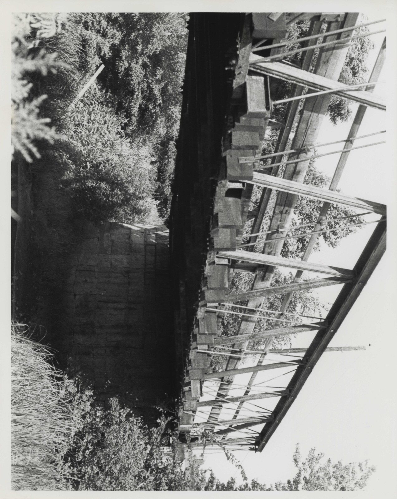
Photographs from the nomination case file, National Park Service records.
Atherton Bridge
Listed on the National Register of Historic Places in
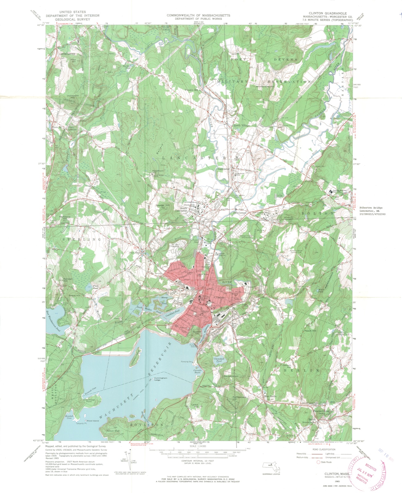
1979. A historic map-sheet match is not published yet. The record needs a coordinate-quality review before it can be joined to a sheet boundary.
From the record
one of 500 National Register listings in Worcester County · listed in 1979 · category: Structure · one of 1 National Historic Landmarks in Worcester County.
National Register reference number.79000377- the number the National Park Service assigned this property when it was listed, and the key its nomination file is catalogued under at the National Archives.
Fires near this property
110 since 2002
Regional context, not property-specific
evidence. The
federal wildfire occurrence database
lists 110 fires within 5 miles of Atherton Bridge between
2002 and 2020, burning about 2,734 acres in total. None started naturally. 5 were recorded as arson.
Distance is straight-line from the map coordinates, so a fire counted
here may appear on a neighbouring settlement's page as well.
Reported cause
Fires
Debris and open burning
52
Missing data/not specified/undetermined
24
Recreation and ceremony
17
Arson/incendiarism
5
Smoking
5
Equipment and vehicle use
4
Misuse of fire by a minor
3
The most recent of
them, most recent first, with the day each was reported and the service
that recorded it.
Regional context, not property-specific
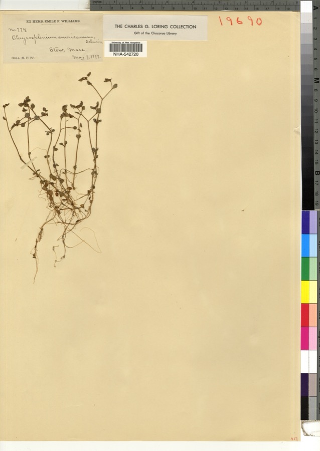
evidence. Museums hold 1,926 specimens
collected within 10 miles of Atherton Bridge between 1858 and
1974: 1,127 Animalia, 514 Plantae, 273 Fungi, 6 Unrecorded, 5 Chromista, 1 Protozoa. 12 distinct Species records are shown.
Collected by A. C. Gibson, A. Ferrett, A. G. Chandler and others. Each is a
physical object with a catalogue
number, and each entry opens the museum's record. This is what was
collected and kept, not a survey of what lives here - nothing can be
concluded from a species being absent.
Regional context, not property-specific
evidence. The federal mineral resources record lists
15 workings within 5 miles of Atherton Bridge: 10 past producers, 4 producers, 1 prospect.
4 still produce. What was taken out: Sand and Gravel, Construction, Stone, Dimension, Stone, Crushed/Broken, Iron. Distance is straight-line from the
map coordinates, so a quarry counted here may appear on a neighbouring
settlement's page as well.
Regional context, not property-specific
evidence. The National Weather Service names
Lancaster, the town this property stands in, in 8 storm reports between 2005 and 2026: 6 thunderstorm wind, 1 hail, 1 funnel cloud.
No death or injury is recorded in these reports. Each account below is quoted exactly as the forecast office
filed it, from the NOAA Storm Events Database, and each date
opens the federal record of that event.
1 paper published in this town,
digitised by the Library of Congress and free to read: 0 issues,
0 pages. Every page is searchable, so a name or a street can be
looked for directly in what the town printed about itself at the time.
No historic map-sheet match is published
for this property yet. That does not mean no map exists. This record needs
a coordinate-quality review before it can be joined to a sheet boundary.
Browse the county's mapped places while that work is
pending.
From the nomination file
1,644 words on record
When this property was proposed for the
National Register, someone wrote the case for it: what the building is,
and why it matters. That document is a federal record in the public domain.
It is quoted below word for word, never summarised. The text was read off the scanned case file by machine, so the
occasional stray character is the recogniser's and the 1970s
typewriter's.
Description of the property
The Atherton Bridge is a single span pony truss constructed in 1870. Located on Bolton Road, in a rural area surrounded by flat, open flood plain, the bridge spans the Nashua River approximately 3/4 miles east of South Lancaster. The eight truss paneled structure has a span of 72' and width of 18½' and rests on large granite block abutments. Although the bridge is not a patented version of the post truss like the nearby Ponakin Bridge(NR-eligible) it employs many Post truss features such as diagonal compression members that incline toward the center of the bridge and riveted dual tension rods that incline outward, the outermost of which extend two panels and the others across one panel. Compression members are Phoenix Columns (patented by the Phoenix Iron Co.
of Phoenixville, Pennsylvania). The end posts are vertical dual tension rods. Top chords are riveted compound beams. Floor construction consists of a cross planked deck supported by longitudinal planking on riveted transverse "I" beams that rests directly on the bottom chords, an older type of bridge technology. Wood transverse beams notched to fit over the bottom chords are spaced between each "I" beam. Because several compression members are loose from their fittings, the bridge has been" closed to traffic for several years.
Statement of significance
/ARCHITECT The Atherton Bridge possesses integrity of location,design, setting, materials, and workmanship and is associated with major transportation and the development of routes in Lancaster. In addition, it is one of two remaining examples known to the Historic American Engineering Record of an important nineteenth century bridge truss type. When erected, the Atherton Bridge was Lancaster's first iron bridge. Built on one of the main roads into Lancaster, the bridge is the most recent in a succession of earlier bridges. As was common practice, thestructure was named for a nearby family, the Athertons, descendants of James Atherton, one of the signers of the petition for incorporation of Lancaster in 1653.
The bridge, which was built byithe town for the sum of $4,000 in 1870, incorporates many design features of the Post truss, patented by Simeon S. Post c. 1866. S.S. Post was a weli known New Hampshire born civil engineer "whose work in addition to bridge design and building included surveys and construction of railroads, particularly the New York and Erie. He was the originator of the system of railroad baggage checking aniversaouy dadg ped end dreh orifinat desiz Anemakinocaity od timitanginersyas The Post truss is distinguished by compression members that incline toward the center of the bridge. It was a major bridge form in the second half of the nineteenth century and was the most frequnetly used bridge form for the trans-continental railroad.
Other important Post truss bridges include the Union Pacific Railroad's crossing of the Missouri River at Omaha. Iwo and one-halt miles in length, this bridge was the largest on the line. Ihe Missouri kiver crossing of the Missouri-kansas-Texas Rallroad was also a Post patented bridge with a span of 256'.
Quoted from the National Register nomination
for reference 79000377, 8 pages, held by the National Archives in Record
Group 79. See the
catalogue record.
Listed places nearby
6 within 8 miles
Other National Register properties close
enough to walk or drive between, ordered by distance from this one. Both
positions come from the same geocoding pass that matched these properties
to their map sheets.
Listing record. National Park Service National Register of Historic Places, listed-properties dataset, current to 2026-05-22.
Map join. Address geocoded through the United States Census geocoder, then tested against the published boundary of every sheet in the USGS Historical Topographic Map Collection.
How this page is made. Listing fields come from federal records; map-sheet coverage is a labelled coordinate-to-boundary calculation, not a source-field claim.
Wildfire. Short, Karen C. 2022. Spatial wildfire occurrence data for the United States, 1992-2020 [FPA_FOD_20221014]. 6th Edition. Fort Collins, CO: Forest Service Research Data Archive. https://doi.org/10.2737/RDS-2013-0009.6 Collected with United States Government funding and usable without additional permissions or fees.
Specimens. Global Biodiversity Information Facility (GBIF), https://www.gbif.org/. Only records licensed CC0 or CC BY are used. Records licensed CC BY-NC are excluded because this site carries advertising. Images are checked individually and any whose licence is non-commercial, no-derivatives or unreadable is refused.
Mines and quarries. USGS Mineral Resources Data System (MRDS) https://mrdata.usgs.gov/mrds/ A work of the United States government, no copyright under 17 U.S.C. 105.
Storms. NOAA National Centers for Environmental Information, Storm Events Database https://www.ncei.noaa.gov/stormevents/ A work of the United States government, no copyright under 17 U.S.C. 105. Narratives are quoted verbatim from the National Weather Service report and are not edited or summarised.
 Block
Block