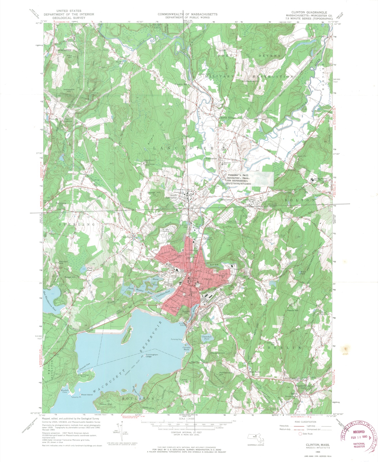
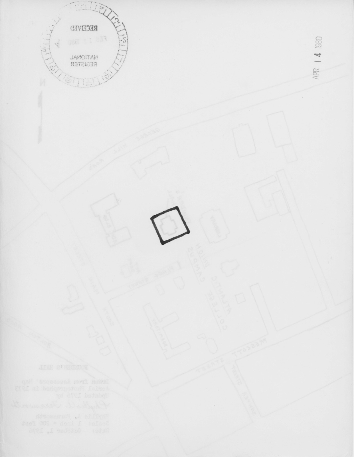
Photographs from the nomination case file, National Park Service records.
Founder's Hall
Listed on the National Register of Historic Places in
1980. A historic map-sheet match is not published yet. The record needs a coordinate-quality review before it can be joined to a sheet boundary.
From the record
one of 500 National Register listings in Worcester County · listed in 1980 · category: Building · one of 1 National Historic Landmarks in Worcester County.
National Register reference number.80001678- the number the National Park Service assigned this property when it was listed, and the key its nomination file is catalogued under at the National Archives.
Fires near this property
103 since 2002
Regional context, not property-specific
evidence. The
federal wildfire occurrence database
lists 103 fires within 5 miles of Founder's Hall between
2002 and 2020, burning about 2,729 acres in total. None started naturally. 5 were recorded as arson.
Distance is straight-line from the map coordinates, so a fire counted
here may appear on a neighbouring settlement's page as well.
Reported cause
Fires
Debris and open burning
47
Missing data/not specified/undetermined
25
Recreation and ceremony
14
Arson/incendiarism
5
Smoking
5
Equipment and vehicle use
4
Misuse of fire by a minor
3
The most recent of
them, most recent first, with the day each was reported and the service
that recorded it.
Regional context, not property-specific
evidence. Museums hold 1,940 specimens
collected within 10 miles of Founder's Hall between 1859 and
1974: 1,134 Animalia, 499 Plantae, 294 Fungi, 6 Unrecorded, 5 Chromista, 2 Protozoa. 12 distinct Species records are shown.
Collected by A. C. Gibson, A. Ferrett, A. G. Chandler and others. Each is a
physical object with a catalogue
number, and each entry opens the museum's record. This is what was
collected and kept, not a survey of what lives here - nothing can be
concluded from a species being absent.
Regional context, not property-specific
evidence. The federal mineral resources record lists
13 workings within 5 miles of Founder's Hall: 8 past producers, 4 producers, 1 prospect.
4 still produce. What was taken out: Sand and Gravel, Construction, Peat, Iron, Zinc. Distance is straight-line from the
map coordinates, so a quarry counted here may appear on a neighbouring
settlement's page as well.
Regional context, not property-specific
evidence. The National Weather Service names
Lancaster, the town this property stands in, in 8 storm reports between 2005 and 2026: 6 thunderstorm wind, 1 hail, 1 funnel cloud.
No death or injury is recorded in these reports. Each account below is quoted exactly as the forecast office
filed it, from the NOAA Storm Events Database, and each date
opens the federal record of that event.
1 paper published in this town,
digitised by the Library of Congress and free to read: 0 issues,
0 pages. Every page is searchable, so a name or a street can be
looked for directly in what the town printed about itself at the time.
No historic map-sheet match is published
for this property yet. That does not mean no map exists. This record needs
a coordinate-quality review before it can be joined to a sheet boundary.
Browse the county's mapped places while that work is
pending.
From the nomination file
2,278 words on record
When this property was proposed for the
National Register, someone wrote the case for it: what the building is,
and why it matters. That document is a federal record in the public domain.
It is quoted below word for word, never summarised. The text was read off the scanned case file by machine, so the
occasional stray character is the recogniser's and the 1970s
typewriter's.
Description of the property
Founder's Hall is located at the center of the campus of Atlantic Union College, approximately 200' north of Flagg Street and 400' west of South Main Street in South Lancaster. Land surrounding the building is laid out in lawns, paths and planting beds. Founder's Hall is a two-and-one-half story structure of balloon-frame construction with decorative elements drawn from both the Victorian Gothic and Queen Anne styles. The structure has a basically rectangular plan with a projecting central pavilion on both its east and west elevations. The building rests on a high brick foundation and is enclosed by a steeply pitched hip roof with gables over both pavilions; all roofs terminate in open eaves with exposed rafters.
The exterior is covered with clapboards, some vertical tongue-and-groove boarding and decorative shingling (in the gables only). The facade (west elevation) is symmetrical; at its center is a one-bay deep pavilion. Set in front of the pavilion is an open porch. This porch sits on a base which is enclosed by lattice-work; rising from the base are chamfered posts which support a shed roof and a decorative gable at the porch's center. Decorative trim of the porch consists of a shingled railing surmounted by squat turned balusters, pierced brackets, an apron beneath the cornice and decorative panelling on the end gables ofthe shed roof (north and south).
At the first story the pavilion contains an entry with panelled doors and a five-pane transom, flanked on each side by one 4/4 window; these windows are set in unmoulded frames and have caps decorated by shallow brackets and a bank of saw-tooth trim. All windows of the building's first two stories have this decorative trim.and are made up of units containing 4/4 sash.
/Architect Barker & Nourse, Architects (Worcester, MA) Statement of Significance (in one paragraph) Founder's Hall retains the integrity of its original design, setting, materials, workmanship, location and historical associations with the development of the private educational system of the Seventh-Day Adventist Church, a system which has a current enrollment of 535,000 students. The building was constructed in the winter of 1883- 1884 under the direction of Elder Stephen N. Haskett, a founder of the Adventist Church, from plans prepared by the Worcester architectural firm of Barker and Nourse in 1883. It is now the oldest extant educational building in the Adventist system. Haskell financed the project by floating a stock issue of $75,000 among the 15,000 Adventists of the time.
Wood for the building's construction was cut in a local woodlot and much of the construction labor was donated without charge. Upon completion, Founder's Hall housed the South Lancaster Academy. Later, the building was used as the administration building of Lancaster Juniox, College and of its successor, the Atlantic union college. Subsequently, the building was in use as the College's Music Conservatory until 1975-1976 when it was restored and converted to the school's Religion center. Included in this last change of use was the opening of a museum room containing Adventist memorabilia and historical documents.
Also included in the building is the Miller Chapel, restored in 1975-1976, in which are exhibited oil portraits of William and Lucy Paulina Miller, leaders of the Millerite Movement of the 1830's and 1840's out of which Adventism grew, as painted by American primitive painter Horace Bundy. In addition, the chapel contains a rare 1843 Millerite Chart, the oak pulpit and rostrum furniture from Miller's church. Soon to be installed is a tracker organ make by John Steer.
Quoted from the National Register nomination
for reference 80001678, 11 pages, held by the National Archives in Record
Group 79. See the
catalogue record.
Listed places nearby
6 within 8 miles
Other National Register properties close
enough to walk or drive between, ordered by distance from this one. Both
positions come from the same geocoding pass that matched these properties
to their map sheets.
Listing record. National Park Service National Register of Historic Places, listed-properties dataset, current to 2026-05-22.
Map join. Address geocoded through the United States Census geocoder, then tested against the published boundary of every sheet in the USGS Historical Topographic Map Collection.
How this page is made. Listing fields come from federal records; map-sheet coverage is a labelled coordinate-to-boundary calculation, not a source-field claim.
Wildfire. Short, Karen C. 2022. Spatial wildfire occurrence data for the United States, 1992-2020 [FPA_FOD_20221014]. 6th Edition. Fort Collins, CO: Forest Service Research Data Archive. https://doi.org/10.2737/RDS-2013-0009.6 Collected with United States Government funding and usable without additional permissions or fees.
Specimens. Global Biodiversity Information Facility (GBIF), https://www.gbif.org/. Only records licensed CC0 or CC BY are used. Records licensed CC BY-NC are excluded because this site carries advertising. Images are checked individually and any whose licence is non-commercial, no-derivatives or unreadable is refused.
Mines and quarries. USGS Mineral Resources Data System (MRDS) https://mrdata.usgs.gov/mrds/ A work of the United States government, no copyright under 17 U.S.C. 105.
Storms. NOAA National Centers for Environmental Information, Storm Events Database https://www.ncei.noaa.gov/stormevents/ A work of the United States government, no copyright under 17 U.S.C. 105. Narratives are quoted verbatim from the National Weather Service report and are not edited or summarised.
 Block
Block