BlockBefore
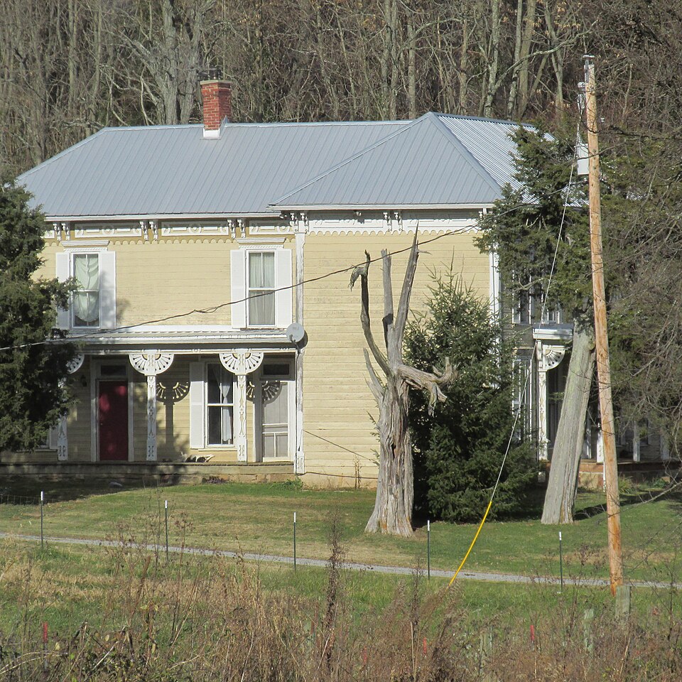
Photograph of Eubanks-Tytus House
Photograph by Aesopposea, CC BY-SA 3.0. Via Wikimedia Commons.

Eubanks-Tytus House

Listed on the National Register of Historic Places in 1979. A historic map-sheet match is not published yet. The record needs a coordinate-quality review before it can be joined to a sheet boundary.

From the record

one of 14 National Register listings in Highland County · listed in 1979 · category: Building.

Sources: the case file at the National Archives · the National Register database, National Park Service

The listing

  • What is counted as historic. The nomination lists 1 building as contributing to the listing.
  • Address. SE of Hillsboro on OH 41, Hillsboro, 45133
  • When was it listed? 1979-02-27
  • Category. building
  • Township. Brushcreek township
  • National Register reference number. 79001865 - the number the National Park Service assigned this property when it was listed, and the key its nomination file is catalogued under at the National Archives.

Fires near this property

9 since 2003

Regional context, not property-specific evidence. The federal wildfire occurrence database lists 9 fires within 5 miles of Eubanks-Tytus House between 2003 and 2020, burning about 44 acres in total. None started naturally. None was recorded as arson. Distance is straight-line from the map coordinates, so a fire counted here may appear on a neighbouring settlement's page as well.

Reported cause Fires
Debris and open burning5
Missing data/not specified/undetermined4

The most recent of them, most recent first, with the day each was reported and the service that recorded it.

DateCause SizeReported by Name on the report
5 April 2006Missing data/not specified/undetermined1.0 acresOhio Department of Natural Resourcesnot named
24 April 2014Missing data/not specified/undetermined5.0 acresOhio Department of Natural Resourcesnot named
30 March 2013Debris and open burning1.5 acresOhio Department of Natural Resourcesnot named
19 March 2018Debris and open burning2.0 acresOhio Department of Natural Resources12505
16 March 2003Debris and open burningunder an acreOhio Department of Natural Resourcesnot named
8 November 2020Debris and open burning1.0 acresOhio Department of Natural Resources15914
17 November 2015Missing data/not specified/undetermined25 acresOhio Department of Natural Resources2545
17 November 2015Missing data/not specified/undeterminedunder an acreOhio Department of Natural Resources2994

Every fire recorded in Highland County

Specimens collected near this property

12 of 870 shown

Regional context, not property-specific evidence. Museums hold 870 specimens collected within 10 miles of Eubanks-Tytus House between 1876 and 1975: 448 Animalia, 360 Fungi, 49 Plantae, 10 Protozoa, 3 Unrecorded. 12 distinct Species records are shown. Collected by 14505, 14519, 14555 and others. Each is a physical object with a catalogue number, and each entry opens the museum's record. This is what was collected and kept, not a survey of what lives here - nothing can be concluded from a species being absent.

Image SpeciesYear Collected by Where, as recorded
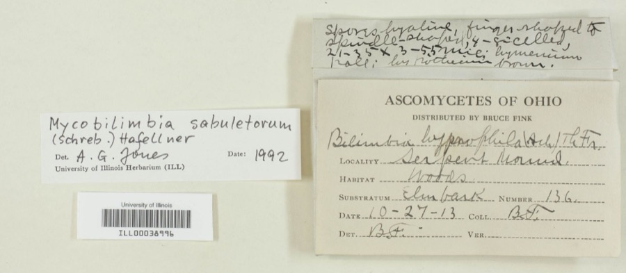
Specimen of Mycobilimbia sabuletorum (Schreb.) HafellnerMycobilimbia sabuletorum (Schreb.) Hafellner1913Bruce FinkSerpent Mound
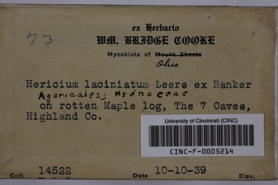
Specimen of Hericium coralloides (Scop.) Pers.Hericium coralloides (Scop.) Pers.1939Cooke, William BridgeSeven Caves (Highlands Nature Sanctuary)
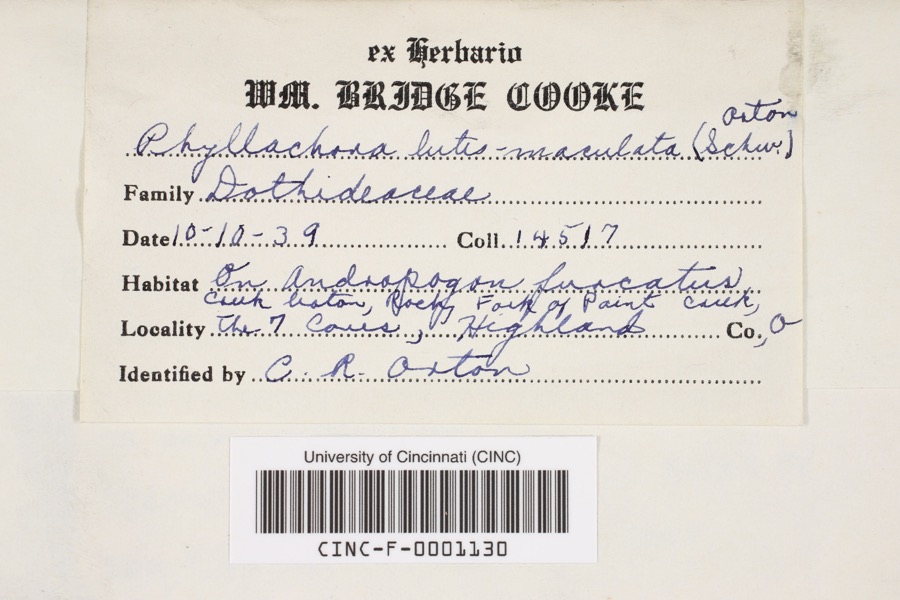
Specimen of Phyllachora luteomaculata (Schwein.) OrtonPhyllachora luteomaculata (Schwein.) Orton1939Cooke, William BridgeRocky Fork of Paint Creek at 7 Caves
A photograph of the species Cordyceps militaris, not of this specimenCordyceps militaris (L.) Link1876W. B. CookeFort Hill State Memorial
A photograph of the species Asplenium rhizophyllum, not of this specimenAsplenium rhizophyllum L.1910Hopkins, L.S."Caves" Paint Creek
A photograph of the species Cystopteris bulbifera, not of this specimenCystopteris bulbifera (L.) Bernh.1910Hopkins, L.S.Careo, Paint Creek
A photograph of the species Diplazium pycnocarpon, not of this specimenDiplazium pycnocarpon (Spreng.) M.Broun1910Hopkins, L.S.Caves Paint Cr., E Highland Co
A photograph of the species Pellaea glabella, not of this specimenPellaea glabella Mett. ex Kuhn1910Hopkins, L.S.Cares, Paint Creek, E Highland Co
A photograph of the species Polysporina simplex, not of this specimenPolysporina simplex (Flot.) Vzda1926Muegel, H.R.(?)east of Crooked Creek
Pipistrellus subflavus subflavus (F.Cuvier, 1832)1927Trautman, M. B. (Milton Bernard), Foster, R. B. (Robert B.) & Hines, J. (John)Dry Cave, Paint Twp., Highland Co., Ohio
A photograph of the species Desmognathus fuscus, not of this specimenDesmognathus fuscus (Rafinesque, 1820)1928Walker, C. F. (Charles F.)Dry Cave, Paint Twp., Highland Co., Ohio
A photograph of the species Eurycea bislineata, not of this specimenEurycea bislineata (Green, 1818)1928Walker, C. F. (Charles F.)Dry Cave, Paint Twp., Highland Co., Ohio

All 870 specimens within 10 miles, at the Global Biodiversity Information Facility.

Storms near this property

60 of 69 shown

Regional context, not property-specific evidence. The National Weather Service names Hillsboro, the town this property stands in, in 69 storm reports between 1994 and 2024: 41 thunderstorm wind, 18 hail, 7 flash flood, 1 tornado. No death or injury is recorded in these reports. Each account below is quoted exactly as the forecast office filed it, from the NOAA Storm Events Database, and each date opens the federal record of that event.

WhenEvent Place namedHarm What the report says
June 2021Flash FloodHillsboro$50,000A culvert was washed on on U.S. Route 62 near Northview Drive.
May 2006Tornado (F0)Hillsboro$30,000A brief tornado moved along a half mile path just north of Rocky Fork Lake. A restaurant along North Shore Road sustained minor siding damage. A real estate office along North Beach Road had portions of its aluminum roof peeled back or completely ripped off. The most extensive damage occurred to a residence about a tenth of a mile to the north-northeast of the real estate office. The home sustained major roof damage, and had an enclosed patio on its front porch completed removed and strewn behind the home. The majority of the patio was deposited into a deck and above ground pool behind the house, causing additional damage. A few trees between six and twelve inches in diameter were snapped between the real estate office and the residence.
July 2015Thunderstorm WindHillsboro$25,000Numerous trees were downed onto several houses along Ivy Hill Road. A garage door and wall were damaged at one residence. A few homes also had shingle and siding damage.
December 2013Thunderstorm WindHillsboro$20,000Trees were blown down county wide due to thunderstorm winds. Some of the debris caused roads to be closed.
June 2019Thunderstorm WindHillsboro$15,000Windows were blown out of the senior center in Hillsboro. Also large branches were knocked down.
May 2011Thunderstorm WindHillsboro$15,000Trees and power lines were down due to damaging thunderstorm winds. A barn was also damaged due to the winds.
May 2020Thunderstorm WindHillsboro$10,000A tree fell onto a vehicle.
June 2020Thunderstorm WindHillsboro$10,000Numerous trees were reported knocked down throughout the city.
June 2020Thunderstorm WindHillsboro$10,000Approximately ten large trees were knocked down at the Hillsboro Cemetery.
June 2019Thunderstorm WindHillsboro$10,000Some large branches were broken along with roof and window damage.
January 2012Thunderstorm WindHillsboro$10,000Several trees were reported down and roof damage occurred due to damaging thunderstorm winds.
February 2008Thunderstorm WindHillsboro$10,000A tree was knocked down on a house, causing minor damage.
May 2003Thunderstorm WindHillsboro$10,000A roof was blown off a mobile home and several trees up to two feet in diameter were snapped near the base of the trunk along Dade Road. A storm survey determined the damage was caused by straight line winds, with gusts estimated up to 70 MPH.
May 1998Thunderstorm WindHillsboro$10,000Winds lifted a roof off a building. Also, trees were downed some of which fell on cars.
May 2024Thunderstorm WindHillsboro$5,000A few large trees were downed and a fence was blown over at Liberty Park.
May 2016Thunderstorm WindHillsboro$5,000Several trees were downed in the Hillsboro area. Power lines were also downed on Woodland Drive.
May 2011Thunderstorm WindHillsboro$5,000Trees were blown down due to damaging thunderstorm winds. One tree fell onto a house due to the winds.
June 2002Thunderstorm WindHillsboro$5,000Several trees were knocked down.
March 2001Thunderstorm WindHillsboro$5,000Numerous trees down citywide
July 1999Thunderstorm WindHillsboro$5,000Numerous large tree limbs were knocked down, some of which fell across roads.
July 1994HailHillsboro$5,000Trees were downed and large hail fell.
July 1994Thunderstorm WindHillsboro$5,000Trees were downed and large hail fell.
September 1996Flash FloodHillsboro$5,000no account filed
April 2020Thunderstorm WindHillsboro$4,000Trees were knocked down along Ohio Route 73 near Diven Road.
June 2020Thunderstorm WindHillsboro$4,000Several large trees were knocked down along OH-124.
September 2024Thunderstorm WindHillsboro$3,000A few trees were downed.
February 2009Thunderstorm WindHillsboro$3,000Trees were knocked down.
August 2009Thunderstorm WindHillsboro$3,000Trees and powerlines were reported down due to damaging thunderstorm winds.
June 2008Thunderstorm WindHillsboro$3,000Trees were knocked down.
December 2006Thunderstorm WindHillsboro$3,000Several large tree limbs were downed.
May 2004Thunderstorm WindHillsboro$3,000Several trees were knocked down. One large 10 inch limb fell across State Route 73.
November 2004HailHillsboro$3,000Power poles were also downed.
August 2003Thunderstorm WindHillsboro$3,000Trees were knocked down.
June 2001Thunderstorm WindHillsboro$3,000Trees down throughout town
October 2001Thunderstorm WindHillsboro$3,000Trees and powerlines were blown down in town.
June 1998Thunderstorm WindHillsboro$3,000Trees downed.
July 1995Thunderstorm WindHillsboro$3,000Several trees downed.
May 2009HailHillsboro$3,000no account filed
May 2010Flash FloodHillsboro$2,000Flash flooding occurred on many streets and rural roads across the county.
April 2017Thunderstorm WindHillsboro$1,000A tree was knocked down along Green Road.
June 2014Thunderstorm WindHillsboro$1,000A tree was downed on Careytown Road due to thunderstorm winds.
November 2013Thunderstorm WindHillsboro$1,000A storage shed was blown off of its foundation due to thunderstorm winds.
June 2012Thunderstorm WindHillsboro$1,000The power was reported out due to damage caused by thunderstorm winds.
July 2012Thunderstorm WindHillsboro$1,000A large tree was downed due to damaging thunderstorm winds.
July 2012Thunderstorm WindHillsboro$1,000A tree was down on Dunlap Road due to thunderstorm winds.
May 2012Flash FloodHillsboro$1,000Very high water was reported over Route 62 and Highway 50 due to heavy rain.
August 2010Thunderstorm WindHillsboro$1,000Large limbs were reported down due to damaging thunderstorm winds.
July 2002Thunderstorm WindHillsboro$1,000Two foot diameter trees were blown down, blocking the access to hiking trails in Paint Creek State Park.
July 2019FloodHillsboro-A few roads had high water on them in the Hillsboro area.
June 2014Heavy RainHillsboro-A few inches of water was over roadways due to heavy rainfall.
April 2005Flash FloodHillsboro-A vehicle became trapped in high water on State Route 247 south of Hillsboro.
May 2002Flash FloodHillsboro-High water covered the intersection of Blazer Road and US Route 50.
April 1999Flash FloodHillsboro-Heavy rainfall caused street flooding in town.
July 1994HailHillsboro-Hail combined with gusty winds did significant crop damage to corn fields.
April 2020HailHillsboro-no account filed
May 2019HailHillsboro-no account filed
July 2011HailHillsboro-no account filed

Every storm recorded in Highland County

Newspapers printed here

0 digitised pages

1 paper published in this town, digitised by the Library of Congress and free to read: 0 issues, 0 pages. Every page is searchable, so a name or a street can be looked for directly in what the town printed about itself at the time.

NewspaperPublished
The News-Herald1886 to 1973

Map coverage status

No historic map-sheet match is published for this property yet. That does not mean no map exists. This record needs a coordinate-quality review before it can be joined to a sheet boundary. Browse the county's mapped places while that work is pending.

From the nomination file

1,369 words on record

When this property was proposed for the National Register, someone wrote the case for it: what the building is, and why it matters. That document is a federal record in the public domain. It is quoted below word for word, never summarised. The text was read off the scanned case file by machine, so the occasional stray character is the recogniser's and the 1970s typewriter's.

Description of the property

wall construction is beveled siding, now painted yellow. The CONDITION DATE UNEXPOSED door on the second story opening onto the porch roof, and centered just above the main entrance. The house has a three bay wide open frame porch on the Italianate Influence architecture.It has a T-shape and the frieze is a scalloped architrave. CHECK ONE Chimneys are located on either end of the front portion house is surrounded by a white rail fence. of the house, with one chimney centered on the base of the T, _FAIR -GOOD - MOVED porch area, and cornice are painted white. The foundation roof is hipped, made of tin, and now painted red. Trim, shutters, front facade and on both sides of the rear wing. The porches are entablature with a saw-toothed vase.

Paneled frieze under the roofline with double bracked cornice. The under the roofline RUINS is made of cut coursed sandstone. wish two lights over two.. Hoodmolds over.the..rectangular windows Windows have double hung sash No original outbuildings remain of this 1860 house.The are five bays on the front and three on the side. - AREAS OF

Statement of significance

The Anthony Eubanks House is a unique and highly decorative structure significant primarily for its architecture. Anthony Eubanks built his house on what was to become line, c. 1860. The Eubanks family were early settlers in the Highland-Pike county area, having originated in Maryland ana come Italianate Influence architecture in rural southern Ohio. daughter, Cynthia. Anthony Eubanks, builder of this house, placed on the site. much to the scandel and horror of the community. The house remains as an outstanding example of the Italianate influenced this period was obviously carefully calculated. The wooden forms of course permitted the builder greater freedom to develop the whimsical millwork of the porches and cornice.

1500-1599 ART COMMERCE ARCHEOLOGY-HISTORIC PERIOD BUILDER/ARCHITECT THEATER SIGNIFICANCE PHILOSOPHY 1900- SCULPTURE POLITICS/GOVERNMENT EXPLORATION/SETTLEMENT INDUSTRY MILITARY MUSIC LITERATURE _COMMUNICATIONS _1700-1799 _TRANSPORTATION -ARCHEOLOGY-PREHISTORIC _AGRICULTURE The Eubanks family settled in the Highland-Pike county _1600-1699 _RELIGION _EDUCATION St. Rt.4l, in Highland County, just west of the Pike County - 1400-1499 of the out the to Ohio via Kentucky.The house is an excellent example of Victorian .ENGINEERING between 1835-l840,named in honor of his wife, Anna, and In the late l880's two maiden aunts resided in the house, area in 1807 when they bought land from Nathaniel Massie.

LAW One INVENTION and were robbed by the outlaw, Bob Mackimie, in this house,

The whole case file for this property - 1,369 words, 11 pages, reproduced complete.

Quoted from the National Register nomination for reference 79001865, 11 pages, held by the National Archives in Record Group 79. See the catalogue record.

Listed places nearby

2 within 8 miles

Other National Register properties close enough to walk or drive between, ordered by distance from this one. Both positions come from the same geocoding pass that matched these properties to their map sheets.

Photograph PropertyDistance Listed
Barretts Mills3.9 miles1972
Barretts Mills (Boundary Increase)3.9 miles1979

Sources for this property

National Archives recordThe nomination case file for reference 79001865 in Record Group 79.
Highland CountyAll 14 listed properties in this county.

Provenance

  • Listing record. National Park Service National Register of Historic Places, listed-properties dataset, current to 2026-05-22.
  • Map join. Address geocoded through the United States Census geocoder, then tested against the published boundary of every sheet in the USGS Historical Topographic Map Collection.
  • How this page is made. Listing fields come from federal records; map-sheet coverage is a labelled coordinate-to-boundary calculation, not a source-field claim.
  • Wildfire. Short, Karen C. 2022. Spatial wildfire occurrence data for the United States, 1992-2020 [FPA_FOD_20221014]. 6th Edition. Fort Collins, CO: Forest Service Research Data Archive. https://doi.org/10.2737/RDS-2013-0009.6 Collected with United States Government funding and usable without additional permissions or fees.
  • Specimens. Global Biodiversity Information Facility (GBIF), https://www.gbif.org/. Only records licensed CC0 or CC BY are used. Records licensed CC BY-NC are excluded because this site carries advertising. Images are checked individually and any whose licence is non-commercial, no-derivatives or unreadable is refused.
  • Storms. NOAA National Centers for Environmental Information, Storm Events Database https://www.ncei.noaa.gov/stormevents/ A work of the United States government, no copyright under 17 U.S.C. 105. Narratives are quoted verbatim from the National Weather Service report and are not edited or summarised.