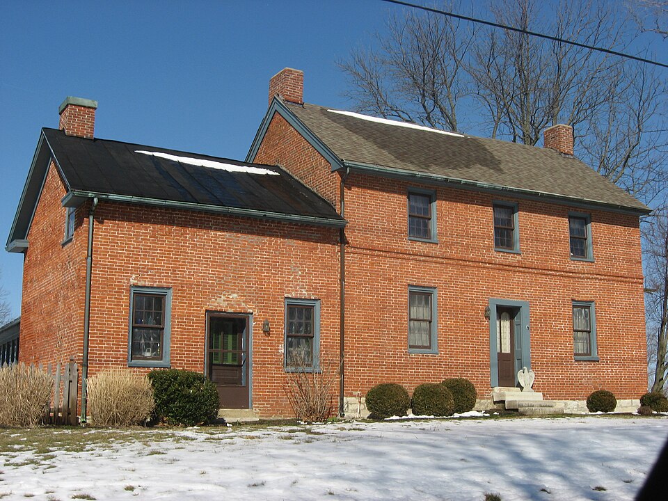
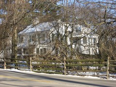
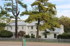
Listed on the National Register of Historic Places in
1979. A historic map-sheet match is not published yet. The record needs a coordinate-quality review before it can be joined to a sheet boundary.
From the record
one of 117 National Register listings in Montgomery County · listed in 1979 · category: Building · one of 4 National Historic Landmarks in Montgomery County.
National Register reference number.79001897- the number the National Park Service assigned this property when it was listed, and the key its nomination file is catalogued under at the National Archives.
The settlement having been established in Washington Township, were soon others to recognize the fertility and advantages of the place, ai the course of a very few years, many families were located in the vicin: the present town of Centerville.
In October, 1815, a meeting of the respectable gentlemen of the con was called at the house of John Archer, Centerville, to discuss the feasihi of establishing a woolen and cotton factory on Hole' s Creek. Books for st subscription were opened immediately after the meeting, and, January 1816, the trustees met at the same place to elect a superintendent and let c tracts for building the factory, digging the race, making the dam and for ir wright work.
Regional context, not property-specific
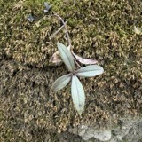
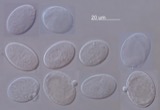
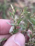
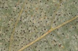
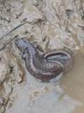
evidence. Museums hold 104 specimens
collected within 10 miles of Bradford, Robert, House between 1839 and
1975: 87 Animalia, 11 Plantae, 3 Chromista, 3 Fungi. 12 distinct Species records are shown.
Collected by A JOHN, A JOHN AND W E DUELLMAN, ANSEL JOHN and others. Each is a
physical object with a catalogue
number, and each entry opens the museum's record. This is what was
collected and kept, not a survey of what lives here - nothing can be
concluded from a species being absent.
Regional context, not property-specific
evidence. The National Weather Service names
Centerville, the town this property stands in, in 29 storm reports between 1995 and 2025: 15 thunderstorm wind, 11 hail, 2 flood, 1 tornado.
No death or injury is recorded in these reports. Each account below is quoted exactly as the forecast office
filed it, from the NOAA Storm Events Database, and each date
opens the federal record of that event.
A microburst producing winds of 70 to 75 mph did significant damage to a few trailers. Several homes sustained siding damage, and numerous trees were knocked down. A 30-foot tower was also downed.
The tornado initially developed just east of State Route 48 in Warren County, at 2358EST, April 2nd. The tornado moved northeast and entered Montgomery County at 2359 EST, just south of Elk Creek Drive. As the tornado moved northeast across far southeast Montgomery County, it cause sporadic tree damage. More large trees were uprooted and damaged along a portion of East Social Row Road, east of Mount Holly Avenue. Tree damage was also noted farther to the northeast near and along Nutt Road and Clyo Road, where the tornado dissipated at 0001EST, April 3rd.
Several large trees up to 15 inches in diameter were downed across the southern and eastern Dayton suburbs. A few homes sustained minor damage from falling trees near Farmersville.
Several reports of hail came in from spotters and a NWS employee. Hail of 2 inches fell south of Centerville. Seven minutes later, 1.5 inch hail was reported south of Miamisburg.
No historic map-sheet match is published
for this property yet. That does not mean no map exists. This record needs
a coordinate-quality review before it can be joined to a sheet boundary.
Browse the county's mapped places while that work is
pending.
From the nomination file
1,750 words on record
When this property was proposed for the
National Register, someone wrote the case for it: what the building is,
and why it matters. That document is a federal record in the public domain.
It is quoted below word for word, never summarised. The text was read off the scanned case file by machine, so the
occasional stray character is the recogniser's and the 1970s
typewriter's.
Description of the property
kitchen: The wood shed was incorporated into a family room addition on the western side in 1952. CONDITION EXCELLENT UNEXPOSED DESCRIPTION FAIR DETERIORATED CHECK ONE woodwork in a hired man's room in the upstairs back wing is simpler The pitched roof with asphalt shingles has close pitched with asphalt shingle. flank doorway and sidelights.A stone lintel is over the cornice. The original house had six rooms and still retains many of its original XGOOD and the enclosure of the porch on the south side to accomodate a new This typical Federal home has Flemish bond brick work on the front angle; the porch is now enclosed. gable end windows.
_UNALTERED original door is located in the center bay with a 3 light transom the addition of a garage to the south wing, a porch on the north side, lock and key. The 8 panel 3 pane transom. The barn is typical of Ohio, constructed in the period around 1840 with stone in detail. Entrance to this room is gained through a door with a lintels. foundation and overhang.The brace frame has vertical blank siding.The roof is The boxed Tongue and groove floors and the woodwork are white pine. Windows are 6/6 double hung sash with architraval frames and stone This door opens onto an outside porch in the re-entrant and sidelights.Corner blocks finish off a wood cornice.Pilasters A cherry banister graces the stairway.Walls are solid brick. The The original eagle waterheads are still in place.
facade and 8 course American bond brick elsewhere. cornice is decorated with an egg and dart freize and dentils.Two eaves.North gable has a stone engraved "Robert Bradford 1839". Carl who bought the house in the early l930's.These changes include -RUINS AREAS OF
Statement of significance
The Robert Bradford house is an excellent example of an early Federal The original barn, reportedly built before 1839,ois located south 1839 1700-1799 1500-1599 1400-1499 EDUCATION POLITICS/GOVERNMENT PHILOSOPHY PERIOD ARCHEOLOGY-HISTORIC SCULPTURE LAW PREHISTORIC THEATER INDUSTRY BUILDER/ARCHITECT SIGNIFICANCE TRANSPORTATION XARCHITECTURE LITERATURE ARCHEOLOGY-PREHISTORIC _COMMUNICATIONS MILITARY Robert Bradford XAGRICULTURE INVENTION MUSIC the environment continues to reflect the lifestyle of the Bradfords. SOCIAL/HUMANITARIAN held a number of jobs until he established his farm in Washington to carefully preserve the house. _EXPLORATION/SETTLEMENT barn does have a new roof of asphalt shingle.
_CONSERVATION _COMMERCE Thomas and Alma Elslager bought the house in l947 and have continued _1600-1699 James and Dorothy Carl began refurbishing the house in the l930's. a log cabin on their farm until the house was built in l839. _ENGINEERING -ECONOMICS - RELIGION -SCIENCE An immigrant from Ireland, Robert Bradford bought land this building west of the house. farm house.Little of the original building has been altered and The barn has a high stone foundation and has title to the land in l822. Robert had been trained as a weaver but Historical Society, 1977.
Quoted from the National Register nomination
for reference 79001897, 16 pages, held by the National Archives in Record
Group 79. See the
catalogue record.
Listed places nearby
6 within 8 miles
Other National Register properties close
enough to walk or drive between, ordered by distance from this one. Both
positions come from the same geocoding pass that matched these properties
to their map sheets.
Listing record. National Park Service National Register of Historic Places, listed-properties dataset, current to 2026-05-22.
Map join. Address geocoded through the United States Census geocoder, then tested against the published boundary of every sheet in the USGS Historical Topographic Map Collection.
How this page is made. Listing fields come from federal records; map-sheet coverage is a labelled coordinate-to-boundary calculation, not a source-field claim.
Specimens. Global Biodiversity Information Facility (GBIF), https://www.gbif.org/. Only records licensed CC0 or CC BY are used. Records licensed CC BY-NC are excluded because this site carries advertising. Images are checked individually and any whose licence is non-commercial, no-derivatives or unreadable is refused.
Storms. NOAA National Centers for Environmental Information, Storm Events Database https://www.ncei.noaa.gov/stormevents/ A work of the United States government, no copyright under 17 U.S.C. 105. Narratives are quoted verbatim from the National Weather Service report and are not edited or summarised.
 Block
Block