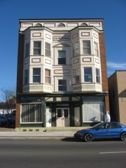
Listed on the National Register of Historic Places in
1979. A historic map-sheet match is not published yet. The record needs a coordinate-quality review before it can be joined to a sheet boundary.
From the record
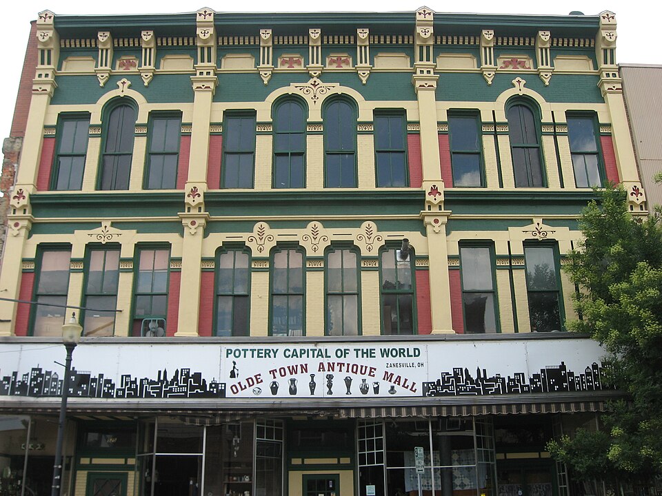
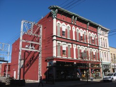
“The Black-Elliott Block is a historic commercial building in downtown Zanesville, Ohio, United States. Located along Main Street near the Muskingum County Courthouse, it was built in 1876 in the Italianate style of architecture.”
Wikipedia article Black-Elliott Block, CC BY-SA 4.0.
one of 70 National Register listings in Muskingum County · listed in 1979 · category: Building.
National Register reference number.79001914- the number the National Park Service assigned this property when it was listed, and the key its nomination file is catalogued under at the National Archives.
What happened here
An account from the chapter on Zanesville city, The inset identifies its exact
source book and publication year.
was so named in honor of Captain John C. Hazlett, of 2d O. V. I., and his cousin, Harry Hazlett, of the 5th U.S. Artillery, both of whom were killed during the Civil war; the post was organized June 1, 1881, with the following officers: C. C. Goddard, post commander; M. V. B. Kennedy, senior vice commander; Wilson C.
The first election for officers for the town of Zanesville was held April 2, 1814, and resulted in, the choice of William Craig, mayor; William Blocksom, recorder; Samuel Frazey, treasurer; Ezekial Bassett, appraiser; Peter Mills, George Reeve, Nathan C. Findlay and James Hampson, councilmen. Findlay refused to serve and John Hamm was chosen to fill the vacancy. The mayor-elect was an Irishman, and carpenter by trade, who came to the town in 1805, and with Thomas Moorehead erected the first Methodist church, in Second street; he was a devout Methodist and had the confidence of his neighbors, but had an insatiable ambition to hold public office; his elevation to the mayoralty caused him to aspire to gubernatorial honors and he became a candidate ; fifty-one votes were cast in his favor in Muskingum county, and none elsewhere, but he was ever after called '""Governor,'' and was pleased with the sobriquet. In 1817 he was appointed collector of county taxes and absconded with the money, located near St. Louis, where his wife joined him and where his investments in real estate made him very wealthy. His bondsmen were James' Mc- Guire, who was bankrupted; James Linder, who was nearly ruined; and James Herron and James Hampson, who were able to sustain the loss without injury.
July 2, 1819, the County Commissioners created Zanesville township, beginning on the Muskingum river on the line dividing the twelfth and thirteenth ranges; thence north to the military line; thence east to the line dividing the sixth and seventh ranges; thence north with said line to the line dividing the second townships of ranges six and seven; thence west to the Muskingum river and down it with the meanderings to the place of beginning. This tract embraces nearly all of what is now Wayne and Washington townships and the present city east of the river; Washington township was cut off June 5. 1822, and Wayne, \larch 6, 1826. Several amendments to the original act were made and March 19, 1850, an act was passed creating the city of Zanesville, which was to comprise so much of the county of Muskingum as was embraced within the limits of and designated in the records of the county as Zanesville township. The act divided the city into four wards, the east and west line of division being the center of the National road from the eastern boundary of the township to the intersection with the center of Fountain alley, and from that point with the center of the allev to the river; the north and south division line was the center of Cypress alley, from both sides of the city. The First ward was the southwest corner of the city as so divided: the Second ward, the northwest corner ; the Third ward, the southeast corner and the Fourth ward, the northeast corner. The mayor was to be
Regional context, not property-specific
evidence. The
federal wildfire occurrence database
lists 61 fires within 5 miles of Black-Elliott Block between
2002 and 2020, burning about 49 acres in total. None started naturally. 2 were recorded as arson.
Distance is straight-line from the map coordinates, so a fire counted
here may appear on a neighbouring settlement's page as well.
Reported cause
Fires
Debris and open burning
35
Power generation/transmission/distribution
7
Equipment and vehicle use
6
Missing data/not specified/undetermined
5
Smoking
3
Arson/incendiarism
2
Recreation and ceremony
2
Other causes
1
The most recent of
them, most recent first, with the day each was reported and the service
that recorded it.
Regional context, not property-specific
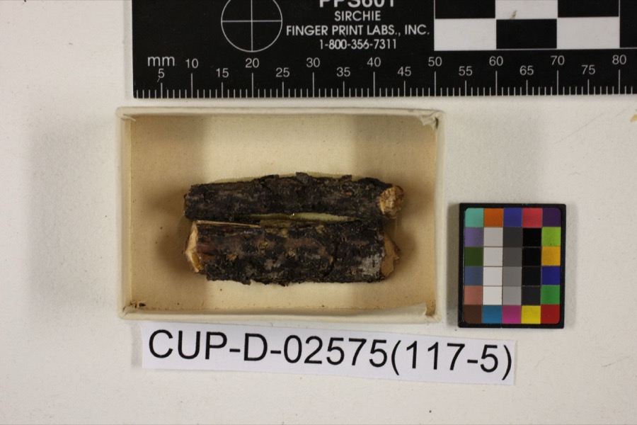
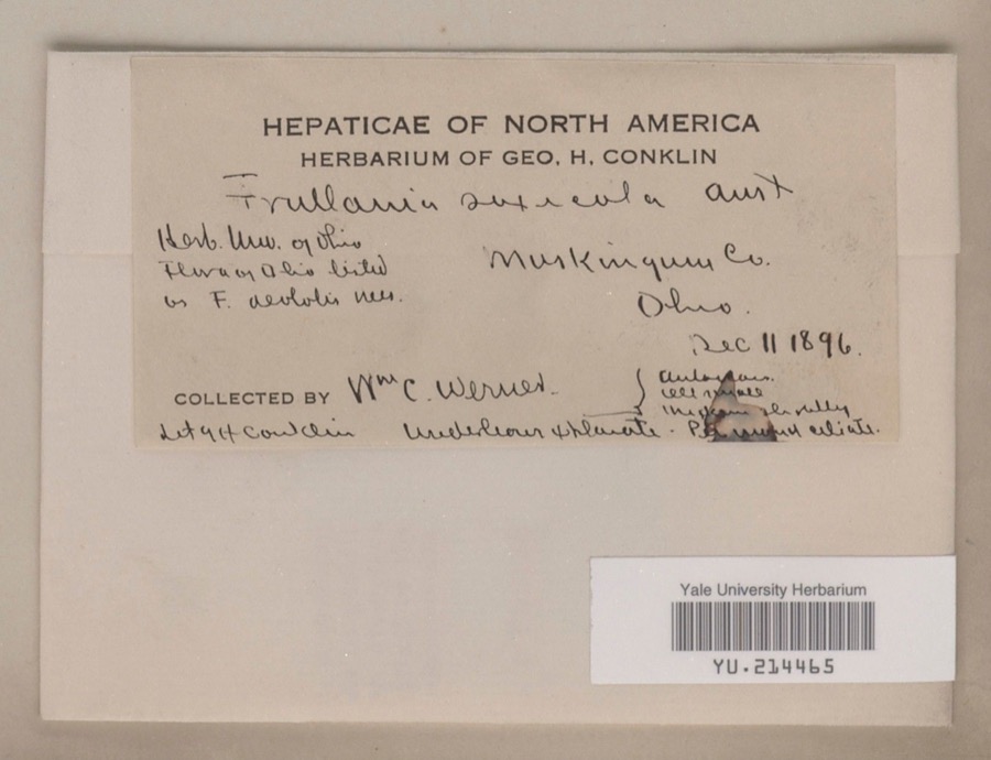
evidence. Museums hold 853 specimens
collected within 10 miles of Black-Elliott Block between 1873 and
1975: 741 Animalia, 87 Plantae, 15 Fungi, 5 Protozoa, 4 Unrecorded, 1 Chromista. 12 distinct Species records are shown.
Collected by A.E. Miller, Adams, W. (William), Trautman, M. B. (Milton Bernard) et al., Adams, W. M. and others. Each is a
physical object with a catalogue
number, and each entry opens the museum's record. This is what was
collected and kept, not a survey of what lives here - nothing can be
concluded from a species being absent.
Regional context, not property-specific
evidence. The federal mineral resources record lists
6 workings within 5 miles of Black-Elliott Block: 3 past producers, 3 producers.
3 still produce. What was taken out: Sand and Gravel, Construction, Iron. Distance is straight-line from the
map coordinates, so a quarry counted here may appear on a neighbouring
settlement's page as well.
Regional context, not property-specific
evidence. The National Weather Service names
Zanesville, the town this property stands in, in 113 storm reports between 1994 and 2026: 62 thunderstorm wind, 26 hail, 17 flash flood, 5 flood.
The reports record 1 death. Each account below is quoted exactly as the forecast office
filed it, from the NOAA Storm Events Database, and each date
opens the federal record of that event.
Thunderstorm winds blew down four power poles and power lines just north of Zanesville. Several trees were also reported down across the eastern part of the county.
Street flooding was reported in and near Zanesville after 1.30 inches fell in 20 minutes. Large branches were downed east of Zanesville. One branch fell on a passing motorist's car. There was no mention of any injuries.
No historic map-sheet match is published
for this property yet. That does not mean no map exists. This record needs
a coordinate-quality review before it can be joined to a sheet boundary.
Browse the county's mapped places while that work is
pending.
From the nomination file
1,309 words on record
When this property was proposed for the
National Register, someone wrote the case for it: what the building is,
and why it matters. That document is a federal record in the public domain.
It is quoted below word for word, never summarised. The text was read off the scanned case file by machine, so the
occasional stray character is the recogniser's and the 1970s
typewriter's.
Description of the property
ed for use as one large storeroom, although the original cast iron columns and place to the facade in the building's long life. break the plane of the middle portion of each story with three windows located over-one configuration. The most distinctive feature of the Black-Elliott Block serves to provide a sense of visual continuity to the building, as well as as well as at the cornice level. The lintels are enhanced by incised stylized the facade is capped with an elaborate, bracketed entablature which projects con- crowning each pilaster. Currently the facade, from the top of the storefront to the cornice, is the elements, also tends to homogenize the polychrome of the red brick and lighter CONDITION UNEXPOSED EXCELLENT UNALTERED applied trim.
XALTERED storerooms on its first story with various offices on the second and third.During X_ORIGINAL SITE CHECK ONE capitols were left intact and remain today.This alteration (probably also in- The entire entablature is capped with amolded corona broken by more floral motifs The Black-Elliott Block is a three-story commercial building built of brick in the outer bays.Two forms of arch are employed in the fenestration scheme of -DETERIORATED volving the removal of a cast iron storefront) is the only change to have taken floral patterns, more lavish in the center of the facade than at the outer reaches.
X GOOD decorated with stylized fleurs-de-lis patterns between the second and third story the building: round arches, located only on the thrid story; and flat-topped arches, divide the facade into the above-mentioned three sections. These pilasters are However, the center windows on the outer sections do feature the floral motif which DATE The upper stories are organized into three vertical sections.Four windows panels with concave rounded corners.The center panel on the outer bays and is its decorative ornamentation.
manis a prime example of the style, so prevalent in nineteenth-century commercial It was built under the ownership of Peter Black and Henry Elliott, prominent sible for the founding of the First National Bank and the construction, among others, a 36' frontage in the building, while Elliott held a 15' section, according to an a subsidiary of Kresge, opened here in 1916. In 1977 the Jupiter Store, another chrome which sets this style apart from other Italianate variations. 1400-1499 1500-1599 areas.
X1800-1899 SIGNIFICANCE PERIOD LAW THEATER AGRICULTURE ARCHEOLOGY-HISTORIC POLITICS/GOVERNMENT BUILDER/ARCHITECT COMMUNICATIONS unknown 1700-1799 ARCHEOLOGY-PREHISTORIC XARCHITECTURE LITERATURE ENGINEERING INDUSTRY _EXPLORATION/SETTLEMENT MILITARY _CONSERVATION _TRANSPORTATION _PREHISTORIC architecture in the city.In addition to its being the last of its kind, it re- probably the foremost entrepreneur of the city during his lifetime and was respon- _RELIGION _PHILOSOPHY years later.An early account of the business ventures of Peter Black makes reference _EDUCATION of High Victorian Italianate architecture, embodying the sense of detail and poly- _SCIENCE _COMMERCE _1600-1699 -SCULPTURE Zanesvillebusinessmen of the latter half of the century.Black (l8l9-l878) was present owner purchased the entire western portion remained in the he founded in 1885and was.operating at the time of his death fourteen the early days of its life.
_1900- - MUSIC Kresge affiliate, closed its doors after a long tenancy in the building. Until the of the Clarendon Hotel. and the nominated property. Black operated a business in 1890 plat of the downtown area. Elliott (1822-1899) was a Baltimore native who Zanesville as the only remaining example of High Victorian Italianate commercial The Black-Elliott Block is nominated for its significance to the city of the building for a time until a short-lived parternership was dissolved.Heowned to the"Black-Elliott it can be determined that it was thus known during _INVENTION
Quoted from the National Register nomination
for reference 79001914, 10 pages, held by the National Archives in Record
Group 79. See the
catalogue record.
Listed places nearby
6 within 8 miles
Other National Register properties close
enough to walk or drive between, ordered by distance from this one. Both
positions come from the same geocoding pass that matched these properties
to their map sheets.
Listing record. National Park Service National Register of Historic Places, listed-properties dataset, current to 2026-05-22.
Map join. Address geocoded through the United States Census geocoder, then tested against the published boundary of every sheet in the USGS Historical Topographic Map Collection.
How this page is made. Listing fields come from federal records; map-sheet coverage is a labelled coordinate-to-boundary calculation, not a source-field claim.
Wildfire. Short, Karen C. 2022. Spatial wildfire occurrence data for the United States, 1992-2020 [FPA_FOD_20221014]. 6th Edition. Fort Collins, CO: Forest Service Research Data Archive. https://doi.org/10.2737/RDS-2013-0009.6 Collected with United States Government funding and usable without additional permissions or fees.
Specimens. Global Biodiversity Information Facility (GBIF), https://www.gbif.org/. Only records licensed CC0 or CC BY are used. Records licensed CC BY-NC are excluded because this site carries advertising. Images are checked individually and any whose licence is non-commercial, no-derivatives or unreadable is refused.
Mines and quarries. USGS Mineral Resources Data System (MRDS) https://mrdata.usgs.gov/mrds/ A work of the United States government, no copyright under 17 U.S.C. 105.
Storms. NOAA National Centers for Environmental Information, Storm Events Database https://www.ncei.noaa.gov/stormevents/ A work of the United States government, no copyright under 17 U.S.C. 105. Narratives are quoted verbatim from the National Weather Service report and are not edited or summarised.
 Block
Block