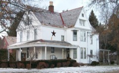
Listed on the National Register of Historic Places in
1979. A historic map-sheet match is not published yet. The record needs a coordinate-quality review before it can be joined to a sheet boundary.
From the record
“The settlement of this region, by reason of the subsequent exaltation of some of the pioneers and their descendents, presents more than ordinary claims to historic interest, as will be seen by the list. Seth Adams and Major Jonathan Cass came here in 1799.”
1794. History of Muskingum County, Ohio, with Illustrations and Biographical Sketches of Prominent Men and Pioneers (1882). Machine-read text.
one of 70 National Register listings in Muskingum County · listed in 1979 · category: Building.
National Register reference number.79001922- the number the National Park Service assigned this property when it was listed, and the key its nomination file is catalogued under at the National Archives.
What happened here
An account from the chapter on Falls township, The inset identifies its exact
source book and publication year.
Archibald McCann was very devoted to the welfare of the young people of his neighborhood, and on Sabbath gave his whole time to teaching ; opening school in the morning, and continuing all day - in studying the Bible. Mr. McCann was drowned in the canal at Zanesville, on the night of March 29th, 1839. "^^^ drawbridge had been left open, and, the night being dark, he did not discover it, and, walking off, fell into the water.
Abel Lewis came to Zanesville from Pennsylvania, in -the year 1800. It is said he was a man of unusual courage, although very cautious. Doubtless a man venturing fi-oni Pennsylvania into Ohio, at that time, was possessed of true courage. The following incident, related of him, evinces his caution : " Traveling on foot, when night came, in order to avoid the danger of being attacked by wild beasts while asleep, he climbed into a tree top, tied his arm to a limb with his pocket handkerchief, and passed the night safely." That the country was settled by such men, was svirely a guarantee of its development in the ways of civilization. Mr. Lewis was clerk of the court from 1803 to 181 1 ; he was a surveyor, also. He removed to the farm now occupied by his son, George J. Lewis, in 1812. George was a small boy at that time, and has lived on the old home place ever since. It is situated near the north boundary, and a little west of the median line of the township.
In 1825, Isaac Dillon engaged in manufacturing linseed oil, carpets, cloths, cassimeres, and satinet. His mills were located at the mouth of the Licking river, in West Zanesville. He had a sawmill just above the bridge, and a store in the brick building now standing between the railroad bridge and the Licking river. They have all passed away ! Others occupy the field, with industries larger and grander, but not moi^e important than those in their day.
Regional context, not property-specific
evidence. The
federal wildfire occurrence database
lists 34 fires within 5 miles of Tanner, William C., House between
2012 and 2020, burning about 30 acres in total. None started naturally. 2 were recorded as arson.
Distance is straight-line from the map coordinates, so a fire counted
here may appear on a neighbouring settlement's page as well.
Reported cause
Fires
Debris and open burning
14
Power generation/transmission/distribution
6
Missing data/not specified/undetermined
4
Equipment and vehicle use
4
Arson/incendiarism
2
Recreation and ceremony
1
Other causes
1
Smoking
1
Misuse of fire by a minor
1
The most recent of
them, most recent first, with the day each was reported and the service
that recorded it.
Regional context, not property-specific
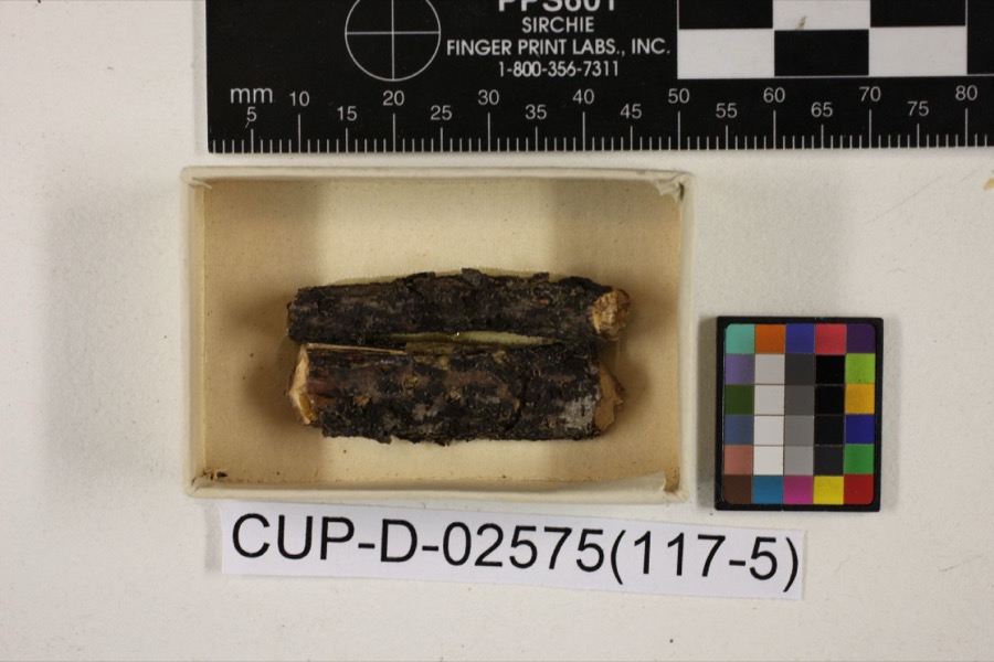
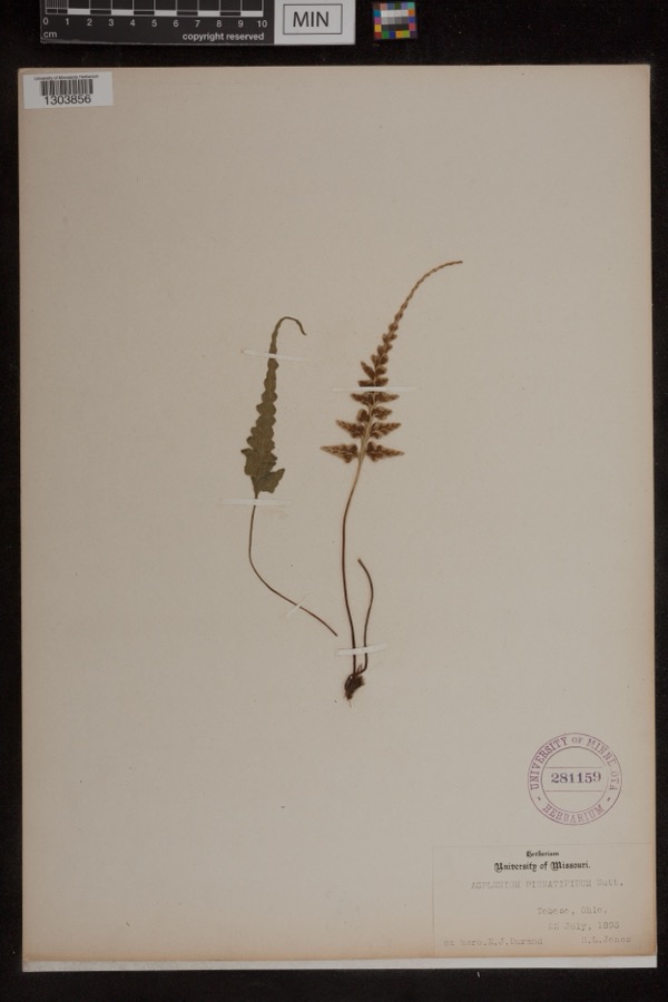
evidence. Museums hold 637 specimens
collected within 10 miles of Tanner, William C., House between 1866 and
1974: 534 Animalia, 68 Plantae, 25 Fungi, 5 Protozoa, 4 Unrecorded, 1 Chromista. 12 distinct Species records are shown.
Collected by A.E. Miller, Adams, W. M., Adler, K. K. and others. Each is a
physical object with a catalogue
number, and each entry opens the museum's record. This is what was
collected and kept, not a survey of what lives here - nothing can be
concluded from a species being absent.
Regional context, not property-specific
evidence. The federal mineral resources record lists
1 working within 5 miles of Tanner, William C., House: 1 past producer.
None of them still produces. What was taken out: Sand and Gravel, Construction. Distance is straight-line from the
map coordinates, so a quarry counted here may appear on a neighbouring
settlement's page as well.
Regional context, not property-specific
evidence. The National Weather Service names
Zanesville, the town this property stands in, in 113 storm reports between 1994 and 2026: 62 thunderstorm wind, 26 hail, 17 flash flood, 5 flood.
The reports record 1 death. Each account below is quoted exactly as the forecast office
filed it, from the NOAA Storm Events Database, and each date
opens the federal record of that event.
Thunderstorm winds blew down four power poles and power lines just north of Zanesville. Several trees were also reported down across the eastern part of the county.
Street flooding was reported in and near Zanesville after 1.30 inches fell in 20 minutes. Large branches were downed east of Zanesville. One branch fell on a passing motorist's car. There was no mention of any injuries.
No historic map-sheet match is published
for this property yet. That does not mean no map exists. This record needs
a coordinate-quality review before it can be joined to a sheet boundary.
Browse the county's mapped places while that work is
pending.
From the nomination file
1,553 words on record
When this property was proposed for the
National Register, someone wrote the case for it: what the building is,
and why it matters. That document is a federal record in the public domain.
It is quoted below word for word, never summarised. The text was read off the scanned case file by machine, so the
occasional stray character is the recogniser's and the 1970s
typewriter's.
Description of the property
support pillars and pilasters, molded capitals, a rather plain entablature, and an un- originally a summer kitchen, somewhat smaller in scale and sheathed in vertical unbattened inset gable-end chimneys and the ell has one chimney rising at the ridge of the roof as The interior of the Tanner House is rather plain in plan and ornament, aptly re- flecting the lifestyle and fortune of the early southeastern Ohio rural family. In plan, the structure is an I-house, but without the usual open-string stair and cen- tral hallway found in most houses using this time-tested, traditional room scheme. tained over 400 acres, the nominated tract contains only ten acres and no historic out- of the Licking River, and the subdivision of immediately adjacent land into building lots.
CONDITION FAIR with beveled poplar siding.The foundation is of sandstone with some vermiculated random-width flooring remains as do fireplaces. and housing a bedroom and bathroom. _DETERIORATED XALTERED voids are trabeated in form, with the fenestration featuring double-hung sash set in The stair is enclosed and rises from the area just inside the main entrance.
Most The William C.Tanner House is located in northwestern Muskingum County approximately CHECK ONE tooling.The exterior of the structure appears to be essentially unaltered from the The Tanner House is a wood frame structure of braced frame construction sheathed well as an external stove chimney set along the west wall;the vertical-sided portion is centered in the facade,although the original door itself has been removed.All _UNALTERED _UNEXPOSED side.There is a five-bay facade with a 34' frontage facing south.The main entrance _EXCELLENT -RUINS original 1-story gable-roof ell which contains the original kitchen, no longer used occurrances: the construction of Dillon Dam and State Park, with the subsequent flooding original.
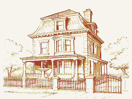
midwestern rural residence from'the second quarter of the nineteenth century and been ruined by the aforementioned Dillon Dam). Before emigrating westward, Edward of his death in 1831, he retained title to 444 acres. His son, William, youngest of ten that he lived all his life on the property, and died in the nominated house in 1894. With the outbreak of the Civil War, W.C. Tanner enlisted in the 97th Ohio Volunteer which he was known until his death thirty years later. Ill health precipitated an early the farm passed to his daughter, Harriett (Mrs. George) Kreager and shortly thereafter mains, and it stands today as a well-preserved example of vernacular domestic architecture. Taken in its local context, the Tanner House is noteworthy for its lack of alteration.
Most have had porches removed or radically altered, or, in the extreme, have been sheathed Dillon Dam and the resulting flooding of the Licking River less than one mile to the north, Tanner House survives only because of its relatively high location, above the flood 1700-1799 1600-1699 ARCHEOLOGY-HISTORIC COMMERCE AGRICULTURE RELIGION PERIOD THEATER ART SCULPTURE SIGNIFICANCE 1900- _PREHISTORIC XMILITARY PHILOSOPHY, _TRANSPORTATION XARCHITECTURE _LITERATURE _COMMUNICATIONS While there were many structures such as this in the early days of the township's settlement, buildings like this--folk houses ornamented with classical detail--are fast disappearing.
Quoted from the National Register nomination
for reference 79001922, 9 pages, held by the National Archives in Record
Group 79. See the
catalogue record.
Listed places nearby
6 within 8 miles
Other National Register properties close
enough to walk or drive between, ordered by distance from this one. Both
positions come from the same geocoding pass that matched these properties
to their map sheets.
Listing record. National Park Service National Register of Historic Places, listed-properties dataset, current to 2026-05-22.
Map join. Address geocoded through the United States Census geocoder, then tested against the published boundary of every sheet in the USGS Historical Topographic Map Collection.
How this page is made. Listing fields come from federal records; map-sheet coverage is a labelled coordinate-to-boundary calculation, not a source-field claim.
Wildfire. Short, Karen C. 2022. Spatial wildfire occurrence data for the United States, 1992-2020 [FPA_FOD_20221014]. 6th Edition. Fort Collins, CO: Forest Service Research Data Archive. https://doi.org/10.2737/RDS-2013-0009.6 Collected with United States Government funding and usable without additional permissions or fees.
Specimens. Global Biodiversity Information Facility (GBIF), https://www.gbif.org/. Only records licensed CC0 or CC BY are used. Records licensed CC BY-NC are excluded because this site carries advertising. Images are checked individually and any whose licence is non-commercial, no-derivatives or unreadable is refused.
Mines and quarries. USGS Mineral Resources Data System (MRDS) https://mrdata.usgs.gov/mrds/ A work of the United States government, no copyright under 17 U.S.C. 105.
Storms. NOAA National Centers for Environmental Information, Storm Events Database https://www.ncei.noaa.gov/stormevents/ A work of the United States government, no copyright under 17 U.S.C. 105. Narratives are quoted verbatim from the National Weather Service report and are not edited or summarised.
 Block
Block