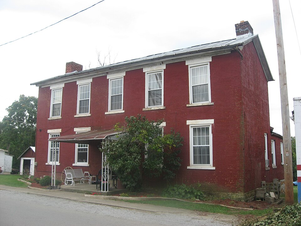
Listed on the National Register of Historic Places in
1980. A historic map-sheet match is not published yet. The record needs a coordinate-quality review before it can be joined to a sheet boundary.
From the record
“Ilia grandparents, both paternal and matornul, Uvod near Londomlerre. Ills paternal grandfather, Micluel Duffey, was horn in 1753, and died in June 1838, and his maternal grandfather, Thomas Ramsey, was born in 1749, and died in Sept. 1833.”
Caldwell's Illustrated Historical Atlas of Adams County, Ohio. 1797-1880 (1880). Machine-read text.
one of 12 National Register listings in Adams County · listed in 1980 · category: Building.
National Register reference number.80002931- the number the National Park Service assigned this property when it was listed, and the key its nomination file is catalogued under at the National Archives.
What happened here
An account from the chapter on Winchester township, The inset identifies its exact
source book and publication year.
studied medicine with Dr. William B. Willson, and had qualified himself for a physician, when death cut him off in his early manhood. He had just begun the practice of medicine at the time of his death. One of David Sinton's sisters never left Ireland, but married there. His other sister, who came with the remainder of the family to this country, married John Sparks, the banker, and died at Union Landing of the cholera, in 1833.
Was established about 1820, and called Scott, from the name of the township in which it was then situated, Winchester not then being a part of Scott. The office retained this name until April 1, 1880, when it was changed to Winchester.
The history of the Winchester public schools extends over a period of seventy-two years, during the first fifty-seven of which it existed as a sub-district, first of Scott, then of Winchester township. A correct chronology of the events of this period would be difficult to obtain. No certain record can be found, and we are forced to rely solely upon the personal recollections of individuals.
Regional context, not property-specific
evidence. The
federal wildfire occurrence database
lists 19 fires within 5 miles of Lewis, Dr. A. C., House between
2004 and 2020, burning about 55 acres in total. 1 started naturally. 2 were recorded as arson.
Distance is straight-line from the map coordinates, so a fire counted
here may appear on a neighbouring settlement's page as well.
Reported cause
Fires
Debris and open burning
11
Equipment and vehicle use
5
Arson/incendiarism
2
Natural
1
The most recent of
them, most recent first, with the day each was reported and the service
that recorded it.
Regional context, not property-specific
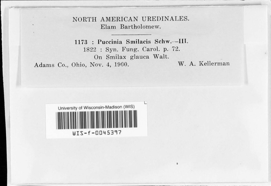
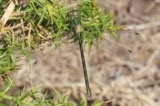
evidence. Museums hold 49 specimens
collected within 10 miles of Lewis, Dr. A. C., House between 1900 and
1975: 39 Animalia, 4 Fungi, 4 Plantae, 2 Protozoa. 12 distinct Species records are shown.
Collected by C. H. Krekeler, N. Krekeler, D. L. Donaldson, Dury, R. (Ralph) and others. Each is a
physical object with a catalogue
number, and each entry opens the museum's record. This is what was
collected and kept, not a survey of what lives here - nothing can be
concluded from a species being absent.
Regional context, not property-specific
evidence. The National Weather Service names
Winchester, the town this property stands in, in 19 storm reports between 1995 and 2024: 11 thunderstorm wind, 6 hail, 2 flash flood.
No death or injury is recorded in these reports. Each account below is quoted exactly as the forecast office
filed it, from the NOAA Storm Events Database, and each date
opens the federal record of that event.
Thunderstorm winds caused significant damage to the town. Trees were downed, sheds destroyed, several roofs blown off, and a church porch was destroyed. The winds were estimated to average 60 to 70 mph with gusts to around 100 mph.
No historic map-sheet match is published
for this property yet. That does not mean no map exists. This record needs
a coordinate-quality review before it can be joined to a sheet boundary.
Browse the county's mapped places while that work is
pending.
From the nomination file
1,714 words on record
When this property was proposed for the
National Register, someone wrote the case for it: what the building is,
and why it matters. That document is a federal record in the public domain.
It is quoted below word for word, never summarised. The text was read off the scanned case file by machine, so the
occasional stray character is the recogniser's and the 1970s
typewriter's.
Description of the property
wing has an end chimney but the fireplace has been covered up completely. tegrity it displays..It has retained the basic floorplan of an "I"house -Here the front entrance, although partly concealed under a one-bay aluminum porch, is probably the most- outstanding exterior feature of the house. -Here the a full classical "I" house. Each fireplace has at one side a tall shal- low built-in closet with paneled wooden doors. dows have lintels and lugsills and are double-hung, six/six sash. The There are no outbuildings associated with the nominated property; the opening. The house frontspiece with a semi-circular tioned modern aluminum porch.
terior width of the window opening several inches wider than the exterior cherry banisters and handrailing, and an unusual treatment of the frames Both fireplaces were al- of the two dining room windows. The one-story brick kitchen wing built off the dining room has a stone- tered in the late nineteenth century by the addition of a heavy cast-metal In an apparent effort to allow more light The only detraction from the house's exterior appearance is the aforemen- Since it could be easily removed and since lies approximately twelve feet from the street. a well-maintained two-story brick I" house laid in common bond.T lined cellar below, and an enclosed wooden porch undetermined age) -ruins Areas of Significance - Check and justify below - prehistoric - archeology-historic - science .
economics X social/ . engineering X 1800-1899 - 1900- - industry - politics/government _ invention Winchester's first resident physician, he came to the town in 1835 and The Lewis House derives secondary
Statement of significance
(in one paragraph) with an individual who was a leading abolitionist in the community of that was widely used in southern Ohio.The full classical I" house - commerce - conservation -archeology-prehistoric - community planning . landscape architecture - religion - agriculture X architecture -art arrival he became,acquainted with the Reva:John Rankin of Ripley and the Although there is no written documentation of this, it is probable is characteristic of housing built in Ohio from the early nineteenth prime example of an "I"--one room depth, two full stories, five bay facade, Specific dates ca. 1845 1600-1699 1500-1599 Winchester during the antebellum years.Dr.Abel Lewis is representative and end chimney placement.
Other houses of this type appear in the commu- Rev.Dyer Burgess of West Union,1eaders of the anti-slavery movement in Although the influence of the dominant southern Ohio, and soon became active in their cause.During this period Ohio.Lewis was a native of New York and studied medicine in Cincinnati. Winchester community was so divided on the issue of slavery that in 1848 Winchester's location along the established routes for runaway.slaves nity;however few retain such a high degree of integrity and none have tury till after the Civil War.
Quoted from the National Register nomination
for reference 80002931, 14 pages, held by the National Archives in Record
Group 79. See the
catalogue record.
Listed places nearby
2 within 8 miles
Other National Register properties close
enough to walk or drive between, ordered by distance from this one. Both
positions come from the same geocoding pass that matched these properties
to their map sheets.
Listing record. National Park Service National Register of Historic Places, listed-properties dataset, current to 2026-05-22.
Map join. Address geocoded through the United States Census geocoder, then tested against the published boundary of every sheet in the USGS Historical Topographic Map Collection.
How this page is made. Listing fields come from federal records; map-sheet coverage is a labelled coordinate-to-boundary calculation, not a source-field claim.
Wildfire. Short, Karen C. 2022. Spatial wildfire occurrence data for the United States, 1992-2020 [FPA_FOD_20221014]. 6th Edition. Fort Collins, CO: Forest Service Research Data Archive. https://doi.org/10.2737/RDS-2013-0009.6 Collected with United States Government funding and usable without additional permissions or fees.
Specimens. Global Biodiversity Information Facility (GBIF), https://www.gbif.org/. Only records licensed CC0 or CC BY are used. Records licensed CC BY-NC are excluded because this site carries advertising. Images are checked individually and any whose licence is non-commercial, no-derivatives or unreadable is refused.
Storms. NOAA National Centers for Environmental Information, Storm Events Database https://www.ncei.noaa.gov/stormevents/ A work of the United States government, no copyright under 17 U.S.C. 105. Narratives are quoted verbatim from the National Weather Service report and are not edited or summarised.
 Block
Block