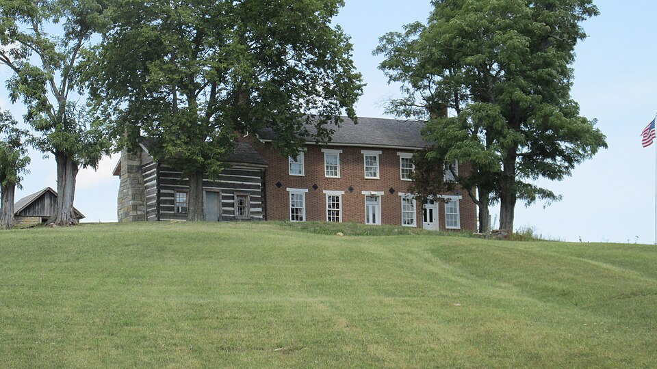
Listed on the National Register of Historic Places in
1977. A historic map-sheet match is not published yet. The record needs a coordinate-quality review before it can be joined to a sheet boundary.
From the record
“Near the village of Seaman in this township is the old homestead of the Silcott family where Craven Edward Silcott, once a prominent character in local aflFairs and county politics, was bom and reared. He resided for many years at the village of Youngsville near his old home where he was engaged in merchandising and conducted a general store.”
A History of Adams County, Ohio, from Its Earliest Settlement to the Present Time, Including Character Sketches of the Prominent Persons Identified with the First Century of the Country's Growth .. (1900). Machine-read text.
one of 12 National Register listings in Adams County · listed in 1977 · category: Building.
National Register reference number.77001039- the number the National Park Service assigned this property when it was listed, and the key its nomination file is catalogued under at the National Archives.
Seaman - This village was laid out after the extension of the Cincinnati and Eastern, now called the Cincinnati, Portsmouth and Virginia Railroad, from Winchester to Portsmouth. It is one of the new and thriving villages that have sprung up along the line of that railroad. It was laid out on the lands of Mrs. Ann Mower in 1888. A postc^ce was established in 1880 with A. Day first postmaster. The first stone in the place was kept by J. Q. Roads. It now contains two dry goods stores, one hardware and implement store, one millinery shop, two blacksmith shops, one saw-mill, two hotels, two livery ilables, aiKi has a population of 175 inhabitants. It is one of the pretty, thriving villages of Adams County.
Near the village of Seaman in this township is the old homestead of the Silcott family where Craven Edward Silcott, once a prominent character in local aflFairs and county politics, was bom and reared. He resided for many years at the village of Youngsville near his old home where he was engaged in merchandising and conducted a general store. While here he was nominated on the Democratic ticket for county auditor, in 1878, but was defeated at the election following, that campaign being r^^rded as the bitterest contest in the history of partisan politics in the county. In the campaign mentioned, one of his staunchest supporters was John P. Leedom, afterwards a member of Congress from Adams County. Silcott and Leedom became very close personal friends and when the lattdr was chosen Sergeant-at-Arms of the House after the expiration of his term as a member of that body, he persuaded Silcott to leave his business and took him to Washington and made him his cashier and chief accountant, a very responsible position. It was then the custom for the Sergeant to draw the salaries of members upon their vouchers, who checked on his cashier for funds. . In this manner hundreds of thousands of dollars came into the hands of the cashier for temporary care*
Regional context, not property-specific
evidence. The
federal wildfire occurrence database
lists 34 fires within 5 miles of Wilson, John T., Homestead between
2003 and 2020, burning about 106 acres in total. None started naturally. 5 were recorded as arson.
Distance is straight-line from the map coordinates, so a fire counted
here may appear on a neighbouring settlement's page as well.
Reported cause
Fires
Debris and open burning
15
Missing data/not specified/undetermined
12
Arson/incendiarism
5
Equipment and vehicle use
2
The most recent of
them, most recent first, with the day each was reported and the service
that recorded it.
Regional context, not property-specific
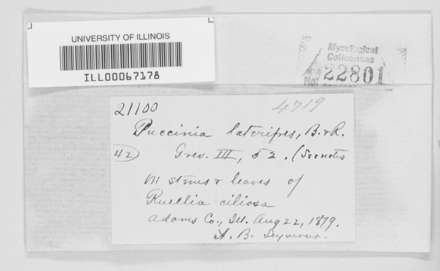
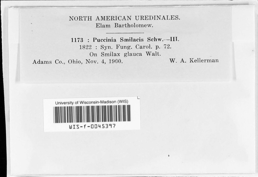
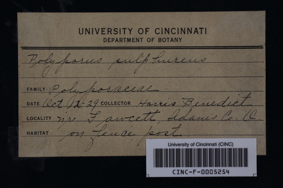
evidence. Museums hold 715 specimens
collected within 10 miles of Wilson, John T., Homestead between 1866 and
1975: 367 Animalia, 249 Fungi, 81 Plantae, 18 Protozoa. 12 distinct Species records are shown.
Collected by A. B. Seymour, A. J. Sharp, A. P. Boesel and others. Each is a
physical object with a catalogue
number, and each entry opens the museum's record. This is what was
collected and kept, not a survey of what lives here - nothing can be
concluded from a species being absent.
Regional context, not property-specific
evidence. The National Weather Service names
Seaman, the town this property stands in, in 25 storm reports between 1995 and 2025: 12 thunderstorm wind, 8 hail, 3 flash flood, 1 tornado.
No death or injury is recorded in these reports. Each account below is quoted exactly as the forecast office
filed it, from the NOAA Storm Events Database, and each date
opens the federal record of that event.
The tornado touched down in an open field west of Greenlee Road, about 1.2 miles northwest of Seaman. The first notable signs of damage occurred to a nearby pole barn, which partially collapsed. The tornado then moved just north of due east, snapping and uprooting numerous trees and large branches along Greenlee Road. There, some of the tin building material from the aforementioned barn was deposited. Additional tree damage continued into a grove along Mount Leigh Road. The tornado then crossed State Route 247 north of its intersection with Mount Leigh Road, about one mile north of Seaman. On the east side of the highway, a roof was partially removed from a single story home. Directly behind this home, two pole barns sustained heavy damage. Farther east, an aerial survey revealed continuous heavy tree damage along West Fork Ohio Brush Creek. The tornado caused destruction of outbuildings and roof damage to a single story home on State Route 770, just west of its intersection with Old State Route 32. The tornado then lifted. Based on the damage surveyed, the maximum estimated wind speed of this tornado was 100 mph.
No historic map-sheet match is published
for this property yet. That does not mean no map exists. This record needs
a coordinate-quality review before it can be joined to a sheet boundary.
Browse the county's mapped places while that work is
pending.
From the nomination file
1,931 words on record
When this property was proposed for the
National Register, someone wrote the case for it: what the building is,
and why it matters. That document is a federal record in the public domain.
It is quoted below word for word, never summarised. The text was read off the scanned case file by machine, so the
occasional stray character is the recogniser's and the 1970s
typewriter's.
Description of the property
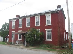
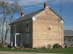
structure built ca. 1832. In 1844 a 2-story, brick house was connected to The north side has exposed logs. A small, not original, brick chimney has been The brick section is 2 x 5 bays with a one-story, shed roofed kitchen at the rear. equal bays each with a single 2/2 light window. Fenestration of the first floor is a one-room cellar under the east end of the home, beneath the general store. Both the east and west ends have small 4 light windows high in the gable placed extends across this portion. A one-story, flat roofed shed has been removed from CONDITION EXCELLENT FAIR CHECK ONE are assembled with half dovetail notching.The south and west sides have clapboard facade have flat stone 1intels with carved cornerstones.Windows have plain seam metal.
originally had a fieldstone chimney which has been torn down in recent years.The of the two eastern bays.Here a doorway is placed between the two windows.T XORIGINAL SITE opened into a large room used as a general store.All doors and windows of the _UNEXPOSED the east side of the house. The earliest portion of the John T. Wilson Homestead is a 1-l/2 story log the east side of the log portion. -GOOD siding. The front has a center door flanked by 6/6 light windows. Te west end not covered by the "L" has a window and a door. A metal roofed, open porch The 1og building is rectangular, built on an uncoursed fieldstone foundation. Logs Flemish bond is employed. The second story of the facade is divided into five The roof is standing seam metal. There are two interior end chimneys.
window is nearly square and is centered above the kitchen "L". The "L" has two windows on the north side and a door on the west.
John T. Wilson was a noted Ohio politician, abolitionist and philanthropist. He poor condition, is the only tangible remains of his life in southern Ohio. Born near Belfast in Highland County, Ohio in 1811, John T. Wilson moved to construction of a rather large, brick house. He designed his house so that one Underground Railroad. The stairway is still intact.
In the fall of 1861 Wilson helped organize the 70th Regiment of the Ohio Volunteer fifty years old at the time, Wilson led his company throughout the two-day battle a Civil War monument and $150,000 for the establishement of a "poor" fund which 1700-1799 INVENTION COMMERCE LAW COMMUNICATIONS CONSERVATION ART AGRICULTURE X1800-1899 EDUCATION BUILDER/ARCHITECT PERIOD RELIGION PHILOSOPHY INDUSTRY 1900- THEATER PREHISTORIC MILITARY TRANSPORTATION SIGNIFICANCE SCULPTURE _EXPLORATION/SETTLEMENT ARCHITECTURE and used this staircase and closet to hide slaves on their trip along the XSOCIAL/HUMANITARIAN -LITERATURE In 1863 he was nominated for the state senate without being a candidate and without Infantry and was appointed Captian of Company E of that unit.Although he was Wilson had made a fortune as a merchant and landowner and became well known for of Shiloh.Due to illness he was forced to resign his commission and return home.
(1864-66)and then served as US Representative for three terms(1866-1872).Mr. -1400-1499 -1600-1699 _ENGINEERING -SCIENCE -ECONOMICS MUSIC erection of a children's home in use today),$5,oo0 to Adams County for -COMMUNITY PLANNING was a very important historical figure in Adams County. This house, though in For twelve years a simple log structure served as his home; then in 1844 he began The most significant feature of the home, however, is a secret stairway his knowledge or consent was elected. He served in the Ohio Senate for two terms Serpent Mound to the Peabody Fund of Harvard University for its preservation. intact.
Quoted from the National Register nomination
for reference 77001039, 19 pages, held by the National Archives in Record
Group 79. See the
catalogue record.
Listed places nearby
3 within 8 miles
Other National Register properties close
enough to walk or drive between, ordered by distance from this one. Both
positions come from the same geocoding pass that matched these properties
to their map sheets.
Listing record. National Park Service National Register of Historic Places, listed-properties dataset, current to 2026-05-22.
Map join. Address geocoded through the United States Census geocoder, then tested against the published boundary of every sheet in the USGS Historical Topographic Map Collection.
How this page is made. Listing fields come from federal records; map-sheet coverage is a labelled coordinate-to-boundary calculation, not a source-field claim.
Wildfire. Short, Karen C. 2022. Spatial wildfire occurrence data for the United States, 1992-2020 [FPA_FOD_20221014]. 6th Edition. Fort Collins, CO: Forest Service Research Data Archive. https://doi.org/10.2737/RDS-2013-0009.6 Collected with United States Government funding and usable without additional permissions or fees.
Specimens. Global Biodiversity Information Facility (GBIF), https://www.gbif.org/. Only records licensed CC0 or CC BY are used. Records licensed CC BY-NC are excluded because this site carries advertising. Images are checked individually and any whose licence is non-commercial, no-derivatives or unreadable is refused.
Storms. NOAA National Centers for Environmental Information, Storm Events Database https://www.ncei.noaa.gov/stormevents/ A work of the United States government, no copyright under 17 U.S.C. 105. Narratives are quoted verbatim from the National Weather Service report and are not edited or summarised.
 Block
Block