BlockBefore
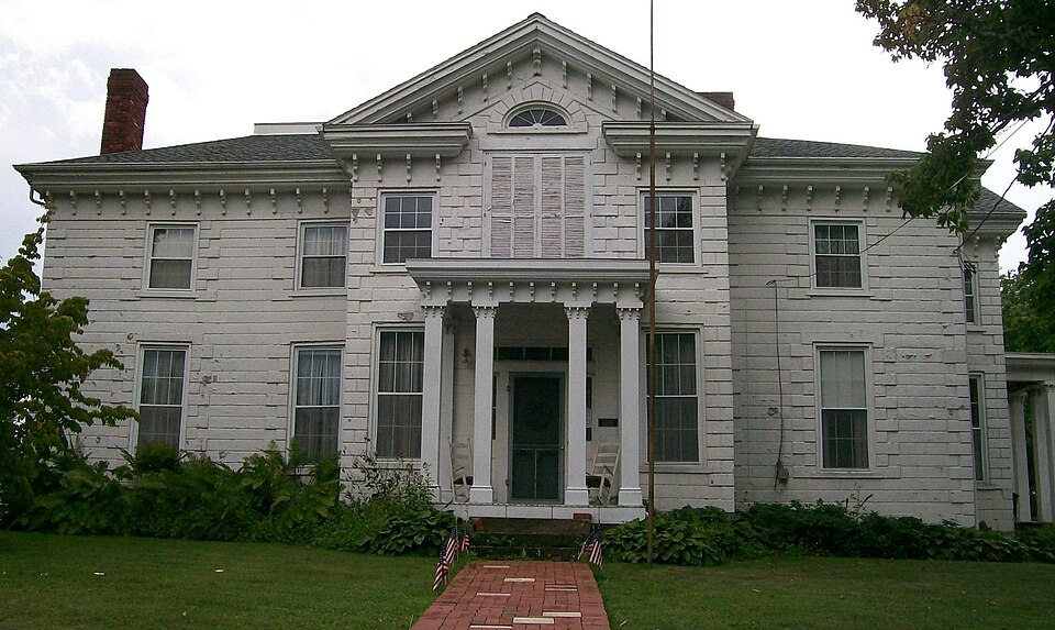
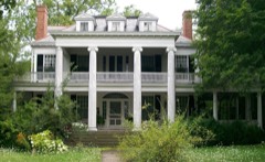
Photograph of Hollister-Parry House
Photograph by Bwsmith84, CC BY 3.0. Via Wikimedia Commons.

Hollister-Parry House

Listed on the National Register of Historic Places in 1980. A historic map-sheet match is not published yet. The record needs a coordinate-quality review before it can be joined to a sheet boundary.

From the record

“The Hollister-Parry House is a historic residence in the village of Woodsfield, Ohio, United States. Built in the middle of the 19th century, it has been named a historic site and converted into a museum.”

Wikipedia article Hollister-Parry House, CC BY-SA 4.0.

one of 9 National Register listings in Monroe County · listed in 1980 · category: Building.

Sources: the Wikipedia article · the case file at the National Archives · the National Register database, National Park Service

The listing

  • What is counted as historic. The nomination lists 1 building as contributing to the listing.
  • Address. 217 Eastern Ave., Woodsfield, 43793
  • When was it listed? 1980-04-16
  • Category. building
  • Township. Center township
  • Architectural style. Italianate architecture, Renaissance Revival architecture
  • National Register reference number. 80003166 - the number the National Park Service assigned this property when it was listed, and the key its nomination file is catalogued under at the National Archives.

Fires near this property

11 since 2012

Regional context, not property-specific evidence. The federal wildfire occurrence database lists 11 fires within 5 miles of Hollister-Parry House between 2012 and 2020, burning about 21 acres in total. 1 started naturally. None was recorded as arson. Distance is straight-line from the map coordinates, so a fire counted here may appear on a neighbouring settlement's page as well.

Reported cause Fires
Debris and open burning6
Equipment and vehicle use2
Power generation/transmission/distribution1
Smoking1
Natural1

The most recent of them, most recent first, with the day each was reported and the service that recorded it.

DateCause SizeReported by Name on the report
15 September 2019Equipment and vehicle use2.0 acresOhio Department of Natural Resources15329
9 August 2020Equipment and vehicle useunder an acreOhio Department of Natural Resources15819
22 April 2016Naturalunder an acreOhio Department of Natural Resources4607
17 April 2016Debris and open burning1.0 acresOhio Department of Natural Resources4814
10 April 2013Smokingunder an acreOhio Department of Natural Resourcesnot named
30 March 2015Debris and open burning2.0 acresOhio Department of Natural Resources779
19 March 2015Debris and open burning3.5 acresOhio Department of Natural Resources523
13 March 2018Debris and open burningunder an acreOhio Department of Natural Resources13746

Every fire recorded in Monroe County

Specimens collected near this property

12 of 390 shown

Regional context, not property-specific evidence. Museums hold 390 specimens collected within 10 miles of Hollister-Parry House between 1860 and 1975: 368 Animalia, 14 Fungi, 6 Plantae, 1 Chromista, 1 Unrecorded. 12 distinct Species records are shown. Collected by Adler, K. K., Adler, K. K. & Walker, C. F. (Charles F.), Adler, K. K. & Wood, T. (Tilley) and others. Each is a physical object with a catalogue number, and each entry opens the museum's record. This is what was collected and kept, not a survey of what lives here - nothing can be concluded from a species being absent.

Image SpeciesYear Collected by Where, as recorded
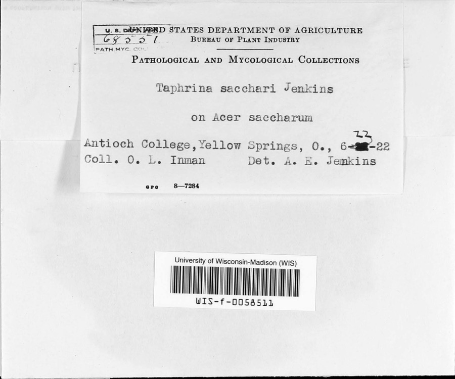
Specimen of Taphrina sacchari JenkinsTaphrina sacchari Jenkins1922O.L. InmanAntioch College
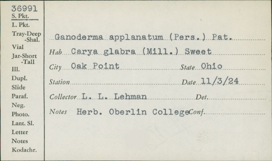
Specimen of Ganoderma applanatum (Pers.) Pat.Ganoderma applanatum (Pers.) Pat.1924L.L. Lehman
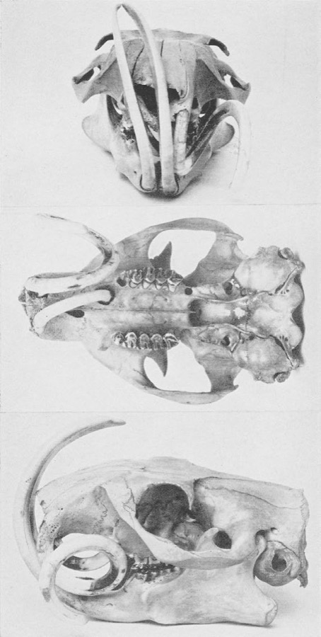
Specimen of Marmota monax monax (Linnaeus, 1758)Marmota monax monax (Linnaeus, 1758)1929Herbert R. MooneyWoodsfield
A photograph of the species Terrapene carolina, not of this specimenTerrapene carolina carolina (Linnaeus, 1758)1860David M. Dennis3 mi. N Graysville
unnamed (fossil)1914Collector UnknownWoodfield Quad; Sec 23, Malaga Twp; (Chert From 130ft Above Washington Coal; Girty Loc 3301, See Memo To Henbest)
A photograph of the species Strophitus undulatus, not of this specimenStrophitus undulatus (Say, 1817)1921Ortmann, Arnold EWoodsfield, Little Muskingum River, Cranenest Fork
A photograph of the species Colletotrichum cereale, not of this specimenColletotrichum cereale Manns1922Thompson W. H.Woodsfield
Peronospora manshurica (Naumov) Syd.1928Archer, W. A.Greenbrier
A photograph of the species Catostomus commersonii, not of this specimenCatostomus commersonii (Lacepède, 1803)1929Trautman, M. B. (Milton Bernard) & Walker, W. H. (W. Harrington)Little Muskingum River tributary, within central Wayne township, near Graysville, Wayne township
A photograph of the species Etheostoma blennioides, not of this specimenEtheostoma blennioides blennioides Rafinesque, 18191929Trautman, M. B. (Milton Bernard) & Walker, W. H. (W. Harrington)Sunfish Creek, within east Adams township, near Clarington, Adams township
A photograph of the species Etheostoma caeruleum, not of this specimenEtheostoma caeruleum Storer, 18451929Trautman, M. B. (Milton Bernard) & Walker, W. H. (W. Harrington)Sunfish Creek, within east Adams township, near Clarington, Adams township
A photograph of the species Etheostoma zonale, not of this specimenEtheostoma zonale (Cope, 1868)1929Trautman, M. B. (Milton Bernard) & Walker, W. H. (W. Harrington)Sunfish Creek, within east Adams township, near Clarington, Adams township

All 390 specimens within 10 miles, at the Global Biodiversity Information Facility.

Storms near this property

45 since 1994

Regional context, not property-specific evidence. The National Weather Service names Woodsfield, the town this property stands in, in 45 storm reports between 1994 and 2024: 20 thunderstorm wind, 12 hail, 9 flash flood, 3 flood. No death or injury is recorded in these reports. Each account below is quoted exactly as the forecast office filed it, from the NOAA Storm Events Database, and each date opens the federal record of that event.

WhenEvent Place namedHarm What the report says
March 1997Flash FloodWoodsfield$3,000,000no account filed
June 2011Thunderstorm WindWoodsfield$50,000Emergency management reported trees down in and around Woodsfield.
June 2011Thunderstorm WindWoodsfield$25,000Law enforcement reported trees down in Woodsfield.
November 2013Thunderstorm WindWoodsfield$15,000Law enforcement reported trees down.
May 2022FloodWoodsfield$10,000Risebeck's Food Market along SR78 is flooded. Numerous other roads were flooded in the Woodsfield area.
December 2016FloodWoodsfield$10,000Emergency management reported flooding of roadways.
June 1998Thunderstorm WindWoodsfield$10,000Thunderstorm winds blew numerous large trees down across the town.
July 2006Thunderstorm WindWoodsfield$8,000Trees and power lines blown down.
April 2001Thunderstorm WindWoodsfield$5,000Thunderstorm winds downed several trees.
August 2001Flash FloodWoodsfield$5,000Several reports of roadway and basement flooding were received in the Woodsfield region
February 2000Flash FloodWoodsfield$5,000Heavy rainfall over the area caused streams to rise over bankfull and flow onto SR 26 near Woodsfield.
June 1998Thunderstorm WindWoodsfield$5,000Thunderstorm winds blew down several trees.
May 1997Thunderstorm WindWoodsfield$5,000Thunderstorm winds blew down a produce stand. Two large trees also fell and a small shed was destroyed along Rt. 26 near Woodsfield.
June 1994Thunderstorm WindWoodsfield$5,000Trees were downed.
June 1996Flash FloodWoodsfield$5,000no account filed
June 2006Thunderstorm WindWoodsfield$3,000Trees down along SR 26.
October 1999Thunderstorm WindWoodsfield$3,000Thunderstorm winds downed several trees and power lines.
July 1999Thunderstorm WindWoodsfield$3,000Thunderstorm winds downed several trees.
July 1999Thunderstorm WindWoodsfield$3,000Thunderstorm winds downed several trees and large limbs.
July 2011Thunderstorm WindWoodsfield$2,000A trained spotter reports of a large tree down in Woodsfield.
January 1996Flash FloodWoodsfield$2,000no account filed
June 2022HailWoodsfield$1,000An emergency manager reported hail the size of a golf ball.
July 1999Thunderstorm WindWoodsfield$1,000Thunderstorm winds downed a large tree.
May 1998Thunderstorm WindWoodsfield$1,000Thunderstorm winds downed a tree.
June 2024Thunderstorm WindWoodsfield-Numerous trees reported down in parts of northern Monroe county.
January 2023FloodWoodsfield-Several roads were closed in the Woodsfield area.
June 2021Thunderstorm WindWoodsfield-Numerous trees and power lines down in town.
June 2021Thunderstorm WindWoodsfield-Trees and power lines down.
September 2018Heavy RainWoodsfield-A COOP Observer recorded 4.06 inches for 72 hour storm total.
February 2009Thunderstorm WindWoodsfield-Law enforcement reported trees and power lines down near Woodsfield.
March 2007HailWoodsfield-One inch hail reported in Woodsfield.
July 2003Flash FloodWoodsfield-Parts of Routes 379, 145, and 78 flooded in northwestern Monroe Co.
January 1999Flash FloodWoodsfield-Heavy rain from earlier thunderstorms caused minor flooding that closed State Routes 800 and 78 in the Woodsfield area.
June 1997Flash FloodWoodsfield-Minor low-land flooding was first reported in Woodsfield. In 45 minutes 1.2 inches of rain was recorded at Woodsfield and Lewisville. State Route 26 between Graysville and Rinard Mills was closed. SR 260 was closed near Sycamore Valley. Wills, Skin, Rich Fork and Wolfpen Creeks all went out of their banks. Numerous small streams were also flooded. SR 26, CR 68 and Twp 562 flooded near the Little Muskingum River. Flooding was also reported along SR 379 in Seneca Township. SR 78, west of Lewisville, was closed.
March 2012HailWoodsfield-no account filed
June 2012HailWoodsfield-no account filed
June 2011HailWoodsfield-no account filed
April 2006HailWoodsfield-no account filed
April 2002HailWoodsfield-no account filed
July 2000HailWoodsfield-no account filed
January 1999HailWoodsfield-no account filed
June 1998HailWoodsfield-no account filed
March 1997Flash FloodWoodsfield-no account filed

Every storm recorded in Monroe County

Newspapers printed here

0 digitised pages

1 paper published in this town, digitised by the Library of Congress and free to read: 0 issues, 0 pages. Every page is searchable, so a name or a street can be looked for directly in what the town printed about itself at the time.

NewspaperPublished
The Spirit of Democracy1844 to 1994

Map coverage status

No historic map-sheet match is published for this property yet. That does not mean no map exists. This record needs a coordinate-quality review before it can be joined to a sheet boundary. Browse the county's mapped places while that work is pending.

From the nomination file

1,269 words on record

When this property was proposed for the National Register, someone wrote the case for it: what the building is, and why it matters. That document is a federal record in the public domain. It is quoted below word for word, never summarised. The text was read off the scanned case file by machine, so the occasional stray character is the recogniser's and the 1970s typewriter's.

Description of the property

1898 Atlas of Monroe County. an 'ell" shape with two story projections at both front and west entrances.Both entrances a one story shed roofed open frame porch in the "ell".A small cheese house typical _fair moved date The house sits on a four acre lot of nearly the dimensions of the lot in The Windows are 6/6 double hung on the firststory and 3/3 double hung on the second bracketing and a partial return.A semi elliptical light is found in the pediment and to do with heating and plumbing.The house is used as a house musuem and as the Xunaltered Areas of SignificanceCheck and justify below - prehistoric _ archeology-historic .

science - sculpture _ social/ - 1800-1899 exploration/settlement _ - philosophy .theater - politics/government .transportation - other (specify) of its architectureas viewed against the backdrop of the village of Woodsfield, a small are restrained in ornament and the pitch of the roof is not steep. Two porticos and was occupied by Nathan Höllister, a prominent attorney. In 1889 the house was sold to Dr. J. R. Parry, a Woodsfield physician and it remained in that family until 1974. commerce 1700-1799 1400-1499 conservation military communications Builder/Architect literature Period humanitarian engineering education law music Specific dates invention economics and exteriorly.

community with modest vernacular architecture predominating.The architecture of the siding which simulates rusticated ashlar stone with distinct quoins.The windows 1900- house possesses some elements of the Renaissance Revival and Italian Villa styles 8.

Statement of significance

(in one paragraph) with flat roofs supported by square columns are featured on the north and west elevations. - archeology-prehistoric - community planning _ architecture When the house was built in 1858 it was considered a "splendid residence" in that it has a block-like appearance, a prominent cornice with bracketing and wood 1859 1500-1599 1600-1699 industry art agriculture 9.

The whole case file for this property - 1,269 words, 11 pages, reproduced complete.

Quoted from the National Register nomination for reference 80003166, 11 pages, held by the National Archives in Record Group 79. See the catalogue record.

Listed places nearby

5 within 8 miles

Other National Register properties close enough to walk or drive between, ordered by distance from this one. Both positions come from the same geocoding pass that matched these properties to their map sheets.

Photograph PropertyDistance Listed
Mooney, William C., House0.2 miles1982
First United Methodist Church0.2 miles2006
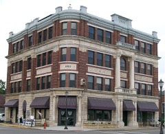
Monroe Bank0.2 miles1980
Monroe County Courthouse0.3 miles1980
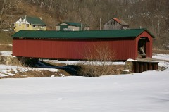
Foreaker Bridge7.3 miles1975

Sources for this property

National Archives recordThe nomination case file for reference 80003166 in Record Group 79.
Wikipedia articleCommunity-written account of this property, licensed CC BY-SA.
Monroe CountyAll 9 listed properties in this county.

Provenance

  • Listing record. National Park Service National Register of Historic Places, listed-properties dataset, current to 2026-05-22.
  • Map join. Address geocoded through the United States Census geocoder, then tested against the published boundary of every sheet in the USGS Historical Topographic Map Collection.
  • How this page is made. Listing fields come from federal records; map-sheet coverage is a labelled coordinate-to-boundary calculation, not a source-field claim.
  • Wildfire. Short, Karen C. 2022. Spatial wildfire occurrence data for the United States, 1992-2020 [FPA_FOD_20221014]. 6th Edition. Fort Collins, CO: Forest Service Research Data Archive. https://doi.org/10.2737/RDS-2013-0009.6 Collected with United States Government funding and usable without additional permissions or fees.
  • Specimens. Global Biodiversity Information Facility (GBIF), https://www.gbif.org/. Only records licensed CC0 or CC BY are used. Records licensed CC BY-NC are excluded because this site carries advertising. Images are checked individually and any whose licence is non-commercial, no-derivatives or unreadable is refused.
  • Storms. NOAA National Centers for Environmental Information, Storm Events Database https://www.ncei.noaa.gov/stormevents/ A work of the United States government, no copyright under 17 U.S.C. 105. Narratives are quoted verbatim from the National Weather Service report and are not edited or summarised.