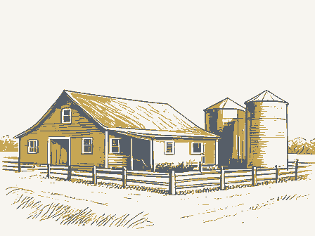
Listed on the National Register of Historic Places in
1980. A historic map-sheet match is not published yet. The record needs a coordinate-quality review before it can be joined to a sheet boundary.
From the record
one of 30 National Register listings in Warren County · listed in 1980 · category: Building.
National Register reference number.80003243- the number the National Park Service assigned this property when it was listed, and the key its nomination file is catalogued under at the National Archives.
Specimens collected near this property
12 of 510 shown
Regional context, not property-specific
evidence. Museums hold 510 specimens
collected within 10 miles of Stanton Farm between 1844 and
1975: 459 Animalia, 42 Plantae, 9 Fungi. 12 distinct Species records are shown.
Collected by A Schwartz, A. R. Gaufin, A.C. Borror and others. Each is a
physical object with a catalogue
number, and each entry opens the museum's record. This is what was
collected and kept, not a survey of what lives here - nothing can be
concluded from a species being absent.
Regional context, not property-specific
evidence. The federal mineral resources record lists
3 workings within 5 miles of Stanton Farm: 2 producers, 1 past producer.
2 still produce. What was taken out: Sand and Gravel, Construction. Distance is straight-line from the
map coordinates, so a quarry counted here may appear on a neighbouring
settlement's page as well.
Regional context, not property-specific
evidence. The National Weather Service names
Springboro, the town this property stands in, in 41 storm reports between 1995 and 2026: 22 thunderstorm wind, 14 hail, 2 lightning, 2 flash flood.
The reports record 1 injury. Each account below is quoted exactly as the forecast office
filed it, from the NOAA Storm Events Database, and each date
opens the federal record of that event.
A swath of damage was observed in the Settlers Walk neighborhood|including Settlers Walk Blvd., Stolle Drive, and Remick Blvd. The|damage also extended to the southeast toward Five Points and|Lytle. Maximum winds associated with the microburst occurred within|this area, and are estimated to be up to 80 mph.||Multiple hardwood trees were knocked down and were pointing in|the same direction. A few softwood trees were also uprooted.
No historic map-sheet match is published
for this property yet. That does not mean no map exists. This record needs
a coordinate-quality review before it can be joined to a sheet boundary.
Browse the county's mapped places while that work is
pending.
From the nomination file
3,304 words on record
When this property was proposed for the
National Register, someone wrote the case for it: what the building is,
and why it matters. That document is a federal record in the public domain.
It is quoted below word for word, never summarised. The text was read off the scanned case file by machine, so the
occasional stray character is the recogniser's and the 1970s
typewriter's.
Description of the property
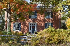
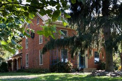
from the "I". The west facade, or long leg of the "I", exhibits five even- are nine-over-six, the remainder are generally six-over-six. The "I" ments. Condition entrance. 7. Description construction. fenestration.A slightly altered Greek Revival portico dominates the front The remainder of the farm complex consists of a brick privy, corn crib, numerals.An open hearth and large hewn timbers highlight the basement. attic windows. notably the reeded mantels, chairrails, and Latin cross pattern doors. variation of the "I" plan, some of the rooms on the second floor have been wing has rather large interior end chimneys.
The window bays are double hung with traditional jack arches, wooden slip- Attached to the rear elevation is a l story brick smokehouse with tall beaded sashes.Windows on the first floor of the front facade - unexposed elevations of the "I"consist of gable ends pierced by paned The Stanton farmhouse, built 1826, is a two and one half story brick build- Stanton built the house in the front block is derived Xfair - moved The attic space exhibits hewn walnut rafters that are incised with Roman partioned.A significant portion of the interior woodwork remains;most enhanced by brick laid in the Flemish bond, displays symmetrical three bay and deterioration.
end chimney.A frame, one story addition of later construction has been the original outbuildings have either been demolished or lost to the ele- -good The barn and corn crib are rectangular Areas of Significance-Check and justify below - prehistoric - archeology-prehistoric - community planning - archeology-historic - science . military _ social/ - engineering . music _ communications - politics/government _transportation .invention .other (specify) Statement of
Statement of significance
(in one paragraph) ous blacks from Virginia to Ohio, Indiana, and Canada, particularly in 1400-1499 economics 1500-1599 Period theater education 8. Significance agriculture industry humanitarian X1800-1899 literature wrote: Specific dates law 1900- Counties in southwestern Ohio constituted one half of the state's Quakers of the committee on Indian Affairs at the Indiana Yearly Meeting. Stanton Federal vernacular architecture in Ohio,and is also noteworthy for its A genuine abolithonst [sic] must be influinct by the spirit Social History Collection, Ohio Historical Society.
- conservation to labour them to there [sic] advantage...we encouraged Today the Stanton house and farm buildings are threatened by a proposed Greenhil1 Farm, from 1825-1959,was occupied by five generations of the ginia, came to Clear Creek Township in 1825 and built the farmhouse in -commerce 1700-1799 - - art -X sculpture X architecture _ art - philosophy the spring of 1826..
During his years in Warren County, Stanton actively traveled extensively during his tenure as Quaker elder, and brought numer- and Columbiana Counties in northeastern Ohio, and Clinton and Warren assist the plight of the impoverished and displaced blacks, for he be- with the poor, the elderly, and the "colored." In his diary Stanton of christ that spirit that breathes peace on earth and good will toward all men of thought - - - we Quakers were favored housing development. Thus, it is imperative the siginificance of this Quaker population in the United States. Specifically, two areas, Belmont them to industry and good economy- complex be placed in its proper perspective.
Quoted from the National Register nomination
for reference 80003243, 41 pages, held by the National Archives in Record
Group 79. See the
catalogue record.
Listed places nearby
6 within 8 miles
Other National Register properties close
enough to walk or drive between, ordered by distance from this one. Both
positions come from the same geocoding pass that matched these properties
to their map sheets.
Listing record. National Park Service National Register of Historic Places, listed-properties dataset, current to 2026-05-22.
Map join. Address geocoded through the United States Census geocoder, then tested against the published boundary of every sheet in the USGS Historical Topographic Map Collection.
How this page is made. Listing fields come from federal records; map-sheet coverage is a labelled coordinate-to-boundary calculation, not a source-field claim.
Specimens. Global Biodiversity Information Facility (GBIF), https://www.gbif.org/. Only records licensed CC0 or CC BY are used. Records licensed CC BY-NC are excluded because this site carries advertising. Images are checked individually and any whose licence is non-commercial, no-derivatives or unreadable is refused.
Mines and quarries. USGS Mineral Resources Data System (MRDS) https://mrdata.usgs.gov/mrds/ A work of the United States government, no copyright under 17 U.S.C. 105.
Storms. NOAA National Centers for Environmental Information, Storm Events Database https://www.ncei.noaa.gov/stormevents/ A work of the United States government, no copyright under 17 U.S.C. 105. Narratives are quoted verbatim from the National Weather Service report and are not edited or summarised.
 Block
Block