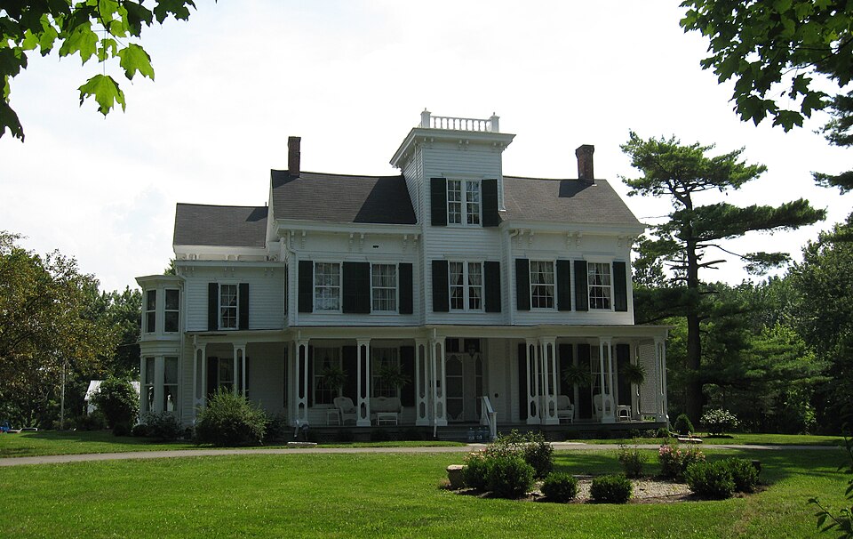
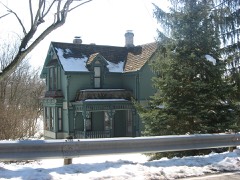
Listed on the National Register of Historic Places in
1979. A historic map-sheet match is not published yet. The record needs a coordinate-quality review before it can be joined to a sheet boundary.
From the record
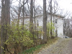
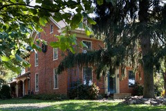
“While the National Historic Register officially entitles the home as the Aaron Wright House, Dr. The current owners of the property, Larry and Cheryl Dillin, utilize his preferred spelling.”
Wikipedia article Dr. Aaron Wright House, CC BY-SA 4.0.
one of 30 National Register listings in Warren County · listed in 1979 · category: Building.
National Register reference number.79001975- the number the National Park Service assigned this property when it was listed, and the key its nomination file is catalogued under at the National Archives.
Specimens collected near this property
12 of 2,818 shown
Regional context, not property-specific
evidence. Museums hold 2,818 specimens
collected within 10 miles of Wright, Dr. Aaron, House between 1844 and
1975: 2,762 Animalia, 43 Plantae, 13 Fungi. 12 distinct Species records are shown.
Collected by A Schwartz, A. R. Gaufin, A.C. Borror and others. Each is a
physical object with a catalogue
number, and each entry opens the museum's record. This is what was
collected and kept, not a survey of what lives here - nothing can be
concluded from a species being absent.
Regional context, not property-specific
evidence. The federal mineral resources record lists
4 workings within 5 miles of Wright, Dr. Aaron, House: 2 producers, 1 plant, 1 past producer.
3 still produce. What was taken out: Sand and Gravel, Construction. Distance is straight-line from the
map coordinates, so a quarry counted here may appear on a neighbouring
settlement's page as well.
Regional context, not property-specific
evidence. The National Weather Service names
Springboro, the town this property stands in, in 41 storm reports between 1995 and 2026: 22 thunderstorm wind, 14 hail, 2 lightning, 2 flash flood.
The reports record 1 injury. Each account below is quoted exactly as the forecast office
filed it, from the NOAA Storm Events Database, and each date
opens the federal record of that event.
A swath of damage was observed in the Settlers Walk neighborhood|including Settlers Walk Blvd., Stolle Drive, and Remick Blvd. The|damage also extended to the southeast toward Five Points and|Lytle. Maximum winds associated with the microburst occurred within|this area, and are estimated to be up to 80 mph.||Multiple hardwood trees were knocked down and were pointing in|the same direction. A few softwood trees were also uprooted.
No historic map-sheet match is published
for this property yet. That does not mean no map exists. This record needs
a coordinate-quality review before it can be joined to a sheet boundary.
Browse the county's mapped places while that work is
pending.
From the nomination file
1,472 words on record
When this property was proposed for the
National Register, someone wrote the case for it: what the building is,
and why it matters. That document is a federal record in the public domain.
It is quoted below word for word, never summarised. The text was read off the scanned case file by machine, so the
occasional stray character is the recogniser's and the 1970s
typewriter's.
Description of the property
The house has an irregular lay-out formed from three two-story offset rectangular All cornices are projecting box gutters supported by paired brackets and wide DATE green louvre shutters and slightly projecting crown molding. standing seam metal roof.Posts which support the overhang on the east are 8
Statement of significance
The Wright House is an imposing example of a mid-19th century country residence. by Berea College in Berea, Kentucky. The exact structural history of the Wright House is unclear; but in its present from any number of Victorian handbooks they featured off-set towers and heavily The house was built for Dr. Aaron Wright in 1857. He was the son of Jonathan Wright who is considered to be the founder of the nearby village of Springboro. established by the Society of the Quakers in 1869. It was the result of their academic studies, which in the opinion of the Quakers, lead to "idle and as work on the farm or in the "mechanics hall" for boys and households duties from Wright's House in 1870 to house the administrative offices, classrooms and dormitories for both males and females.
As the economy of Springboro waned when bypassed by the railroad lines, the fortunes of the College also declined. The. subsequently demolished. educational heritage. 1700-1799 1857 ART Doyle.
LAW SCIENCE PERIOD ENGINEERING BUILDER/ARCHITECT LITERATURE AGRICULTURE TRANSPORTATION THEATER SCULPTURE INDUSTRY MUSIC dissolute ways." The College was established to provide work at a "useful task" _POLITICS/GOVERNMENT XARCHITECTURE _EXPLORATION/SETTLEMENT In addition, it is an important historical link to the Miami Valley College, MILITARY -1600-1699 bracketed cornices.Another intriguing feature of the Wright House is the full XEDUCATION dissatisfaction with colleges that offered no activities for students outside of _COMMERCE - PREHISTORIC - CONSERVATION -1400-1499 -1500-1599 -ECONOMICS - PHILOSOPHY Aaron Wright was born in Pennsylvania in 18l0,received a medical degree from -RELIGION -1900- -COMMUNITY PLANNING in Ohio in the third quarter of the 19th century.
Taking their inspiration 19th century and is very well maintained by its present elderly owner, Mrs. I. B.
Quoted from the National Register nomination
for reference 79001975, 10 pages, held by the National Archives in Record
Group 79. See the
catalogue record.
Listed places nearby
6 within 8 miles
Other National Register properties close
enough to walk or drive between, ordered by distance from this one. Both
positions come from the same geocoding pass that matched these properties
to their map sheets.
Listing record. National Park Service National Register of Historic Places, listed-properties dataset, current to 2026-05-22.
Map join. Address geocoded through the United States Census geocoder, then tested against the published boundary of every sheet in the USGS Historical Topographic Map Collection.
How this page is made. Listing fields come from federal records; map-sheet coverage is a labelled coordinate-to-boundary calculation, not a source-field claim.
Specimens. Global Biodiversity Information Facility (GBIF), https://www.gbif.org/. Only records licensed CC0 or CC BY are used. Records licensed CC BY-NC are excluded because this site carries advertising. Images are checked individually and any whose licence is non-commercial, no-derivatives or unreadable is refused.
Mines and quarries. USGS Mineral Resources Data System (MRDS) https://mrdata.usgs.gov/mrds/ A work of the United States government, no copyright under 17 U.S.C. 105.
Storms. NOAA National Centers for Environmental Information, Storm Events Database https://www.ncei.noaa.gov/stormevents/ A work of the United States government, no copyright under 17 U.S.C. 105. Narratives are quoted verbatim from the National Weather Service report and are not edited or summarised.
 Block
Block