Listed on the National Register of Historic Places in
1982. A historic map-sheet match is not published yet. The record needs a coordinate-quality review before it can be joined to a sheet boundary.
From the record
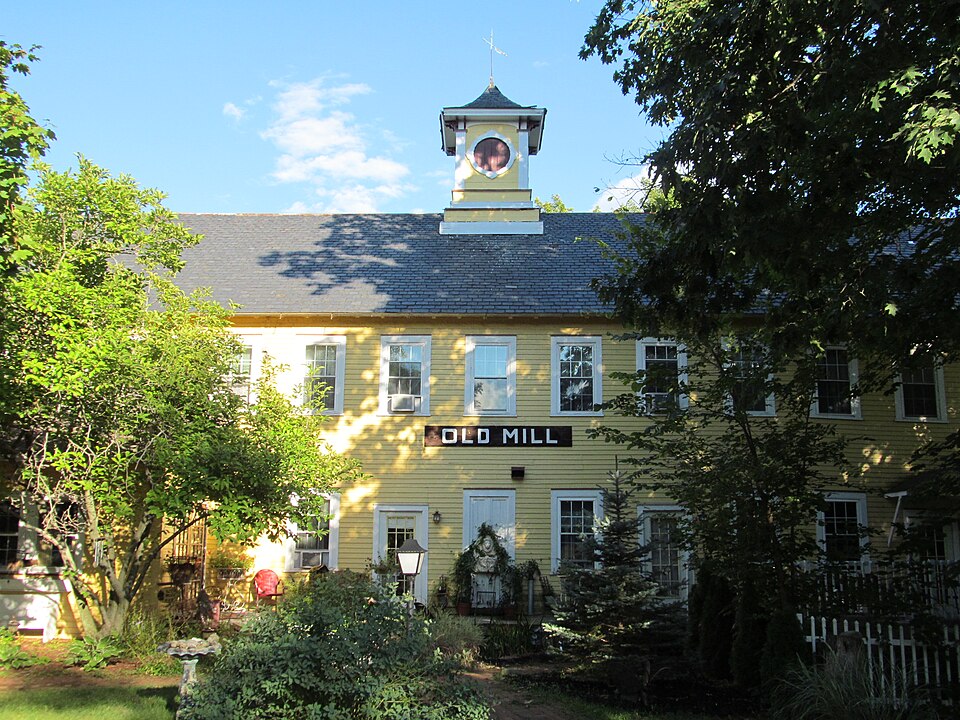
“The Old Mill Site Historic District in Hatfield, Massachusetts encompasses the site of a late 19th century mill. It is one of only two such sites in the town.”
Wikipedia article Old Mill Site Historic District, CC BY-SA 4.0.
one of 32 National Register listings in Hampshire County · listed in 1982 · category: District.
National Register reference number.82001911- the number the National Park Service assigned this property when it was listed, and the key its nomination file is catalogued under at the National Archives.
What happened here
An account from the chapter on Hatfield town, The inset identifies its exact
source book and publication year.
The letter referred to is in this volume. It is from Rev. Solomon Stoddard, then minister at Northampton, dated Sept. 15, 1675. It is a long letter, reciting minutely the movements of the contending forces in the valley. Stoddard tells of the disarming of the near-by Indians, August 24th, the affair at Sugar Loaf, August 25th, and says, "We heard no more of the Indians till the first of September, when they shot down a garrison soldier at Pocumtuck, that was looking after his horse, and ran violently up into the town, many people having scarcely time enough to get into the garrison: that day they burnt most of their houses and barns, the garrisons not being strong enough to sally out upon them, but killed two of their men from their forts." He gives a full account of the tragic events which accompanied the distruction of Northfield, September 2-6; the second attack on Deerfield September 12th; the relief expedition, September 13th, and the arrival of Captain Moseley at Hadley, September 14th.
There can be no doubt that Mather's story of the "alarm" at Hadley was true. The same could have been said of Hatfield and Northampton, when the astounding news reached them of the attack that day upon Deerfield. No doubt they too "were in the utmost confusion," while making preparation for their defence. The usual method of Indians in warfare is, to watch chances for a surprise; then a swift stroke, and speedy retreat. But at Deerfield the first shock was unsuccessful; the Indians lingered, and in a measure besieged the garrisons, expecting to lay the whole town in ashes; part being busy in plundering and burning, out of musket range from the stockades. In the meantime this condition had been discovered and reported by scouts from below. It was the first attack upon any town in the valley, and what would be their fate after Deerfield had been destroyed, was the main thought. Of course, the people of Hadley were "in consternation by a most sudden and violent alarm, which routed them the whole day after," and doubtless a sleepless night followed. We must always note that Mather does not give the story of the alarm as part of the history of the war. He was dwelling strictly upon the dealings of God with the people, and the effect of prayer in turning aside His wrath.
Judd attempts an explanation: it was because the Judges were concealed there. He says, "It was necessary at the time and long after, to throw a veil over the transactions of that day, which has been, and can be, only partially removed." Let us examine this explanation - does it explain! How could this silence be enforced! The facts must have been known to every person in Hadley, inhabitants and soldiers; to all in Hatfield and Northampton. The story must have been repeated to the hundreds of soldiers who came to Hadley that week, for there was the headquarters of the army and the gathering place of the forces from the East and from Connecticut. Silence might perhaps have been imposed upon the magistrates and ministers, but what of the miscellaneous multitude ? All must see the utter impossibility of keeping their mouths shut, when, in the very nature of the case, no reason could be given, without betraying the fatal secret. On the contrary, if the people of Hadley believed they had been saved from destruction by an angel sent of God, why should not this amazing thing be proclaimed from every pulpit with joy and thanksgiving, be discussed at every fireside in the land, and preached in every camp that they were the chosen people of the Lord! This was by far and far the most important event in the history of New England; and how soon would the news have spread to the uttermost parts of the earth; and how would the literature of the times have teemed with the marvelous story. How the superstitious savage would have quailed in terror at this act of the white man's God! The bloody events of the current week show no such effect. If true, why do we not find traditions or recorded facts in the families of Barnard, Baldwin, Boltwood, Coleman, Dickinson, Hawks, Moody, Porter, Russell, Smith, Warner, or Wells, who were on the spot; or in those of Allis, Arms, Belden, Cowles, Field, Frary, Gillet, Graves, Hubbard, Hinsdale, Kellogg, Lyman, Munn, Montague, Marsh, Morton, Parsons, Pomeroy, Sheldon, Stebbins and scores of others in the surrounding towns, descendants of all of which families are now living among us? Look at the contrast! The knowledge of this wonderful deliverance of beset Hadley, by the act of the heroic Goffe, or the direct act of God, lay dormant and unknown for ninety years, to creep out at length through a traditionary anecdote handed down in a single family in far-off Boston, and then only preserved in a marginal footnote to a printed page. But Hutchinson, even, who published the tradition, did not believe the mysterious appearance part of the story, and the part which he did accept quietly slumbered for thirty years longer, until it was revived and printed by President Stiles, and so scattered broadcast as veritable history.
Regional context, not property-specific
evidence. The
federal wildfire occurrence database
lists 75 fires within 5 miles of Old Mill Site Historic District between
2003 and 2020, burning about 63 acres in total. 3 started naturally. 4 were recorded as arson.
Distance is straight-line from the map coordinates, so a fire counted
here may appear on a neighbouring settlement's page as well.
Reported cause
Fires
Missing data/not specified/undetermined
31
Debris and open burning
15
Equipment and vehicle use
14
Recreation and ceremony
7
Arson/incendiarism
4
Natural
3
Railroad operations and maintenance
1
The most recent of
them, most recent first, with the day each was reported and the service
that recorded it.
Regional context, not property-specific
evidence. Museums hold 10,255 specimens
collected within 10 miles of Old Mill Site Historic District between 1781 and
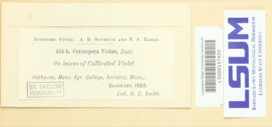
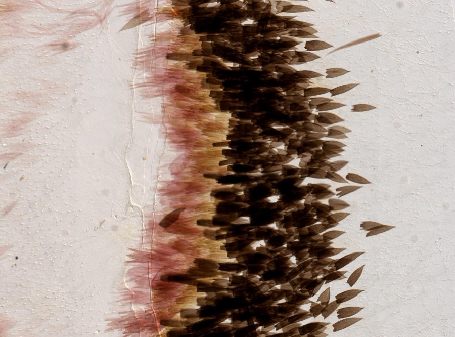
1975: 4,080 Animalia, 3,553 Plantae, 2,374 Fungi, 138 Chromista, 97 Protozoa, 12 Unrecorded, 1 Bacteria. 12 distinct Species records are shown.
Collected by A V Osmun, A., A. Albee and others. Each is a
physical object with a catalogue
number, and each entry opens the museum's record. This is what was
collected and kept, not a survey of what lives here - nothing can be
concluded from a species being absent.
Regional context, not property-specific
evidence. The federal mineral resources record lists
18 workings within 5 miles of Old Mill Site Historic District: 8 producers, 7 past producers, 1 occurrence, 1 prospect.
8 still produce. What was taken out: Brick Clay, Sand and Gravel, Construction, Clay, Barium-Barite. Distance is straight-line from the
map coordinates, so a quarry counted here may appear on a neighbouring
settlement's page as well.
Regional context, not property-specific
evidence. The National Weather Service names
Hatfield, the town this property stands in, in 18 storm reports between 1996 and 2025: 16 thunderstorm wind, 2 lightning.
No death or injury is recorded in these reports. Each account below is quoted exactly as the forecast office
filed it, from the NOAA Storm Events Database, and each date
opens the federal record of that event.
No historic map-sheet match is published
for this property yet. That does not mean no map exists. This record needs
a coordinate-quality review before it can be joined to a sheet boundary.
Browse the county's mapped places while that work is
pending.
From the nomination file
2,933 words on record
When this property was proposed for the
National Register, someone wrote the case for it: what the building is,
and why it matters. That document is a federal record in the public domain.
It is quoted below word for word, never summarised. The text was read off the scanned case file by machine, so the
occasional stray character is the recogniser's and the 1970s
typewriter's.
Description of the property
The Hatfield mill site, which comprises three mill buildings on both sides of the Mill River dam and a Warren pony truss bridge just over the falls, is an intact site which accurately depicts 19th century rural industrial life. The Shattuck Gun Shop is a wood frame, post and beam mill building with slate roof and clapboard siding which was constructed on the north side of the Mill River in 1881. The three-story building is 17 bays long by 6 bays wide and measures approximately 30 feet by 100 feet. It is situated perpendicular to the course of the river. The fenestration consists of single, double-hung windows with 6/6 sash located in each bay on all three floors. The foundation is comprised of mixed granite and sandstone, with part of the building resting on existing bedrock.
Part of the foundation is submerged in the river to accommodate a penstock and turbine located in the lower level. The roof is supported by wooden trusses with the top truss carrying a series of tie rods that support the floors and allow for clear spans throughout the building. The center of the pitched roof is surmounted by a square cupola capped with a pagoda-shaped roof. A tall chimney protrudes from the roof on the east side of the building. The entire structure is in excellent condition. The Porter-McLeod Machine Shop is one-story, post and beam industrial mill building 1o- cated on the south side of the Mill River. green, are masonry,with some wood siding. The building measuresapproximately 45 feet * on a concrete stab Romaation.
The exterior walls, which are painted light by 275 feet and rests on a concrete slab foundation. Wood trusses stand eight feet in center, with each bay containing a large, double-hung window with 12/12 sash.
/Architect Unknown Statement of Significance (in one paragraph) The Old Mill site in Hatfield possesses integrity of location, design, setting, materials and borkdpastems od iur inouiatid hithtory ant cat hies the distincteveant canteristion to of a type of mill construction. The Old Mill site in Hatfield therefore meets criteria A & C of the National Register of Historic Places. The Old Mill site in Hatfield was first used for industrial purposes in the seventeenth A settler named Thomas Meekins was voted all rights to a waterfall and 20 acres of swampland in 1661 in return for his services as a miller to the town of Hadley which included Hatfield until its establishment as a separate town in 1670.
The natural water power of the site induced Meekins to build a gristmill and, in 1669, an adjacent sawmill on the north side of the waterfall. In the mid-1800's, Harvey Moore bought the Old Mill site and built two new mills. A gristmill was built on the south side of the falls and a sawmill was erected across the river. mills were purchased from Moore by Henry Porter and the Fitch brothers and became the Crescent Pistol Company. Subsequent to this, the shop was renamed the Prescott Pistol Shop and finally it became the Shattuck Gun Shop after Major Charles Spencer Shattuck. He operated the shop for 35 years. The existing shop was built in 1881 to replace Shattuck's mill which was destroyed by fire.
The existing machine shop on the south site of the river was built by Henry Porter in In 189l the Prospect Street Bridge was built to connect the two sides of the river and allow easy access and transport of materials and people at this manufacturing center of Hatfield.
Quoted from the National Register nomination
for reference 82001911, 19 pages, held by the National Archives in Record
Group 79. See the
catalogue record.
Listed places nearby
6 within 8 miles
Other National Register properties close
enough to walk or drive between, ordered by distance from this one. Both
positions come from the same geocoding pass that matched these properties
to their map sheets.
Listing record. National Park Service National Register of Historic Places, listed-properties dataset, current to 2026-05-22.
Map join. Address geocoded through the United States Census geocoder, then tested against the published boundary of every sheet in the USGS Historical Topographic Map Collection.
How this page is made. Listing fields come from federal records; map-sheet coverage is a labelled coordinate-to-boundary calculation, not a source-field claim.
Wildfire. Short, Karen C. 2022. Spatial wildfire occurrence data for the United States, 1992-2020 [FPA_FOD_20221014]. 6th Edition. Fort Collins, CO: Forest Service Research Data Archive. https://doi.org/10.2737/RDS-2013-0009.6 Collected with United States Government funding and usable without additional permissions or fees.
Specimens. Global Biodiversity Information Facility (GBIF), https://www.gbif.org/. Only records licensed CC0 or CC BY are used. Records licensed CC BY-NC are excluded because this site carries advertising. Images are checked individually and any whose licence is non-commercial, no-derivatives or unreadable is refused.
Mines and quarries. USGS Mineral Resources Data System (MRDS) https://mrdata.usgs.gov/mrds/ A work of the United States government, no copyright under 17 U.S.C. 105.
Storms. NOAA National Centers for Environmental Information, Storm Events Database https://www.ncei.noaa.gov/stormevents/ A work of the United States government, no copyright under 17 U.S.C. 105. Narratives are quoted verbatim from the National Weather Service report and are not edited or summarised.
 Block
Block