Listed on the National Register of Historic Places in
1973. A historic map-sheet match is not published yet. The record needs a coordinate-quality review before it can be joined to a sheet boundary.
From the record
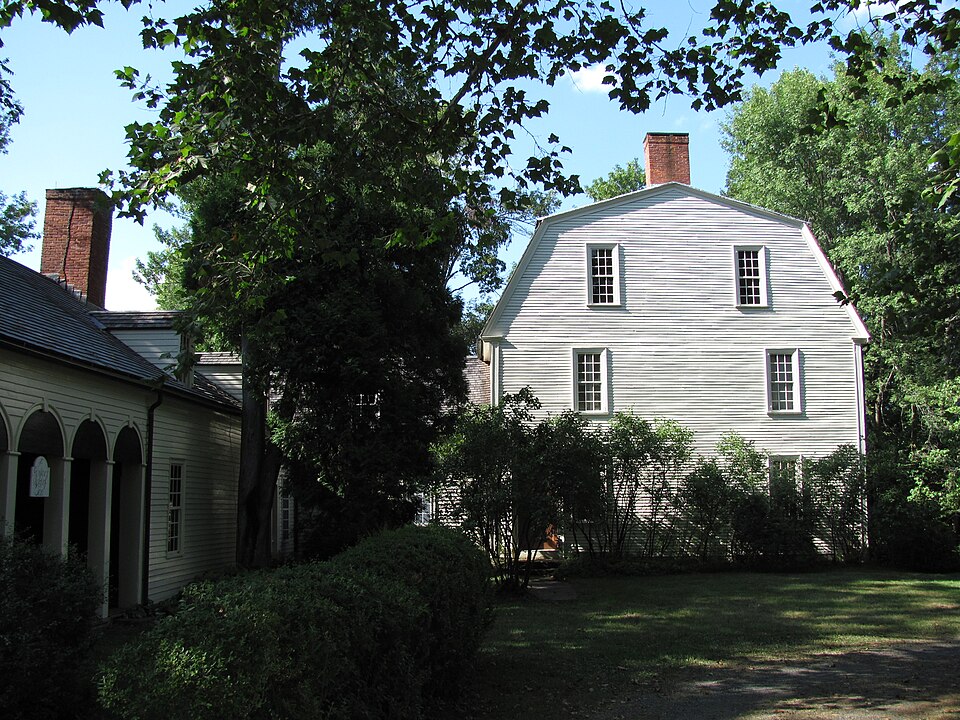
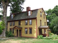
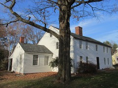
“The Porter-Phelps-Huntington House, known historically as Forty Acres, is a historic house museum at 130 River Drive in Hadley, Massachusetts. It is open seasonally, from May to October.”
Wikipedia article Porter-Phelps-Huntington House, CC BY-SA 4.0.
one of 32 National Register listings in Hampshire County · listed in 1973 · category: Building.
National Register reference number.73000303- the number the National Park Service assigned this property when it was listed, and the key its nomination file is catalogued under at the National Archives.
What happened here
An account from the chapter on Hadley town, The inset identifies its exact
source book and publication year.
These few lines are to let you understand that we are arrived at Albany now with the captives, and we now stand in need of assistance, for my charges is very great and heavy; and therefore any that have any love to our condition, let it move them to come and help us in this strait. Three of the captives are murdered, - old Goodman Plympton, Samuel Foot's daughter,Samuel Russell.
The town of Hadley is one of the oldest in the Connecticut valley. Differences of opinion in relation to discipline, baptism, and the qualifications for church membership, had so rent the churches of Hartford and Wethersfield, that Gov. John Webster, Elder William Goodwin, and Rev . John Russell, with their friends, at length decided to seek a new home at a higher point on the river.
There are events in the history of Hadley of which her citizens are, and of right ought to be, very proud. They may tell of heroes living and dying there, whose dust sanctifies their soil - heroes of war, and heroes of peace. The actions of the former are usually on a stage where they can be seen and known of all men. For the most part these live and act conscious of a watching world, and assured that lasting memorials will perpetuate their names and deeds. We point to Hadley's farmer-soldier General Hooker on Beacon Hill.
Regional context, not property-specific
evidence. The
federal wildfire occurrence database
lists 72 fires within 5 miles of Porter-Phelps-Huntington House between
2003 and 2020, burning about 63 acres in total. 2 started naturally. 4 were recorded as arson.
Distance is straight-line from the map coordinates, so a fire counted
here may appear on a neighbouring settlement's page as well.
Reported cause
Fires
Missing data/not specified/undetermined
30
Debris and open burning
15
Equipment and vehicle use
13
Recreation and ceremony
7
Arson/incendiarism
4
Natural
2
Railroad operations and maintenance
1
The most recent of
them, most recent first, with the day each was reported and the service
that recorded it.
Regional context, not property-specific
evidence. Museums hold 10,264 specimens
collected within 10 miles of Porter-Phelps-Huntington House between 1781 and
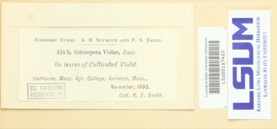
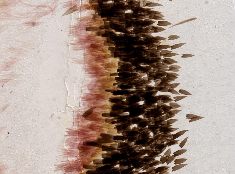
1975: 4,087 Animalia, 3,555 Plantae, 2,374 Fungi, 138 Chromista, 97 Protozoa, 12 Unrecorded, 1 Bacteria. 12 distinct Species records are shown.
Collected by A V Osmun, A., A. Albee and others. Each is a
physical object with a catalogue
number, and each entry opens the museum's record. This is what was
collected and kept, not a survey of what lives here - nothing can be
concluded from a species being absent.
Regional context, not property-specific
evidence. The federal mineral resources record lists
16 workings within 5 miles of Porter-Phelps-Huntington House: 8 producers, 7 past producers, 1 unknown.
8 still produce. What was taken out: Brick Clay, Sand and Gravel, Construction, Clay, Barium-Barite. Distance is straight-line from the
map coordinates, so a quarry counted here may appear on a neighbouring
settlement's page as well.
Regional context, not property-specific
evidence. The National Weather Service names
Hadley, the town this property stands in, in 36 storm reports between 1996 and 2025: 21 thunderstorm wind, 8 hail, 5 flash flood, 2 lightning.
No death or injury is recorded in these reports. Each account below is quoted exactly as the forecast office
filed it, from the NOAA Storm Events Database, and each date
opens the federal record of that event.
In Northampton, Route 9 near the VA hospital was flooded with a foot of water. Portions of Market and State Streets were flooded. King Street was flooded in front of the McDonald's. Multiple basements along Church Street were flooded with 6 to 8 feet of water. Portions of route 202 in South Hadley were flooded with at least a foot of water.
Trees on Route 47 in Hadley were downed by thunderstorm winds. In Amherst, trees and wires on Mill Valley, Moody Bridge, and Chapel Roads and East Pleasant, Mechanic and East Maple Streets were downed by thunderstorm winds. One of these trees was downed onto a car. Two water treatment plants were also damaged in the resulting power loss in Amherst.
Trees and wires on Rocky Hill Road and Farm Lane were downed by thunderstorm winds. One of these trees closed Farm Lane until the tree could be removed.
No historic map-sheet match is published
for this property yet. That does not mean no map exists. This record needs
a coordinate-quality review before it can be joined to a sheet boundary.
Browse the county's mapped places while that work is
pending.
From the nomination file
2,643 words on record
When this property was proposed for the
National Register, someone wrote the case for it: what the building is,
and why it matters. That document is a federal record in the public domain.
It is quoted below word for word, never summarised. The text was read off the scanned case file by machine, so the
occasional stray character is the recogniser's and the 1970s
typewriter's.
Description of the property
Ruins - Unexposed (Check One) - Moved riginal Site The Porter-Phelps-Huntington House, on River Drive north of Hadley, is set back from the road across a wide expanse of lawn and shade trees. The homestead consists of a three-storied gambrel roofed house which faces east. An early one-and-ahalf story ell is attached to the west end of the house. From this a later ell extends to the south and includes a woodshed and chaise house; the latter is a twentieth century reconstruction of a 1795 structure. To the south of the chaise house lies a sunken garden, planted in the ruins of the stone foundation of an old barn. This barn now stands in Hadley proper, serving as a farm museum. To the north of the house lies a second garden, parts of which were laid out when the house was built.
Moses Porter began clearing the land for the Porter-Phelps-Huntington House, also known as Forty Acres, in the winter of 1752. The following spring a cellar was excavated for the ell, and on May 27 of that year the roof of the house was raised. As originally completed, the house was a two story structure, with a pitched roof and rusticated exterior. Porter's son-in-law, Charles Phelps, was responsible for all the structural changes between 1770 and 1799, by which time the house had realized its present form. In M 177- a kitchen ell was added to the south of the original ell. In 1782, at the time the barn was being raised, the main house was rotated on its axis, form south to west, to face the highway which in 1752 had been only a cart Z track throught the meadows.
This rotation would have been necessitated the remøwal of at least one chimney.
The Porter-Phelphs-Huntington House is a treasury of rural life in eighteenth century Massachusetts. Begun in 1752, it was the first house constructed outside the stockaded town of Hadley and has remained nearly unchanged in appearance since 1799. The house is also a memorial to three families which were associated with it for ten generations and to three men in particular, Moses Porter, Charles Phelps and Bishop F. D. Huntington. Moses Porter, grandson of the first child born in Hadley, built this Colonial mansion on Forty Acre Meadow. The Porter Family had held partial title to the land since Hadley was laid out in 1659, and by 1752 owned almost the entire meadow area. Because of its location, Moses Porter gave his house the name "Forty Acres, " by which it is still generally known.
Porter was killed in 1755, during the French and Indian War, but his wofe and daughter Elizabeth continued to live at Forty Acres. In 1770, Elizabeth Porter married Charles Phelps, a young lawyer from Northampton, who was later to serve as Squire of Hadley under four governors. The extensive changes which Phelps made in his wife's house between 1771 and 1799 gave the Porter-Phelps-Huntington House it present appearance. In addition to his legal training, Phelps had acquired a knowledge of engi- neering and architecture, which explains the success of the alterations he made to the house.
Yale's famous travelling president Timothy Dwight visited the house in the late 1790's and wrote of Forty Acres "...this ey atowledge."post destrable possession, of the same kind and extent, within Dwight is responsible for the Huntington connection with Forty Acres. At his suggestion, Dan Huntington, former tutor Litchfield, Connecticut, arranged at Yale and pastor at an exchange of pulpits so that he could preach at Hadley.
Quoted from the National Register nomination
for reference 73000303, 13 pages, held by the National Archives in Record
Group 79. See the
catalogue record.
Listed places nearby
6 within 8 miles
Other National Register properties close
enough to walk or drive between, ordered by distance from this one. Both
positions come from the same geocoding pass that matched these properties
to their map sheets.
Listing record. National Park Service National Register of Historic Places, listed-properties dataset, current to 2026-05-22.
Map join. Address geocoded through the United States Census geocoder, then tested against the published boundary of every sheet in the USGS Historical Topographic Map Collection.
How this page is made. Listing fields come from federal records; map-sheet coverage is a labelled coordinate-to-boundary calculation, not a source-field claim.
Wildfire. Short, Karen C. 2022. Spatial wildfire occurrence data for the United States, 1992-2020 [FPA_FOD_20221014]. 6th Edition. Fort Collins, CO: Forest Service Research Data Archive. https://doi.org/10.2737/RDS-2013-0009.6 Collected with United States Government funding and usable without additional permissions or fees.
Specimens. Global Biodiversity Information Facility (GBIF), https://www.gbif.org/. Only records licensed CC0 or CC BY are used. Records licensed CC BY-NC are excluded because this site carries advertising. Images are checked individually and any whose licence is non-commercial, no-derivatives or unreadable is refused.
Mines and quarries. USGS Mineral Resources Data System (MRDS) https://mrdata.usgs.gov/mrds/ A work of the United States government, no copyright under 17 U.S.C. 105.
Storms. NOAA National Centers for Environmental Information, Storm Events Database https://www.ncei.noaa.gov/stormevents/ A work of the United States government, no copyright under 17 U.S.C. 105. Narratives are quoted verbatim from the National Weather Service report and are not edited or summarised.
 Block
Block