Listed on the National Register of Historic Places in
1982. A historic map-sheet match is not published yet. The record needs a coordinate-quality review before it can be joined to a sheet boundary.
From the record
“The first village laid out in the township was called Plainficld. It was located about a mile south of the present village of Plainfield, on the west bank of Wills creek, and platted October 10, 1816.”
History of Coshocton County, Ohio; (1881). Machine-read text.
one of 16 National Register listings in Coshocton County · listed in 1982 · category: Building.
National Register reference number.82004415- the number the National Park Service assigned this property when it was listed, and the key its nomination file is catalogued under at the National Archives.
The remains of the prehistoric dwellers in Linton township are not very numerous. There are, however, several low fortifications and a few small mounds along the valley of Wills creek. One of these fortifications is situated on the plains, about half a mile southwest from Plainfield, at the cross roads. It consists of four embankments, enclosing a square figure containing several acres. At each corner of the square is an entrance. The embanktnent originally was perhaps six feet above the surrounding level, but it has since been almost obliterated by the plow. Another circular embankment, enclosing about an acre, was found on the farm belonging to V. J. Powelson, in section 22, several miles farther down the creek. The outlines are now so slight as to be scarcely discernable.
Near Plainfield, about 1840, Mr. J. D. Workman opened a small earthen mound on his place. He found nothing except several storie relics. Another, about two miles below, was excavated some ten years later by Wesley Patrick. It contained a few bones belonging to the human skeleton, including the skull, jaw bone "and thigh. These were of an unusually large size and indicated the skeleton to be fully seven feet in length.
Regional context, not property-specific
evidence. The
federal wildfire occurrence database
lists 16 fires within 5 miles of Johnson, Thomas, House between
2005 and 2020, burning about 175 acres in total. None started naturally. None was recorded as arson.
Distance is straight-line from the map coordinates, so a fire counted
here may appear on a neighbouring settlement's page as well.
Reported cause
Fires
Missing data/not specified/undetermined
8
Debris and open burning
7
Smoking
1
The most recent of
them, most recent first, with the day each was reported and the service
that recorded it.
Regional context, not property-specific
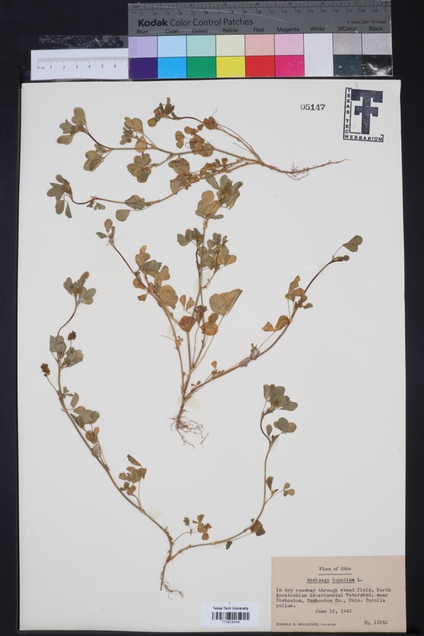
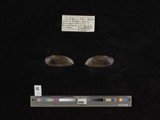
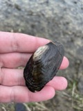
evidence. Museums hold 407 specimens
collected within 10 miles of Johnson, Thomas, House between 1892 and
1974: 288 Animalia, 86 Plantae, 29 Fungi, 3 Protozoa, 1 Unrecorded. 12 distinct Species records are shown.
Collected by A. D. Huryn, A. Spreitzer, Barnes, R.C. and others. Each is a
physical object with a catalogue
number, and each entry opens the museum's record. This is what was
collected and kept, not a survey of what lives here - nothing can be
concluded from a species being absent.
Regional context, not property-specific
evidence. The National Weather Service names
Plainfield, the town this property stands in, in 8 storm reports between 2004 and 2021: 4 thunderstorm wind, 3 hail, 1 flash flood.
No death or injury is recorded in these reports. Each account below is quoted exactly as the forecast office
filed it, from the NOAA Storm Events Database, and each date
opens the federal record of that event.
No historic map-sheet match is published
for this property yet. That does not mean no map exists. This record needs
a coordinate-quality review before it can be joined to a sheet boundary.
Browse the county's mapped places while that work is
pending.
From the nomination file
3,316 words on record
When this property was proposed for the
National Register, someone wrote the case for it: what the building is,
and why it matters. That document is a federal record in the public domain.
It is quoted below word for word, never summarised. The text was read off the scanned case file by machine, so the
occasional stray character is the recogniser's and the 1970s
typewriter's.
Description of the property
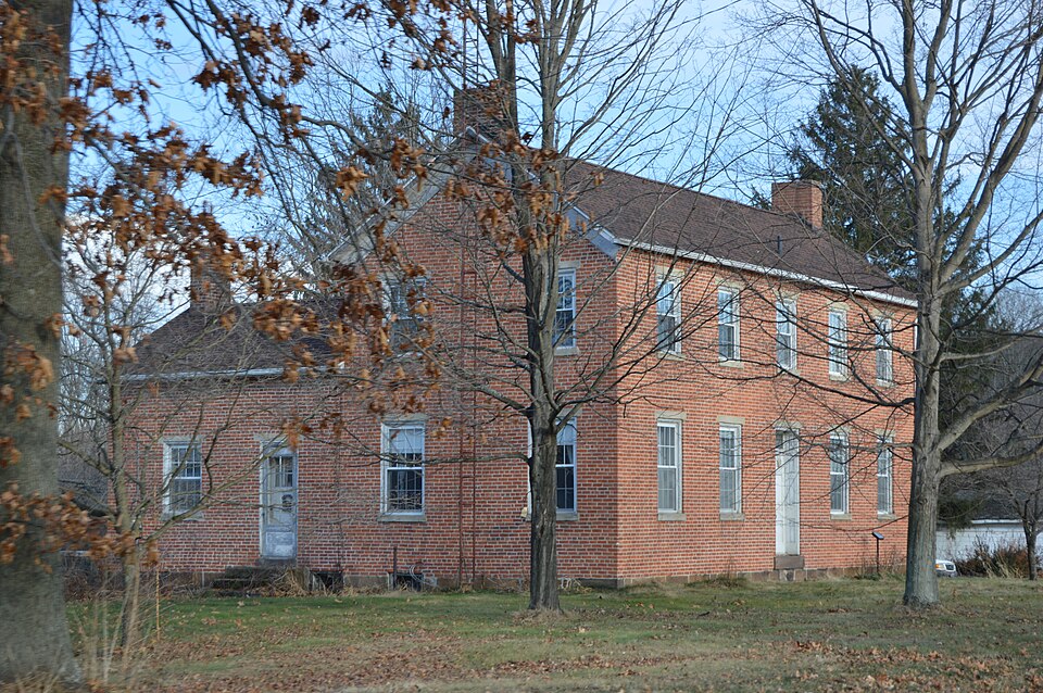
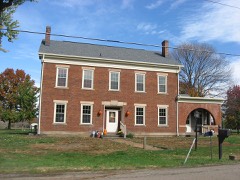
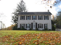
house from the road.To the north the land slopes downward to a flood plain with from the front portion of the second floor hallway. The house is located on a spacious lot along the main road at the eastern edge an exceptionally wide front hallway.On either side of the hallway are parlors. The east parlor has more elaborate woodwork than the west parlor. North of the Extending northward from the northwest corner of the main building is a story- features little exterior ornament. Its gable roof does not feature returns.
crafted stairway.The stairway is unusual in that it has two landings in what is openings with plain sandstone sills and 1intels.In the center on the first - prehistoric - archeology-prehistoric - - community planning - archeology-historic - conservation .law _ science .agriculture _ economics - sculpture _ architecture - education . military _ social/ - engineering .music . exploration/settlement - - philosophy _ theater . industry - politics/government _ transportation - other (specify) ca. 1836 Statement of
Statement of significance
(in one paragraph) higher ground about forty years ago so that this house, which was once at the western edge of the original town, is now at the eastern end of the present 1400-1499 1600-1699 1500-1599 communications 1700-1799 commerce humanitarian literature Period invention Builder/Architect Specific dates 1900- original site. X_1800-1899 8. Significance structures were demolished at this time.Thus, the Johnson House is an important residence in Plainfield and is the only surviving brick building from that era. The Thomas Johnson House is the largest and best preserved pre-Civil War prominent men in the county in his day and one of its earliest settlers.
Areas of Significance-Check and justify below was instrumental in plotting the town of Plainfield and built the first The Muskingum Watershed Conservancy District relocated Plainfield toa site on Johnson served from 1818 until his death in 1840 as an associate judge of Coschoc- which was built through the county from 1827 to 1830.He was one of the most a tavern, that same year. He gave the village cemetery to the new community. Township and became one of the first settlers of Plainfield.He served in the 1ink to Plainfield's past as one of the few historic buildings to survive on its _art - landscape architecture- _religion Thomas Johnson was born in Glentubert, Monaghan County, Ireland in 1783, community.
A number of early frame buildings were moved but all the other brick and emigrated to America in 1806.In 1809 Johnson purchased 1and in Linton FOR NPS USE ONLY NATIONAL PARK SERVICE NATIONAL REGISTER OF HISTORIC PLACES DATE ENTERED INVENTORY -- NOMINATION FORM Plainfield, Ohio ITEM NUMBER 8 The Thomas Johnson House, built about 1836, is a major landmark.
Quoted from the National Register nomination
for reference 82004415, 17 pages, held by the National Archives in Record
Group 79. See the
catalogue record.
Listed places nearby
2 within 8 miles
Other National Register properties close
enough to walk or drive between, ordered by distance from this one. Both
positions come from the same geocoding pass that matched these properties
to their map sheets.
Listing record. National Park Service National Register of Historic Places, listed-properties dataset, current to 2026-05-22.
Map join. Address geocoded through the United States Census geocoder, then tested against the published boundary of every sheet in the USGS Historical Topographic Map Collection.
How this page is made. Listing fields come from federal records; map-sheet coverage is a labelled coordinate-to-boundary calculation, not a source-field claim.
Wildfire. Short, Karen C. 2022. Spatial wildfire occurrence data for the United States, 1992-2020 [FPA_FOD_20221014]. 6th Edition. Fort Collins, CO: Forest Service Research Data Archive. https://doi.org/10.2737/RDS-2013-0009.6 Collected with United States Government funding and usable without additional permissions or fees.
Specimens. Global Biodiversity Information Facility (GBIF), https://www.gbif.org/. Only records licensed CC0 or CC BY are used. Records licensed CC BY-NC are excluded because this site carries advertising. Images are checked individually and any whose licence is non-commercial, no-derivatives or unreadable is refused.
Storms. NOAA National Centers for Environmental Information, Storm Events Database https://www.ncei.noaa.gov/stormevents/ A work of the United States government, no copyright under 17 U.S.C. 105. Narratives are quoted verbatim from the National Weather Service report and are not edited or summarised.
 Block
Block