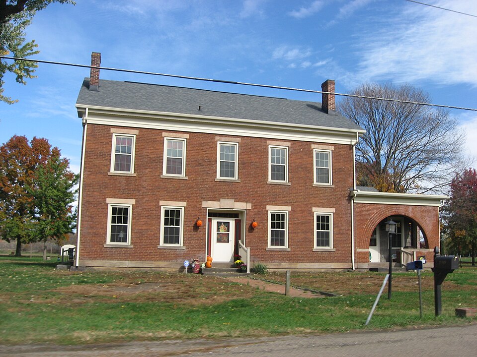
Listed on the National Register of Historic Places in
1978. A historic map-sheet match is not published yet. The record needs a coordinate-quality review before it can be joined to a sheet boundary.
From the record
“The West Lafayette Baptist church was formed in 1870, by dividing the congregation of White Eyes Baptist church into two parts and organizing the western division into a separate congregation. The White Eyes Plains church was the first Baptist society formed in Coshocton county.”
History of Coshocton County, Ohio; (1881). Machine-read text.
one of 16 National Register listings in Coshocton County · listed in 1978 · category: Building.
National Register reference number.78002028- the number the National Park Service assigned this property when it was listed, and the key its nomination file is catalogued under at the National Archives.
The topographical features of the township differ somewhat from those of most other townships, A broad expanse of level country, known as White Eyes plains, begins in the western part of the township and continues eastward eight or ten miles, through Oxford township into Tuscarawas county. It has an average width of about two miles and follows the bottom lands on the south of the river. It is separated from these bottom lands generally by a bluff rising thirty or fortyfeet. About a half mile north of the village of West Lafayette is a remarkable hill, isolated from all others. The plains stretch away to the south and a narrow valley separates it from the river on the north. Towards the east it rises abruptly to a considerable height, but on the opposite side it slopes very gradually and does not reach the level of the surrounding country for a half mile or more. The soil of the plains is a gravelly sand. It was considered worthless by the first settlers, as crops could be raised upon it with indifferent success, but later it was found to be quite fertile under proper cultivation. The plains were very sparsely timbered at the advent of. the earliest pioneers. Clumps of bushes, or stunted trees, were scattered here and there, but generally tall, waving grass, called wild grass, was the only existing vegetation. The rich river valley was heavily timbered with the sycamore, sugar and other species of woodland growth. South of the plains the surface is broken up into hills, which had a scanty covering of trees, such as the oak, chestnut, hickory, poplar, walnut and other varieties.
Stryker Morgan kept tavern in the western part of the township, where Prancis McGuire now lives, in early times. He came from Sussex county. New Jersey, about 1820, and provided entertainment for the traveler until he died, a few years before the late war. " Morgan's tavern," at the time of its erection, was the only weatherboarded building in the township house near West Lafayette. Samuel C. McMunn, several years later, owned one about a half mile east of town. The building of the railroad withdrew the custom from these country taverns, and theydied a natural death soon after.
Regional context, not property-specific
evidence. The
federal wildfire occurrence database
lists 25 fires within 5 miles of Ferguson, Andrew, House between
2005 and 2019, burning about 199 acres in total. None started naturally. None was recorded as arson.
Distance is straight-line from the map coordinates, so a fire counted
here may appear on a neighbouring settlement's page as well.
Reported cause
Fires
Debris and open burning
13
Missing data/not specified/undetermined
9
Smoking
1
Power generation/transmission/distribution
1
Other causes
1
The most recent of
them, most recent first, with the day each was reported and the service
that recorded it.
Regional context, not property-specific
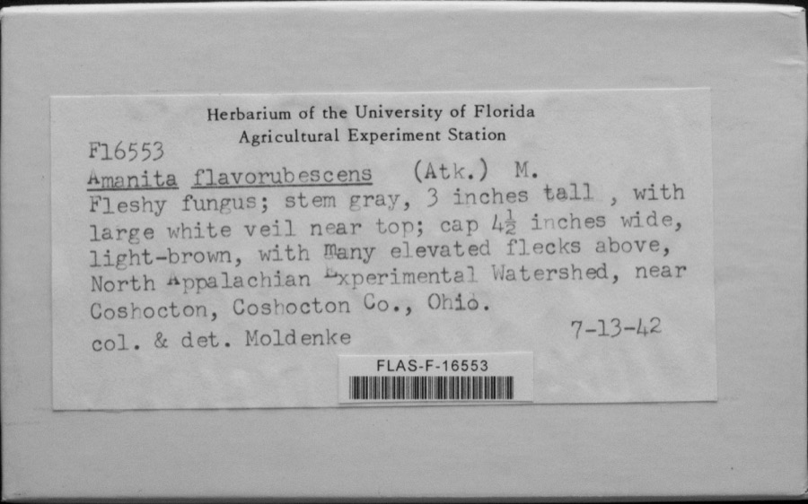
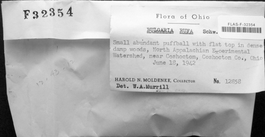
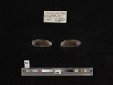
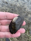
evidence. Museums hold 992 specimens
collected within 10 miles of Ferguson, Andrew, House between 1892 and
1974: 608 Plantae, 287 Animalia, 88 Fungi, 4 Bacteria, 4 Protozoa, 1 Unrecorded. 12 distinct Species records are shown.
Collected by A. D. Huryn, A. Spreitzer, Barnes, R.C. and others. Each is a
physical object with a catalogue
number, and each entry opens the museum's record. This is what was
collected and kept, not a survey of what lives here - nothing can be
concluded from a species being absent.
Regional context, not property-specific
evidence. The federal mineral resources record lists
2 workings within 5 miles of Ferguson, Andrew, House: 1 past producer, 1 producer.
1 still produces. What was taken out: Sand and Gravel, Construction. Distance is straight-line from the
map coordinates, so a quarry counted here may appear on a neighbouring
settlement's page as well.
Regional context, not property-specific
evidence. The National Weather Service names
West Lafayette, the town this property stands in, in 26 storm reports between 1995 and 2024: 18 thunderstorm wind, 4 flash flood, 3 hail, 1 funnel cloud.
No death or injury is recorded in these reports. Each account below is quoted exactly as the forecast office
filed it, from the NOAA Storm Events Database, and each date
opens the federal record of that event.
According to the emergency manager, one road collapse occurred with numerous additional road closures. An apartment complex and a retirement community were evacuated due to high water.
No historic map-sheet match is published
for this property yet. That does not mean no map exists. This record needs
a coordinate-quality review before it can be joined to a sheet boundary.
Browse the county's mapped places while that work is
pending.
From the nomination file
1,824 words on record
When this property was proposed for the
National Register, someone wrote the case for it: what the building is,
and why it matters. That document is a federal record in the public domain.
It is quoted below word for word, never summarised. The text was read off the scanned case file by machine, so the
occasional stray character is the recogniser's and the 1970s
typewriter's.
Description of the property
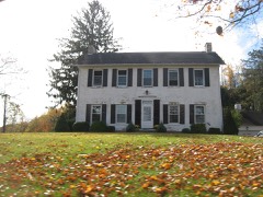
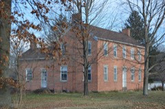
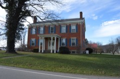
brick, laid in common bond. The foundation is of rusticated ashlar and bay facade, with all windows double hung, 6/6, set on extended lug sills 1889. This addition features an arcaded front porch and a center gable Coshocton jail, recently razed) rise from each side of the roof at each gable buildings have been removed from the landscape, including an apparently INTERIOR: There are fourteen rooms on the interior of the Ferguson house. flooring except that of the kitchen is original and in fine repair. The CONDITION end. XALTERED outstanding feature of the interior is the aforementioned central hallway frame construction and clapboard-covered. latches throughout the house.
X_ORIGINAL SITE _UNALTERED The house presently sits on less than one acre of ground, although _UNEXPOSED garage-carriage house (probably of recent construction),and a summer - DETERIORATED CHECK ONE front features a trabeated door with fixed transom and with a partial return matching the partial returns of the roof of the A one-story brick addition was made to the east side of the house about four of which are surrounded by their priginal wooden mantles.The X.EXCELLENT -GOOD -FAIR -RUINS Also, there is one walk-in attic-like room. EXTERIOR: The Ferguson house is vernacular in style, built entirely of rubble sandstone. It is an L-shaped house, with a one-story kitchen ell extending north from the northwest corner of the house.
There is a five- the west and five rooms on the right, on the first floor. The second floor which boasts a handsome cherry balustrade, said to have been carved by Door hardware includes the original rimlock on the front door and Norfolk la Ferguson himself. There are five fireplaces, rooms are spacious and feature ten-foot ceilings. main house.
Andrew Ferguson, one of the county's most prominent early citizens. to-do farmer who at one time owned over five hundred acres of fine land in The home, however, stands as a living monument to its builder, whose con- Township, assisted with the canal, and generally encouraged the growth of 1600-1699 ECONOMICS ARCHEOLOGY-HISTORIC SIGNIFICANCE EDUCATION ART CONSERVATION PERIOD AGRICULTURE MILITARY SCIENCE PREHISTORIC _PHILOSOPHY ARCHEOLOGY-PREHISTORIC LAW _COMMUNICATIONS MUSIC XPOLITICS/GOVERNMENT INDUSTRY XTRANSPORTATION XEXPLORATION/SETTLEMENT INVENTION restoration of its interior and exterior.
_SOCIAL/HUMANITARIAN _1700-1799 X1800-1899 _SCULPTURE This house is an outstanding example of vernacular architecture in -1400-1499 _LITERATURE _THEATER Ferguson was born in Ireland in 1795 and emigrated to the United States in ted as a land contractor for the then-new Ohio Erie Canal.He continued _RELIGION brick, and was built by one of the early white settlers of this part -1500-1599 1806.He settled in Lafayette Township around 1825 and in 1827was appoin- -COMMERCE -1900- 1838 and as a state legislator during the 1850-1851 term. He was a well- Apart from his interests in politics, Ferguson and his family the state. The home is now in the hands of a man who has begun a careful BUILDER/ARCHITECT Andrew Ferguson tributions were many.
He helped to settle the area around Lafayette hands of the Ferguson family from the time of its construction until 1910.
Quoted from the National Register nomination
for reference 78002028, 18 pages, held by the National Archives in Record
Group 79. See the
catalogue record.
Listed places nearby
6 within 8 miles
Other National Register properties close
enough to walk or drive between, ordered by distance from this one. Both
positions come from the same geocoding pass that matched these properties
to their map sheets.
Listing record. National Park Service National Register of Historic Places, listed-properties dataset, current to 2026-05-22.
Map join. Address geocoded through the United States Census geocoder, then tested against the published boundary of every sheet in the USGS Historical Topographic Map Collection.
How this page is made. Listing fields come from federal records; map-sheet coverage is a labelled coordinate-to-boundary calculation, not a source-field claim.
Wildfire. Short, Karen C. 2022. Spatial wildfire occurrence data for the United States, 1992-2020 [FPA_FOD_20221014]. 6th Edition. Fort Collins, CO: Forest Service Research Data Archive. https://doi.org/10.2737/RDS-2013-0009.6 Collected with United States Government funding and usable without additional permissions or fees.
Specimens. Global Biodiversity Information Facility (GBIF), https://www.gbif.org/. Only records licensed CC0 or CC BY are used. Records licensed CC BY-NC are excluded because this site carries advertising. Images are checked individually and any whose licence is non-commercial, no-derivatives or unreadable is refused.
Mines and quarries. USGS Mineral Resources Data System (MRDS) https://mrdata.usgs.gov/mrds/ A work of the United States government, no copyright under 17 U.S.C. 105.
Storms. NOAA National Centers for Environmental Information, Storm Events Database https://www.ncei.noaa.gov/stormevents/ A work of the United States government, no copyright under 17 U.S.C. 105. Narratives are quoted verbatim from the National Weather Service report and are not edited or summarised.
 Block
Block