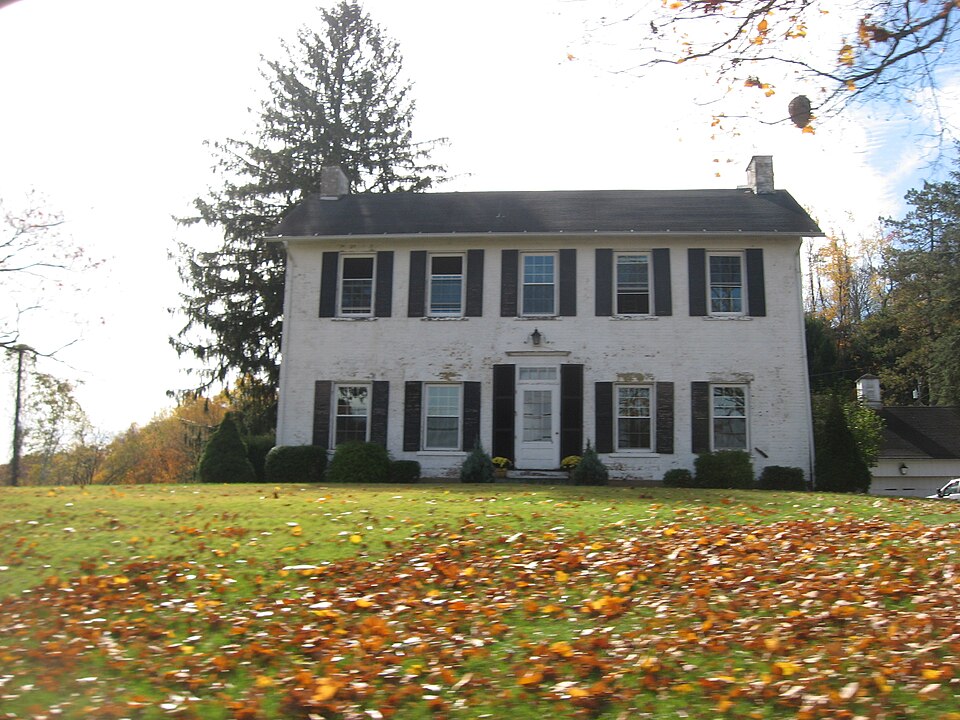
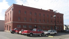
Listed on the National Register of Historic Places in
1980. A historic map-sheet match is not published yet. The record needs a coordinate-quality review before it can be joined to a sheet boundary.
From the record
“The West Lafayette Baptist church was formed in 1870, by dividing the congregation of White Eyes Baptist church into two parts and organizing the western division into a separate congregation. The White Eyes Plains church was the first Baptist society formed in Coshocton county.”
History of Coshocton County, Ohio; (1881). Machine-read text.
one of 16 National Register listings in Coshocton County · listed in 1980 · category: Building.
National Register reference number.80002967- the number the National Park Service assigned this property when it was listed, and the key its nomination file is catalogued under at the National Archives.
The topographical features of the township differ somewhat from those of most other townships, A broad expanse of level country, known as White Eyes plains, begins in the western part of the township and continues eastward eight or ten miles, through Oxford township into Tuscarawas county. It has an average width of about two miles and follows the bottom lands on the south of the river. It is separated from these bottom lands generally by a bluff rising thirty or fortyfeet. About a half mile north of the village of West Lafayette is a remarkable hill, isolated from all others. The plains stretch away to the south and a narrow valley separates it from the river on the north. Towards the east it rises abruptly to a considerable height, but on the opposite side it slopes very gradually and does not reach the level of the surrounding country for a half mile or more. The soil of the plains is a gravelly sand. It was considered worthless by the first settlers, as crops could be raised upon it with indifferent success, but later it was found to be quite fertile under proper cultivation. The plains were very sparsely timbered at the advent of. the earliest pioneers. Clumps of bushes, or stunted trees, were scattered here and there, but generally tall, waving grass, called wild grass, was the only existing vegetation. The rich river valley was heavily timbered with the sycamore, sugar and other species of woodland growth. South of the plains the surface is broken up into hills, which had a scanty covering of trees, such as the oak, chestnut, hickory, poplar, walnut and other varieties.
Stryker Morgan kept tavern in the western part of the township, where Prancis McGuire now lives, in early times. He came from Sussex county. New Jersey, about 1820, and provided entertainment for the traveler until he died, a few years before the late war. " Morgan's tavern," at the time of its erection, was the only weatherboarded building in the township house near West Lafayette. Samuel C. McMunn, several years later, owned one about a half mile east of town. The building of the railroad withdrew the custom from these country taverns, and theydied a natural death soon after.
Regional context, not property-specific
evidence. The
federal wildfire occurrence database
lists 22 fires within 5 miles of Miller, Daniel, House between
2005 and 2020, burning about 94 acres in total. None started naturally. None was recorded as arson.
Distance is straight-line from the map coordinates, so a fire counted
here may appear on a neighbouring settlement's page as well.
Reported cause
Fires
Debris and open burning
11
Missing data/not specified/undetermined
8
Smoking
2
Power generation/transmission/distribution
1
The most recent of
them, most recent first, with the day each was reported and the service
that recorded it.
Regional context, not property-specific
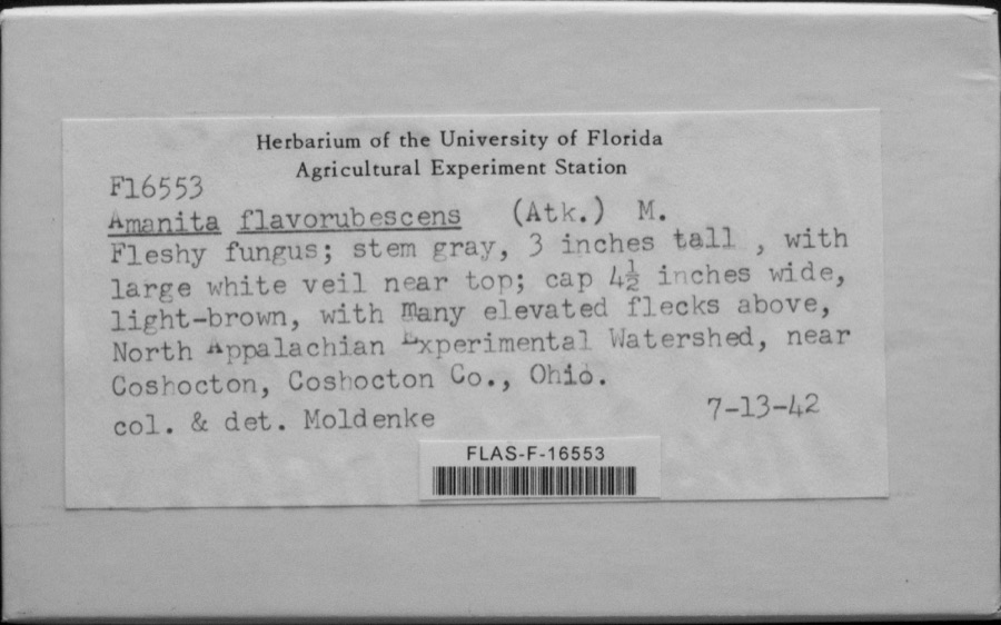
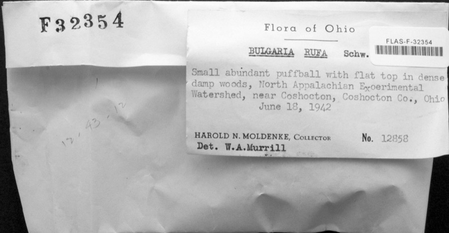
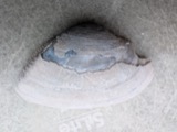
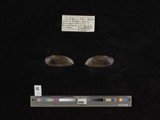
evidence. Museums hold 1,260 specimens
collected within 10 miles of Miller, Daniel, House between 1846 and
1974: 636 Plantae, 494 Animalia, 120 Fungi, 4 Bacteria, 4 Protozoa, 2 Unrecorded. 12 distinct Species records are shown.
Collected by A. D. Huryn, A. Spreitzer, Albaugh, W. F. and others. Each is a
physical object with a catalogue
number, and each entry opens the museum's record. This is what was
collected and kept, not a survey of what lives here - nothing can be
concluded from a species being absent.
Regional context, not property-specific
evidence. The National Weather Service names
West Lafayette, the town this property stands in, in 26 storm reports between 1995 and 2024: 18 thunderstorm wind, 4 flash flood, 3 hail, 1 funnel cloud.
No death or injury is recorded in these reports. Each account below is quoted exactly as the forecast office
filed it, from the NOAA Storm Events Database, and each date
opens the federal record of that event.
According to the emergency manager, one road collapse occurred with numerous additional road closures. An apartment complex and a retirement community were evacuated due to high water.
No historic map-sheet match is published
for this property yet. That does not mean no map exists. This record needs
a coordinate-quality review before it can be joined to a sheet boundary.
Browse the county's mapped places while that work is
pending.
Named in the fire insurance atlases
Sanborn surveyors printed an index of the
town's establishments at the front of each atlas. This property is named in
one, read straight off the scanned sheet.
When this property was proposed for the
National Register, someone wrote the case for it: what the building is,
and why it matters. That document is a federal record in the public domain.
It is quoted below word for word, never summarised. The text was read off the scanned case file by machine, so the
occasional stray character is the recogniser's and the 1970s
typewriter's.
Description of the property
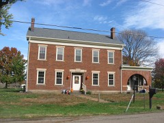
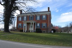
floor windows. The front entrance is centrally located and features a massive wood door with removed. The rear porch has been enclosed and houses a bathroom and laundry. The basement Small quarter-circle attic windows are placed on each side of these chimneys.The cornice is The window openings are rectangular and feature was enlarged but has woodwork similar to that of the original.The rear wing contains a and a half story wing, giving the building a T" shaped configuration. The house rests on a openings with single pane sash, although new six pane sash have been reinstalled on the first which is five bays wide and two full stories in height. Extending out from the rear is a one which is now enclosed.Two chimneys rise above the peaks of the gable ends of the house.
have been added to the bedrooms.The rear wing has a large bedroom with sloping ceilings, pitched gable roof is on the rear wing.Along the east side of the rear wing is a porch, also used for window sills and lintels.T . landscape architecture _ religion - archeology-historic - agriculture . sculpture _music X 1800-1899 .commerce - philosophy - politics/government other (specify) This house is an impressive, well-preserved example of Greek Revival architecture. It is one of the relatively few five bay brick farmhouses in Coshocton County that prosperous and politically active farmers. later Daniel Miller built this house. Later, Daniel's son Basil Miller acquired the present owners have lived here since 1955.
1500-1599 1400-1499 1600-1699 1700-1799 1833 1900- transportation conservation economics communications engineering theater humanitarian education Builder/Architect industry Period military invention art Specific dates prehistoric literature exploration/settlement law social/ 8.
Statement of significance
(in one paragraph) Areas of Significance-Check and justify below Xarchitecture significance of this house as the home for many years of one of the county's more Pioneer George Miller purchased 986 acresof 1and in this area in1806and settled - Larcheology-prehistoric _ community planning here in a log cabin. In 1823 he sold 300 acres to his son, Daniel Miller. Ten years house and farm. son, Arlie Holderbaum acquired the property in 1934 and sold it four years later. The science fines:t of its period in Coshocton County.of secondary importance is the historical survives in good condition.Its main stairway is claimed to be the largest and Basil was:a prosperous farmer and-member of the local school board.
Quoted from the National Register nomination
for reference 80002967, 11 pages, held by the National Archives in Record
Group 79. See the
catalogue record.
Listed places nearby
6 within 8 miles
Other National Register properties close
enough to walk or drive between, ordered by distance from this one. Both
positions come from the same geocoding pass that matched these properties
to their map sheets.
Listing record. National Park Service National Register of Historic Places, listed-properties dataset, current to 2026-05-22.
Map join. Address geocoded through the United States Census geocoder, then tested against the published boundary of every sheet in the USGS Historical Topographic Map Collection.
How this page is made. Listing fields come from federal records; map-sheet coverage is a labelled coordinate-to-boundary calculation, not a source-field claim.
Wildfire. Short, Karen C. 2022. Spatial wildfire occurrence data for the United States, 1992-2020 [FPA_FOD_20221014]. 6th Edition. Fort Collins, CO: Forest Service Research Data Archive. https://doi.org/10.2737/RDS-2013-0009.6 Collected with United States Government funding and usable without additional permissions or fees.
Specimens. Global Biodiversity Information Facility (GBIF), https://www.gbif.org/. Only records licensed CC0 or CC BY are used. Records licensed CC BY-NC are excluded because this site carries advertising. Images are checked individually and any whose licence is non-commercial, no-derivatives or unreadable is refused.
Storms. NOAA National Centers for Environmental Information, Storm Events Database https://www.ncei.noaa.gov/stormevents/ A work of the United States government, no copyright under 17 U.S.C. 105. Narratives are quoted verbatim from the National Weather Service report and are not edited or summarised.
 Block
Block