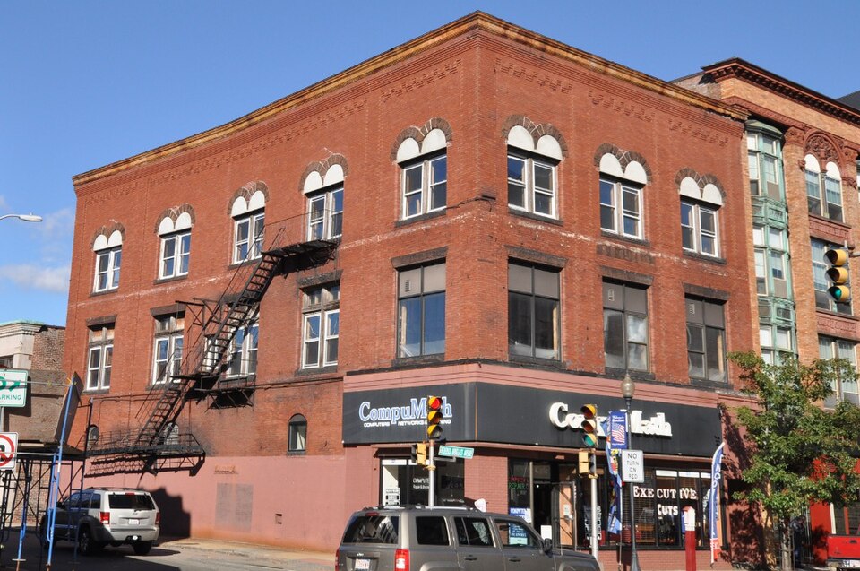
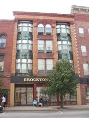
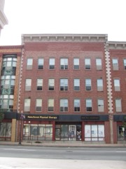
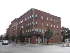
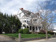
Built in 1898 in the Romanesque Revival architecture. Listed on the National Register of Historic Places in
1982. A historic map-sheet match is not published yet. The record needs a coordinate-quality review before it can be joined to a sheet boundary.
From the record
“The Curtis Building is a historic commercial building in Brockton, Massachusetts, US. The three-story brick building was built in 1870, and is a fine local example of Romanesque styling.”
Wikipedia article Curtis Building, CC BY-SA 4.0.
one of 93 National Register listings in Plymouth County · listed in 1982 · category: Building · built in 1898, Romanesque Revival architecture · one of 1 National Historic Landmarks in Plymouth County.
National Register reference number.82004424- the number the National Park Service assigned this property when it was listed, and the key its nomination file is catalogued under at the National Archives.
The history of Brockton has been written, and is at last presented to the public, after an unexpected amount of labor. There is no. locality in New England which has undergone more rapid changes than this. In ISOO the auth(ir wrote an extended histor)' of the town of North Bridgewater, which has long since gone out of print, containing then about six thousand inhabitants. The rapid growth of the town, the change (jf name t(j Brockton, and afterwards its incorporation into a city, rendered the necessity for a new and enlarged naiTative work under the distinctive name of Brockton. The work has been subject to unavoidable delay owing to the extra amount of work in its preparation, and it is submitted to the citizens of Brockton and vicinity, with all its imperfections, with the hope that it may not be disappointing to those who are interested in and have by their encouragement and generous subscriptions been the means of its publication. Of the importance of works of this class, we may be pardoned for quoting from an eminent writer on kindred works: *
The undersigned citizens and legal voters in the town of North Bridgewater, while willing or desirous to change the corporate name of the town, respectfully beg leave to protest against adopting the name of Brockton, and ask to be heard by themselves or counsel thereon.
Regional context, not property-specific
evidence. The
federal wildfire occurrence database
lists 429 fires within 5 miles of Curtis Building between
2005 and 2020, burning about 181 acres in total. 5 started naturally. 8 were recorded as arson.
Distance is straight-line from the map coordinates, so a fire counted
here may appear on a neighbouring settlement's page as well.
Reported cause
Fires
Debris and open burning
216
Missing data/not specified/undetermined
135
Misuse of fire by a minor
31
Recreation and ceremony
17
Smoking
16
Arson/incendiarism
8
Natural
5
Fireworks
1
The most recent of
them, most recent first, with the day each was reported and the service
that recorded it.
Regional context, not property-specific
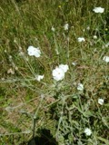
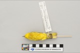
evidence. Museums hold 782 specimens
collected within 10 miles of Curtis Building between 1857 and
1975: 432 Plantae, 216 Fungi, 131 Animalia, 1 Chromista, 1 Protozoa, 1 Unrecorded. 12 distinct Species records are shown.
Collected by A. A. Eaton, A. B. Seymour, A. Clark and others. Each is a
physical object with a catalogue
number, and each entry opens the museum's record. This is what was
collected and kept, not a survey of what lives here - nothing can be
concluded from a species being absent.
Regional context, not property-specific
evidence. The federal mineral resources record lists
11 workings within 5 miles of Curtis Building: 9 past producers, 1 producer, 1 plant.
2 still produce. What was taken out: Sand and Gravel, Construction, Stone, Crushed/Broken. Distance is straight-line from the
map coordinates, so a quarry counted here may appear on a neighbouring
settlement's page as well.
Regional context, not property-specific
evidence. The National Weather Service names
Brockton, the town this property stands in, in 26 storm reports between 1994 and 2023: 8 thunderstorm wind, 8 hail, 3 heavy rain, 3 lightning.
The reports record 60 injuries. Each account below is quoted exactly as the forecast office
filed it, from the NOAA Storm Events Database, and each date
opens the federal record of that event.
Numerous trees and wires were downed by thunderstorm winds throughout Brockton. This includes trees and wires on Warren Avenue in front of the Boys and Girls Club, near the high school, on Route 14, on French and Perkins Avenues, and on Ash Street. One of these trees fell on a dentists office on South Street in the Campello neighborhood.
A line of thunderstorms moved across parts of central and eastern Massachusetts with wind gusts to 40 to 50 mph. In Lowell, two children received minor injuries when a tree fell on them after it was uprooted by winds gusting to an estimated 50 mph. In Southboro, large tree limbs were downed. In Swampscott, a tree fell on an automobile. In Belmont, Cambridge, and Watertown, tree limbs and a few power lines were reported blown down. In Brockton, two large tree limbs were knocked down. In downtown Boston, a street sign was blown down and hit a man on the head.
No historic map-sheet match is published
for this property yet. That does not mean no map exists. This record needs
a coordinate-quality review before it can be joined to a sheet boundary.
Browse the county's mapped places while that work is
pending.
From the nomination file
1,791 words on record
When this property was proposed for the
National Register, someone wrote the case for it: what the building is,
and why it matters. That document is a federal record in the public domain.
It is quoted below word for word, never summarised. The text was read off the scanned case file by machine, so the
occasional stray character is the recogniser's and the 1970s
typewriter's.
Description of the property
The Curtis Building is located in downtown Brockton and was the last building to be con- structed in a block bounded by Main Street, High Street, and Legion Parkway. three story red brick structure with rusticated brownstone trim. Design elements are drawn from the Romanesque revival. The Main Street facade is divided into three bays by brick piers which rise to a cor- sills. pane of glass with a double transom above. The third has been blocked in and now con- tains a conventional sized window with double-hung 6/6 sash. The windows of the third floor are round arched and contain 1/1 double hung sash. A brownstone panel in the center bay above the second story window bears the name of the builder: "S.B.
Curtis." The High Street elevation, which is five bays in length, is treated in similar fashion. It continues the corbeled cornice and its end bays are set off by brick piers. Windows are treated in indentical fashion although here, only the second floor window closest to Main Street has been altered with a single pane of glass. The major alteration to the building is the Main Street storefrontwhich has been rebuilt several times.
Statement of significance
(in one paragraph) Builder/Architect Unknown _ religion _ science - sculpture _ social/ humanitarian _ theater _ transportation other (specity) The Curtis Building possesses integrity of location, design, setting, materials, and workmanship and as a good example of Victorian commercial design, meets criterion C. The building was constructed in 1898 by Sylvanus B. Curtis, a member of one of the old- est families in Brockton. The family name appears as early as 1738 in the records of North Bridgewater, the community which would later be named Brockton. Curtis began his to branch out into real estate, acquiring the Metropolitan Hotel across the street from the site of the Curtis Building.
While the hotel must have occupied most of George Curtis' time (he is listed as proprietor in 1892) Sylvanus continued to acquire property. The acquisition of the Curtis Building site from the estate of Tyler Cobb on May 31, 1884 attracted the attention of Brockton historian, Bradtora Kingman, Ior, at $5.45 per square foot, it was "the biggest price ever paid per foot for real estate in the city." Curtis must have rented the two story wood frame buidling on the site which he purchased from Tyler Cobb for a number of years before deciding to build his own commercial block. Although a precise date for construction of the building has not been established, it is not visible in a photograph of Main Street dated 1895. The Sanborn Map of 1909, however, clearly shows the new brick building.
A new listing for Sylvanus B. Curtis, Realtor, at 107 Main Street, in the commercial directory of 1899, indicates a probable construction date of 1898. This was a period of rapid growth for the local shoe industry and un- precedented prosperity for Brockton.
Quoted from the National Register nomination
for reference 82004424, 13 pages, held by the National Archives in Record
Group 79. See the
catalogue record.
Listed places nearby
6 within 8 miles
Other National Register properties close
enough to walk or drive between, ordered by distance from this one. Both
positions come from the same geocoding pass that matched these properties
to their map sheets.
Listing record. National Park Service National Register of Historic Places, listed-properties dataset, current to 2026-05-22.
Map join. Address geocoded through the United States Census geocoder, then tested against the published boundary of every sheet in the USGS Historical Topographic Map Collection.
How this page is made. Listing fields come from federal records; map-sheet coverage is a labelled coordinate-to-boundary calculation, not a source-field claim.
Wildfire. Short, Karen C. 2022. Spatial wildfire occurrence data for the United States, 1992-2020 [FPA_FOD_20221014]. 6th Edition. Fort Collins, CO: Forest Service Research Data Archive. https://doi.org/10.2737/RDS-2013-0009.6 Collected with United States Government funding and usable without additional permissions or fees.
Specimens. Global Biodiversity Information Facility (GBIF), https://www.gbif.org/. Only records licensed CC0 or CC BY are used. Records licensed CC BY-NC are excluded because this site carries advertising. Images are checked individually and any whose licence is non-commercial, no-derivatives or unreadable is refused.
Mines and quarries. USGS Mineral Resources Data System (MRDS) https://mrdata.usgs.gov/mrds/ A work of the United States government, no copyright under 17 U.S.C. 105.
Storms. NOAA National Centers for Environmental Information, Storm Events Database https://www.ncei.noaa.gov/stormevents/ A work of the United States government, no copyright under 17 U.S.C. 105. Narratives are quoted verbatim from the National Weather Service report and are not edited or summarised.
 Block
Block