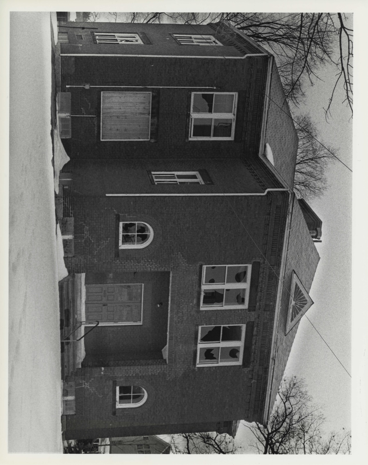
Photographs from the nomination case file, National Park Service records.
Bowers School
Listed on the National Register of Historic Places in
1983. A historic map-sheet match is not published yet. The record needs a coordinate-quality review before it can be joined to a sheet boundary.
From the record
one of 500 National Register listings in Worcester County · listed in 1983 · category: Building · one of 1 National Historic Landmarks in Worcester County.
National Register reference number.83004108- the number the National Park Service assigned this property when it was listed, and the key its nomination file is catalogued under at the National Archives.
Fires near this property
95 since 2004
Regional context, not property-specific
evidence. The
federal wildfire occurrence database
lists 95 fires within 5 miles of Bowers School between
2004 and 2020, burning about 111 acres in total. None started naturally. 5 were recorded as arson.
Distance is straight-line from the map coordinates, so a fire counted
here may appear on a neighbouring settlement's page as well.
Reported cause
Fires
Debris and open burning
46
Recreation and ceremony
20
Missing data/not specified/undetermined
14
Smoking
5
Arson/incendiarism
5
Misuse of fire by a minor
3
Equipment and vehicle use
2
The most recent of
them, most recent first, with the day each was reported and the service
that recorded it.
Regional context, not property-specific
evidence. Museums hold 1,650 specimens
collected within 10 miles of Bowers School between 1858 and
1974: 1,098 Animalia, 271 Fungi, 266 Plantae, 6 Unrecorded, 5 Chromista, 4 Protozoa. 12 distinct Species records are shown.
Collected by A. C. Gibson, A. Ferrett, A. G. Chandler and others. Each is a
physical object with a catalogue
number, and each entry opens the museum's record. This is what was
collected and kept, not a survey of what lives here - nothing can be
concluded from a species being absent.
Regional context, not property-specific
evidence. The federal mineral resources record lists
17 workings within 5 miles of Bowers School: 12 past producers, 4 producers, 1 prospect.
4 still produce. What was taken out: Sand and Gravel, Construction, Stone, Dimension, Stone, Crushed/Broken, Iron. Distance is straight-line from the
map coordinates, so a quarry counted here may appear on a neighbouring
settlement's page as well.
Regional context, not property-specific
evidence. The National Weather Service names
Clinton, the town this property stands in, in 12 storm reports between 1999 and 2021: 5 thunderstorm wind, 4 hail, 1 lightning, 1 funnel cloud.
No death or injury is recorded in these reports. Each account below is quoted exactly as the forecast office
filed it, from the NOAA Storm Events Database, and each date
opens the federal record of that event.
A weak tornado touched down in the early afternoon in the town of |Clinton in eastern Worcester County, Massachusetts. A NWS |meteorologist conducted a storm survey following tips from amateur |radio operators and the local fire chief. The following information |summarizes all of the reports. ||The tornado touched down near the intersection of Cedar Street and |Church Street. It tracked northeastward, impacting Benefit Street, |Haskell Avenue, and Water Street at Beech Street. This is a path |length of 0.5 miles. The approximate path width was 35 yards. Damage |photos led to estimates of maximum wind speeds of 75 to 80 mph, |which is an EF0 on the Enhanced Fujita Scale. The time, based on |radar and eyewitness accounts, was from 130 PM to 131 PM EDT. ||A row of trees was snapped and downed in a convergent fashion near |Church Street at Cedar Street. Other trees were downed on Haskell |Avenue at Beech Street. The fire chief relayed that multiple |residents witnessed a tornado touchdown on Water Street, where |extensive damage was observed.
In Clinton, power lines were down on California Court at Beacon Street. Also, power lines were down elsewhere on Beacon Street and on Route 110. Trees and wires were down on a car on Parker Street.
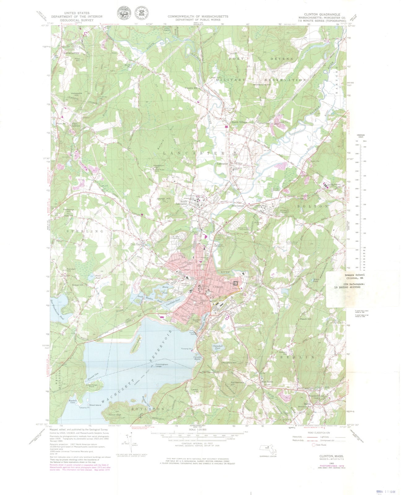
No historic map-sheet match is published
for this property yet. That does not mean no map exists. This record needs
a coordinate-quality review before it can be joined to a sheet boundary.
Browse the county's mapped places while that work is
pending.
From the nomination file
2,211 words on record
When this property was proposed for the
National Register, someone wrote the case for it: what the building is,
and why it matters. That document is a federal record in the public domain.
It is quoted below word for word, never summarised. The text was read off the scanned case file by machine, so the
occasional stray character is the recogniser's and the 1970s
typewriter's.
Description of the property
The Bowers School stands approximately in the center of its original ½ acre lot on the south side of Water Street in Clinton. Asphalt paved parking lot and playyard surround the building which is set back 75' from the street on a slight rise. Early settlement of this area centered around the mills along the nearby Nashua River; today the school is surrounded by a residential neighborhood of one and two family houses, dating primarily. from the late nineteenth century. Built originally as a small one-room frame school house in 1847, the Bowers School was completely remodelled in 1892 to its present form. The building rises two stories from a low foundation of fieldstone (below grade) and cut granite to a combination gable and hip roof covered in gray Vermont slate.
The main body of the building is executed in red brick laid in running bond. In plan, the building is rectangular with a large two-story projecting entrance pavilion on the north elevation facing Water Street. A massive brick chimney rises from the center of the main block. The syrmetrically aligned fenestration consists of rectangular windows arranged in pairs and triplets set in sharply cut openings with sandstone lintels (wide) and sills (narrow). Truncated rectangular windows with brick lintels light the basement. A major decorative feature of the building is its brick cornice, consisting of three courses: bracket-like corbelling, a broken band of sawtooth pattern, and a continuous line of corbelling at the roofline. The facade (north) is dominated by the central entrance pavilion..
The entry itself con- sists of double doors recessed in a large plain rectangular opening and flanked by round arched windows, and surmounted by two pairs of rectangular windows.
/Architect Joshua Thissell (1892 reconstruction) Statement of Significance (in one paragraph) The Bowers School was designed in 1892 by local architect Joshua Thissell. Thissell employed a standard period scheme for small scale schools, but elevated the Bowers School above the norm by employing brick rather than wood as a contruction material. Addition- ally, the Bowers School was used as a model for subsequent turn of the century schools in Clinton. Most importantly, the Bowers School reflects the rapid growth of industry and population in 19th century Clinton. Built on the site of one of Clinton's five mid-19th century schools (none of which survive), this one directly reflects the commmity's association, us meetst iriteria lesign, setting materials, 1.
and C oi the National Register of Historic Places. later part of Millville and Clintonville, and eventually incorporated as Clinton in 1850. During the early part of the nineteenth century, Clintonville, which was situated on a mill stream, began to develop its own identity as industries prospered. By 1800 Clintonville contained two districts of the Lancaster School Committee. The commnity continued to grow, outstripping Lancaster, and by 1850 the newly incorporated town of Clinton boasted five schools which were turned over to the new town by Lancaster. The Bowers School originated in 1847 on land donated to the town by Sidney Harris, a descendant of the area's first white settlers. The school krown as the Harris Hill School; was built to house students during the 1847-48 academic year.
At this time the school conmittee embarked on a bold new educational policy: this primary school adopted a graded three tier system and mandatory examination.
Quoted from the National Register nomination
for reference 83004108, 10 pages, held by the National Archives in Record
Group 79. See the
catalogue record.
Listed places nearby
6 within 8 miles
Other National Register properties close
enough to walk or drive between, ordered by distance from this one. Both
positions come from the same geocoding pass that matched these properties
to their map sheets.
Listing record. National Park Service National Register of Historic Places, listed-properties dataset, current to 2026-05-22.
Map join. Address geocoded through the United States Census geocoder, then tested against the published boundary of every sheet in the USGS Historical Topographic Map Collection.
How this page is made. Listing fields come from federal records; map-sheet coverage is a labelled coordinate-to-boundary calculation, not a source-field claim.
Wildfire. Short, Karen C. 2022. Spatial wildfire occurrence data for the United States, 1992-2020 [FPA_FOD_20221014]. 6th Edition. Fort Collins, CO: Forest Service Research Data Archive. https://doi.org/10.2737/RDS-2013-0009.6 Collected with United States Government funding and usable without additional permissions or fees.
Specimens. Global Biodiversity Information Facility (GBIF), https://www.gbif.org/. Only records licensed CC0 or CC BY are used. Records licensed CC BY-NC are excluded because this site carries advertising. Images are checked individually and any whose licence is non-commercial, no-derivatives or unreadable is refused.
Mines and quarries. USGS Mineral Resources Data System (MRDS) https://mrdata.usgs.gov/mrds/ A work of the United States government, no copyright under 17 U.S.C. 105.
Storms. NOAA National Centers for Environmental Information, Storm Events Database https://www.ncei.noaa.gov/stormevents/ A work of the United States government, no copyright under 17 U.S.C. 105. Narratives are quoted verbatim from the National Weather Service report and are not edited or summarised.
 Block
Block