BlockBefore
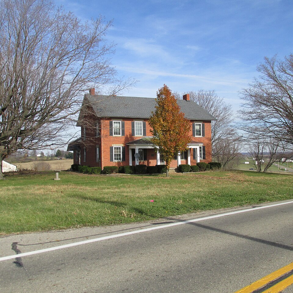
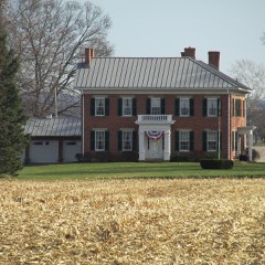
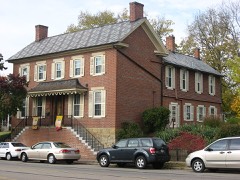
Photograph of Stevenson Peters House
Photograph by Aesopposea, CC BY-SA 3.0. Via Wikimedia Commons.

Peters, Stevenson, House

Listed on the National Register of Historic Places in 1984. A historic map-sheet match is not published yet. The record needs a coordinate-quality review before it can be joined to a sheet boundary.

From the record

“The Stevenson Peters House is a historic farm complex near the city of Circleville in Pickaway County, Ohio, United States. Built in the mid-19th century, the complex has been named a historic site.”

Wikipedia article Stevenson Peters House, CC BY-SA 4.0.

one of 20 National Register listings in Pickaway County · listed in 1984 · category: Building.

Sources: the Wikipedia article · the case file at the National Archives · the National Register database, National Park Service

The listing

  • What is counted as historic. The nomination lists 6 buildingss as contributing to the listing.
  • Address. 9860 SR 188, Circleville, 43103
  • When was it listed? 1984-02-09
  • Category. building
  • Township. Walnut township
  • National Register reference number. 84003797 - the number the National Park Service assigned this property when it was listed, and the key its nomination file is catalogued under at the National Archives.

Fires near this property

7 since 2019

Regional context, not property-specific evidence. The federal wildfire occurrence database lists 7 fires within 5 miles of Peters, Stevenson, House between 2019 and 2019, burning about 10 acres in total. None started naturally. None was recorded as arson. Distance is straight-line from the map coordinates, so a fire counted here may appear on a neighbouring settlement's page as well.

Reported cause Fires
Debris and open burning6
Smoking1

The most recent of them, most recent first, with the day each was reported and the service that recorded it.

DateCause SizeReported by Name on the report
5 August 2019Debris and open burningunder an acreOhio Department of Natural Resources15354
25 August 2019Debris and open burningunder an acreOhio Department of Natural Resources15340
20 July 2019Smokingunder an acreOhio Department of Natural Resources15342
9 November 2019Debris and open burningunder an acreOhio Department of Natural Resources15345
5 October 2019Debris and open burningunder an acreOhio Department of Natural Resources15350
25 October 2019Debris and open burningunder an acreOhio Department of Natural Resources15347
15 October 2019Debris and open burning10 acresOhio Department of Natural Resources15349

Every fire recorded in Pickaway County

Specimens collected near this property

12 of 1,987 shown

Regional context, not property-specific evidence. Museums hold 1,987 specimens collected within 10 miles of Peters, Stevenson, House between 1876 and 1975: 1,793 Animalia, 142 Fungi, 49 Plantae, 2 Unrecorded, 1 Protozoa. 12 distinct Species records are shown. Collected by A. Spreitzer, A. White, M. Trautman, T. Cavender, Acker, G. & Class and others. Each is a physical object with a catalogue number, and each entry opens the museum's record. This is what was collected and kept, not a survey of what lives here - nothing can be concluded from a species being absent.

Image SpeciesYear Collected by Where, as recorded
Specimen of Aecidium galii Pers.Aecidium galii Pers.1883Kellerman, W.A.Amanda
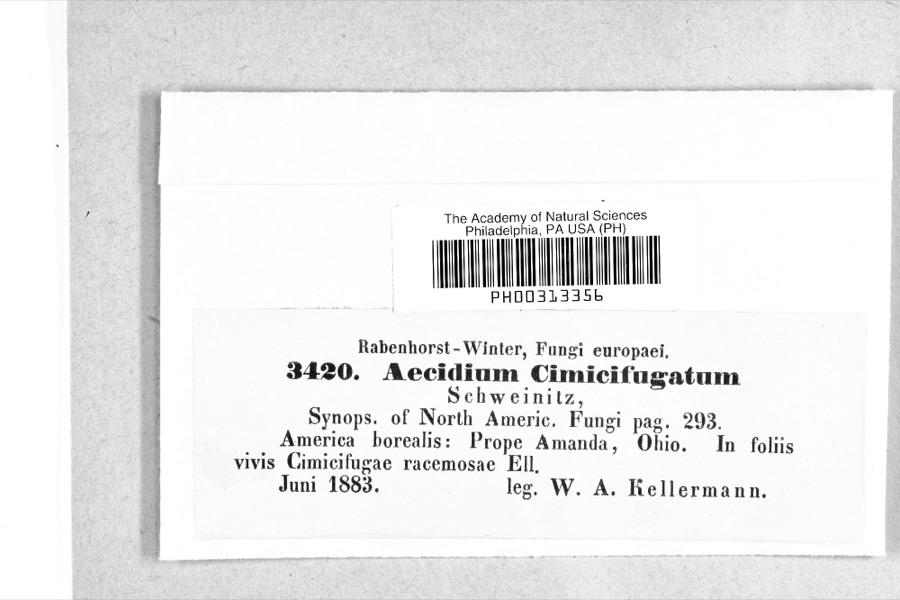
Specimen of Caeoma cimicifugatum Schwein.Caeoma cimicifugatum Schwein.1883W. A. KellermanAmanda
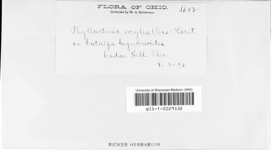
Specimen of Phyllactinia corylea (Pers.) P.Karst.Phyllactinia corylea (Pers.) P.Karst.1892W.A. Kellerman
A photograph of the species Caprimulgus vociferus, not of this specimenCaprimulgus vociferus vociferus A.Wilson, 18121876Jones, H. (Howard)Darby Creek, Circleville, Pickaway, Ohio, USA
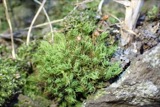
A photograph of the species Bartramia pomiformis, not of this specimenBartramia pomiformis F.Weber & D.Mohr1880W. Kellerman
A photograph of the species Cardinalis cardinalis, not of this specimenCardinalis cardinalis (Linnaeus, 1758)1880Mearns, E.A.Circleville near Scioto River.
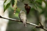
A photograph of the species Empidonax virescens, not of this specimenEmpidonax virescens (Vieillot, 1818)1880Jones, H. (Howard)Niles Woods, near Circleville, Pickaway Co., Ohio
Anomodon rostratus (Hedw.) Schimp.1882W. Kellerman
A photograph of the species Anomodon viticulosus, not of this specimenAnomodon viticulosus (Hedw.) Hook. & Taylor1882W. A. Kellerman
A photograph of the species Atrichum undulatum, not of this specimenAtrichum undulatum (Hedw.) P.Beauv.1882W. A. Kellerman
A photograph of the species Auricularia auricula, not of this specimenAuricularia auricula (L.) Underw.1882W. A. Kellerman
A photograph of the species Bisporella pallescens, not of this specimenBisporella pallescens (Pers.) S.E.Carp. & Korf1882W. A. KellermanAmanda.

All 1,987 specimens within 10 miles, at the Global Biodiversity Information Facility.

Storms near this property

60 of 75 shown

Regional context, not property-specific evidence. The National Weather Service names Circleville, the town this property stands in, in 75 storm reports between 1994 and 2026: 29 thunderstorm wind, 21 hail, 14 flood, 7 flash flood. The reports record 7 injuries. Each account below is quoted exactly as the forecast office filed it, from the NOAA Storm Events Database, and each date opens the federal record of that event.

WhenEvent Place namedHarm What the report says
October 1999Tornado (F3)Circleville6 hurt, $4,000,000A tornado touched down west of Circleville, pulling a small shed off of its foundation and destroying a section of a construction building. after this, the tornado lifted and then touched down in a more developed area in town. It destroyed a building housing two businesses and ripped the roof off of a section of a strip mall, ejecting furniture from inside the structure. A large sign weighing several hundred pounds was ripped from its foundation and blown twenty feet away. A tractor trailer with a load of 18 to 19 tons was blown over and dragged ten feet away from where it landed. The tornado then proceeded to a housing development where several homes were destroyed, several roofs ripped off, and garages either destroyed or moved from their foundations. Trees were twisted and broken off at their bases and carports were also torn from nearby houses.
August 2019Thunderstorm WindCircleville1 hurt, $9,000A tree fell onto a vehicle along Northridge Road near Nicholas Road. One serious injury was reported.
August 2006Tornado (F0)Circleville$250,000A tornado touched down along State Route 361, causing damage to three buildings at the Pickaway Machine and Fabricating Company. Portions of the aluminum roofing and insulation were removed from these three buildings, and deposited throughout the complex and in a cornfield across Route 361. Corn stalks at six to eight feet in height were knocked over in a 150 foot wide swath across this cornfield, extending for a mile to the northeast to Boggs Road. Across Boggs Road, minor tree and limb damage occurred, with part of an open air aluminum shed being blown into a nearby tree line.
October 2010Thunderstorm WindCircleville$75,000A building collapsed and trees were reported down due to damaging thunderstorm winds.
June 2001Tornado (F0)Circleville$50,000A small tornado moved across the south side of Circleville producing minor structural and roof damage to a few buildings, and some damage to nine cars at a dealership. Numerous trees and power lines were also knocked down.
May 2001LightningCircleville$50,000Significant damage to a house caused by a lightning strike.
April 2011Thunderstorm WindCircleville$20,000Trees were uprooted, a barn was moved off its foundation, and power lines were reported down due to damaging thunderstorm winds.
June 2025Flash FloodCircleville$15,000Water was rushing over Pontious Lane. Several vehicles were inundated by the water.
June 2008HailCircleville$15,000no account filed
June 2025Flash FloodCircleville$10,000Water was rushing over the 2000 block of North Court Street and a portion of the road was washed away.
September 2019Thunderstorm WindCircleville$10,000A few trees were downed onto some houses and a few power lines were also downed.
August 2018Thunderstorm WindCircleville$10,000Multiple trees were knocked down over a road. In addition, a tree fell onto a house.
July 1998Thunderstorm WindCircleville$10,000Trees downed.
June 2008HailCircleville$8,000no account filed
June 2011Thunderstorm WindCircleville$6,000A shed was blown over and several large limbs were down due to damaging thunderstorm winds.
November 2020Thunderstorm WindCircleville$5,000Several trees were downed throughout Washington Township east of Circleville.
January 2000Flash FloodCircleville$5,000Heavy rainfall caused some streets to be flooded in Circleville.
September 2000Thunderstorm WindCircleville$5,000Trees knocked down by thunderstorm winds.
July 1994Thunderstorm WindCircleville$5,000Trees were downed. Four head of cattle were killed at the Oscar Waller Farm from being struck by lightning as they took shelter under a tree.
May 2022Thunderstorm WindCircleville$4,000A few large trees were downed on Nicholas Drive.
June 2011Thunderstorm WindCircleville$4,000Trees and power lines were reported down due to damaging thunderstorm winds.
August 2021Thunderstorm WindCircleville$3,000A few trees were downed.
May 2015Thunderstorm WindCircleville$3,000Several trees were downed across the Circleville area.
June 2012Thunderstorm WindCircleville$3,000A large tree was downed on a house on Half Avenue due to damaging thunderstorm winds.
August 2007Thunderstorm WindCircleville$3,000Trees were knocked down.
April 2003Thunderstorm WindCircleville$3,000A few trees and limbs were downed in town.
April 2003Thunderstorm WindCircleville$3,000Trees and large limbs were downed in town.
June 2003Thunderstorm WindCircleville$3,000Trees and large limbs were downed.
July 2001Thunderstorm WindCircleville$3,000Trees were knocked down on the west and east side of Circleville.
March 2026Thunderstorm WindCircleville$2,000A barn and a home both sustained minor siding damage.
June 2012Thunderstorm WindCircleville$2,000Multiple large tree limbs were reported down due to damaging thunderstorm winds.
August 2010Thunderstorm WindCircleville$2,000Several trees were reported down across the county.
June 2004Thunderstorm WindCircleville$2,000One tree and several large limbs were downed.
May 2002Thunderstorm WindCircleville$2,000Two trees were knocked down near town.
June 2000Thunderstorm WindCircleville$2,000A tree and several large limbs were blown down on Island Road.
November 2007HailCircleville$2,000no account filed
April 1996Thunderstorm WindCircleville$2,000no account filed
May 2022Thunderstorm WindCircleville$1,000A tree was downed along Oakland Terrace.
July 2007HailCircleville$1,000no account filed
August 2019Thunderstorm WindCircleville$250A small limb was knocked down in Circleville.
June 2025FloodCircleville-High water was reported on several roads in Circleville.
July 2025Flash FloodCircleville-Watt Street was reported to have water flowing across it.
July 2025FloodCircleville-Island Road was closed due to high standing water.
July 2025FloodCircleville-High water was reported over Edwards Road.
July 2025FloodCircleville-A portion of the Kroger Parking lot flooded along Hargus Creek.
February 2022FloodCircleville-Island Road was closed due to high water.
May 2020FloodCircleville-Water rising out of Hominy Creek limited access to a few homes off of East Main Street in Circleville.
February 2019FloodCircleville-Several roads were closed due to flooding.
February 2019FloodCircleville-Several roads remained closed due to flooding.
June 2019FloodCircleville-A portion of North Court Street was closed due to high water.
June 2019FloodCircleville-Numerous roads were closed due to flooding.
April 2018FloodCircleville-High water was reported at multiple locations throughout Pickaway County.
August 2018FloodCircleville-High water was reported on State Routes 138 and 104.
June 2018FloodCircleville-Water was reported over two roads.
June 2018FloodCircleville-A few inches of standing water was reported on Island Road.
June 2009HailCircleville-Hail from three quarters of an inch to an inch in diameter was reported. Several trees were also downed and shingles were torn off of a roof.
July 2006Flash FloodCircleville-Island Road was flooded and closed.
May 2004Flash FloodCircleville-Numerous roads were flooded.
July 2002Flash FloodCircleville-Morris Road was closed for a period of time due to high water.
April 2024HailCircleville-no account filed

Every storm recorded in Pickaway County

Map coverage status

No historic map-sheet match is published for this property yet. That does not mean no map exists. This record needs a coordinate-quality review before it can be joined to a sheet boundary. Browse the county's mapped places while that work is pending.

From the nomination file

2,300 words on record

When this property was proposed for the National Register, someone wrote the case for it: what the building is, and why it matters. That document is a federal record in the public domain. It is quoted below word for word, never summarised. The text was read off the scanned case file by machine, so the occasional stray character is the recogniser's and the 1970s typewriter's.

Description of the property

The Stevenson Peters residence reflects the common midwest rural house type referred to as There is a l4 story summer kitchen to the west of the main house. It too is made of common Historic photographs of the house and complex (c.1875) show that the house originally had deteriorated windows.with shutters.An existing sandstone and frame springhouse now houses equipment for There is also a small hip roofed addition to the west.The original portion has vertical open porch on the east and a smaller room on the west.(See floor plan.) There are two end chimneys and one internal chimney on the "fair" NPS Form 10-900-a OMB No. 1024-0018 Exp.

10-31-84 National Park Service Peters, Stevenson, Residence, Pickaway County, Ohio Page Inventory-Nomination Form Continuation sheet received date entered exterior brick was sandblasted. National Register of Historic Places Other alteration to the house since built include a standing seam metal roof with projecting Item number the uniqueness of the plan of this house in the community makes it particularly significant.

United States Department of the Interior Although the integrity of the farm house is compromised by some of these later alterations, added to the east side of the wing with a patio filling in the "L"of the plan.The original Previously the house had been painted with a creme "nu-bricking"(c.194l?).In 1977 the For NPS use only shutters have been replaced with plastic ones and the roof is now covered in asphalt shingles.

(3-82) eaves and the existing 3 bay porch.(c.l9oo?).A shed roof aluminum-sided addition has been Areas of Significance - Check and justify below - prehistoric - archeology-historic .law - - agriculture _ literature - sculpture X architecture -art - music _ exploration/settlement _ - philosophy :communications - politics/government _ transportation that the variation was incorporated to take advantage of the hillside view and breezes.

Read the complete 2,300-word case file.

Statement of significance

(in one paragraph) and the existing inventory of structures in Pickaway and neighboring Fairfield Counties, 8. Significance 1900- section has one major room centered and then flanked by the porch on the east side and conjunction with its affiliation with the prominent Peters family makes it a noteworthy was among the first settlers in Pickaway County. structure.It is also significant as an early farm complex which remains active in the walnut woodwork and staircase are extant.

Specific dates 1852 184l map of the Township indicates Stevenson was holding land in the vicinity of the The residence was constructed in 1852.The lintel over the front door is inscribed;" same family today.Because of the prominent location of the house on a hillside and a smaller room to the west.In reviewing all of the architecture in Walnut Township a farmer, who was one of the largest landholders in the township and whose family Al9o6 history of Pickaway County exclaims that "the Peters family is one of good standing - - other(specify) - - science -community planning - landscape architecture _ religion rear section of the basic rectangular shape. Therefore, the floor plan becomes a five type, having two rooms in the front divided by a central hall and stairway.

The rear of the "4 over 4" rural house type and because of its affiliation with Stevenson Peters, relocated in Walnut Township, Pickaway County, Ohio.when he was at an eatly age. An archeology-prehistoric no other structure with this double story open porch feature was identified.

Read the complete 2,300-word case file.

The whole case file for this property - 2,300 words, 20 pages, reproduced complete.

Quoted from the National Register nomination for reference 84003797, 20 pages, held by the National Archives in Record Group 79. See the catalogue record.

Listed places nearby

6 within 8 miles

Other National Register properties close enough to walk or drive between, ordered by distance from this one. Both positions come from the same geocoding pass that matched these properties to their map sheets.

Photograph PropertyDistance Listed
Redlands6.2 miles1982
Ashville Depot6.8 miles1980
McCrea, Matthew, House7.1 miles1988
Watt-Groce-Fickhardt House7.5 miles1985
Memorial Hall7.5 miles1980
Saint Philip's Episcopal Church7.8 miles1986

Sources for this property

National Archives recordThe nomination case file for reference 84003797 in Record Group 79.
Wikipedia articleCommunity-written account of this property, licensed CC BY-SA.
Pickaway CountyAll 20 listed properties in this county.

Provenance

  • Listing record. National Park Service National Register of Historic Places, listed-properties dataset, current to 2026-05-22.
  • Map join. Address geocoded through the United States Census geocoder, then tested against the published boundary of every sheet in the USGS Historical Topographic Map Collection.
  • How this page is made. Listing fields come from federal records; map-sheet coverage is a labelled coordinate-to-boundary calculation, not a source-field claim.
  • Wildfire. Short, Karen C. 2022. Spatial wildfire occurrence data for the United States, 1992-2020 [FPA_FOD_20221014]. 6th Edition. Fort Collins, CO: Forest Service Research Data Archive. https://doi.org/10.2737/RDS-2013-0009.6 Collected with United States Government funding and usable without additional permissions or fees.
  • Specimens. Global Biodiversity Information Facility (GBIF), https://www.gbif.org/. Only records licensed CC0 or CC BY are used. Records licensed CC BY-NC are excluded because this site carries advertising. Images are checked individually and any whose licence is non-commercial, no-derivatives or unreadable is refused.
  • Storms. NOAA National Centers for Environmental Information, Storm Events Database https://www.ncei.noaa.gov/stormevents/ A work of the United States government, no copyright under 17 U.S.C. 105. Narratives are quoted verbatim from the National Weather Service report and are not edited or summarised.