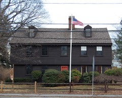
Listed on the National Register of Historic Places in
1985. A historic map-sheet match is not published yet. The record needs a coordinate-quality review before it can be joined to a sheet boundary.
From the record
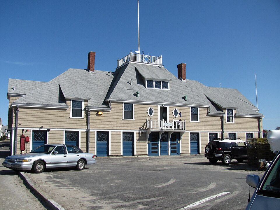
“Swampscott Fish House is a historic fishing supply storage house off Humphrey Street on Fisherman's Beach in Swampscott, Massachusetts. It is the oldest active fish house in the country.”
Wikipedia article Swampscott Fish House, CC BY-SA 4.0.
one of 350 National Register listings in Essex County · listed in 1985 · category: Building · one of 2 National Historic Landmarks in Essex County.
National Register reference number.85001120- the number the National Park Service assigned this property when it was listed, and the key its nomination file is catalogued under at the National Archives.
Fires near this property
46 since 2003
Regional context, not property-specific
evidence. The
federal wildfire occurrence database
lists 46 fires within 5 miles of Swampscott Fish House between
2003 and 2020, burning about 240 acres in total. 1 started naturally. 4 were recorded as arson.
Distance is straight-line from the map coordinates, so a fire counted
here may appear on a neighbouring settlement's page as well.
Reported cause
Fires
Recreation and ceremony
19
Smoking
11
Arson/incendiarism
4
Missing data/not specified/undetermined
3
Misuse of fire by a minor
2
Equipment and vehicle use
2
Debris and open burning
2
Fireworks
1
Natural
1
Railroad operations and maintenance
1
The most recent of
them, most recent first, with the day each was reported and the service
that recorded it.
Regional context, not property-specific
evidence. Museums hold 9,289 specimens
collected within 10 miles of Swampscott Fish House between 1800 and
1975: 4,270 Plantae, 2,899 Animalia, 927 Chromista, 526 Fungi, 439 Unrecorded, 218 Bacteria, 10 Protozoa. 12 distinct Species records are shown.
Collected by A B. Proper, A H HIGGINSON, A. A. Eaton and others. Each is a
physical object with a catalogue
number, and each entry opens the museum's record. This is what was
collected and kept, not a survey of what lives here - nothing can be
concluded from a species being absent.
Regional context, not property-specific
evidence. The federal mineral resources record lists
5 workings within 5 miles of Swampscott Fish House: 2 plants, 1 unknown, 1 producer, 1 occurrence.
3 still produce. What was taken out: Stone, Crushed/Broken, Iron, Gold, Silver, Platinum, Palladium, Mercury. Distance is straight-line from the
map coordinates, so a quarry counted here may appear on a neighbouring
settlement's page as well.
Regional context, not property-specific
evidence. The National Weather Service names
Swampscott, the town this property stands in, in 8 storm reports between 1995 and 2022: 7 thunderstorm wind, 1 hail.
No death or injury is recorded in these reports. Each account below is quoted exactly as the forecast office
filed it, from the NOAA Storm Events Database, and each date
opens the federal record of that event.
Trees and wires were downed on several streets in Marblehead and Swampscott, including Pickwick Road in Marblehead and Thomas and Banks Roads in Swampscott. One of the trees on Banks Road fell onto a garage. A tree on Thomas Road landed on a house causing extensive damage.
No historic map-sheet match is published
for this property yet. That does not mean no map exists. This record needs
a coordinate-quality review before it can be joined to a sheet boundary.
Browse the county's mapped places while that work is
pending.
From the nomination file
4,342 words on record
When this property was proposed for the
National Register, someone wrote the case for it: what the building is,
and why it matters. That document is a federal record in the public domain.
It is quoted below word for word, never summarised. The text was read off the scanned case file by machine, so the
occasional stray character is the recogniser's and the 1970s
typewriter's.
Description of the property
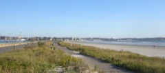
The Swampscott Fish House, built in 1896, is located off Humphrey Road, on the southern shore of Swampscott, Massachusetts. Swampscott's 1andmass is triangular, bounded by the towns of Salem and Marblehead to the north, the city of Lynn to the west, and the Atlantic Ocean to the south and east. Although the town has an area of only 3.07 square miles, its coastline is 4.3 miles long. The southern shore of Swampscott is characterized by several smal1 bays opening into Nahant Bay. The Fish House sits at a 90-degree angle to Humphrey Road, between the road and Blaney Beach, known locally as Fishermen's Beach, or Fishies. The beach is framed by Blaney Rock to the west and Lincoln House Point to the east. The surrounding area has mixed commercial and residential uses.
To the east of the Fish House is a well-established residential neighborhood of nineteenth and early-twentieth century houses. Immediately to the north of the building is Humphrey Street; a new 28-unit condominium development is located directly across the street. Along Humphrey Road are a number of retail stores and small service offices. To the west of the Fish House is Blaney Beach Park, a municipally owned park that is partially paved forparking. In addition to parking, this area is used for the storage of boats and equipment by local fisherman, particularly during the winter months. To the south of the Fish House is a fishing pier, constructed during the 1960s. Alongside the pier is a boat launching ramp.
The Fish House sits on a parcel of land that is approximately 130x165 feet in area. A substantial portion of the lot has been paved for parking.
(in one paragraph) Builder/Architect Henry W. Rogers The Swampscott Fish House in Swampscott, Massachusetts, possesses integrity of location, design, setting, materials, workmanship, feeling and association. Swampscott's fishing industry has been an important part of its economy from the seventeenth century, and remains active today. Built in 1896, the Fish House is the only known municipally-built fish house in the state, and has remained in continuous use as a commercial fish house for its ninety-year history. The Fish House is a large, handsome building with design influences from the Colonial Revival and Shingle styles, reflecting prevailing architectural styles of the resort summer homes built in the same period.
As the only known municipally-built fish house in Massachusetts, for its associations with the fishing industry in Swampscott, and for its reflection of high-style summer cottage architecture, the Swampscott Fish House meets criteria A and C for listing on the National Register of Historic Places on the state and local levels. Swampscott was first settled by Europeans in 1629, when five men moved south from Salem to Lynn, then comprising the present towns of Lynn, Lynnfield, Nahant, Saugus, and Swampscott. Swampscott possessed a distinct identity as a fishing village from its earliest days, although it legally remained a part of Lynn for over 200 years. town by act of the Massachusetts Legislature.
At that time, the town had a r set or the Massachusets teotsTaztune In 1852, Swampscott was separately incorporated as a population of approximately 1,000 residents, most of whom were engaged in the fishing industry. Fishing was an important economic activity in Swampscott from the seventeenth century. Early fishermen went out in small dories, staying fairly close to 1and. After 1795, the use of schooners, locally known as jiggers, became prevalent, and the fleet pursued fish further out to sea.
Quoted from the National Register nomination
for reference 85001120, 14 pages, held by the National Archives in Record
Group 79. See the
catalogue record.
Listed places nearby
6 within 8 miles
Other National Register properties close
enough to walk or drive between, ordered by distance from this one. Both
positions come from the same geocoding pass that matched these properties
to their map sheets.
Listing record. National Park Service National Register of Historic Places, listed-properties dataset, current to 2026-05-22.
Map join. Address geocoded through the United States Census geocoder, then tested against the published boundary of every sheet in the USGS Historical Topographic Map Collection.
How this page is made. Listing fields come from federal records; map-sheet coverage is a labelled coordinate-to-boundary calculation, not a source-field claim.
Wildfire. Short, Karen C. 2022. Spatial wildfire occurrence data for the United States, 1992-2020 [FPA_FOD_20221014]. 6th Edition. Fort Collins, CO: Forest Service Research Data Archive. https://doi.org/10.2737/RDS-2013-0009.6 Collected with United States Government funding and usable without additional permissions or fees.
Specimens. Global Biodiversity Information Facility (GBIF), https://www.gbif.org/. Only records licensed CC0 or CC BY are used. Records licensed CC BY-NC are excluded because this site carries advertising. Images are checked individually and any whose licence is non-commercial, no-derivatives or unreadable is refused.
Mines and quarries. USGS Mineral Resources Data System (MRDS) https://mrdata.usgs.gov/mrds/ A work of the United States government, no copyright under 17 U.S.C. 105.
Storms. NOAA National Centers for Environmental Information, Storm Events Database https://www.ncei.noaa.gov/stormevents/ A work of the United States government, no copyright under 17 U.S.C. 105. Narratives are quoted verbatim from the National Weather Service report and are not edited or summarised.
 Block
Block