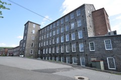
Listed on the National Register of Historic Places in
1986. A historic map-sheet match is not published yet. The record needs a coordinate-quality review before it can be joined to a sheet boundary.
From the record
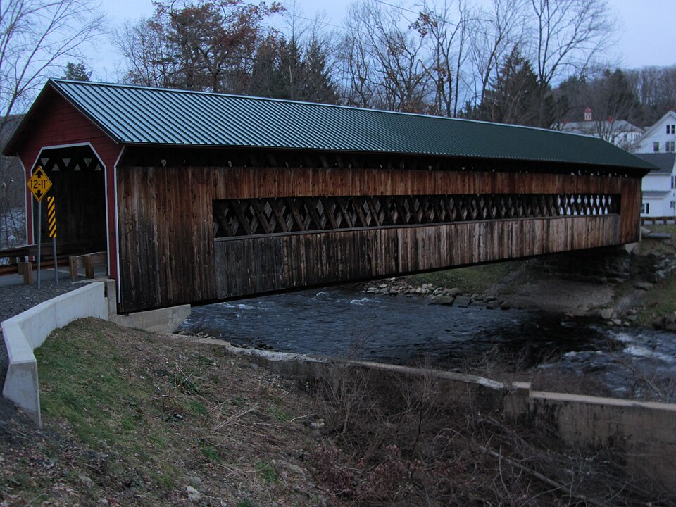
“Ware-Hardwick Covered Bridge is a historic covered bridge spanning the Ware River on Old Gilbertville Road and Bridge Street in Ware and the village of Gilbertville within Hardwick, Massachusetts. It is one of a small number of surviving 19th-century covered bridges in the state.”
Wikipedia article Ware-Hardwick Covered Bridge, CC BY-SA 4.0.
one of 32 National Register listings in Hampshire County · listed in 1986 · category: Structure.
National Register reference number.86001006- the number the National Park Service assigned this property when it was listed, and the key its nomination file is catalogued under at the National Archives.
The eastern band of schists leaves the county at the south line of Orange, and, traversing Worcester County for a long distance, reenters the area of the map in Ware and crosses Palmer and Monson. The fourfold division of the schists, which has been persistent over so large an area, and which seems to be somewhat less distinct at the beginning of this band in Orange, here fails entirely. It is reduced to a twofold division of amphibolites below, resting directly upon the Monson gneiss, and a great volume of fibrolitic mica-schists, the lower portion of which may represent the whetstone-schist, but in which no persistent lithological distinctions can be established.
Mica-schist from Ware. In the bluff near the contact of mica-schist on hornblende-schist, 175 rods southwest of B. Bond's house, is seen a black, fine-grained schist with wavy, shining lamination surface, which may almost be called an argillite, with rarely deep-red garnets and large porphyi-itic spots of white feldspar.
Regional context, not property-specific
evidence. The
federal wildfire occurrence database
lists 22 fires within 5 miles of Ware--Hardwick Covered Bridge between
2015 and 2020, burning about 10 acres in total. 5 started naturally. None was recorded as arson.
Distance is straight-line from the map coordinates, so a fire counted
here may appear on a neighbouring settlement's page as well.
Reported cause
Fires
Missing data/not specified/undetermined
8
Equipment and vehicle use
6
Natural
5
Smoking
1
Recreation and ceremony
1
Debris and open burning
1
The most recent of
them, most recent first, with the day each was reported and the service
that recorded it.
Regional context, not property-specific
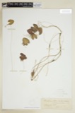
evidence. Museums hold 398 specimens
collected within 10 miles of Ware--Hardwick Covered Bridge between 1857 and
1975: 222 Animalia, 118 Plantae, 57 Fungi, 1 Chromista. 12 distinct Species records are shown.
Collected by A. C. Gibson, A. Lavallee, A. P. Chute and others. Each is a
physical object with a catalogue
number, and each entry opens the museum's record. This is what was
collected and kept, not a survey of what lives here - nothing can be
concluded from a species being absent.
Regional context, not property-specific
evidence. The federal mineral resources record lists
3 workings within 5 miles of Ware--Hardwick Covered Bridge: 2 past producers, 1 plant.
1 still produces. What was taken out: Sand and Gravel, Construction. Distance is straight-line from the
map coordinates, so a quarry counted here may appear on a neighbouring
settlement's page as well.
Regional context, not property-specific
evidence. The National Weather Service names
Ware, the town this property stands in, in 28 storm reports between 1995 and 2025: 18 thunderstorm wind, 4 flood, 3 hail, 2 lightning.
The reports record 3 injuries. Each account below is quoted exactly as the forecast office
filed it, from the NOAA Storm Events Database, and each date
opens the federal record of that event.
Lightning struck the medical office building on the campus of Baystate Mary Lane Hospital in Ware, blowing out the building's electrical panel. In addition, three people who were on the telephone at the time of the strike reported feeling numbness and a tingling in their arms. All three walked over to the hospital to be checked out and were fine.
In Amherst, a newly paved driveway washed out onto Bay Road. There was substantial damage on the University of Massachusetts-Amherst campus. In the Morrill Science Center IV, a transformer blew up when one foot of water flooded the room where it is housed. Two to six feet of water flooded portions of the Murray D. Lincoln campus center damaging meeting rooms, offices, and one escalator. Finally, in the Boyden Gymnasium, floodwaters caused a concrete gym floor to heave. In Ware, Anderson Road was flooded out, closing the road.
Numerous trees and wires were downed in Ware, including along Gilbertville and Campbell Roads. Six other roads were also closed due to the downed trees and wires.
At 1018 AM EST, an amateur radio operator reported flooding related to an ice jam on the Ware River in Ware. The Ware Airport was flooded, and a portion of Church Street was closed.
One lane of Route 9, starting at the Belchertown line, was closed due to flooding. In addition, several small streams and rivers went into flood during this time. No damage was reported with this flooding. These rivers included: the West branch of the Westfield River at Huntington, the Mill River, and the Connecticut River at Northampton.
No historic map-sheet match is published
for this property yet. That does not mean no map exists. This record needs
a coordinate-quality review before it can be joined to a sheet boundary.
Browse the county's mapped places while that work is
pending.
From the nomination file
2,362 words on record
When this property was proposed for the
National Register, someone wrote the case for it: what the building is,
and why it matters. That document is a federal record in the public domain.
It is quoted below word for word, never summarised. The text was read off the scanned case file by machine, so the
occasional stray character is the recogniser's and the 1970s
typewriter's.
Description of the property
The covered bridge over the Ware River at the village of Gilbertsville, Massachusetts links the towns of Ware in Hampshire County and Hardwick Worcester County. The single span is at right angles to the Old Gilbertsville Road from Ware Village; the road makes a sharp right turn into the bridge from the Ware side, and continues straight onto Bridge Street in Gilbertsville on the Hardwick side. The bridge is a Town lattice truss, constructed on the principle patented by Ithiel Town in 1820. Its dimensions are approximately 25 by 137 feet. The continuous web of diagonal members that forms the trusses is pegged together with cylindrical wooden treenails, two at each intersection and three through the top and bottom chords.
Both deck and superstructure have been reinforced with iron rods, bolts and tie bars. Theexterior cladding of the bridge consists of vertical planks extended from the bottom of the trusses to within a few feet of the eaves; above this point the trusses are exposed and light is admitted. The cladding is brought several yards into the tunnel at either end. The exterior siding was replaced as recently as 1954, but a number of planks are missing. The roof is asphalt and the deck is planked with boards laid at right angles to the line of traffic. The portals of the bridge are shouldered, with vertical siding on the uprights and horizontal siding across the gables. The exterior is painted barn-red, trimmed with white on the Hardwick side.
The portals are disfigured with graffiti, particularly on the more isolated Ware side. 00B235 Nowose NecEY .UCO 9T0ns 15 iee d8 ris sifpa 08c. g: 2001 PinDeEs DgY 8.
Statement of significance
(in one paragraph) The Ware-Hardwick bridge at Gilbertsville has unusual significance as one of only four 19th century wooden bridges, roofed to protect their structural Massecsusetts.ain ane present rarist odi so inbridges ing iass cousttos iin The present rarity of such bridges in Massachusetts is in contrast to their former importance in the Commonwealth as elsewhere in. 19th century New England. Timothy Palmer and William Howe, inventors of two of the early trussing systems, were natives of Massachusetts. Ithiel. Town, who, in 1820, patented the "Town Lattice Mode" on which the Gilbertsville bridge is based, designed the impressive covered toll bridgewhich for 102 years spanned the Connecticut River at Springfield.
Northeast, In his book Covered Bridges of the Richard Sanders Allen distributed over Massachusetts. "2states that "well over T0D roofed spans were Of the various structural systems available, Town's lattice truss was particularly attractive to local builders; fo a trysses contrnued to be erected ne tal Engl and Tong after teniet tomtaad Toum ervsseg Continued to be erected in iew England tond Ater Tehiet romniead on a dense web of simple, diagonally crossing planks. patent had expired. Two of the Commonwealth's four in situ covered bridges are constructed on the Town truss system; the Gilbertsville bridge, erected in the 1880s is evidence of the lingering appeal of the system.
As a still-functional example of this important and now rare 19th century engineering type, the covered bridge at Gilbertsville is nominated to the National Register under criterion C, as it embodies the distinctive characteristics of a type, period, and method of construction. "The beauti ful manufacturing village of Gilbertsville"3 to which this bridge leads, was founded in 1860. in that year the George H.
Quoted from the National Register nomination
for reference 86001006, 12 pages, held by the National Archives in Record
Group 79. See the
catalogue record.
Listed places nearby
2 within 8 miles
Other National Register properties close
enough to walk or drive between, ordered by distance from this one. Both
positions come from the same geocoding pass that matched these properties
to their map sheets.
Listing record. National Park Service National Register of Historic Places, listed-properties dataset, current to 2026-05-22.
Map join. Address geocoded through the United States Census geocoder, then tested against the published boundary of every sheet in the USGS Historical Topographic Map Collection.
How this page is made. Listing fields come from federal records; map-sheet coverage is a labelled coordinate-to-boundary calculation, not a source-field claim.
Wildfire. Short, Karen C. 2022. Spatial wildfire occurrence data for the United States, 1992-2020 [FPA_FOD_20221014]. 6th Edition. Fort Collins, CO: Forest Service Research Data Archive. https://doi.org/10.2737/RDS-2013-0009.6 Collected with United States Government funding and usable without additional permissions or fees.
Specimens. Global Biodiversity Information Facility (GBIF), https://www.gbif.org/. Only records licensed CC0 or CC BY are used. Records licensed CC BY-NC are excluded because this site carries advertising. Images are checked individually and any whose licence is non-commercial, no-derivatives or unreadable is refused.
Mines and quarries. USGS Mineral Resources Data System (MRDS) https://mrdata.usgs.gov/mrds/ A work of the United States government, no copyright under 17 U.S.C. 105.
Storms. NOAA National Centers for Environmental Information, Storm Events Database https://www.ncei.noaa.gov/stormevents/ A work of the United States government, no copyright under 17 U.S.C. 105. Narratives are quoted verbatim from the National Weather Service report and are not edited or summarised.
 Block
Block