Listed on the National Register of Historic Places in
1986. A historic map-sheet match is not published yet. The record needs a coordinate-quality review before it can be joined to a sheet boundary.
From the record
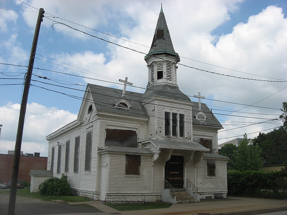
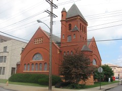
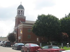
“The Welsh Congregational Church was a historic church in Youngstown, Ohio, United States. Built in 1861 by Youngstown's Welsh American community, it was once the center of Welsh life in Youngstown, and was listed on the National Register of Historic Places.”
Wikipedia article Welsh Congregational Church, CC BY-SA 4.0.
one of 59 National Register listings in Mahoning County · listed in 1986 · category: Building.
Architectural style. Queen Anne style architecture in the United States, Greek Revival architecture
National Register reference number.86001947- the number the National Park Service assigned this property when it was listed, and the key its nomination file is catalogued under at the National Archives.
What happened here
An account from the chapter on Youngstown city, The inset identifies its exact
source book and publication year.
Samuel Argat. a young English sea captain from Virginia, who early in 161 3 was cruising off the coast of Maine, learning from the Indians of the presence of the French in that vicinity, attacked and destroyed the settlement of St. Sauveur. Soon after, on a second expediliou made under the authority of Sir Thomas Dale, governor of Virginia, he destroyed also that of Port Royal.
Viewed as a whole, the surface of Mahoning county mny be regarded as an undulating plain, sloping gentlv to the north, its southern litie running on or rear the divide lief ween the waters of the Mahoning- on the north and the Little Heaver on the south, and having an altitude of from three to five 1 utidred feet above the valleys of the n< rth border. Topographically, the county forms a portion of the highlands of the southern rim of the lake basin, but since the rim is cut through by the deep gorge oi the Mahoning, the drainage, though locally northward, is all earned through that channel into the Ohio. Hut little of the surface is even locally level, but consists of an alternation of broad valleys of excavation, separated by rounded bills and table j lands, with gentle slopes. It is all varied and I picturesque, while at the same time it is well f adapted for agricultural purposes, and is now very generally in a high state of cultivation. The soil is in some places derived from the decomposition of the underlying rocks; but it, for the most part, rests ujjon a sheet of drift material, for the county lies within the drift area, though reaching its margin on the south. The general slope of the surface, ami part of the local erosion, seem to have Ix'cn produced by the southern extension of a tongue or lolxr of the great glacier, which, moving from the north, excavated the low country that lies between the highlands of Geauga and Portage on the west and those of Pennsylvania on the east. By this agent the northern out-crop of rocks which underlies the county have !>een ground away, and a large amount of material transported southward from its place of origin. As the eroded rocks were largely sandstone and conglomerate, much of the transported material is sand and gravel. Glacial marks are seen on the exposed surfaces of the harder rocks in nearly all parts of the county, and they are especially noticeable on the sandstone ledges on the northeast side of the Mahoning in Youngstown and Poland and on the higher strata of the same character in the southern part of Canfield and Ellsworth. The direction of the glacial scratches is nearly north and south; but they are sometimes reflected by local impediments a few degrees either east or west.
Coa! N'ii One, "I'll is is the scam which furnishes the famous Brier Hill, or Mahoning coal, so extensively used for irmi smelting and widely distributed through the markets of the northwest. It is the sanie seam that is sn largely worked in western Pennsylvania. The true position of this coal scam ts from twenty In fifty feet above tin- conglomerate. The quality of the Mahoning \ alley coal is so excellent and the coal field lies so near the (ireat Lakes market that it has become the lusis of an extensive commerce, and the mainsjiring of the most iiii]>oi t.uit iron industry of the West. The first development of coal mining in the valley of the Mahoning took place at the old Brier Hill and ("rah Creek mines near the north line of Youngstown. The search for coal has radiated from this center m every direction, and as a consequence the country about Youngstown has been more thoroughly explored than any other part of the county. A number of extensive basins have been discovered here, and several of them have U-en extensively worked
Regional context, not property-specific
evidence. The
federal wildfire occurrence database
lists 10 fires within 5 miles of Welsh Congregational Church between
2010 and 2020, burning about 7 acres in total. None started naturally. None was recorded as arson.
Distance is straight-line from the map coordinates, so a fire counted
here may appear on a neighbouring settlement's page as well.
Reported cause
Fires
Debris and open burning
8
Equipment and vehicle use
1
Missing data/not specified/undetermined
1
The most recent of
them, most recent first, with the day each was reported and the service
that recorded it.
Regional context, not property-specific
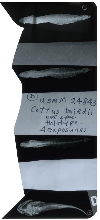
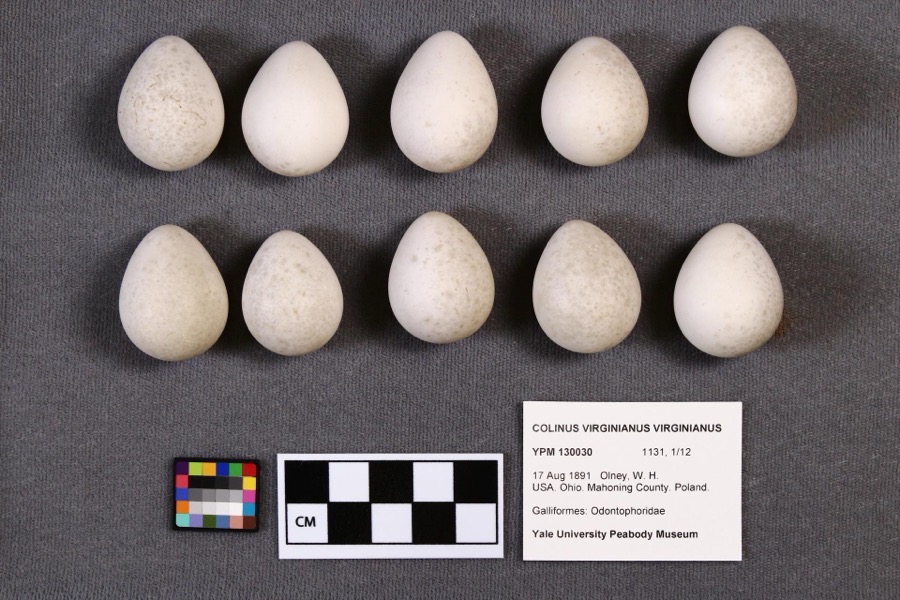
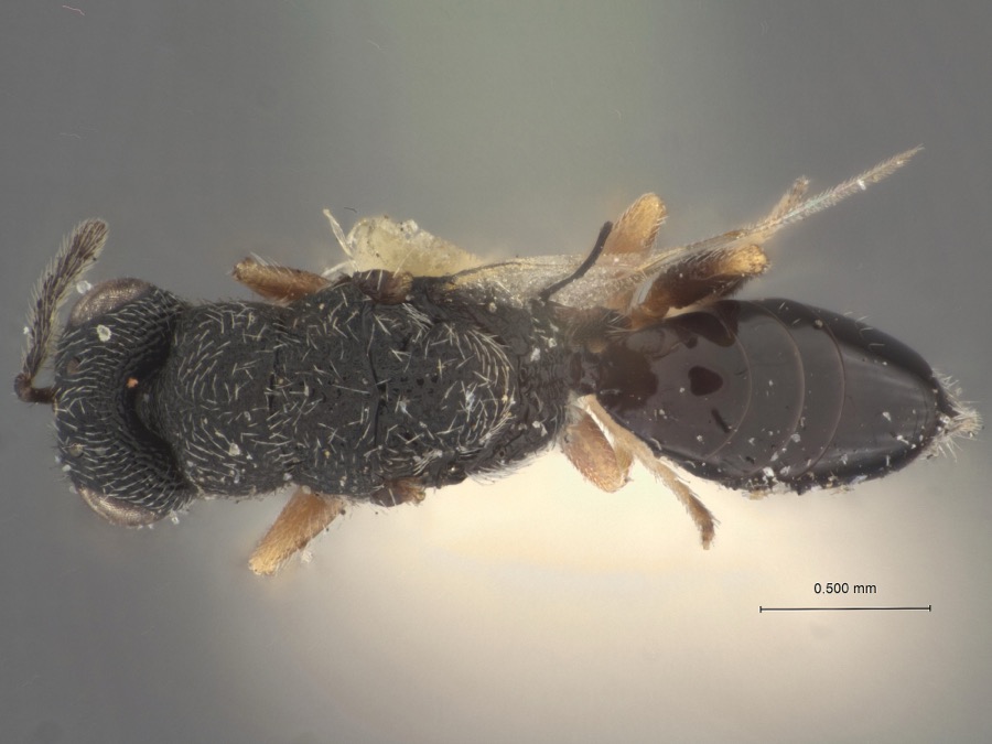
evidence. Museums hold 282 specimens
collected within 10 miles of Welsh Congregational Church between 1853 and
1974: 198 Animalia, 78 Plantae, 5 Fungi, 1 Chromista. 12 distinct Species records are shown.
Collected by A.E. Daugherty, B Withers, Baird, S. F. and others. Each is a
physical object with a catalogue
number, and each entry opens the museum's record. This is what was
collected and kept, not a survey of what lives here - nothing can be
concluded from a species being absent.
Regional context, not property-specific
evidence. The federal mineral resources record lists
3 workings within 5 miles of Welsh Congregational Church: 2 producers, 1 past producer.
2 still produce. What was taken out: Sand and Gravel, Construction, Iron, Aluminum. Distance is straight-line from the
map coordinates, so a quarry counted here may appear on a neighbouring
settlement's page as well.
Regional context, not property-specific
evidence. The National Weather Service names
Youngstown, the town this property stands in, in 44 storm reports between 1993 and 2015: 25 thunderstorm wind, 17 hail, 1 lightning, 1 tornado.
No death or injury is recorded in these reports. Each account below is quoted exactly as the forecast office
filed it, from the NOAA Storm Events Database, and each date
opens the federal record of that event.
A tornado touched down just southwest of the Mahoning River between Gibson and Poland Avenues on the northeast side of Youngstown. The tornado then skipped northeast for approximately eight miles before dissipating on the eastern edge of the city just south of the Trumbull County border. The damage path was 50 to 100 yards in width and was intermittent in nature. Ten businesses and around 80 homes were damaged by the tornado. One business was destroyed, and of the 80 homes, 60 had major damage. Two railroad cars were overturned and hundreds of trees were toppled along the damage path.
Thunderstorm winds caused some damage in the City of Youngstown. Four tents were toppled at a festival in the downtown area resulting in a few minor injuries. A church on Oakhill Avenue lost a large section of roofing. Many trees and large trees limbs were downed across the city as well.
Thunderstorm winds downed many trees. A building at Youngstown State University suffered damage when a 70 foot by 90 foot section of roof was peeled off. Awnings on two houses were also blown off.
Numerous reports of hail ranging from penny to quarter size were observed by trained spotters between Youngstown and Boardman. A trained spotter also estimated wind gusts around 65 mph in Boardman at 14:30 EST.
2 papers published in this town,
digitised by the Library of Congress and free to read: 0 issues,
0 pages. Every page is searchable, so a name or a street can be
looked for directly in what the town printed about itself at the time.
No historic map-sheet match is published
for this property yet. That does not mean no map exists. This record needs
a coordinate-quality review before it can be joined to a sheet boundary.
Browse the county's mapped places while that work is
pending.
From the nomination file
2,058 words on record
When this property was proposed for the
National Register, someone wrote the case for it: what the building is,
and why it matters. That document is a federal record in the public domain.
It is quoted below word for word, never summarised. The text was read off the scanned case file by machine, so the
occasional stray character is the recogniser's and the 1970s
typewriter's.
Description of the property
J summary paragraph 7 boundary selection yes ruins deteriorated Category Ownership resubmission clarity Condition Recom./Criteria Status unexposed Discipline REJECT dates alterations/integrity Accessible 5. Location of Legal Description Mahoning County Substantive Review: Youngstown MRA) 1988 Working No. completeness NR decision 1. Name J fair Entered in JUN Areas of Significance-Check and justify below Specific dates summary paragraph relationship of integrity to
Statement of significance
: It is significant for its association with the immigration and settlement entrance with ornate scroll brackets supporting the shed-roofed porch hood. Welsh church which retains its architectural integrity; as the oldest remaining church and the only unaltered frame church in the downtown area The Welsh Congregational Church meets National Register criteria A and C. To either side of the entrance are one story additions with a central bay Other features of the building are more clearly Greek Revival in style and of the Welsh in Youngstown during the 19th century; as the only downtown style from its original construction in 1861 and the Queen Anne style from dominant cross gable forming its main facade.
The building is clapboarded Welsh Congregational Church increased with the opening of the Brier Hill coal fields in 1846, with the Hill, the Welsh Baptist Church was established in 1846 and the Welsh The Welsh Congregational Church was built in 1861, followed by the Welsh with a church on East Rayen Avenue in 1882. In addition to the Welsh Congregational, the Welsh Presbyterian Church also remains standing and is downtown church associated with this ethnic group which retains its architectural integrity.
In addition, the Welsh Congregational was in Architecturally, the Welsh Congregational Church is one of the most church to the current popular style, resulting in a unique combination of such as the octagonal bell tower, patterned shingles, and decorative porch building, however, and the church is noted as a particularly good surviving church of any denomination in downtown Youngstown. Acreage: Less than one acre. VBD: Nominated area consists of Lot # 600, measuring 100' by 75'.
Quoted from the National Register nomination
for reference 86001947, 11 pages, held by the National Archives in Record
Group 79. See the
catalogue record.
Listed places nearby
6 within 8 miles
Other National Register properties close
enough to walk or drive between, ordered by distance from this one. Both
positions come from the same geocoding pass that matched these properties
to their map sheets.
Listing record. National Park Service National Register of Historic Places, listed-properties dataset, current to 2026-05-22.
Map join. Address geocoded through the United States Census geocoder, then tested against the published boundary of every sheet in the USGS Historical Topographic Map Collection.
How this page is made. Listing fields come from federal records; map-sheet coverage is a labelled coordinate-to-boundary calculation, not a source-field claim.
Wildfire. Short, Karen C. 2022. Spatial wildfire occurrence data for the United States, 1992-2020 [FPA_FOD_20221014]. 6th Edition. Fort Collins, CO: Forest Service Research Data Archive. https://doi.org/10.2737/RDS-2013-0009.6 Collected with United States Government funding and usable without additional permissions or fees.
Specimens. Global Biodiversity Information Facility (GBIF), https://www.gbif.org/. Only records licensed CC0 or CC BY are used. Records licensed CC BY-NC are excluded because this site carries advertising. Images are checked individually and any whose licence is non-commercial, no-derivatives or unreadable is refused.
Mines and quarries. USGS Mineral Resources Data System (MRDS) https://mrdata.usgs.gov/mrds/ A work of the United States government, no copyright under 17 U.S.C. 105.
Storms. NOAA National Centers for Environmental Information, Storm Events Database https://www.ncei.noaa.gov/stormevents/ A work of the United States government, no copyright under 17 U.S.C. 105. Narratives are quoted verbatim from the National Weather Service report and are not edited or summarised.
 Block
Block