Listed on the National Register of Historic Places in
1987. A historic map-sheet match is not published yet. The record needs a coordinate-quality review before it can be joined to a sheet boundary.
From the record
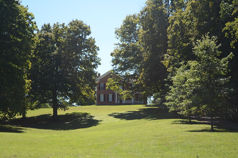
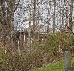
“John Artz Farmhouse is a historic building located at 5125 Duffy Road Berne, Ohio near Lancaster.”
Wikipedia article John Artz Farmhouse, CC BY-SA 4.0.
one of 29 National Register listings in Fairfield County · listed in 1987 · category: Building · one of 1 National Historic Landmarks in Fairfield County.
National Register reference number.87000644- the number the National Park Service assigned this property when it was listed, and the key its nomination file is catalogued under at the National Archives.
It is said that Berne Township was named in honor of the Canton of Berne, in Switzerland, by Samuel Carpenter, at the time of its organization, a citizen. There are two post-offices in the township - Sugar Grove, eight miles below Lancaster,
Joseph Stukey and two brothers were early settlers and reared large families. Stukey built a good mill at the mouth of Rush creek. Joseph Stukey was a prominent man and an associate judge for this county for one or two terms. He was appointed by the Court of Common Pleas one of the receivers of the Lancaster bank, when it was wound up in 1842. Levi jMoore and Asa Spurgeon were among the first to settle below Lancaster.
Regional context, not property-specific
evidence. The
federal wildfire occurrence database
lists 27 fires within 5 miles of Artz, John, Farmhouse between
2003 and 2020, burning about 113 acres in total. None started naturally. None was recorded as arson.
Distance is straight-line from the map coordinates, so a fire counted
here may appear on a neighbouring settlement's page as well.
Reported cause
Fires
Debris and open burning
11
Power generation/transmission/distribution
8
Missing data/not specified/undetermined
4
Smoking
2
Recreation and ceremony
1
Equipment and vehicle use
1
The most recent of
them, most recent first, with the day each was reported and the service
that recorded it.
Regional context, not property-specific
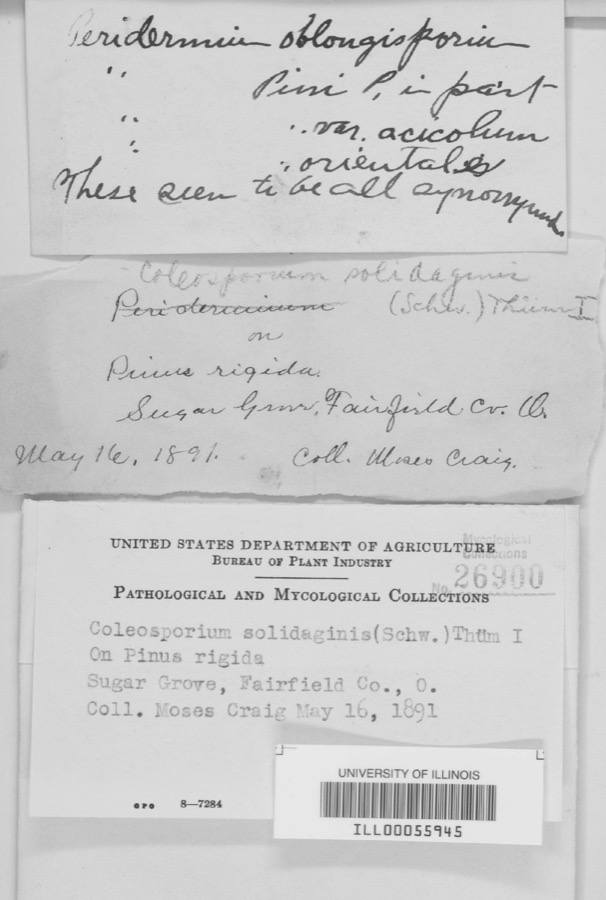
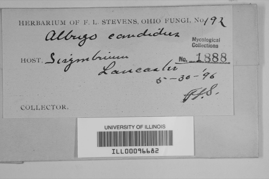
evidence. Museums hold 1,481 specimens
collected within 10 miles of Artz, John, Farmhouse between 1839 and
1975: 898 Animalia, 339 Fungi, 230 Plantae, 7 Protozoa, 5 Unrecorded, 2 Chromista. 12 distinct Species records are shown.
Collected by A. Schrader, Angerman, C. (Carl) & Triplehorn, C. A. (Charles A.), Asa Gray; W. S. Sullivant and others. Each is a
physical object with a catalogue
number, and each entry opens the museum's record. This is what was
collected and kept, not a survey of what lives here - nothing can be
concluded from a species being absent.
Regional context, not property-specific
evidence. The federal mineral resources record lists
5 workings within 5 miles of Artz, John, Farmhouse: 3 past producers, 2 producers.
2 still produce. What was taken out: Sand and Gravel, Construction. Distance is straight-line from the
map coordinates, so a quarry counted here may appear on a neighbouring
settlement's page as well.
Regional context, not property-specific
evidence. The National Weather Service names
Lancaster, the town this property stands in, in 97 storm reports between 1994 and 2026: 48 thunderstorm wind, 32 hail, 9 flash flood, 4 flood.
The reports record 1 injury. Each account below is quoted exactly as the forecast office
filed it, from the NOAA Storm Events Database, and each date
opens the federal record of that event.
Flash flooding along Fetters Run near College Avenue caused damage to the roadway, as well as significant damage to the Lancaster Festival stages, equipment, and vehicles.
Multiple water rescues occurred in the apartment complex along Sater Drive where water was over three feet deep. Additionally, over 30 vehicles were flooded in deep water.
Multiple swift water rescues were needed for animals trapped inside of a building submerged with three to four feet of water on Granville Pike. The building backs up to Fetters Run stream.
Numerous trees and power lines were blown down across the eastern part of the county. There was minor damage to siding and gutters on a few homes on Betz Road, to the west of Lancaster.
A ground survey with assistance form the Fairfield County EMA confirmed a brief and weak tornado touched down in the southwest part of Lancaster.||The survey revealed an eyewitness report of a very weak tornado on the ground near a residence at the west end of Mount Ida Avenue in Lancaster. No damage occurred at this residence. From there the weak tornado moved east through a wheat field with a narrow path of flattened wheat in a convergent pattern. From there the tornado moved between Tarhe Street and Twin Creek Way where minor tree damage occurred, including a couple of uprooted trees and snapped limbs. The tornado appears to have lifted as it approached south Broad Street.
6 papers published in this town,
digitised by the Library of Congress and free to read: 0 issues,
0 pages. Every page is searchable, so a name or a street can be
looked for directly in what the town printed about itself at the time.
No historic map-sheet match is published
for this property yet. That does not mean no map exists. This record needs
a coordinate-quality review before it can be joined to a sheet boundary.
Browse the county's mapped places while that work is
pending.
From the nomination file
1,863 words on record
When this property was proposed for the
National Register, someone wrote the case for it: what the building is,
and why it matters. That document is a federal record in the public domain.
It is quoted below word for word, never summarised. The text was read off the scanned case file by machine, so the
occasional stray character is the recogniser's and the 1970s
typewriter's.
Description of the property
The interior of the Artz house includes a variety of decorative elements Because the original barn and support buildings no longer exist, the supported by square posts with doric capitals. Check one is extended to the rear by a two story ell which was probably added soon after with carved spindles. -moved staircase, several large wood fireplace mantles, and wood trim. All woodwork date ruins fair which have been preserved by the current owners.These include a central the initial construction.A plain entablature is topped by a returning The property includes two non-historic outbuildings of recent construction. hardwood chestnut.
Most of the 33 windows in the house contain their original An interesting example of the transition from Greek Revival to the Italianate boundaries have been drawn to include only the house. which rests upon a sandstone ridge within a 160 acre farm. - archeology-prehistoric .-- community planning - archeology-historic - agriculture _ economics - sculpture X architecture .social/ - art .
engineering _ music X 1800-1899 - exploration/settlement - philosophy _ theater -industry - politics/government .transportation _ invention Located in a picturesque setting in Berne Township, Fairfield County, the John front and two story side wing design, plain entablature, and cornice returns, brick arch lintels and four-over-four saches, while the front entrance with wide eaves and scroll-like brackets, combine with a spindled balustrade on the front porch, further enhancing the facade. Residence (NR listed 1978) features a hipped roof, five bay facade with a two and hipped roof.
The Tal Imadge-Mithoff House (NR listed 1976) features a three Artz lived on the property from 1857 until 1895 when he retired to live 1600-1699 1500-1599 1400-1499 commerce communications 1700-1799 humanitarian Period Builder/Architect science Unknown prehistoric 1900- law - other (specify) 8.
Statement of significance
(in one paragraph) soon after his arrival from Rockingham County, Virginia.Local historical ..education of construction with the exception of cornice brackets removed ca.19o0.John story tower and lancet window surrounds. Pugh-Kettle House (listed 1983) is rectangular in shape with a central cupola mother, Nancy Hanks.
Artz constructed a log house on the property followed by Italianate style constructed with a gable front and two story wing.The Iisted on the National Register built between 1851-1867.The Henry Musser Areas of Significance-Check and justify below of 1875,the exterior of the house has not been greatly altered since the date military --conservation wing plan of the Artz house is not as common in the county as I-house with Hufford Residence ca.1830 includes a two story rear wing landscape architecture... religion ...literature c. 185/ transitional Greek Revival-Italianate architecture.
The house is Constructed in 1857, the house is one of the latest in Fairfield County to surveyed buildings in Fairfield County of either the Greek Revival or (FAI-10-8) in Lancaster was built in 1860 in the Italianate style without incorporate the Greek Revival style during a period when most homes were The land on which the house was located was acquired by Jacob Artz in 1818 between 1857 and 1860.
According to a drawing in the Fairfield County Atlas Specific dates distinguished by incorporating Greek Revival characteristics such as the gable sources claim that his wife Sarah was an aunt of Abraham Lincoln through his Artz House is significant under Criterion C as an excel lent example of UT M References - state - national -local I hereby certify that this property is included in the National Register Lancaster code county organization Easting Northing Columbus date name/title Zone Ohio State Historic Preservation Officer signature date November 18, 1986 22 North Front Street Attest: 12.
Quoted from the National Register nomination
for reference 87000644, 16 pages, held by the National Archives in Record
Group 79. See the
catalogue record.
Listed places nearby
6 within 8 miles
Other National Register properties close
enough to walk or drive between, ordered by distance from this one. Both
positions come from the same geocoding pass that matched these properties
to their map sheets.
Listing record. National Park Service National Register of Historic Places, listed-properties dataset, current to 2026-05-22.
Map join. Address geocoded through the United States Census geocoder, then tested against the published boundary of every sheet in the USGS Historical Topographic Map Collection.
How this page is made. Listing fields come from federal records; map-sheet coverage is a labelled coordinate-to-boundary calculation, not a source-field claim.
Wildfire. Short, Karen C. 2022. Spatial wildfire occurrence data for the United States, 1992-2020 [FPA_FOD_20221014]. 6th Edition. Fort Collins, CO: Forest Service Research Data Archive. https://doi.org/10.2737/RDS-2013-0009.6 Collected with United States Government funding and usable without additional permissions or fees.
Specimens. Global Biodiversity Information Facility (GBIF), https://www.gbif.org/. Only records licensed CC0 or CC BY are used. Records licensed CC BY-NC are excluded because this site carries advertising. Images are checked individually and any whose licence is non-commercial, no-derivatives or unreadable is refused.
Mines and quarries. USGS Mineral Resources Data System (MRDS) https://mrdata.usgs.gov/mrds/ A work of the United States government, no copyright under 17 U.S.C. 105.
Storms. NOAA National Centers for Environmental Information, Storm Events Database https://www.ncei.noaa.gov/stormevents/ A work of the United States government, no copyright under 17 U.S.C. 105. Narratives are quoted verbatim from the National Weather Service report and are not edited or summarised.
 Block
Block