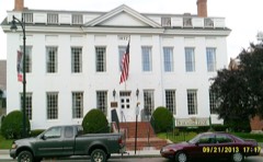
Listed on the National Register of Historic Places in
1987. A historic map-sheet match is not published yet. The record needs a coordinate-quality review before it can be joined to a sheet boundary.
From the record
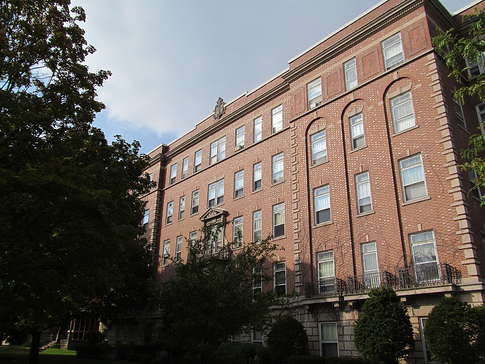
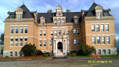
“Luke's Hospital, is a historic former hospital building at 379 East Street in Pittsfield, Massachusetts. The Colonial Revival building was constructed in 1926, and was the first Roman Catholic hospital in Berkshire County.”
Wikipedia article Providence Court, CC BY-SA 4.0.
one of 94 National Register listings in Berkshire County · listed in 1987 · category: Building · one of 1 National Historic Landmarks in Berkshire County.
National Register reference number.87001107- the number the National Park Service assigned this property when it was listed, and the key its nomination file is catalogued under at the National Archives.
The names inscribed on the monument are those of citizens of Pittsfield who died in the war, either from wounds, or, before their discharge, from disease contracted in the war ; not including citizens of other places, who served on her quota. They are as follows :
It was determined to place it at the west end of the park, in or near which, a large portion of the Pittsfield soldiers volunteered, and which possessed many other associations of patriotic interest; and the park, however beautiful, being not considered in a proper condition for the reception of the contemplated work, the town placed in the hands of the committee before-named, a further sum of seven thousand dollars, for the purpose of making some longdesired improvements. The nature of these improvements was left to the discretion of the committee, by whom the following changes were made : The oval plot which constitutes the park, was surrounded by a handsome and substantial coping of granite, outside of which a broad gravel walk, with granite curbing, was built. The surface of the plot was graded, and a considerable number of trees, which had become so thick as to impede each other's growth, were felled. The Old Elm had fallen in 1861. In addition to this, the grade of Park place was reduced so as to make it more uniform with that of Bank row.
Regional context, not property-specific
evidence. The
federal wildfire occurrence database
lists 118 fires within 5 miles of Providence Court between
2002 and 2020, burning about 82 acres in total. 2 started naturally. 2 were recorded as arson.
Distance is straight-line from the map coordinates, so a fire counted
here may appear on a neighbouring settlement's page as well.
Reported cause
Fires
Debris and open burning
66
Recreation and ceremony
17
Smoking
7
Railroad operations and maintenance
7
Missing data/not specified/undetermined
6
Equipment and vehicle use
4
Misuse of fire by a minor
4
Natural
2
Arson/incendiarism
2
Power generation/transmission/distribution
1
Other causes
1
Fireworks
1
The most recent of
them, most recent first, with the day each was reported and the service
that recorded it.
Regional context, not property-specific
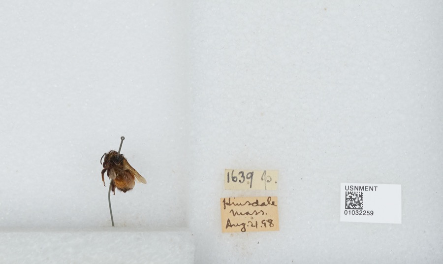
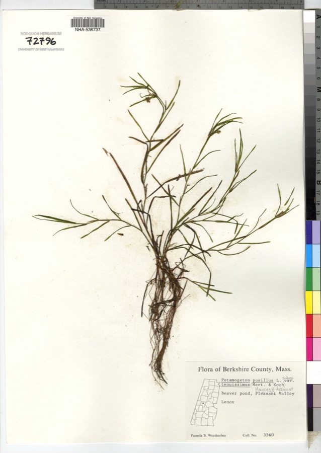
evidence. Museums hold 1,006 specimens
collected within 10 miles of Providence Court between 1834 and
1975: 470 Plantae, 329 Animalia, 203 Fungi, 4 Unrecorded. 12 distinct Species records are shown.
Collected by A. H. Mead, A. K. Harrison, A. K. Harrison, Florence and others. Each is a
physical object with a catalogue
number, and each entry opens the museum's record. This is what was
collected and kept, not a survey of what lives here - nothing can be
concluded from a species being absent.
Regional context, not property-specific
evidence. The federal mineral resources record lists
15 workings within 5 miles of Providence Court: 8 past producers, 4 producers, 2 occurrences, 1 unknown.
4 still produce. What was taken out: Iron, Sand and Gravel, Construction. Distance is straight-line from the
map coordinates, so a quarry counted here may appear on a neighbouring
settlement's page as well.
Regional context, not property-specific
evidence. The National Weather Service names
Pittsfield, the town this property stands in, in 98 storm reports between 1994 and 2025: 64 thunderstorm wind, 17 hail, 13 flash flood, 3 flood.
The reports record 1 injury. Each account below is quoted exactly as the forecast office
filed it, from the NOAA Storm Events Database, and each date
opens the federal record of that event.
Survey team observed several structures with shingle damage to roofs. Many limbs and several trees were knocked down. Upon observation these trees were determined to be shallow rooted. Roofs dislodged from clubhouse and dugout of Waconah Park baseball stadium. Eyewitnesses with various vantage points reported observing rotating debris consistent with a tornado. Additional reports indicate a portion of the fencing at Waconah Park was also knocked down, and bleachers along the left field were pushed backward. In addition, trees and wires were downed on Tyler Street and Woodlawn Avenue, and two moored motor boats at Burbank Park were flipped over and partially submerged. There was also a report of a tree falling on a house on Charles Street. Top winds estimated at 70 mph.
A line of thunderstorms, that developed over eastern New York, moved into southern Berkshire county shortly after noon on May 25. This line of storms continued to produce strong gusty winds that brought numerous large trees and power lines down throughout the city of Pittsfield.
A cold front moving east into Berkshire County triggered widely scattered severe thunderstorms. The storms brought down large limbs and power lines in the town of Pittsfield.
No historic map-sheet match is published
for this property yet. That does not mean no map exists. This record needs
a coordinate-quality review before it can be joined to a sheet boundary.
Browse the county's mapped places while that work is
pending.
From the nomination file
5,656 words on record
When this property was proposed for the
National Register, someone wrote the case for it: what the building is,
and why it matters. That document is a federal record in the public domain.
It is quoted below word for word, never summarised. The text was read off the scanned case file by machine, so the
occasional stray character is the recogniser's and the 1970s
typewriter's.
Description of the property
pue fc housitg forets esdetay, Pistsnienposing khve-stor py or idk and fumestone structure built in 1926. The building is located on the corner of East and Fourth Streets in a formerly residential section of downtown Pittsfield now dominated by institutional buildings. Set back one hundred feet from East EZEZED Street, the building is fronted by lawn and ornamental plantings. To the east is an extensive asphalted parking area. Adjacent to the nominated property is the Queen Anne-style Allen House (1886, NR 1980). Pittsfield High School stands across the street to the south, and the Mt. Carmel Roman Catholic The Georgian Revival-style brick building, designed by J. W.
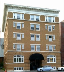
Donohue of Springfield, is essentially T-shaped in plan, with a rectangular main block enlivened by projecting pavilions flanking a central entrance. Beh ind the ma in block are a five-story wing constructed as part of the original plan and a two-story ell added in 1964. The building rests on a concrete foundation and is surmounted by a flat roof. A brick parapet with 1imestone coping masks the roof; its central cartouche with cross and sword expresses the hospital's ecclesiastical affiliation. Other 1imestone trim includes sills, keystones, quoins, and belt courses. Also on the property is a former warehouse (ca. (906), converted to apartments in the late 1970s. Considerably altered, it does not contribute to the property's significance.
The former hospital laundry, to the rear of the main building, now belongs to Mt. Carmel Roman Catholic Church and is not part of this nomination. The main (south) facade is thirteen bays wide, symmetrically arranged, and divided into three sections by the slightly projecting three-bay pavilions. Limestone quoins define the facade. The ground story is faced with rusticated 1 imestone.
(in one paragraph) Builder/Architect J.W. Donohue St. Luke's Hospital, Pittsfield (now known as Providence Court), is a well-preserved and unusually intact Georgian Revival-style hospital of finely crafted and detailed early 20th century construction. Built in 1926 by the Roman Catholic Diocese of Springfield, St. Luke's was the first Catholic teach ing hospital in Berkshire County. Its merger with Pittsfield General Hospital in 1967 was the nation's first union of a Catholic and nonsectarian health facility. Retaining integrity of location, design, setting, materials, workmanship, and feeling, as well as associations with the region's Catholic community at the turn of the century, St. Luke's fulfils Criterion C of the National Register of Historic Places on the local level. St.
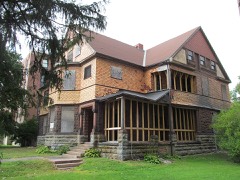
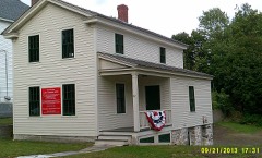
Luke's Hospital was Pittsfield's third hospital and the first established under the auspices of the Catholic church. It was founded in 1916 by the Roman Catholic Diocese of Springfield, who used the charitable bequest of clergyman Rev. Charles J. Boylan to remodel two frame houses on Springside Avenue, one mile north of the nominated property. was dedicated early in 1917. By the close of that year, however, the facilities had proven inadequate. On behalf of the church, Bishop Thomas BUSER Beaven purchased the one-acre Allen Estate on East Street, home of wealthy Pittsfield horse breeder William Russell Allen. one of Pittsfield's most prestigious residential neighborhoods. Anne-style residence, constructed in 1886, became a 28-bed maternity hospital. It was named St.
Luke's in honor of the patron saint of (The building was listed in the National Register in 1980.) The Boylan Memorial Hospital remained in use for surgery and medical treatments. Five years later, in 1922, the church again found itself in need of a larger building. Construction of the nominated property, erected specifically for use as a church-related hospital, began in 1923.
Quoted from the National Register nomination
for reference 87001107, 23 pages, held by the National Archives in Record
Group 79. See the
catalogue record.
Listed places nearby
6 within 8 miles
Other National Register properties close
enough to walk or drive between, ordered by distance from this one. Both
positions come from the same geocoding pass that matched these properties
to their map sheets.
Listing record. National Park Service National Register of Historic Places, listed-properties dataset, current to 2026-05-22.
Map join. Address geocoded through the United States Census geocoder, then tested against the published boundary of every sheet in the USGS Historical Topographic Map Collection.
How this page is made. Listing fields come from federal records; map-sheet coverage is a labelled coordinate-to-boundary calculation, not a source-field claim.
Wildfire. Short, Karen C. 2022. Spatial wildfire occurrence data for the United States, 1992-2020 [FPA_FOD_20221014]. 6th Edition. Fort Collins, CO: Forest Service Research Data Archive. https://doi.org/10.2737/RDS-2013-0009.6 Collected with United States Government funding and usable without additional permissions or fees.
Specimens. Global Biodiversity Information Facility (GBIF), https://www.gbif.org/. Only records licensed CC0 or CC BY are used. Records licensed CC BY-NC are excluded because this site carries advertising. Images are checked individually and any whose licence is non-commercial, no-derivatives or unreadable is refused.
Mines and quarries. USGS Mineral Resources Data System (MRDS) https://mrdata.usgs.gov/mrds/ A work of the United States government, no copyright under 17 U.S.C. 105.
Storms. NOAA National Centers for Environmental Information, Storm Events Database https://www.ncei.noaa.gov/stormevents/ A work of the United States government, no copyright under 17 U.S.C. 105. Narratives are quoted verbatim from the National Weather Service report and are not edited or summarised.
 Block
Block